Key Points: September 22, 2017
Synopsis: Good Friday morning! We are watching drenching storms this morning across central Minnesota which has dropped 1-4″ of rain locally. This system will diminish this afternoon, but our attention then turns to a slow moving front bringing some severe risks to eastern North Dakota and northern Minnesota this evening and tonight. Another wave of energy comes later tomorrow into Sunday with additional heavy rains across the Dakotas and northern Minnesota. This slow moving front will continue to creep south and east through early next week bringing additional rains. Cooler conditions will be the main theme behind the front as well. Some harvest delays are expected into next week, but latest indications are that drier conditions return for later next week and beyond. Have a blessed day!
Today’s Video (7 min):
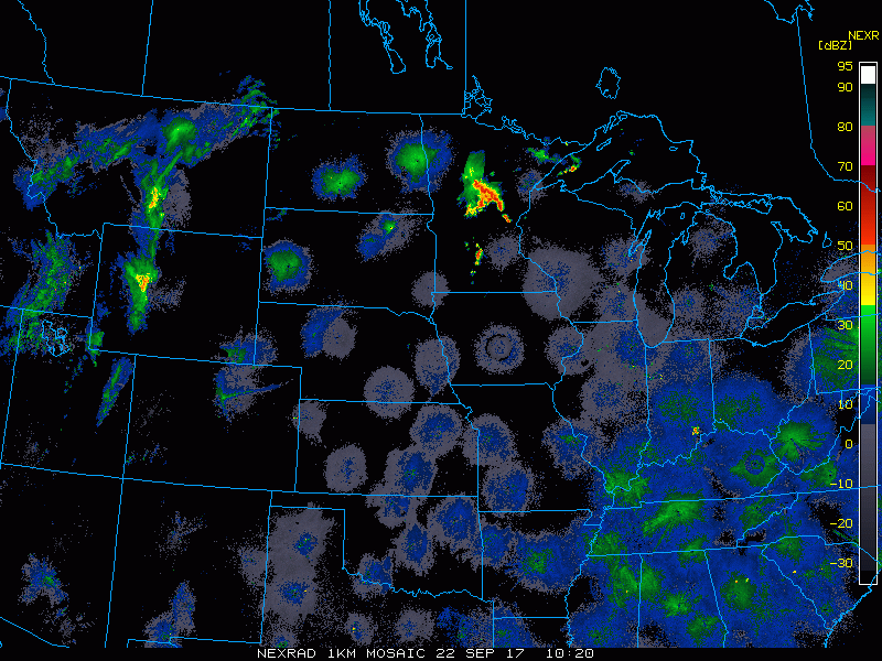
Current radar shows that cluster of storms in Minnesota.
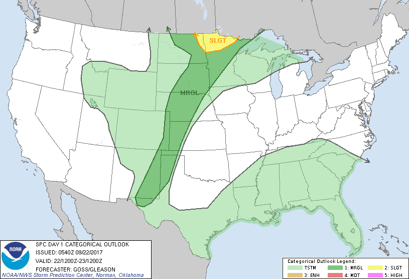
There is a severe risks this afternoon and tonight. SPC outlook is below.
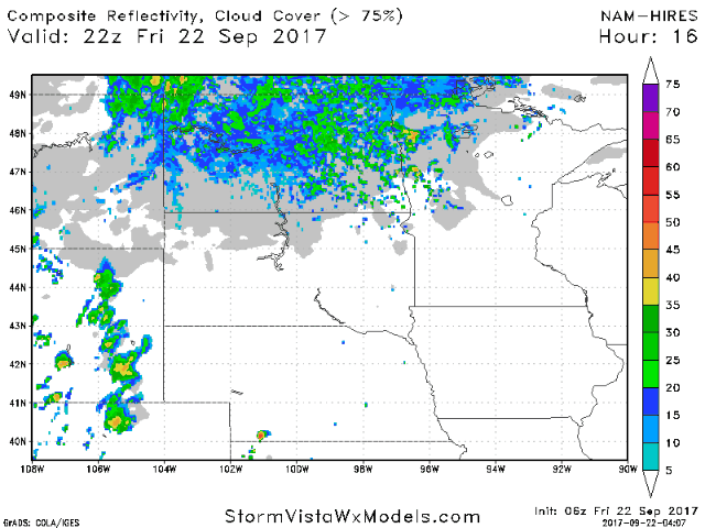
Projected radar into Saturday times it all out for you.
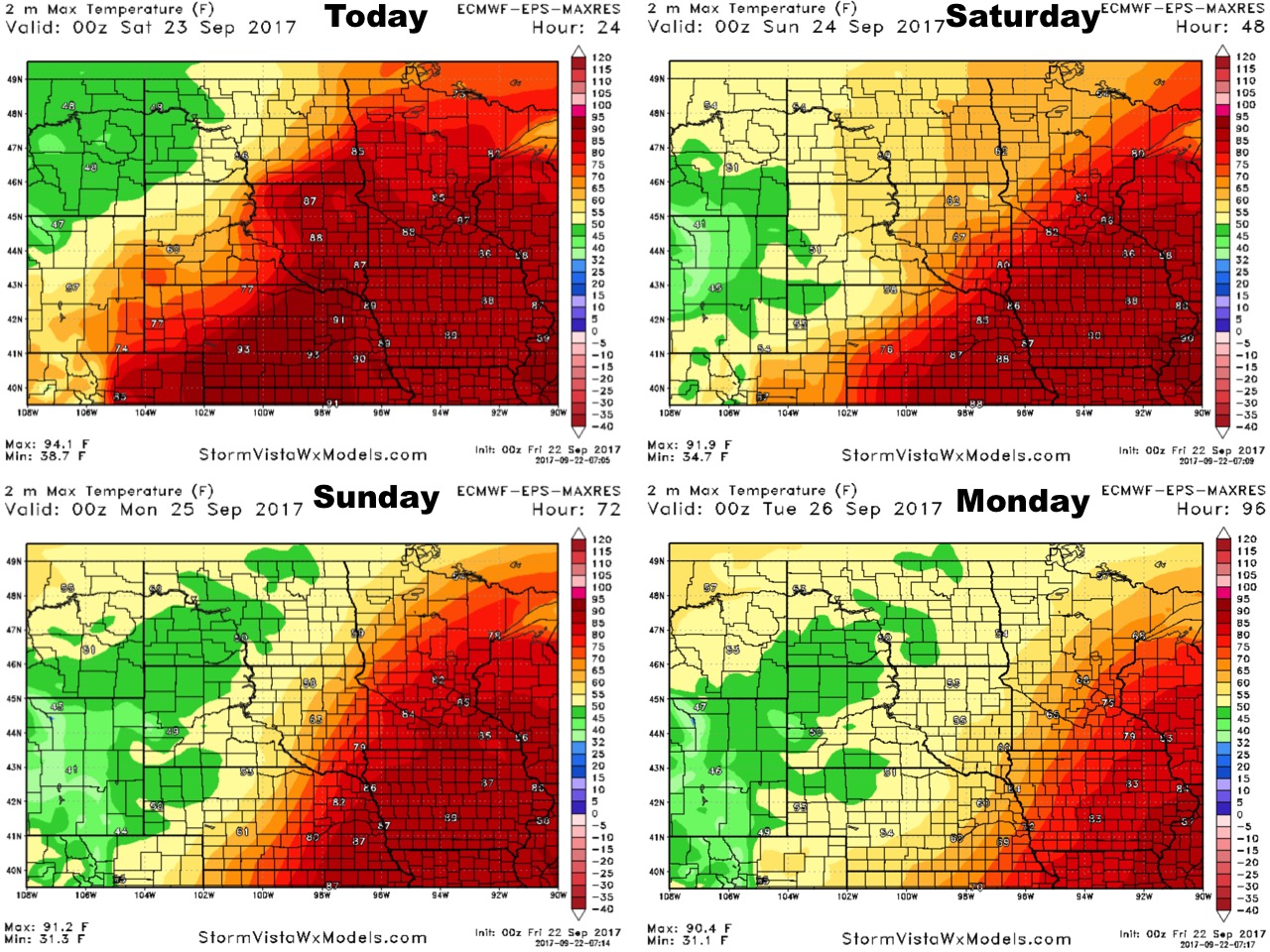
High temperatures will be variable depending on location.
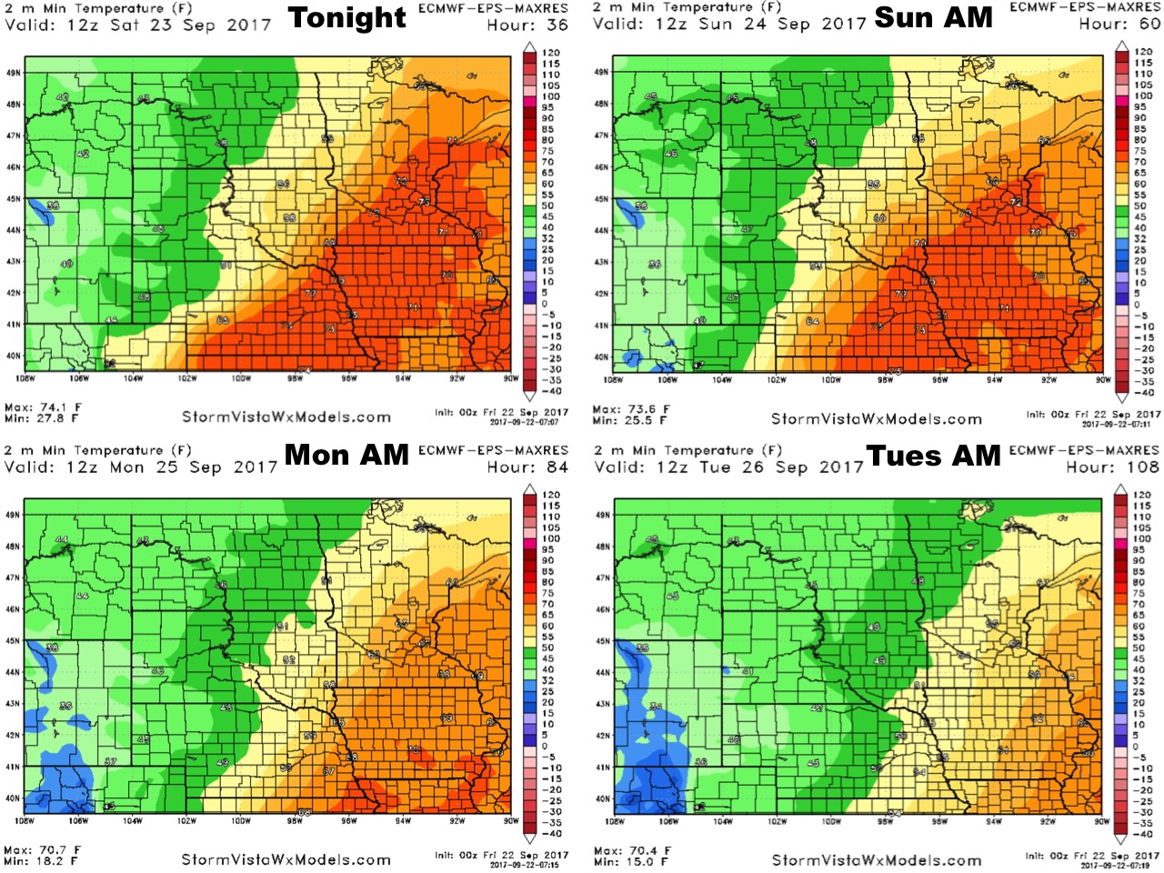
Low temperatures are similar.
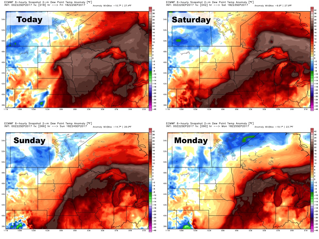
Humidity looks high along and ahead of the front as well.
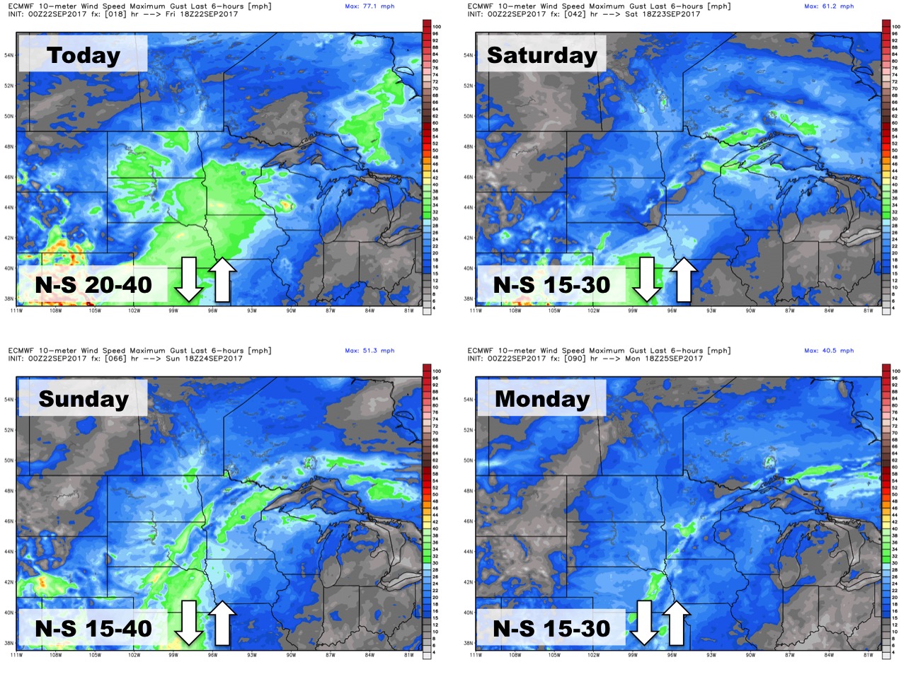
Winds over the next 4 days are below.
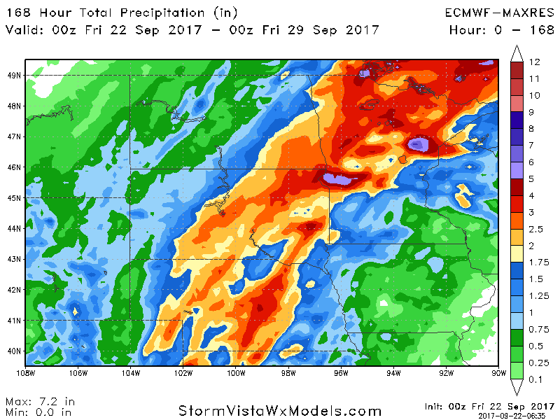
Total rainfall through midweek next week is impressive with some seeing 3-6″ of rainfall.
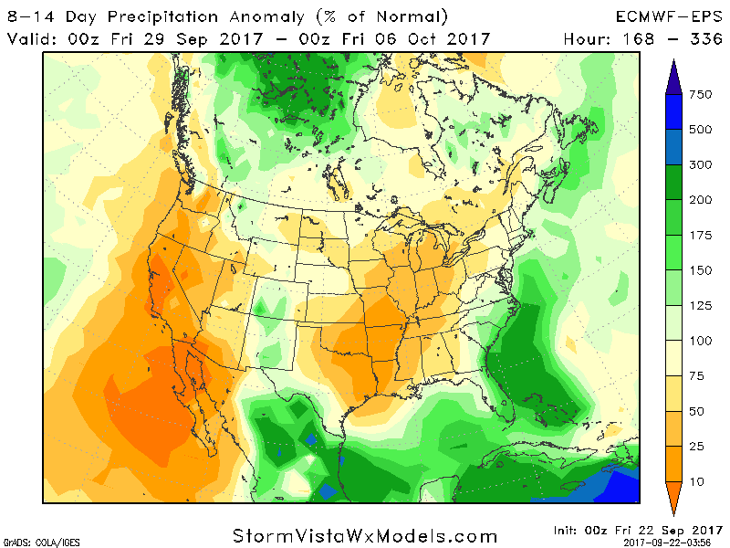
While harvest delays are expected this week, week 2 data shows drier risks into early October.