Key Points: September 14, 2017
Synopsis: Good Thursday morning! We are tracking a weak disturbance bringing some showers to the Dakotas. This will push east and weaken today while it stays hot for many across zone 9. The bigger system of note comes tomorrow into Saturday as a wave of low pressure forms along a cold front. This will deliver some heavy rains to the Dakotas and northern Minnesota – some places may see 2-4″! Temperatures will briefly crash below normal behind the front Sunday-Monday before rising back above normal for the middle of the week. Week 2 precipitation looks to remain above normal as well. Have a blessed day!
Today’s Video (6 min):
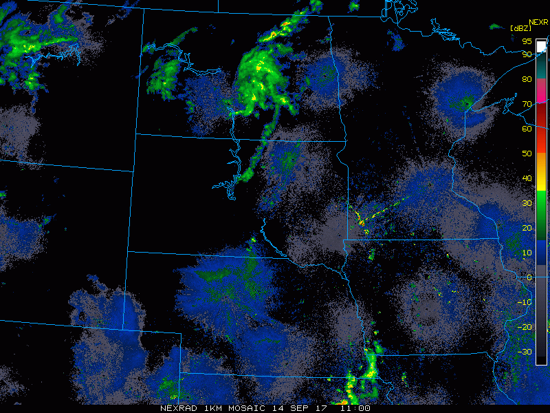
Current radar shows some activity in the Dakotas this morning.
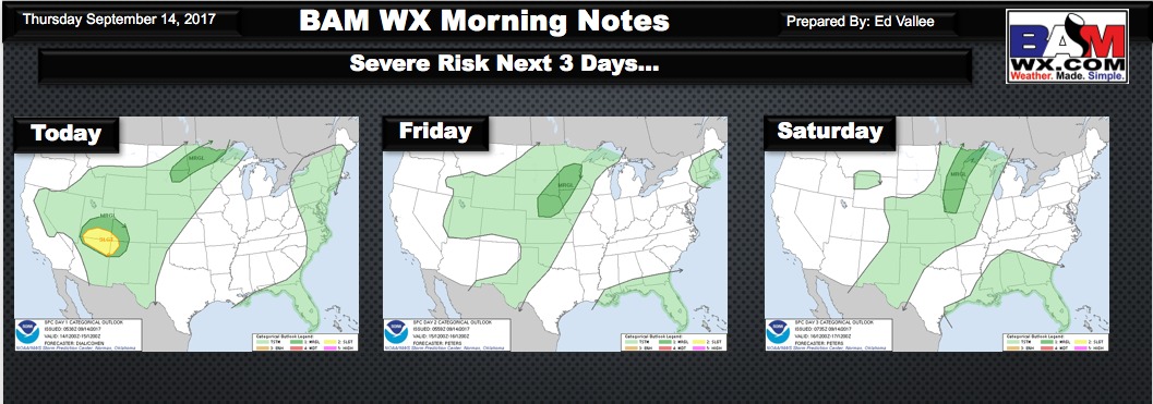
The next 3 days look active with respect to severe weather, shown below.
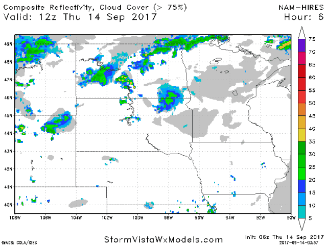
Project radar through Saturday afternoon shows the active times ahead quite well.
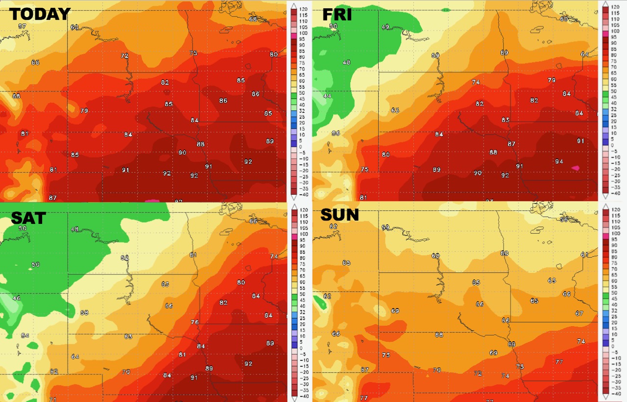
High temperatures will fall rapidly behind the front north and west through Monday.
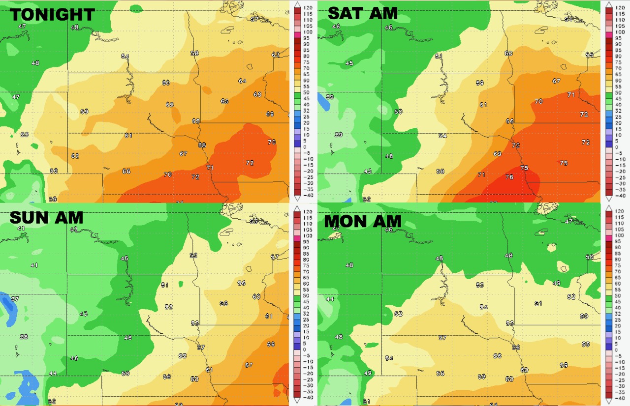
Low temperatures will react similarly.
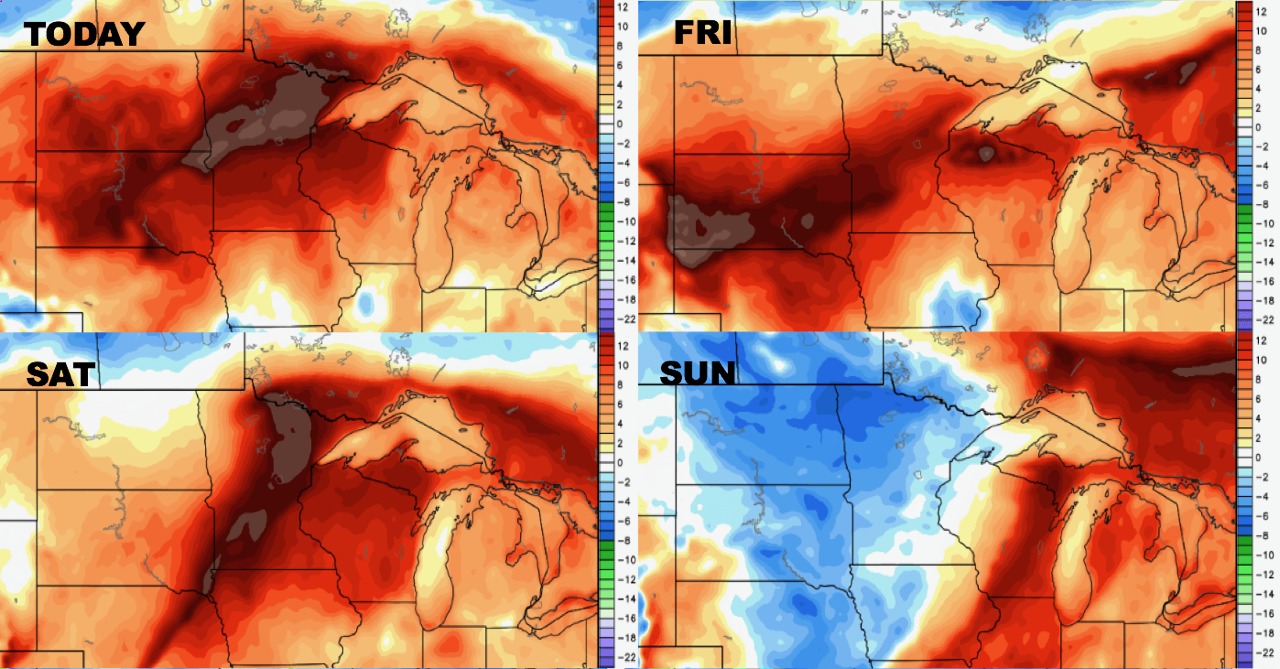
Humidity will definitely remain above normal through the weekend thanks to the rainfall.
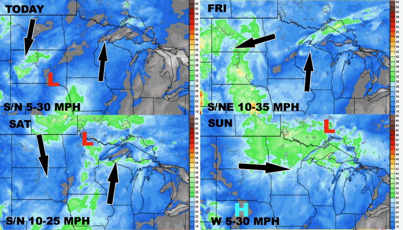
Wind forecast the next 4 days is below.
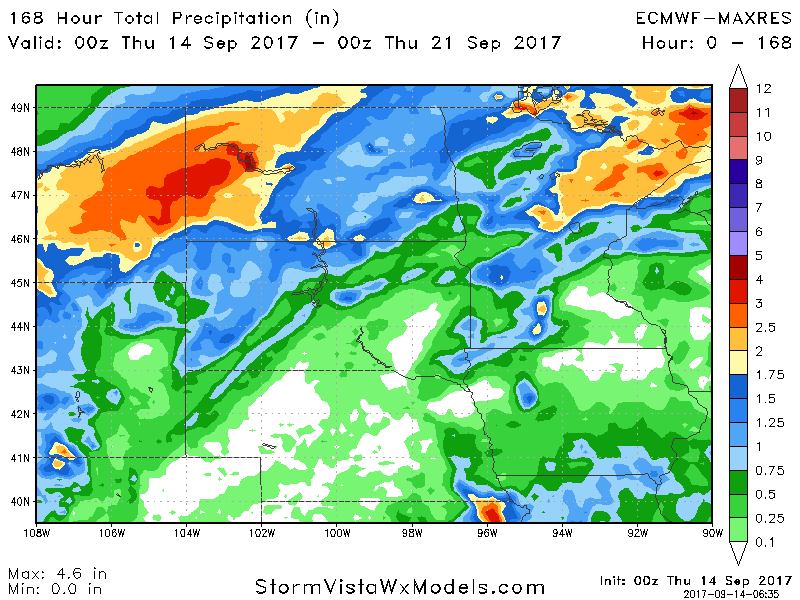
Total rainfall through next Wednesday is shown below. Note the heaviest across ND.
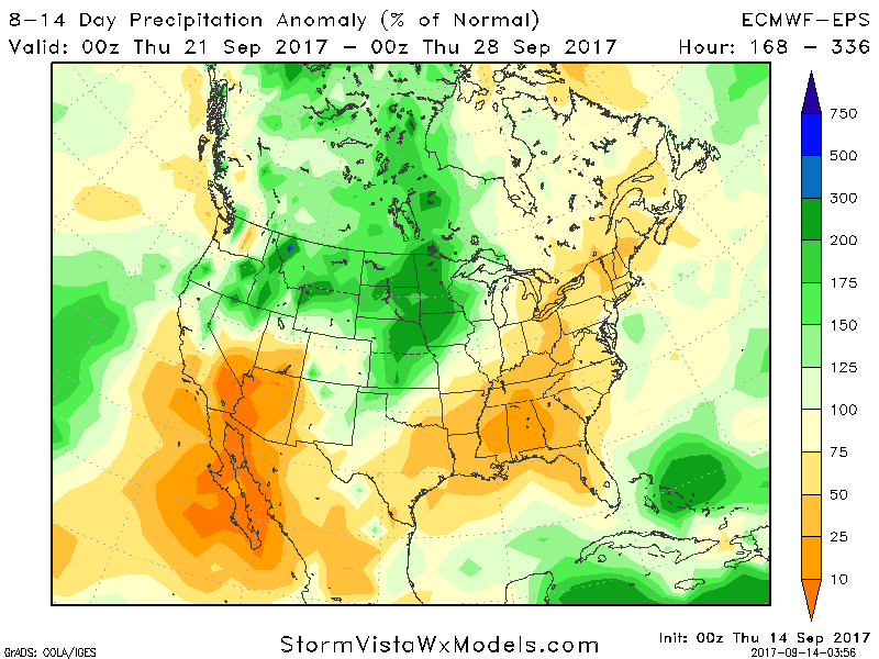
Week 2 continues to look wet compared to normal.