Northern Plains Update: Heat Building Into The Weekend. E.
Key Points: September 7, 2017
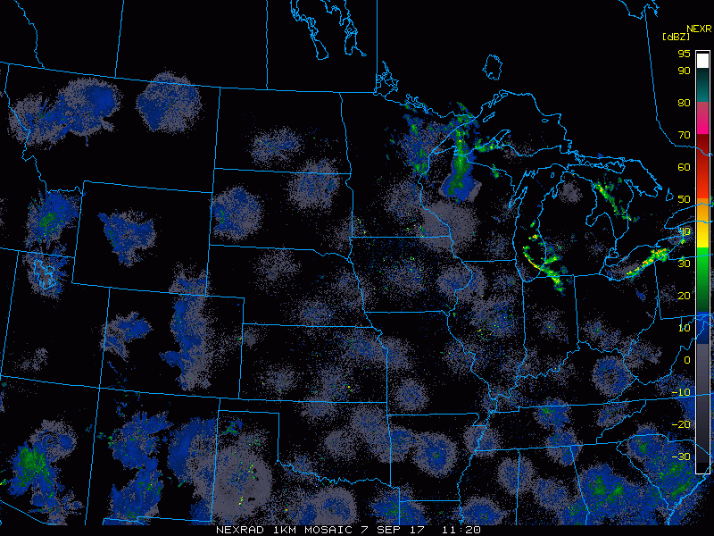
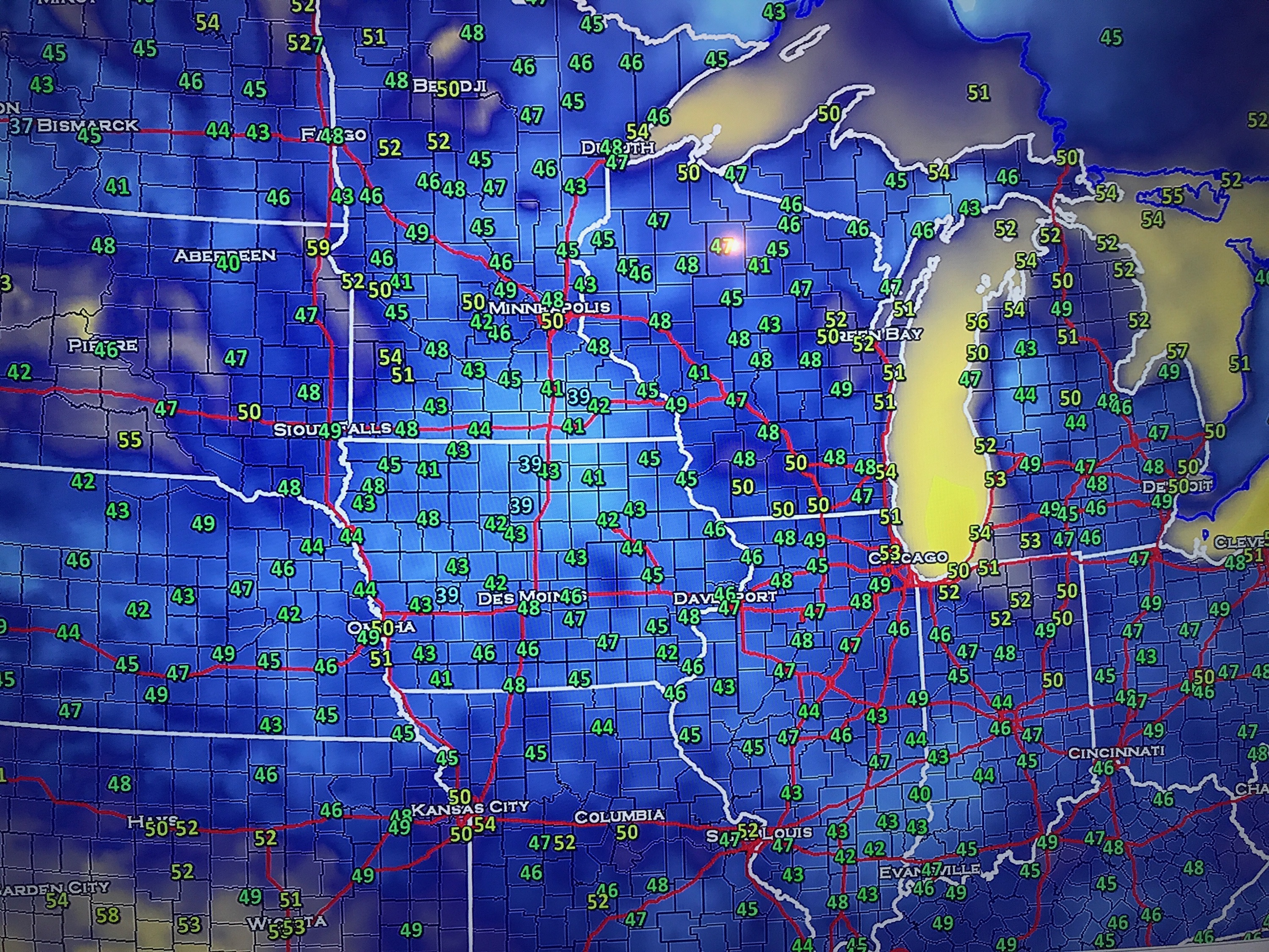
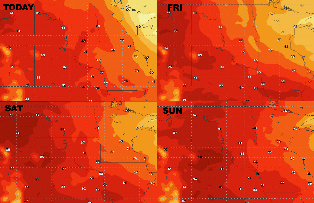
Synopsis: Good Thursday morning! Radar once again scanning clear this morning along with some very cool conditions, particularly across southern Minnesota and Wisconsin. Some places have once again dipped into the 30s! This cool airmass will push out of the region today and give way to some warmer than normal conditions late this week and into the weekend. This will especially be true across the Dakotas where some low 90s aren’t out of the question! Cooler air likely returns by the middle of next week. Have a blessed day!
Today’s Video (4 min):
Current radar:
It was mighty cool out there this morning. Temperatures from 6:30 AM CDT.
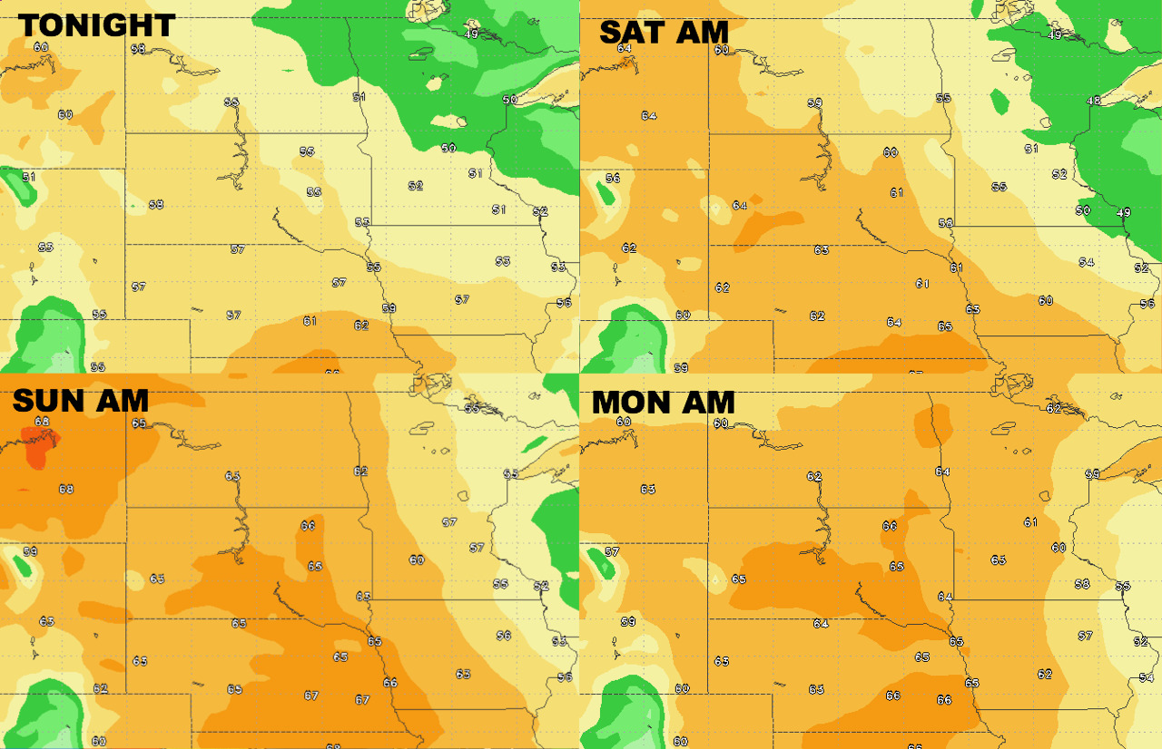
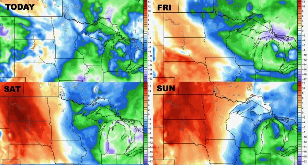
High temperatures over the next 4 days show the warm up expected.
Low temperatures are similar.
Humidity also rises through the weekend.
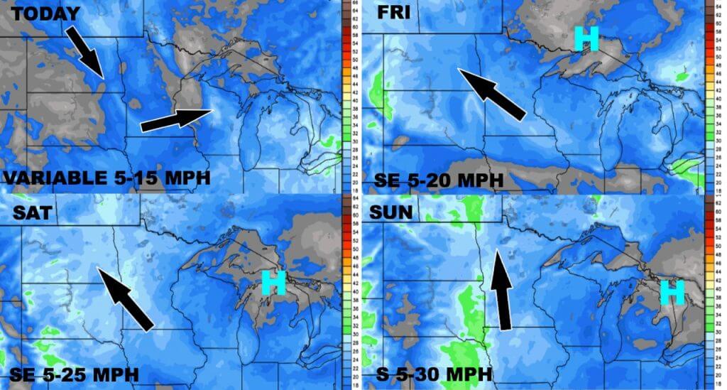
Wind forecast for the next 4 days is below.
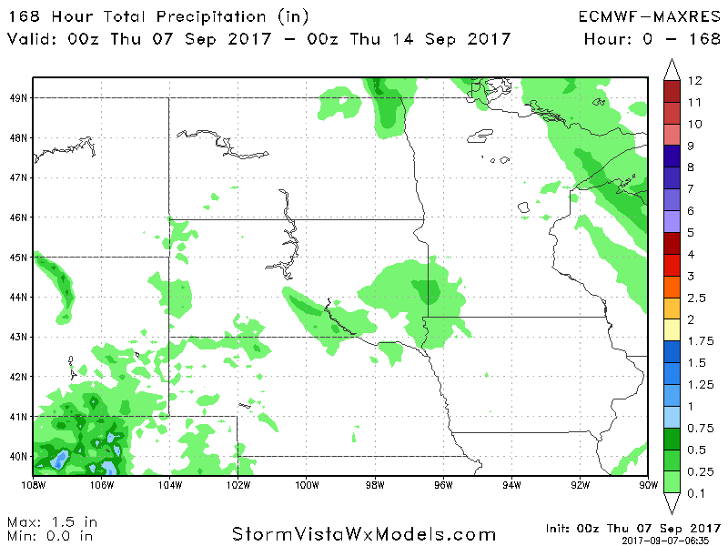
Total precipitation over the next 7 days looks light, especially across the Dakotas.