Key Points: September 21, 2017
Synopsis: Good Thursday morning! We are watching a warm front bringing some showers to the Dakotas, while the rest of the region is dry this morning. A disturbance will bring the threat of flooding across portions of Minnesota and Wisconsin overnight tonight into early Friday. A slow moving cold front will also bring the risk of severe weather across eastern South Dakota and Minnesota Friday as well. These storms can contain damaging winds and large hail. This very active pattern will continue through early next week thanks to the slow moving cold front – some will end up with a significant amount of rain! Have a blessed day.
Today’s Video (7 min):
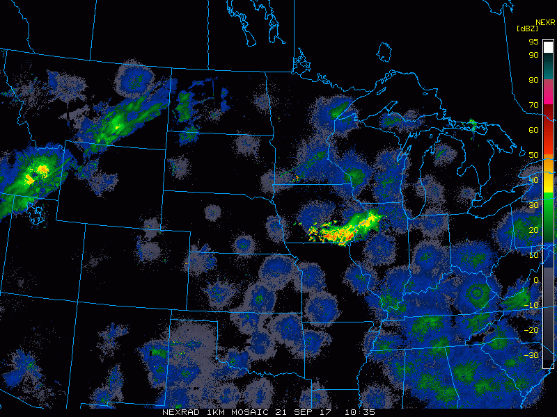
Current radar shows showers in ND, moving northeast.
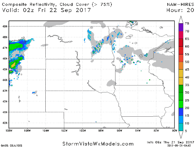
Drenching storms possible overnight in MN and WI.
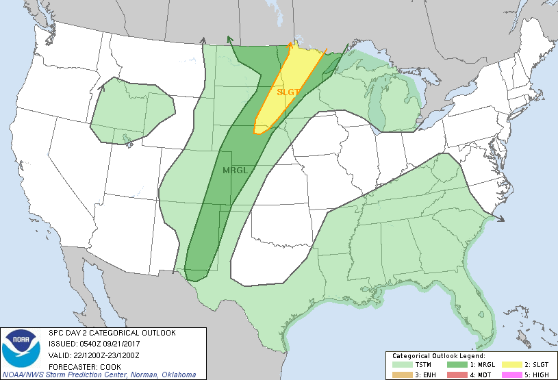
Severe risk increases late tomorrow afternoon and tomorrow night. SPC outlook shown below.
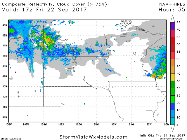
Projected radar tomorrow into tomorrow night.
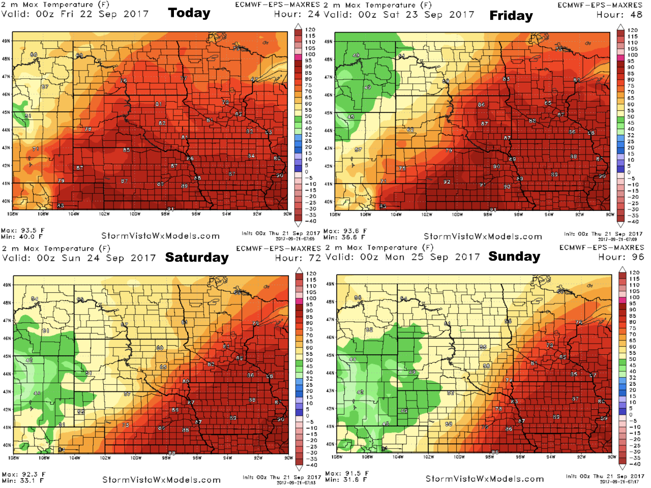
Temperatures over the next 4 days will be dictated by the cold front.
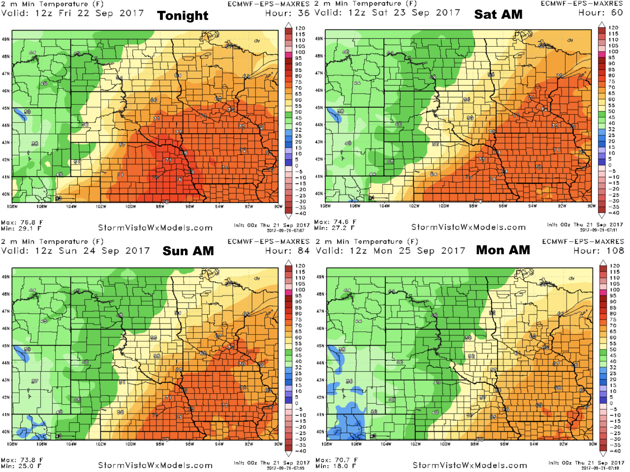
Low temperatures are similar.
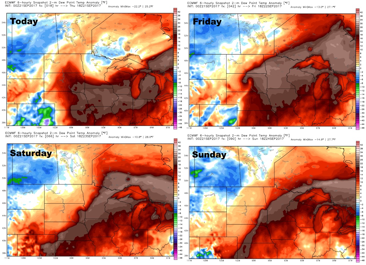
Humidity compared to normal over the next 4 days is below.
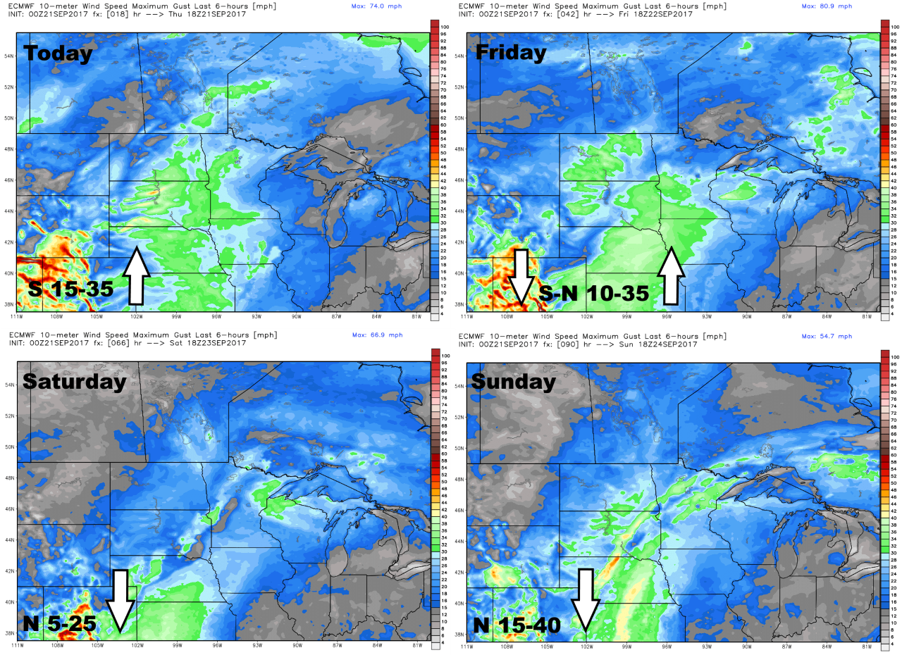
The wind forecast over the next 4 days is quite breezy along the front.
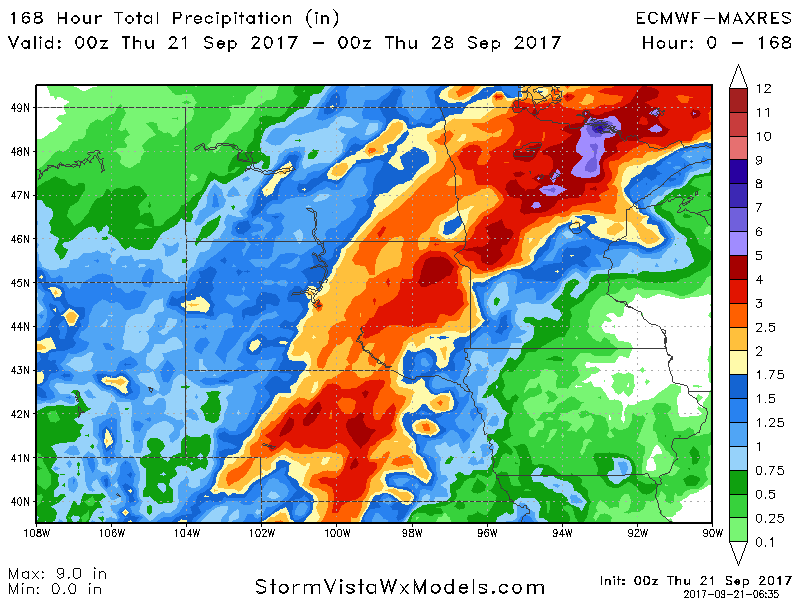
Total rainfall is impressive through midweek next week as well.