Key Points – Monday, August 7, 2017:
***We are so excited for this week and all of you that have signed up for our open house! As a reminder, you will receive all of our product via email, just make sure you’re looking at the right forecast locally; remember, the advantage of having a team of meteorologists at your fingertips can be priceless. With our service you will have access to our team of meteorologists 24/7.
Throughout the week we really want you to take advantage of the content we put out and use it to your advantage! At anytime this week you feel like you have seen enough to make a decision and you’re ready to sign up we will offer you a 20% off discount if you sign up BEFORE your trial expires August 11th. Please do not hesitate to reach out to us at anytime if you have any questions. Have a blessed week! -BAM staff.***
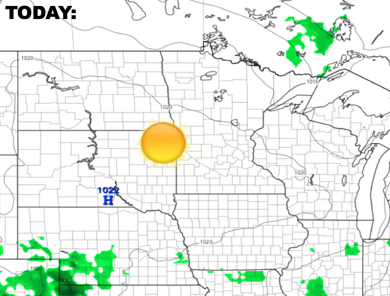
Synopsis: Very nice weather on the way for today with lots of sunshine across the region as high pressure moves overhead. Changes arrive heading through mid-week with showers and storms returning, some possibly strong. The video below goes into detailed analysis regarding the rain chances this week, and a look at the longer range forecast.
Today’s Video (7:38):
Expect mostly sunny skies and pleasant temps today.
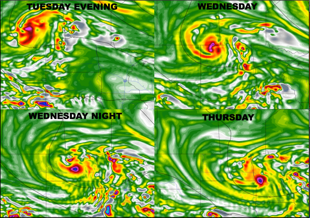
The next rain/storm risks will arrive across the western Dakotas late Tuesday, then spreads east across the region heading into Wednesday as an upper-level disturbance combines with a front moving through. Here is a look at the upper-level energy forecast through Thursday. Basically, think of the bolder colors to be where rain would occur.
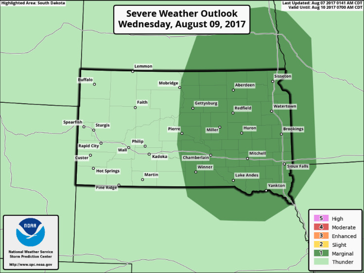
The Storm Prediction Center has placed a marginal severe risk over the eastern half of South Dakota, southeast North Dakota, and southwest Minnesota. This is not looking to be a major deal, but a few severe wind gusts/hail cannot be ruled out.
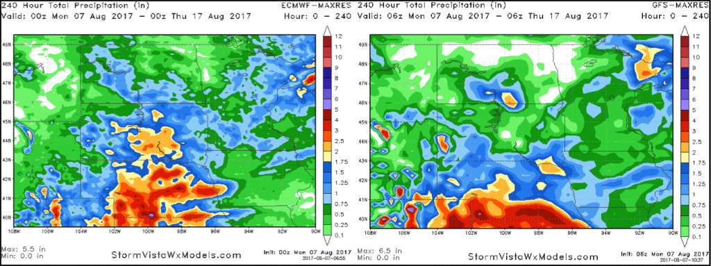
The region should catch a break from any storm chances late Thursday into early Friday, then additional chances late Friday through Saturday. Here is a look at 10-day rainfall guidance from the GFS and European models. Overall, both models are very similar regarding rainfall distribution.
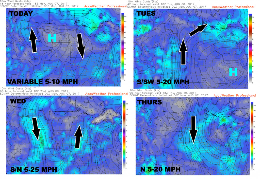
Wind forecast over the next 4 days.
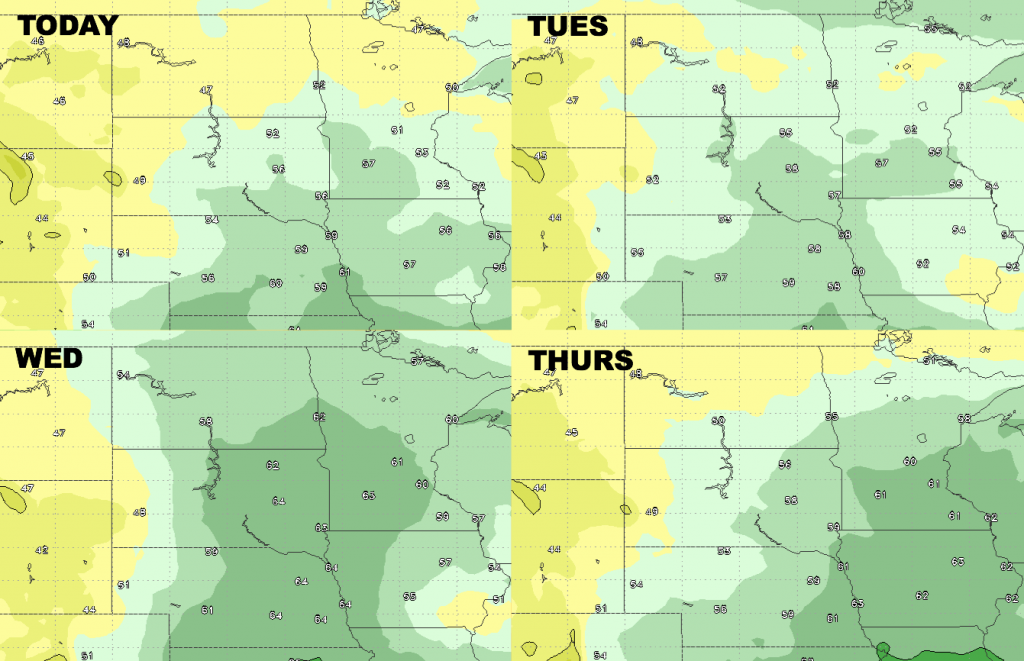
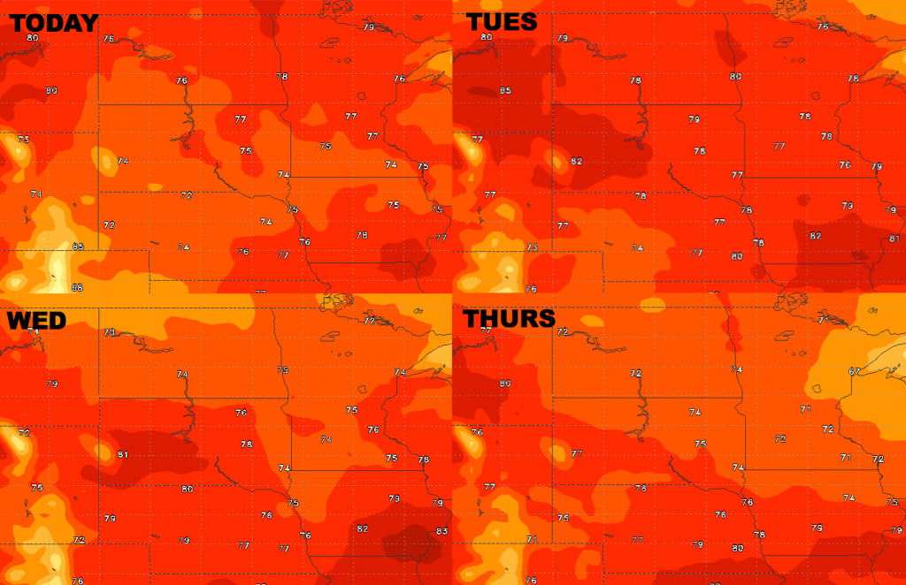
High temperature guidance over the next 4 days.. staying pleasant for August.
Low temperature guidance is shown below.

Here are the dew points from normal…increasing moisture levels through mid-week, then drier air builds back in behind the cold front on Thursday from northwest to southeast.