Key Points – Monday, June 26, 2017:
Synopsis: Good Monday morning, we hope you all had a wonderful weekend! We continue to be cooler than normal through mid-week across the central US before the warmth starts to pick back up again. However, the rainfall and storms department stays quite active this week into the weekend with multiple storm threats noted in today’s video…can’t rule out strong storms at times here as well. The forecast is packed today, so if you have any questions at all please don’t hesitate to reach out as we know it’s a very important time of year. Have a blessed day!
Current Radar:
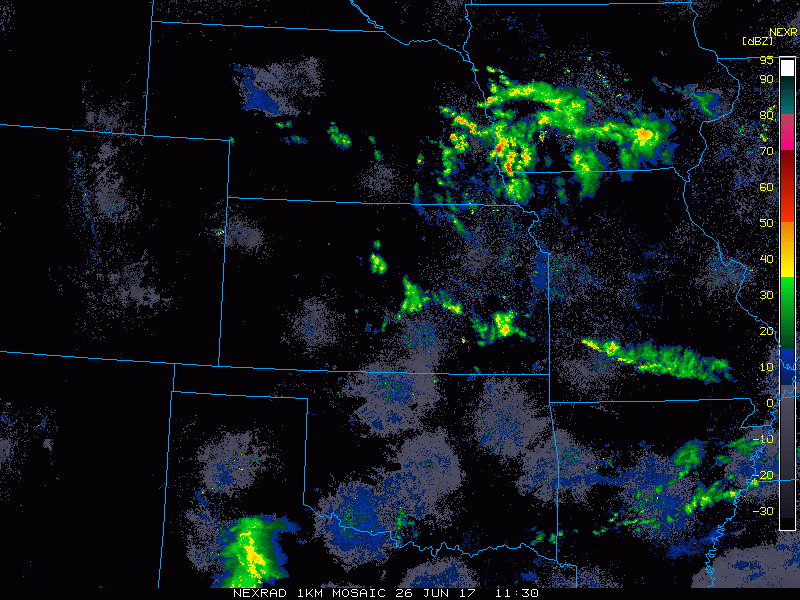
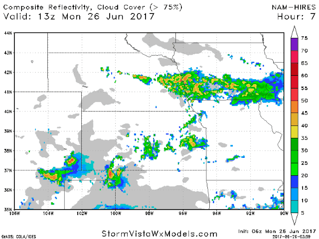
Simulated radar today…watching these storms drifting south and east throughout the day along a weak frontal boundary to, the focus being across mainly Missouri getting into this evening…watching things diminish as the sun sets.
Late tomorrow evening (Tuesday) we are watching for potential strong to severe storms ~8pm western Nebraska/Kansas continue east into Wednesday morning…settling mainly across Iowa waking up in the early AM hours.

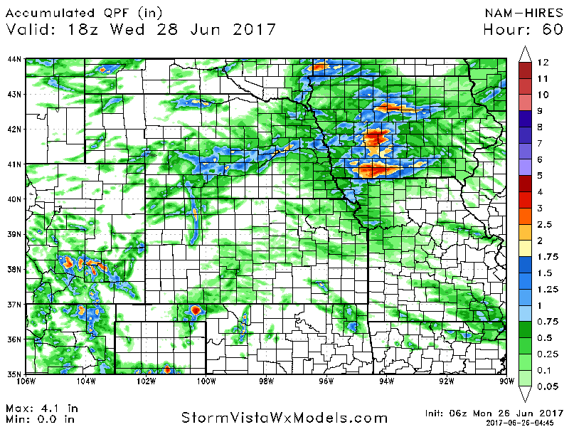
Rainfall totals through the next 60 hours…with main focus of rainfall will be across Nebraska into Iowa with 1-3″ possible.
Severe storm outlooks Tuesday through Thursday, we highlight the risks in the video, the main threats being damaging/gusty winds and isolated large hail.
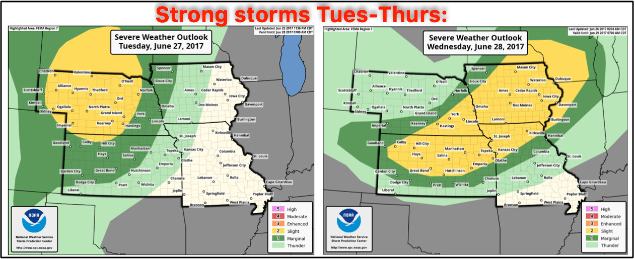
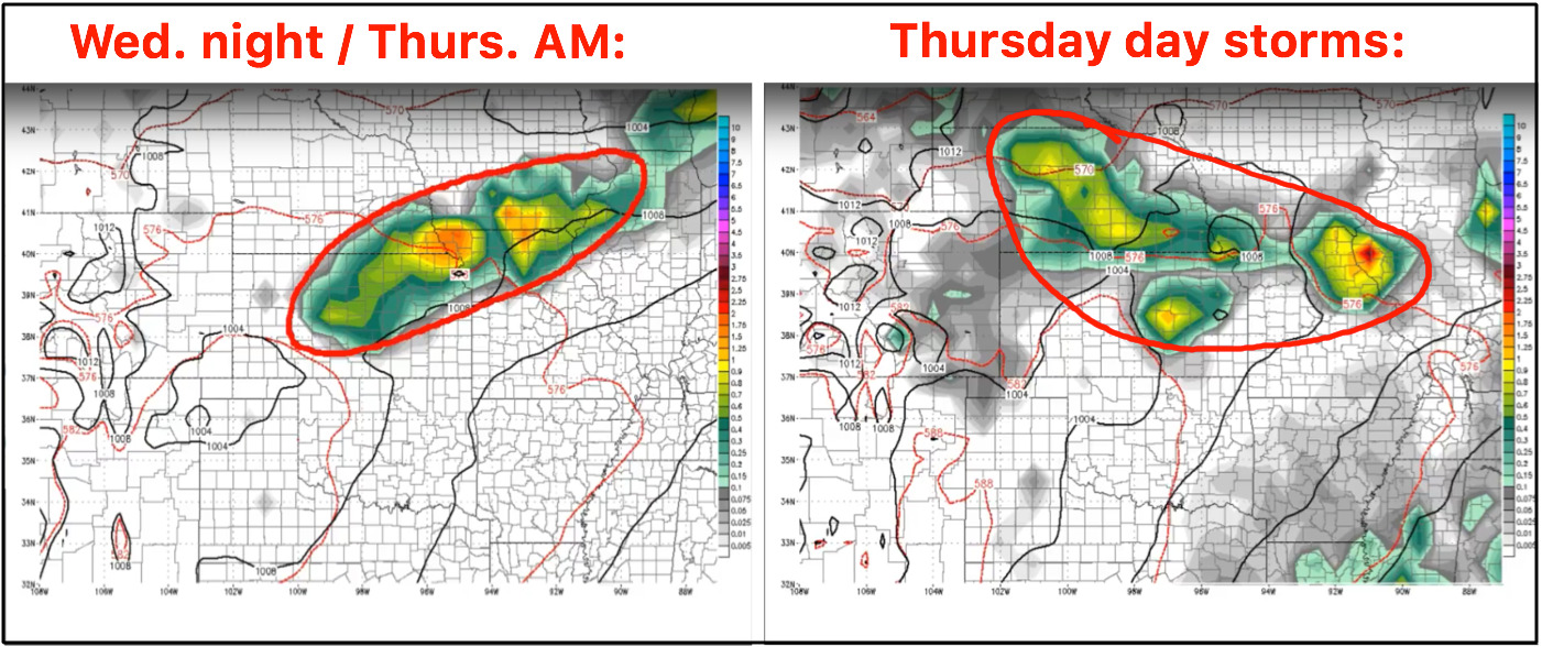
Wednesday night into Thursday we have a decent risk for additional stronger storms across central parts of the Zone, with additional storms possible during the day on Thursday ~50-60% coverage possible. The area circled below matches up pretty well with the Day 3 risk shown above for strong storms.
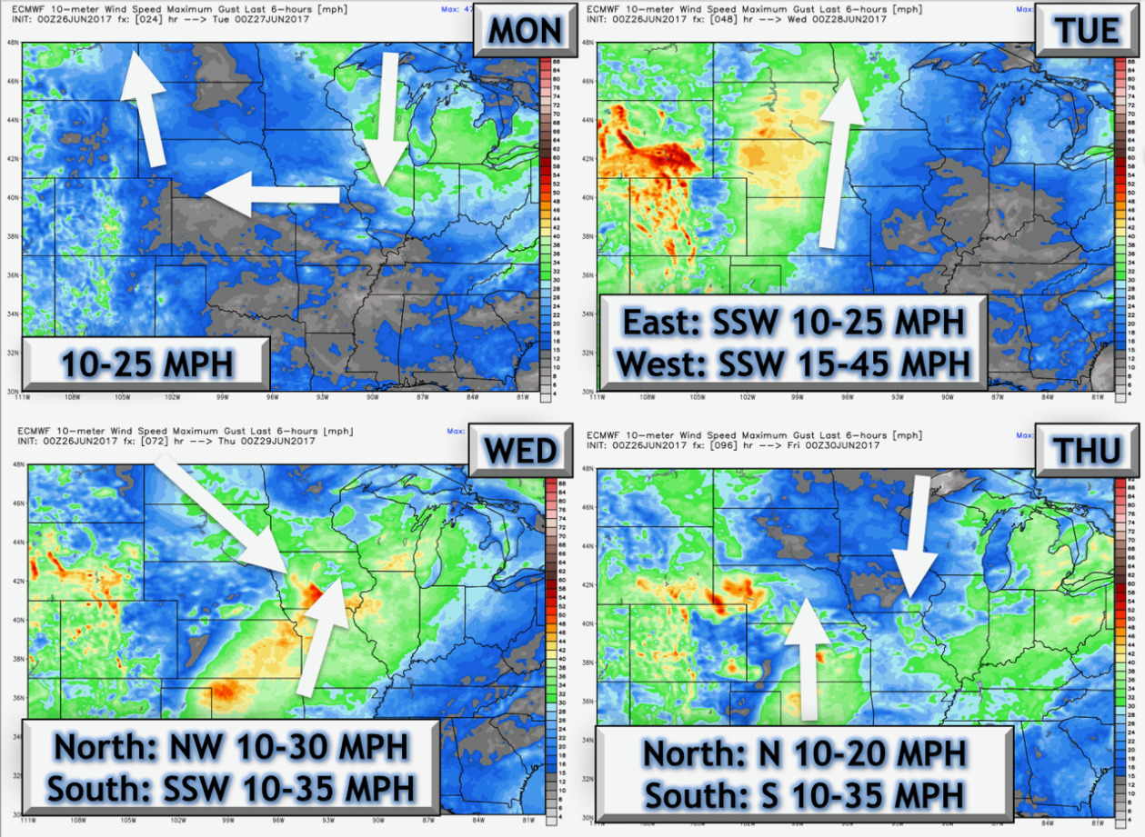
Here’s a look at the wind forecast over the next 4 days:
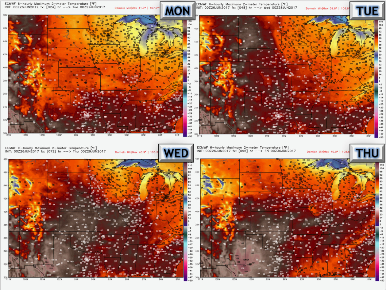
Looking at temperatures over the next 4 days…see the warming trend through mid-week and beyond.
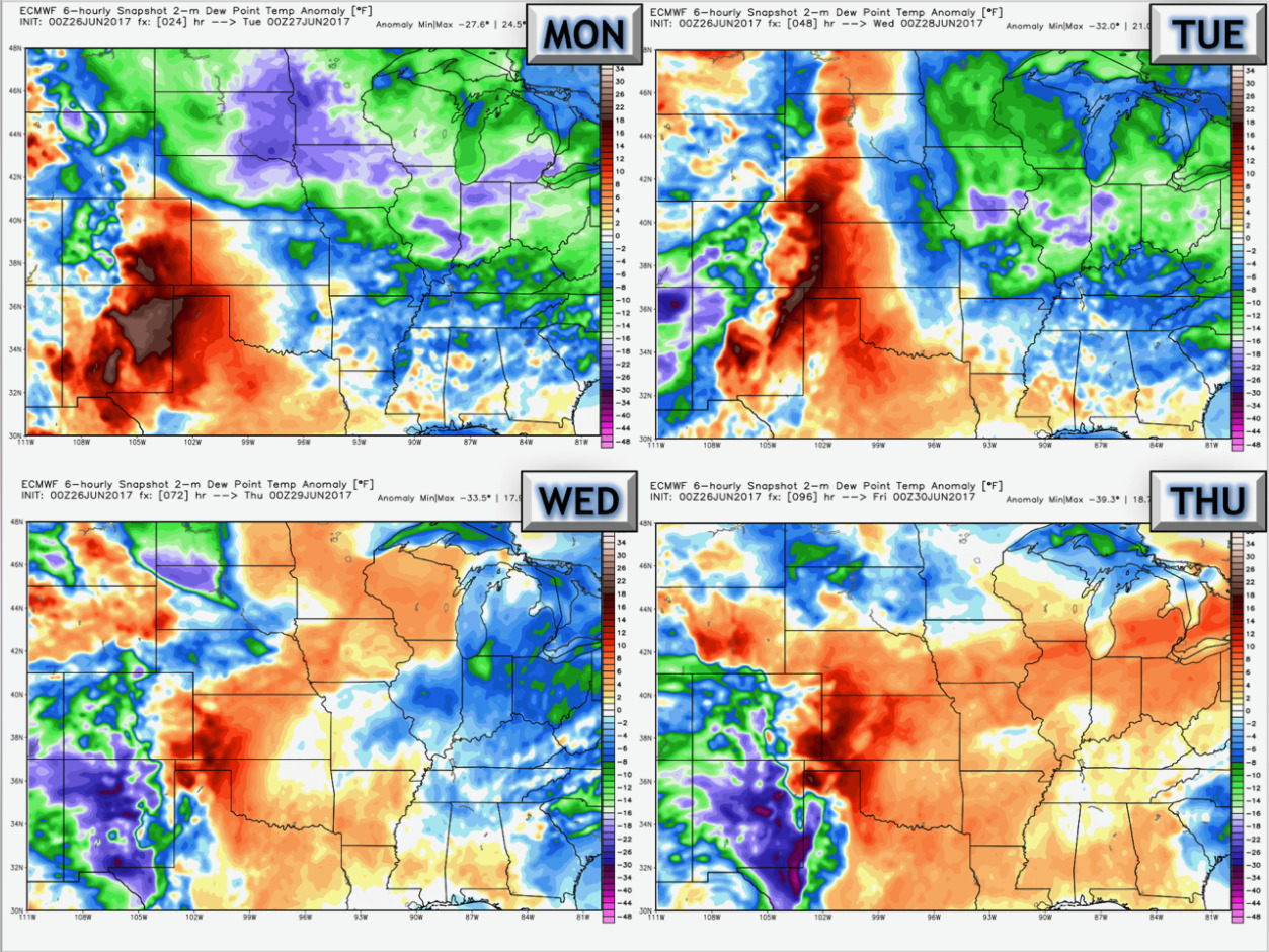
Dew points from normal here as well…starting to get more humid as well through mid-week.
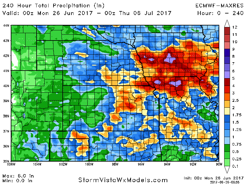
Rainfall totals over the next 10 days from the latest European forecast guidance…the main focus of the rainfall will be across eastern Nebraska, Eastern Kansas into Iowa and Missouri…3″+ certainly on the table here in localized spots.
Confidence:
- Above average confidence the central Plains stays very active with multiple storm chances this week into the weekend.
- Average and increasing confidence we are cooler today into tomorrow before the warmth starts to overspread the Zone once again mid-week and beyond.
- Average confidence of for the risk of strong storms Tuesday into Wednesday/Thursday as well.
Video (8 min):