Key Points – Monday, June 19, 2017:
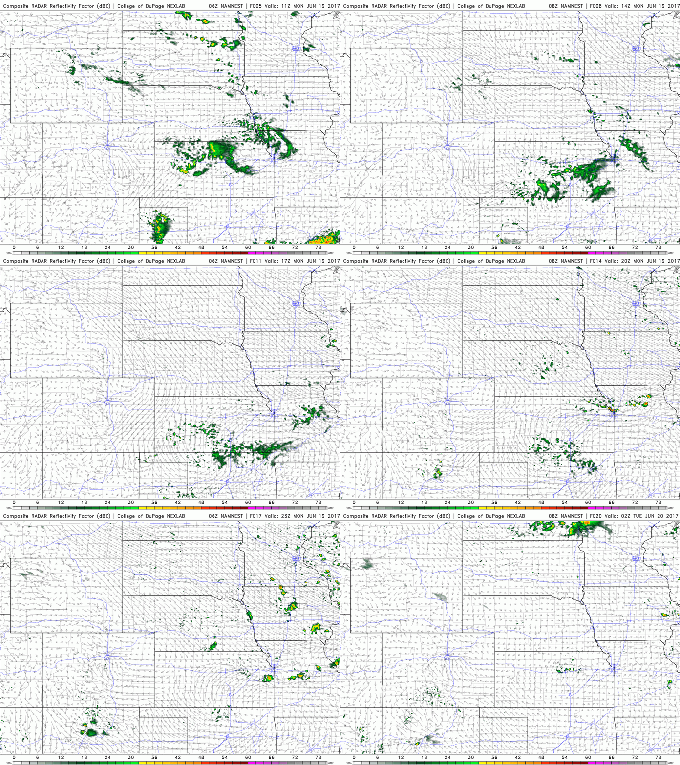
Synopsis: Good Monday morning! A few light showers moving through Kansas and Iowa this morning, some isolated storms possible later this afternoon across the eastern half of the Zone as well. Watching for a strong storm threat Wednesday into Thursday across the central Plains…and for a cooler pattern to work its way in this weekend through the end of June as well. Have a blessed day!
Isolated storms today across mainly Iowa and Missouri today, with a coverage ~20/30%…areas further west stay mostly dry and sunny.
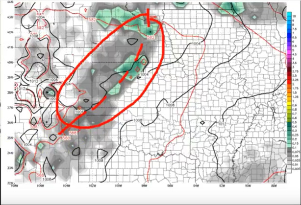
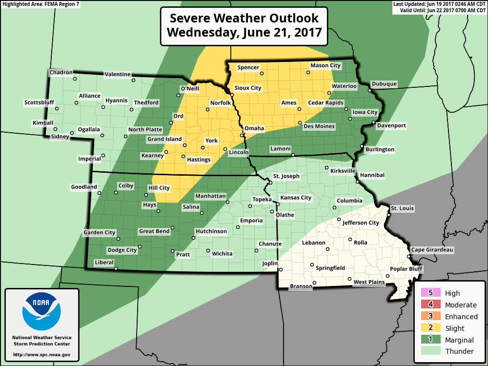
On the day on Wednesday into Thursday morning we are watching for a strong storm risk as a cold front moves through the central Plains.
The main threats will be large hail and damaging winds…with a marginal tornado threat as well here.
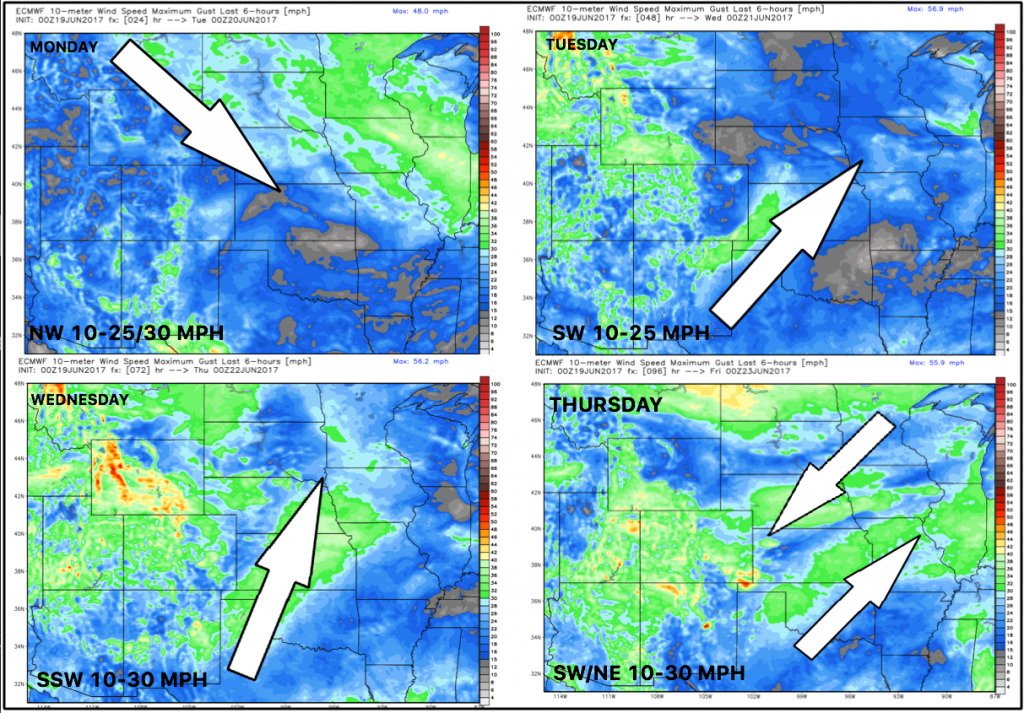
Winds next 4 day:
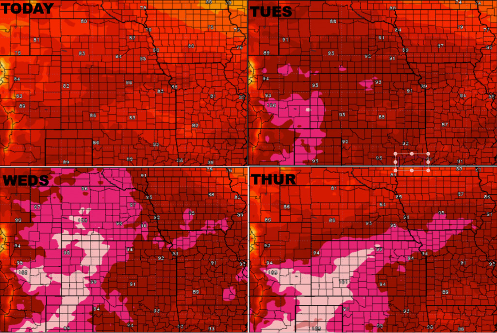
Temperatures next 4 day:
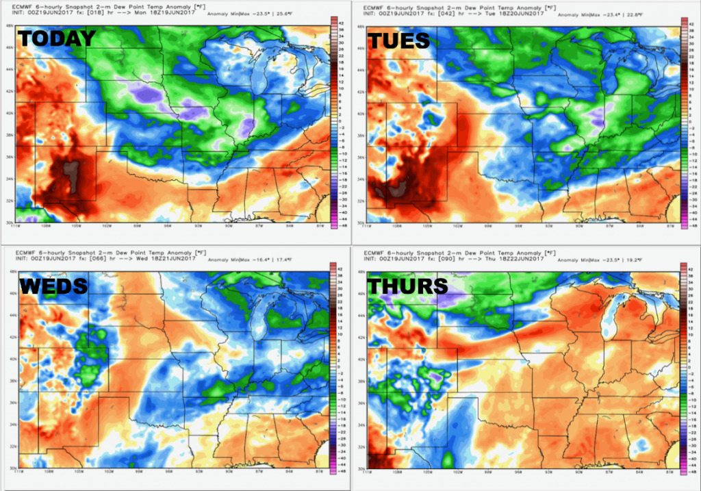
Dew points from normal next 4 day…getting a little more humid by Wed/Thurs.
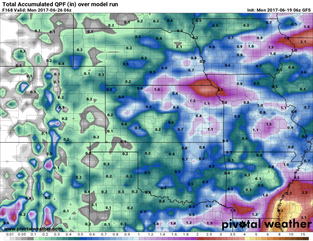
Precipitation expected through the next week…main focus is northern Kansas, eastern Nebraska, northwestern Missouri and eastern Iowa with 1.5″+ possible.
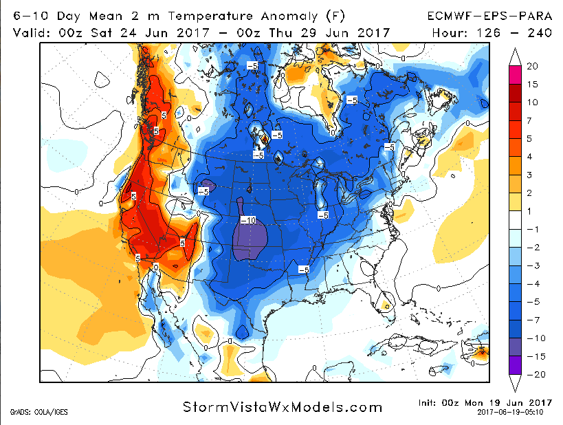
Temperatures from normal in the 6-10 day timeframe…cooler times ahead to end the month which is very different from the first half of the month!
Confidence:
- Average confidence of isolated storms across mainly Missouri and Iowa today into tonight…fading as the sun sets.
- Average but increasing confidence of a stronger storm threat Wednesday into Thursday morning across the central Plains.
- Increasing confidence we turn cooler than normal beyond the next 5 days getting into the weekend and next week.
Video (7 min):
