Key Points – Thursday, July 13, 2017:
Synopsis: Good Thursday morning! In today’s video we discuss the pattern into the weekend, as the cold front continues to sag south and east through the central Plains, can’t rule out localized heavy rainfall and a few strong storms as it does so. Getting into the weekend we see energy focused mainly across western Kansas with the remaining parts of the Zones seeing nicer conditions under high pressure. Some of the warmth gets knocked day today into tomorrow from the front, but Saturday and Sunday look warm back into the 80s/90s with humidity returning as well. Have a blessed day!
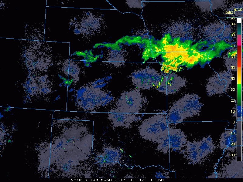
Current Radar:
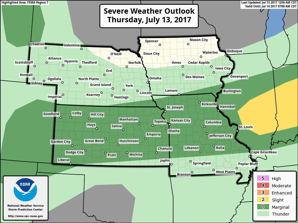
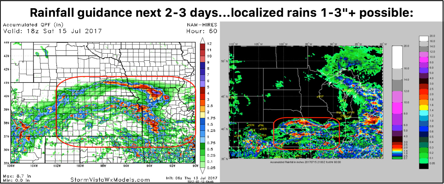
Strong storm risk guidance for today focused across the central to southern parts of the Zone areas as the cold front starts to swing through:
Here’s the upper-level energy forecasted through the next 2 days…the cold front will sweep south and east today, moving the showers and storms risks from Nebraska/Iowa to Kansas and Missouri…some of these strong with heavy rains at times. On Friday we continue to see energy present across Kansas/MO before shifting to the south by Saturday morning, where the remaining energy is focused across western Kansas for another rain threat.
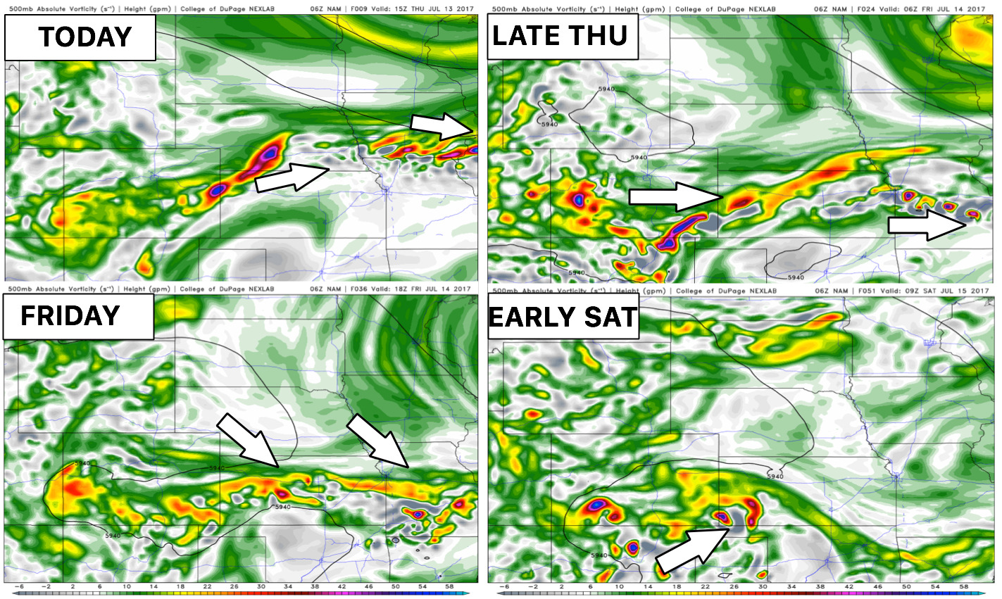
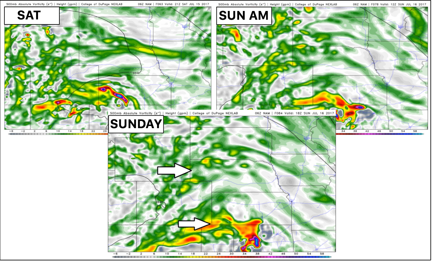
Glancing at the same energy forecast for Saturday through Sunday…main focus will continue to be across western/southern Kansas for rain chances…areas further north and east look to be under drier conditions. Despite low confidence, there is a risk for some energy to move northwest to southeast across northeast Iowa later on Saturday we will need to watch, but current thinking right now is the focus is more into the Midwest/Ohio Valley.
Total rainfall guidance here…some localized heavy rainfall still possible between 1-3″ (isolated higher too)…locations further north across northern Nebraska/Iowa will stay drier. Some solid rain chances across Kansas and Missouri will help the dry conditions get a drink in some areas.
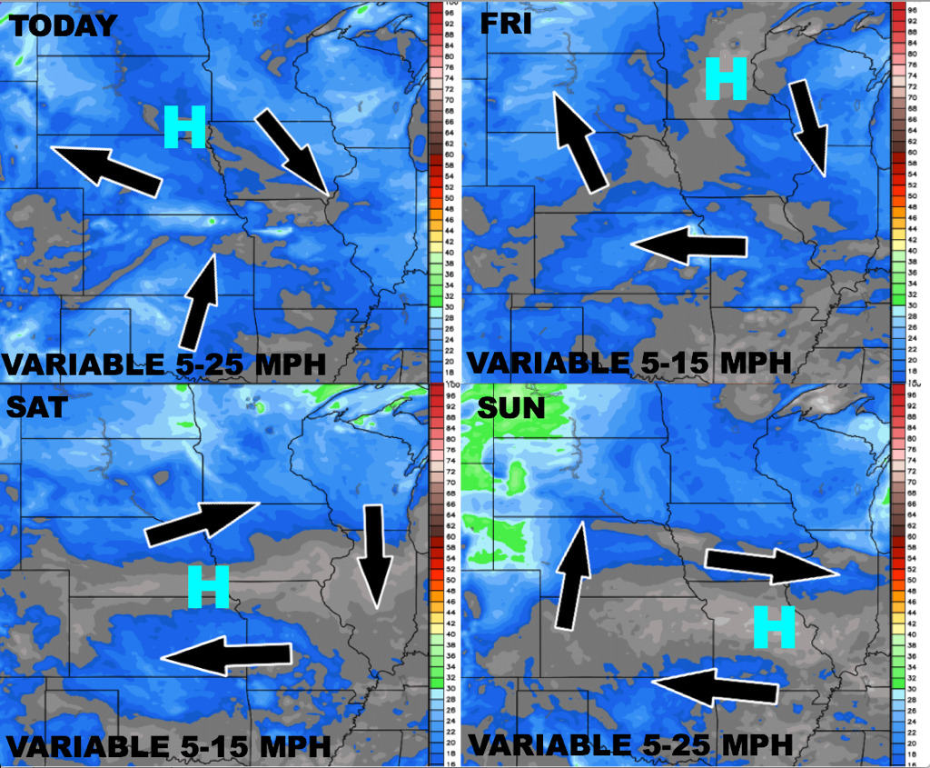
Here’s your wind forecast for the next 4 days:
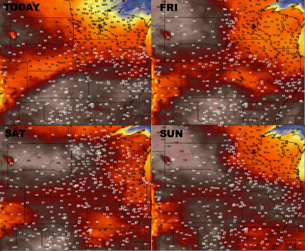
Temperature forecast into the weekend:
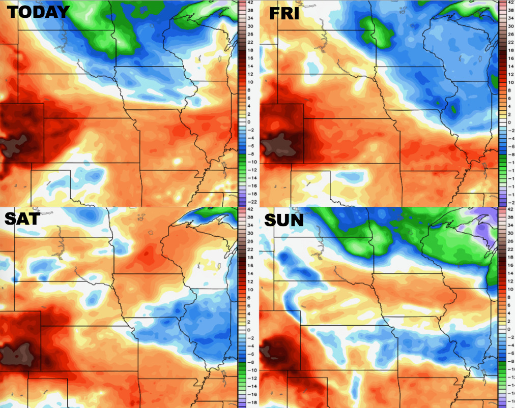
Here’s your dew points from normal as well:
Confidence:
- Above average confidence the rain/storm chances shift off to the south and east today into Friday morning as the cold front swings through.
- Average to above average confidence overall drier and nicer conditions persist into the weekend, although we do note some energy focused across portions of Kansas that could spark some isolated storms.
- Slightly below average confidence in exactly where the energy for storms will be focused into next week, but it does appear the locations across the southern half of the area look to stay drier with the moisture flow once again to the north and east.
Video (6 min):