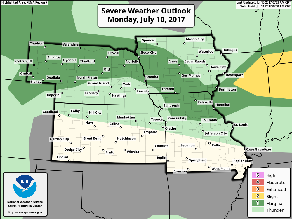
Key Points – Monday, July 10, 2017:
Synopsis: Good Monday morning! Today we discuss the active storm threat across mainly the northern half of the central Plains into mid-week as well as the furnace kicking on in regards to temperature in the upper 90s to lower 100s. It’s a very complex pattern here with the flow overtop of the ridge, if you have any questions please let us know, have a blessed day!
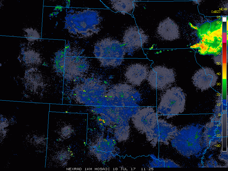
Current Radar:
Here’s a 4-panel of energy we are watching for storms late tonight through Thursday morning across the central Plains. The reason why we just to show “vorticity” is because even our best simulated radar data isn’t picking up well on the storm threats. In the video we discuss each day in detail, but the main focus of storms and rainfall this week will be focused across parts of Nebraska and Iowa, maybe northwestern Kansas, meanwhile we have a drier pattern across most of Kansas into Missouri.
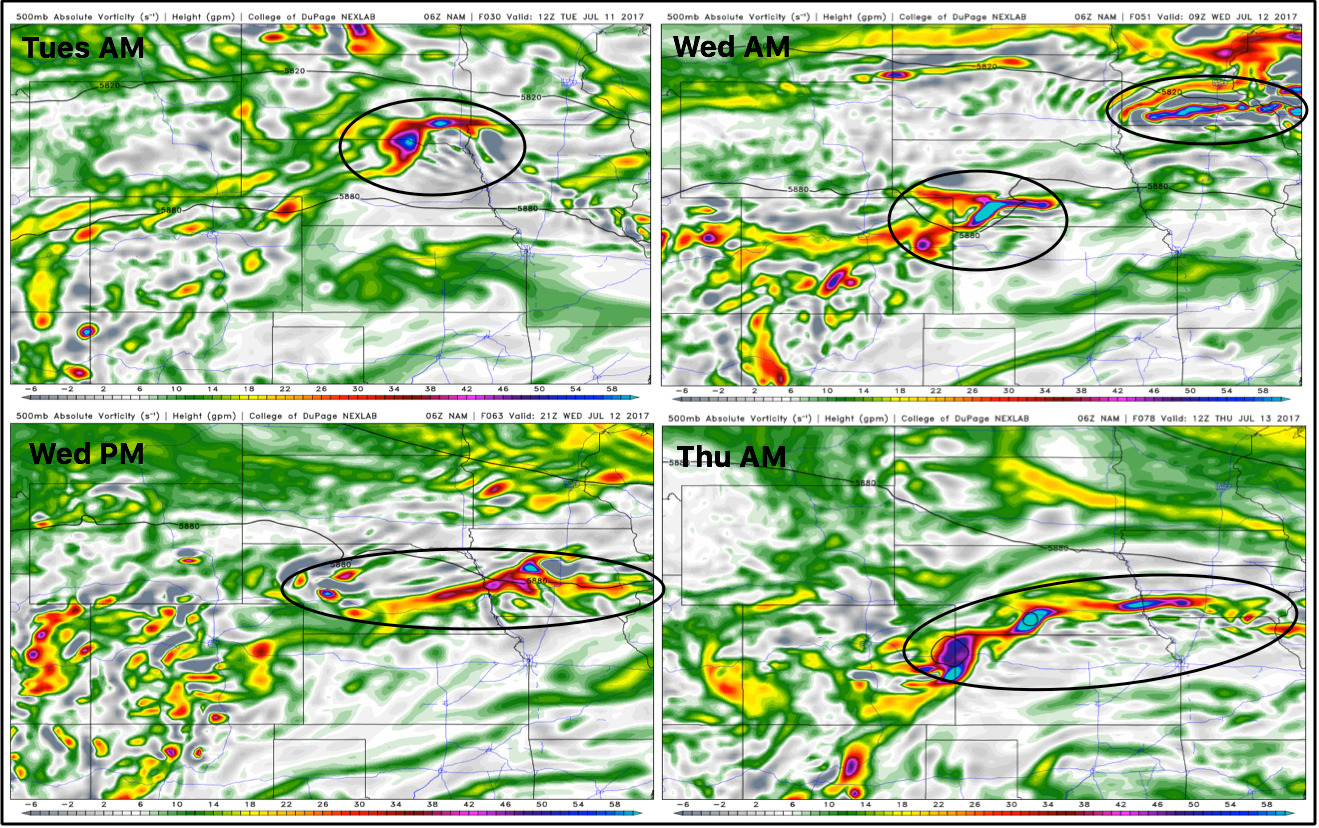
We have a strong storm thunderstorm risk across parts of Nebraska and Iowa for these storms over night…can’t rule out parts of northern Missouri as well.
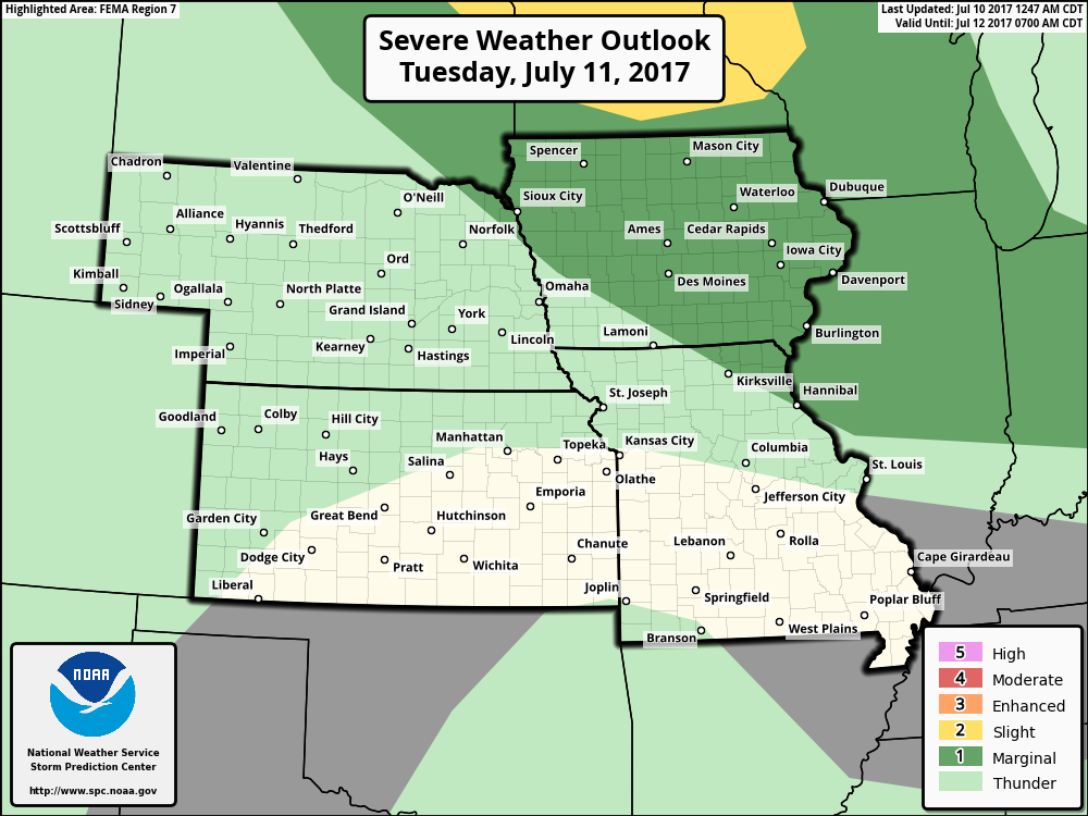
Moving into Tuesday night into Wednesday morning an additional risk for strong storms will be possible…could see this expanded more into eastern Nebraska.
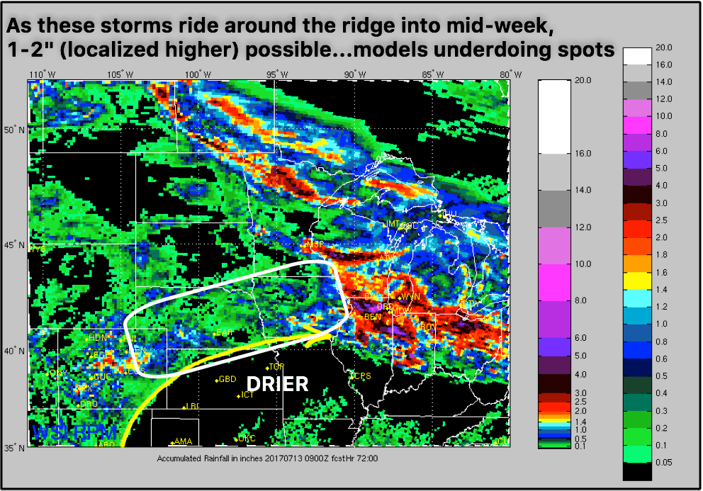
First off a disclaimer that no model on the planet is accurately picking up on the rainfall forecast heading into mid-week…as these storms ride around the ridge our latest analysis is 1-2″ with localized higher amounts on the table as these pieces of energy move east.
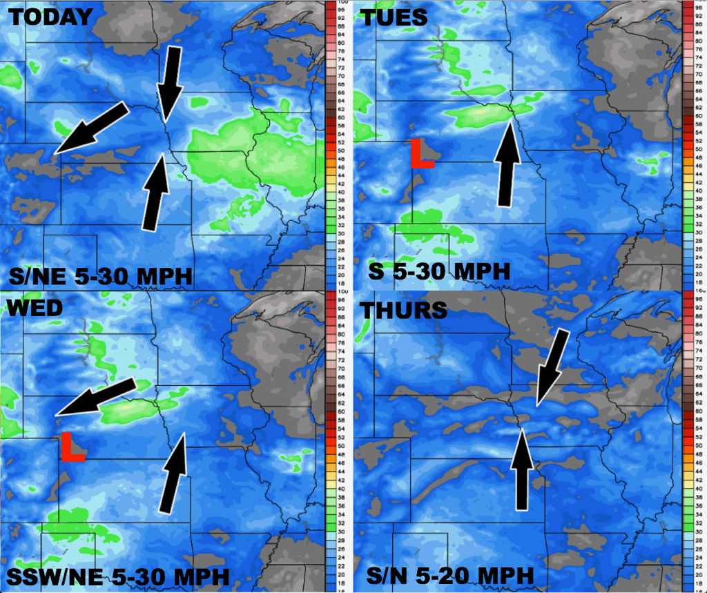
Wind forecast into mid-week is below:
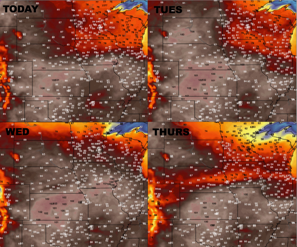
Here is a glance at the temperature guidance, it certainly will be quite warm with upper 90s and even lower 100s on the table:
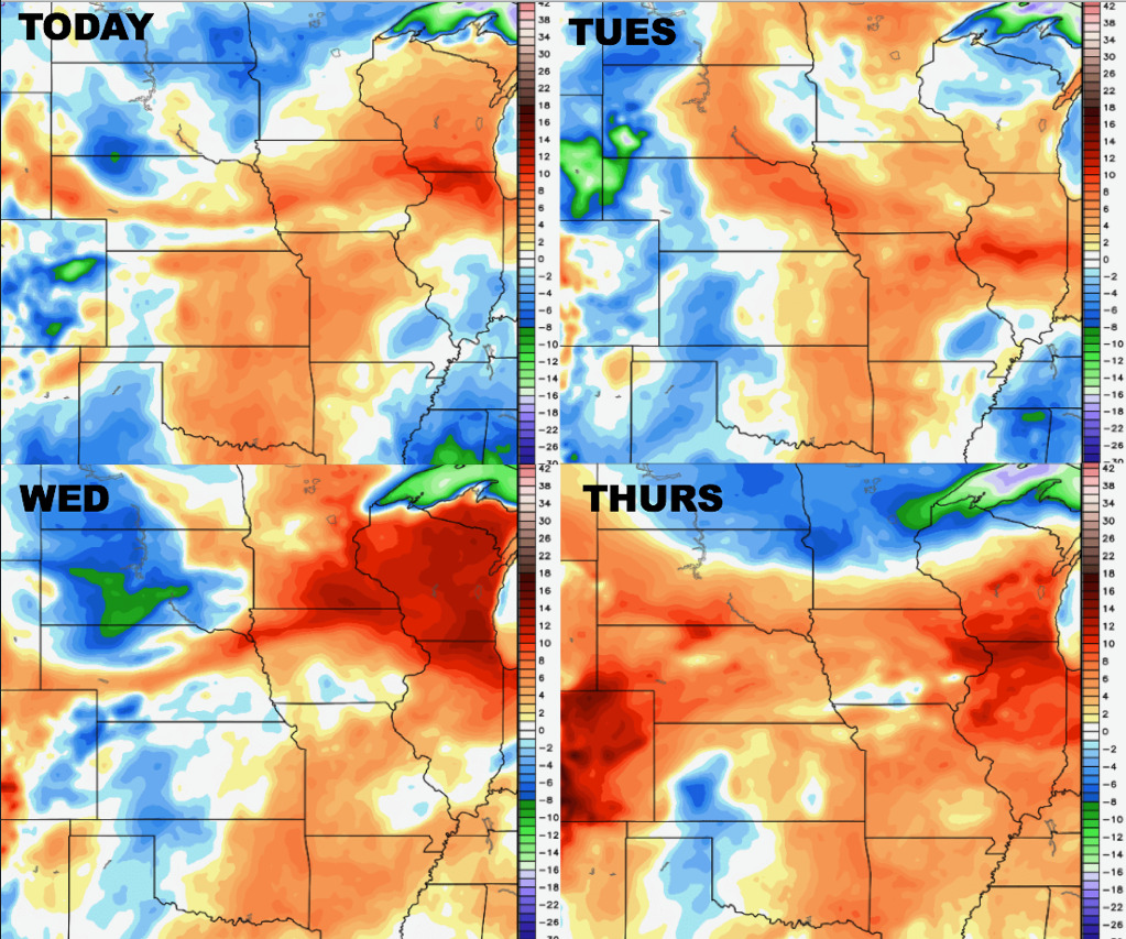
Dew points from normal also suggest a muggy week especially across the eastern half of the Zone:
Confidence:
- High confidence it’s going to be a very warm week across the central Plains with many seeing upper 90s to lower 100s.
- Average confidence of the storm clusters forecasted to move west to east mainly across the northern half of the central Plains through mid-week.
- Average confidence some of these storms may be strong to severe at times as well.
Video (7 min):