Key Points – Tuesday August 1, 2017:
Synopsis: Good Tuesday morning! Most of the area stays dry today, with storm chances moving in from the north this evening. Storm chances will increase heading into mid/late week. Rainfall coverage overall looks hit and miss, with the northern portions of the area likely seeing the best rainfall coverage. Once the cold front passes, much cooler and drier air will move into the region. All the details in the video. Have a blessed day, and let us know if you have any questions!
Today’s video (8 min):
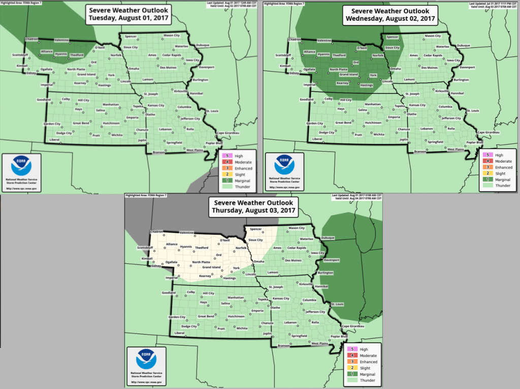
Here are the Storm Prediction Center outlooks over the next 3 days:
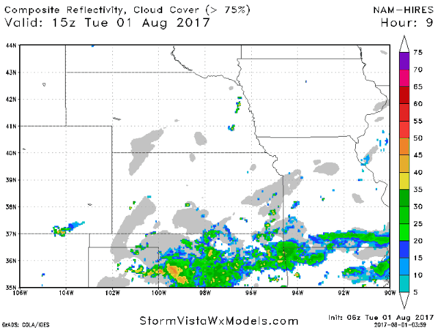
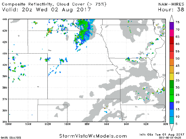
Most of the day will be dry for the area, however, storm chances will increase across Nebraska late this afternoon into tonight as energy drops in from the north.
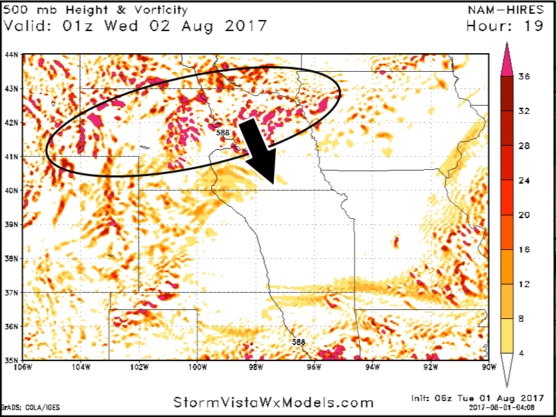
Here is a look at the NAM vorticity. This energy will spark storms across Nebraska and northwest Iowa this evening.
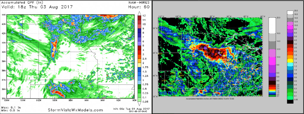
Higher storm chances will arrive late Wednesday into Thursday as an area of low pressure swings across the northern Plains and an associated cold front moves through the area.
Rainfall amounts will be very hit and miss for most. Better chances as you head across northern Iowa, then heavy rain amounts just to the north over Minnesota. Still some uncertainty on the southern extent of the heavier rain.
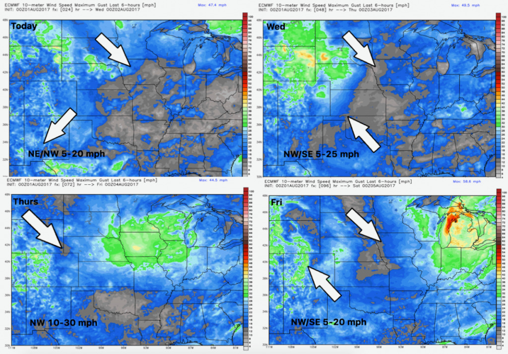
Wind forecast over the next 4 days is shown below.
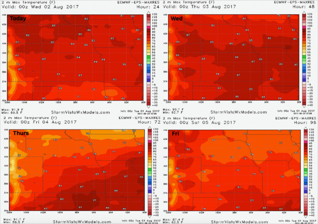
High temperature guidance through Friday is shown below. A sharp drop in temperatures behind the front Thursday into Friday.
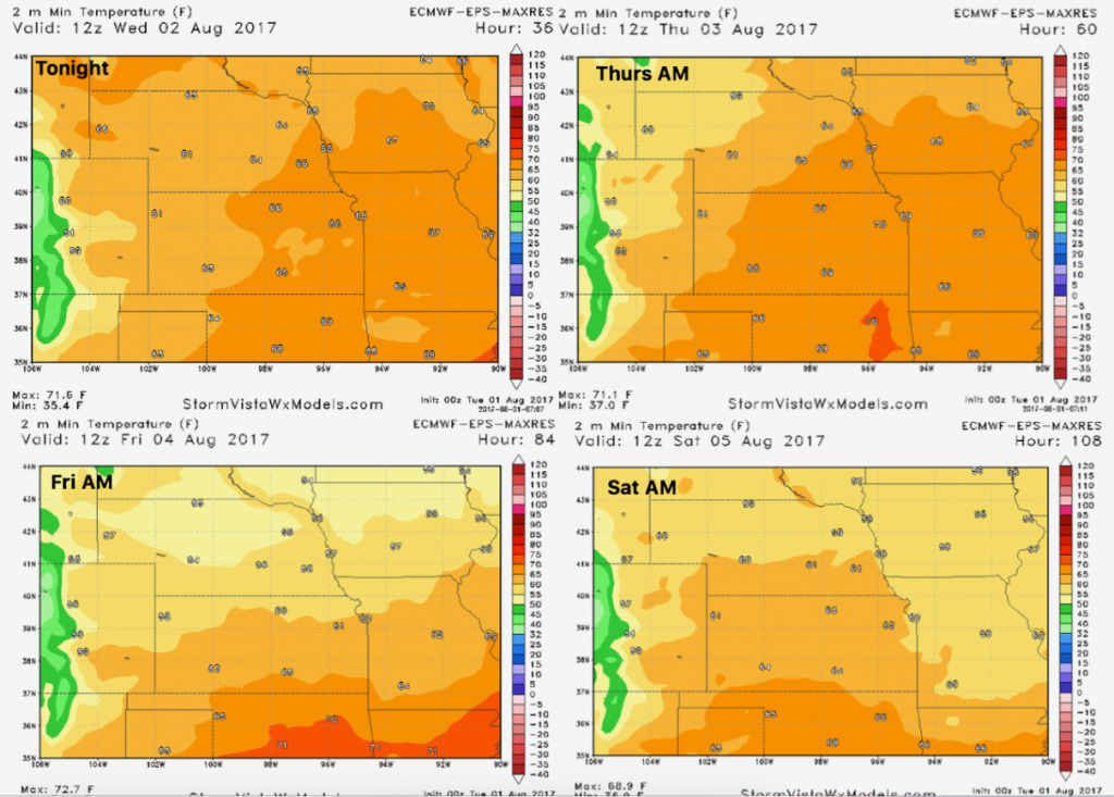
Here is the low temperature forecast into late week.
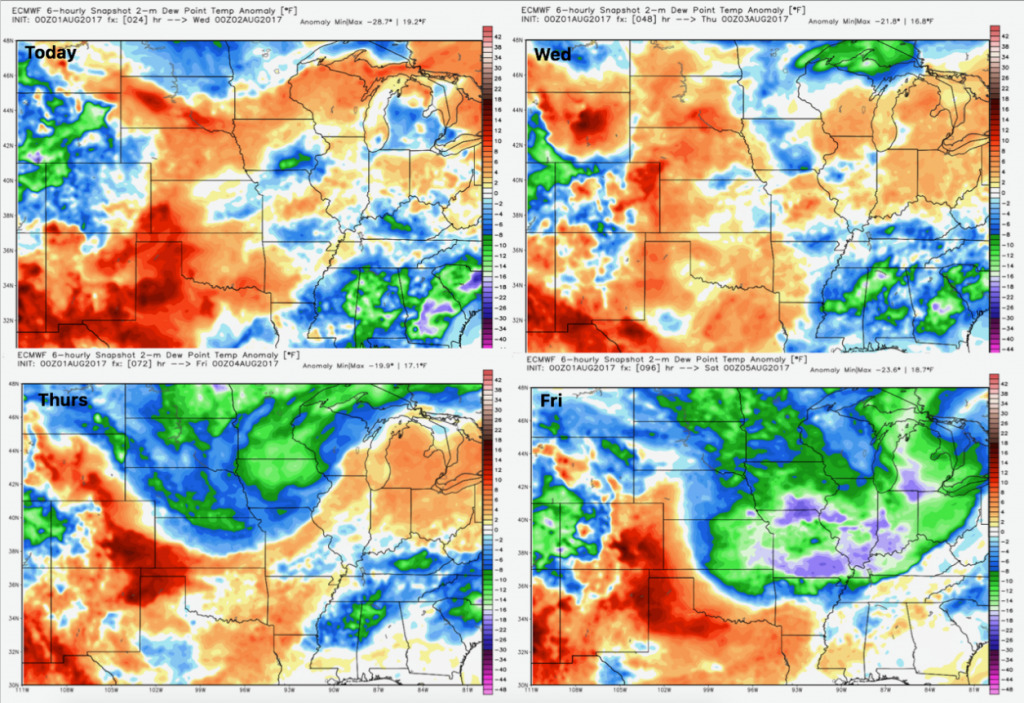
Dewpoints from normal: