Key Points – Friday, April, 14, 2017:
Synopsis: Good Friday morning! Today we discuss the strong to severe storm threat today and Saturday, even can’t rule out an isolated tornado as well along the warm and cold fronts across portions of Zone 8. We remain VERY active into next week with multiple shower and t’storm chances…we even have a growing concern for a stalled out stationary front mid to late next week that could drop some serious rainfall and even cause some flooding issues that we need to start taking very seriously. Details in the video, have a blessed Easter Weekend!
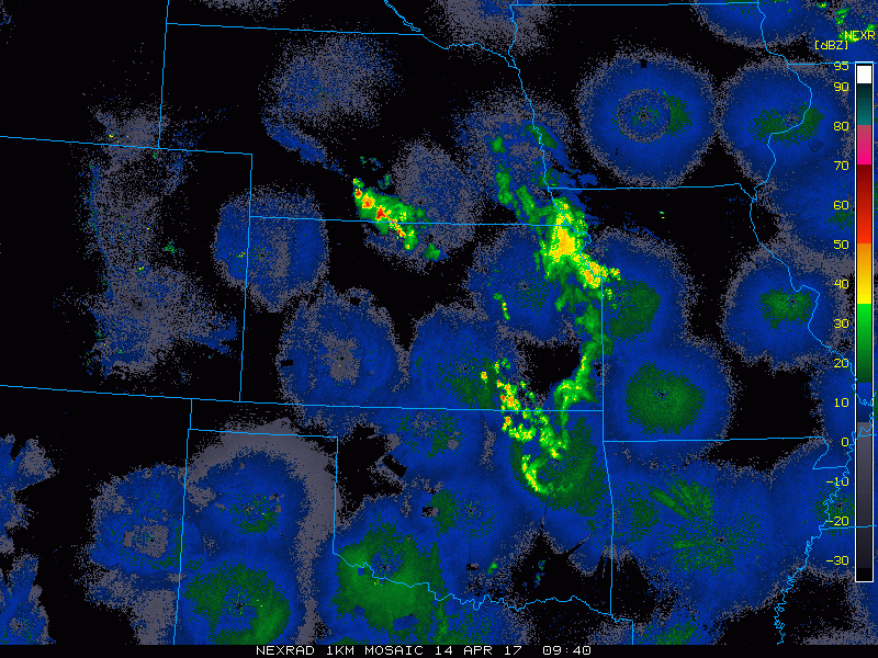
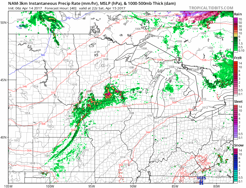
Current radar and showers ands storms move east across portions of Nebraska, eastern Kansas into western Missouri and southwestern Iowa.
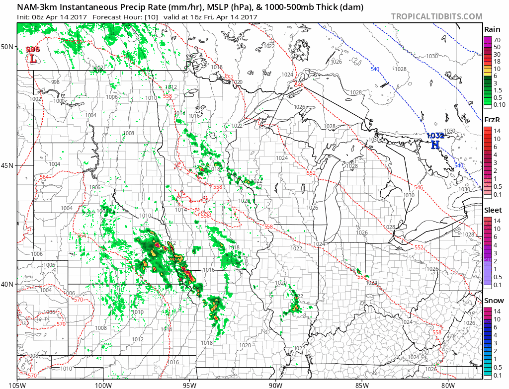
Simulated radar…by 1pm today we see the t’storms moving north and east off of the warm front…watching ~6-7pm for the strong to severe threat today to increase as seen below. Heavy rains working north of Zone 8 as well into portions of southeast Minnesota and Wisconsin later tonight. Coverage is ~50% with these showers and t’storms.
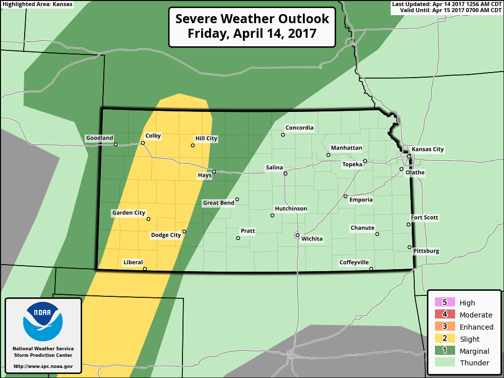
Day 1 outlook for strong storms today…a damaging wind and isolated large hail risk are the main threats across southern Nebraska into the western half of Kansas…although an isolated tornado cannot be ruled out.
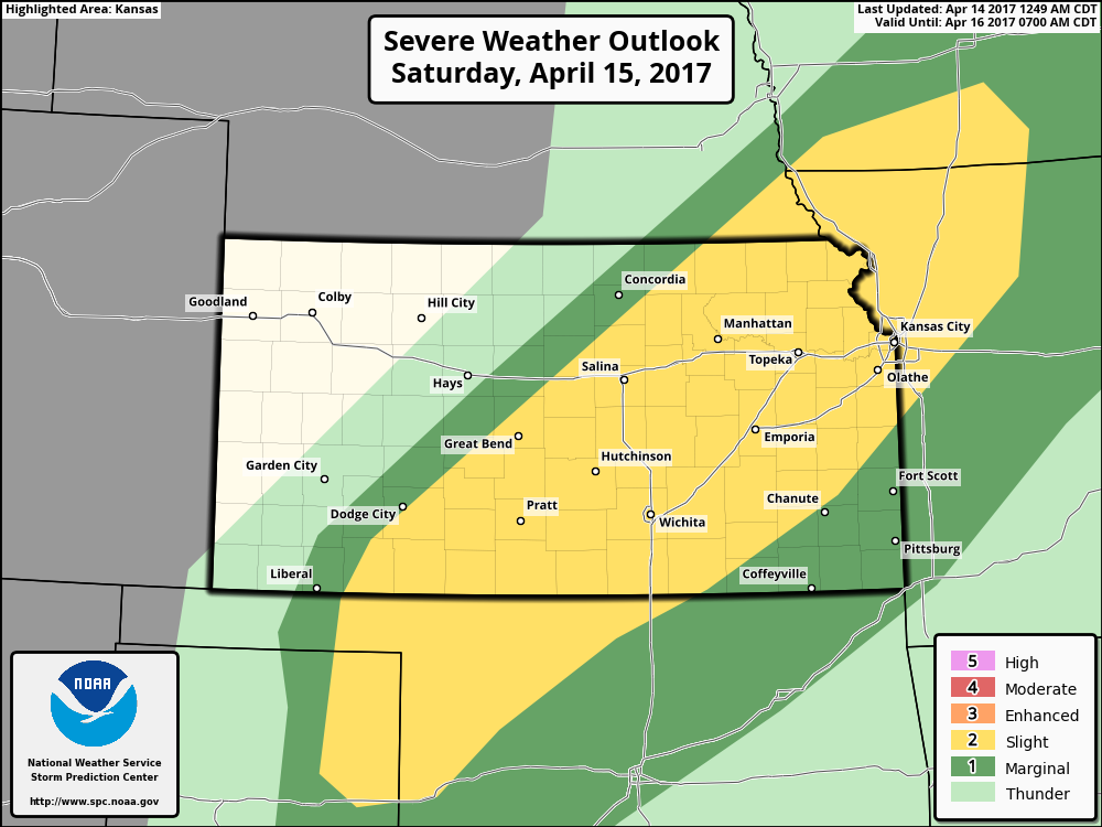
Day 2 slight risk for Saturday…hail, damaging winds and even a few isolated tornadoes possible here along a cold front probably between the hours between 5-10pm across southeastern Iowa, northwestern Missouri into eastern Kansas.
Simulated Radar from this as t’storms develop along the cold front sweeping east Saturday evening into early Sunday morning across the same areas mentioned above. Some localized heavy rainfall will be possible as well discussed below.
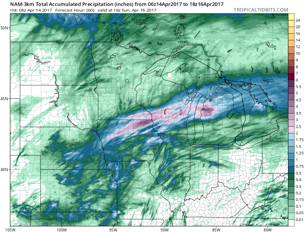
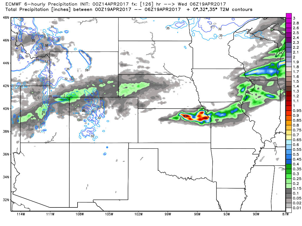
Rainfall totals over the next 60 hours…1-2″ possible from Wisconsin, southern Minnesota south to Iowa into eastern Kansas and northern Missouri…0.25-0.3″ in other areas where the threat is more isolated for t’storms.
High pressure sets in Sunday before our next shower and t’storm chance comes later Sunday into Monday across Kansas and Missouri where some heavy rainfall may be possible too.
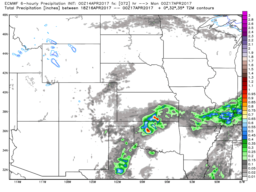
Monday night into Tuesday a heavier rainmaker looks to sweep from west to east across the Dakotas into Minnesota and Wisconsin on Tuesday. Zone 9 locations could see between 1.0-1.5″ of additional rainfall in this one system where it’s been very dry recently.
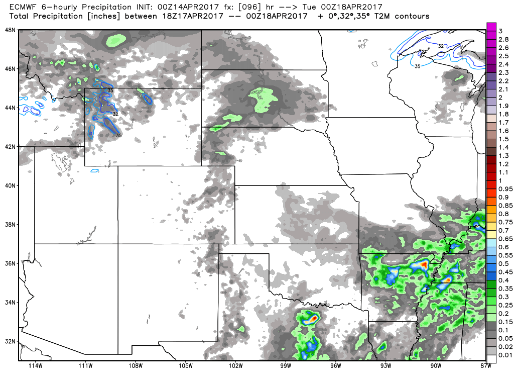
The big story is a front that looks to stall across the area along a stationary front across portions of Nebraska east through northern Kansas, Iowa and northern Missouri Wednesday into late week…this one system could drop over 1.5-2.0″+ of rainfall as it just sits and hangs out…this needs to be monitored closely as it would set us back big time from getting back into the fields.
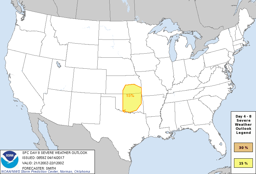
Day 8 severe t’storm risk issued this morning as well as a negatively tilted trough (this increases rise in the atmosphere that helps fuel severe storms) looks to push through late next week into the weekend…we need to keep close eyes on this. This stormy pattern to end April and begin May is well teleconnected by our organic forecasting methods we’ve been discussing in the long-range videos.
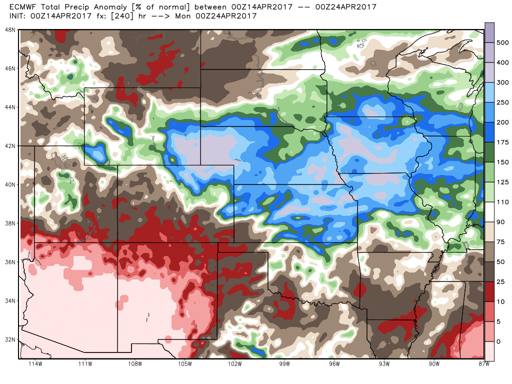
10-day total rainfall anomalies…this is a problem. Some locations spanning from southern MN to IA, NE, Northern MO and KS likely seeing 3-400% above the normal precipitation. Big-time growing concern for very saturated fields.
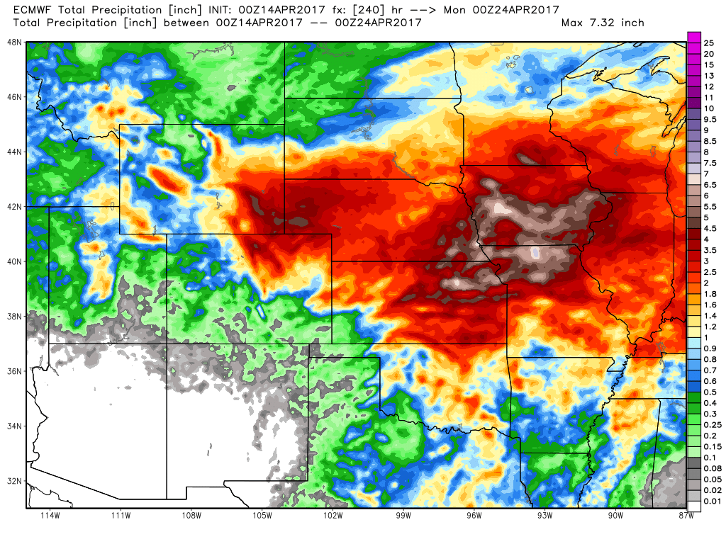
Here’s a look at the actual rainfall totals from the latest European as well…which suggests a widespread swatch of 3.0″+ from Nebraska, southern South Dakota, southern Minnesota, southern Wisconsin into Iowa, Kansas and northern Missouri. It also suggests a small area of 5″+ across portions of Iowa, eastern Nebraska, northeastern Kansas into Missouri that cause some serious saturated soils, even some flooding possible here.
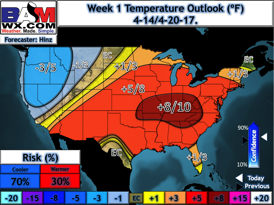
Very warm over the next 7 days via our latest week 1 temperature anomaly maps updated this morning across Zone 8, meanwhile we see more seasonal temps expected across northwestern Zone 9 into the western Dakotas and slightly above normal further east into Minnesota and Wisconsin.
Confidence and Risk:
- Above average confidence of showers and t’storms lifting north of the warm front across Zone 8 today and into eastern Zone 9 by early Friday morning.
- Average risk for strong to severe storms as well across portions of Southern Nebraska into Kansas…can’t rule out an isolated tornado.
- Above average confidence of additional t’storms Saturday along cold front moving west to east.
- Average risk for severe storms here as well, including the threat for isolated tornadoes as well.
- High confidence the pattern remains very active over the next 10 days.
- Above average risk that a stationary front stalls out mid to late next week bringing very heavy rainfall to the Ag Belt…the details are still a little fuzzy but the threat remains very real.
Today’s video (8 min):