Key Points – Wednesday, June 21, 2017:
Synopsis: Good Wednesday morning! Watching for stronger storms possible today especially north and west, the threat continuing Thursday across many central Plains locations as a frontal pushes northwest to southeast…can’t rule out localized heavier rainfall in spots as well. We discuss in the video how the pattern will be changing as the front sweeps through on Thursday…cooler times ahead, but continued active times ahead as well for the central Plains. Have a blessed day!
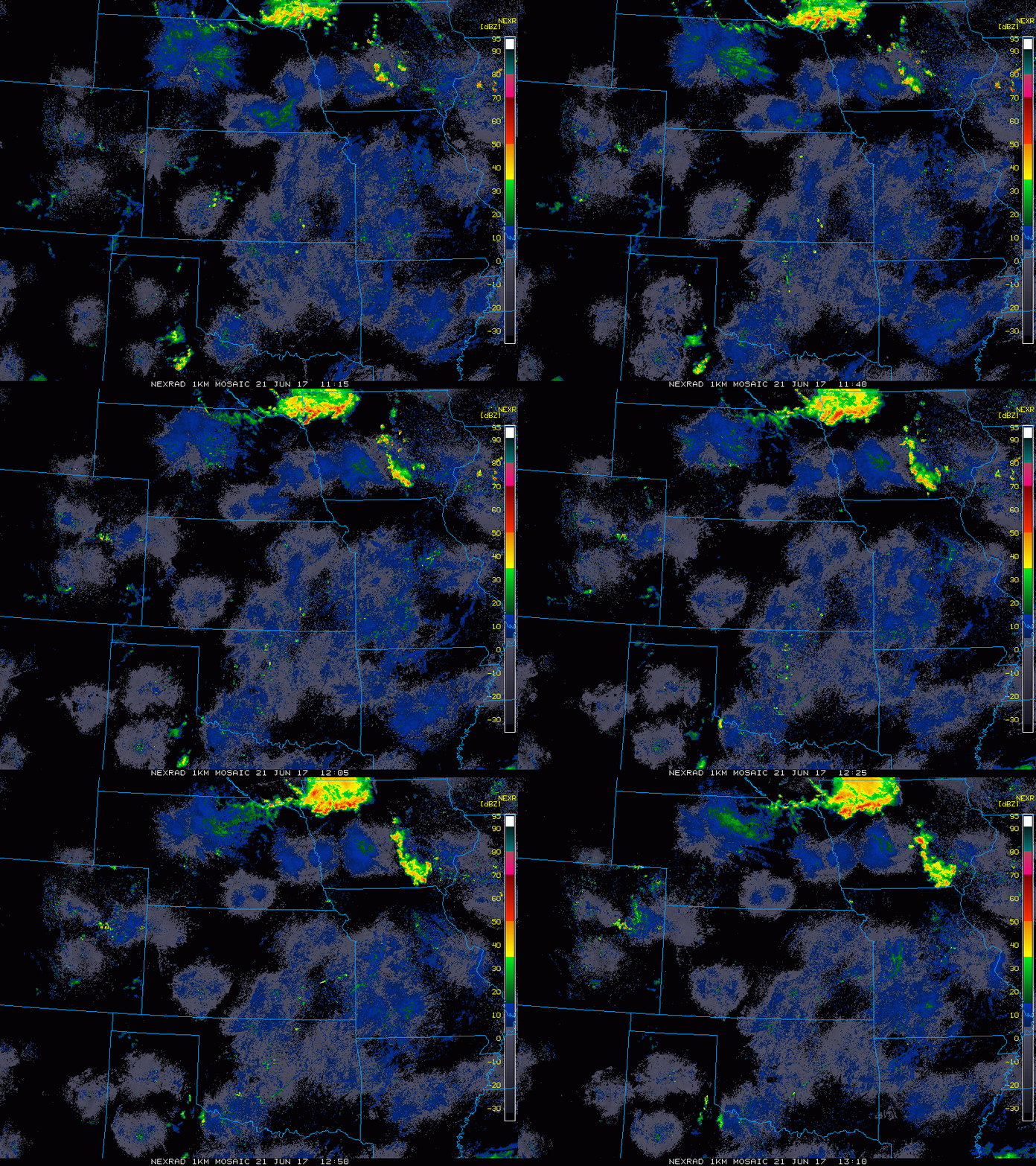
Current Radar this morning…heavy rains continue across parts of Iowa:
Watching for a batch of heavy rainfall focused across eastern Iowa today to continue, activity ramps up in storm coverage ~6pm into the overnight across eastern Nebraska, western Iowa and parts of Kansas through Thursday morning.
Looking ~4-6pm across eastern Nebraska and western Iowa Thursday as the cold front sags southeast through the overnight before the front clears the central Plains on Friday:
Latest thoughts on strong storms over the next 2 days…in these stronger storms will be the risk for localized heavy rainfall > 1.0″, gusty to damaging winds, isolated large hail and can’t rule out an isolated tornado as well.
Here’s latest guidance on rainfall totals over the next 60 hours…again, these are hit or miss in nature with 1-3″ possible across the eastern half of Iowa and more isolated 1-3″ amounts across the rest of Zone 8. Many locations stay dry due to the convective nature of these storms.
Latest wind forecast over the next 4 days…we get windy tomorrow as the cold front moves southeast:
Current temperature forecast over the next 4 day…certainly see a cooling trend also as the cold front pushes south and east Friday into the weekend:
Here’s a glance at dew points from normal into early weekend:
Latest guidance on rainfall through the next 10 days…again, use this as the idea more than the specific numbers…it tells us the pattern remains overall active across the central Plains…but not everyone cashes in on the heavier rainfall.
Confidence:
- Above average confidence a cluster of storms continues across Iowa throughout the day today.
- Average confidence scattered storms, some being strong, pop across parts of eastern Nebraska, western Iowa and Kansas later this evening.
- Above average confidence additional showers and storms move northwest to southeast on Thursday along a cold front…some being strong with localized heavy rainfall possible.
- Above average confidence a cooler pattern will move in once the cold front passes east Friday into this weekend.
Today’s video (6 min):


