Key Points – Friday, April 21, 2017:
Synopsis: Good Friday morning! Today we discuss the flooding rains going through the southern portions of the Ag Belt today into Saturday…the pattern ahead looks brutal, if you can get out and work now we highly recommend it. In the video we also discuss the drier pattern setting in over the next 4-5 days before we flip the switch mid to late next week and watch storm system after storm system track through the Plains. We know most folks are hard at work in the fields right now, we highly encourage you to take the time to watch these videos and reach out if you have any questions. Have a blessed weekend!
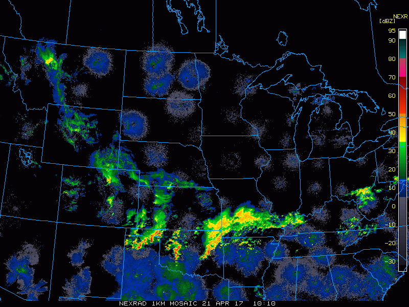
Current Radar:
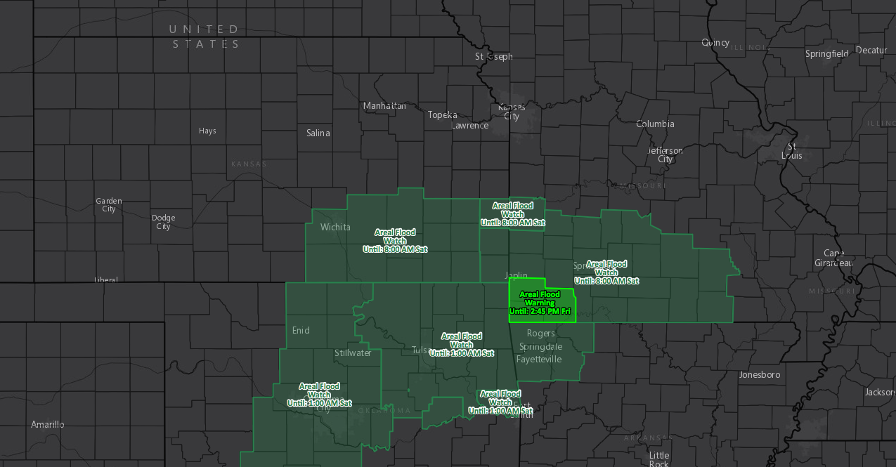
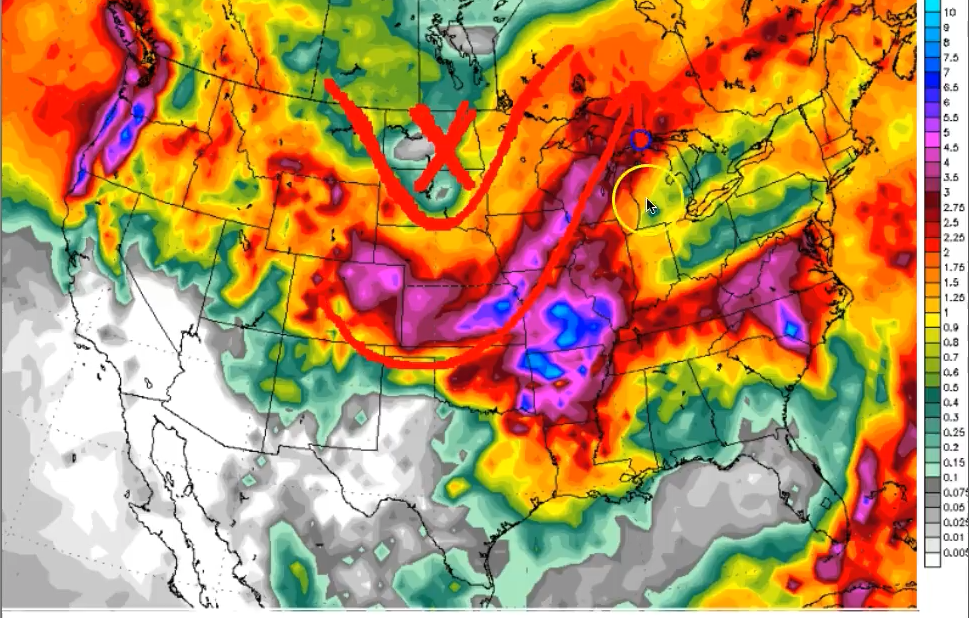
Current look at flood watches issued through 8am Saturday across portions of southeastern Kansas through southwestern Missouri.
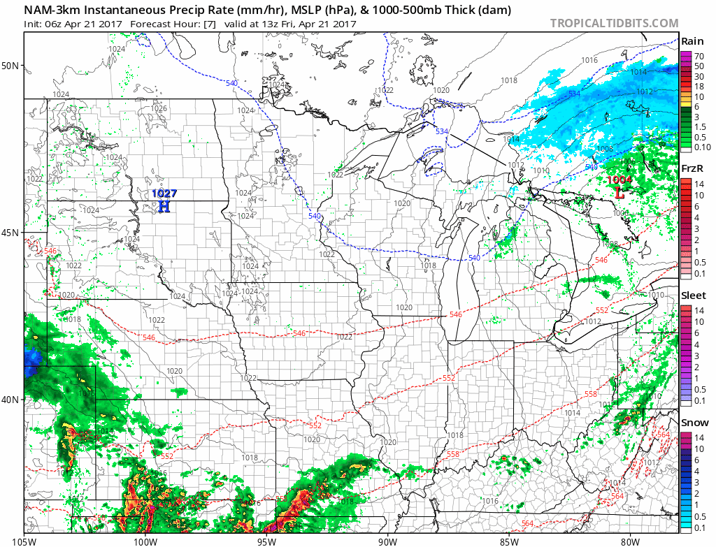
Simulated radar showing remaining showers today into tonight progressing east across Kansas into Missouri before pushing off further east into the Midwest later on Saturday. Meanwhile, high pressure lingers across Zone 9 today through the weekend keeping things pleasant and dry!
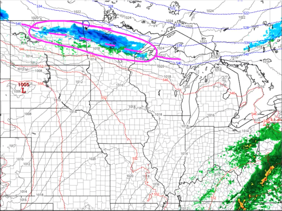
A small disturbance works its way through the northern Plains on Sunday, with some potential snow showers working in as well from North Dakota into northern Minnesota. Otherwise, folks further south and into Zone 8 stay dry.
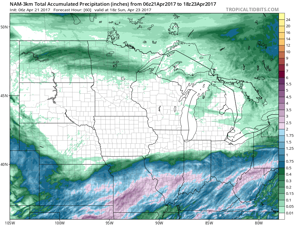
Total rainfall from the heavy rains moving through across the southern Ag Belt across southeast Kansas through Missouri that could top over 3.0″ of rainfall in some spots. Folks in the central Ag Belt stay dry over the next 4-5 days which is why we recommend folks getting out and getting things done while they can.
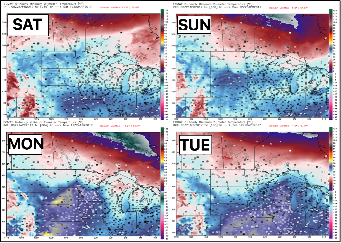
Widespread temps near or below freezing Sat-Tues mornings as seen below to the north…can’t rule out some frost on vegetation especially across the northern Plains locations.
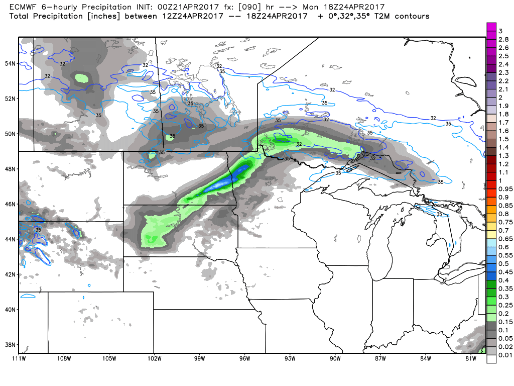
Next disturbance comes to the northern Plains across the Dakotas into Minnesota on Monday, meanwhile we stay drier for folks further south across the central and southern Ag Belt on Monday.
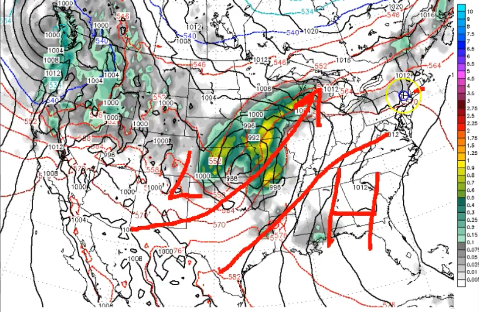
Noticing a very stormy and active pattern set in mid to late next week and beyond as we discuss in the video, high pressure sets up further west allowing the low pressure systems to track right across the heart of the Ag Belt, which means storms and heavy rainfall potential.
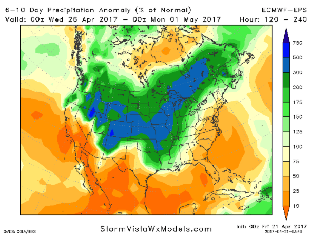
Rainfall totals over the next 10 days are big…however, we think parts of the Plains across the Dakotas could miss out on this a little bit with the heaviest rainfall tracking further east and south. At this same time, this is A LOT of rain across Iowa, Kansas into Missouri…given how active the pattern is ahead, we agree with some of these rainfall totals.
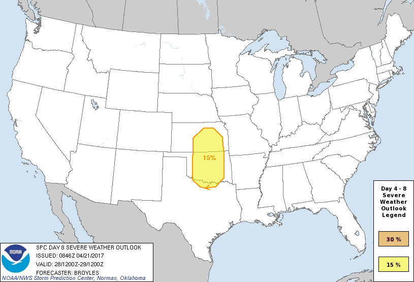
We have a Day 8 severe risk issued today as well for late next week into the weekend…and to put this into perspective, we hardly ever see risks issued out this far so to see this issued tells us one thing: next week you’ll absolutely want to stay glued to the forecast especially across the central to southern Ag Belt for strong storm potential.
Just for more added confidence, the pattern in the 6-10 day as seen well below by the European ensemble is remarkably wet across much of the Ag Belt through next weekend.
Confidence and Risk:
- Above average confidence a heavy rain maker continues to push east across Kansas into Missouri through Saturday morning.
- Overall, we have average to above average confidence that Zones 8/9 stay fairly dry through early next week with high pressure overhead.
- Increasing confidence the pattern flips to active once again mid to late next week with above normal rainfall across the Ag Belt being forecasted by all of our model ensembles.
- Above average risk for some strong storms later into next week across the central to southern Ag Belt given how far out we are…but it’s something we are watching closely.
Today’s video (7 min):