Key Points – Thursday, April 20, 2017:
Synopsis: Good Thursday morning! After today we have a stretch of drier weather ahead over the next ~5 days or so before we get wet again in the 6-10 day as discussed below. Overall, with the exception of the northern Plains folks we will be warmer than normal the next 10 days, however getting further out into the 11-15 day we flip the switch in the Ag belt to cooler than normal temperatures; this, coupled with forecasted above normal rainfall certainly won’t help us consistently get into the fields, more details in the video. Have a blessed day!
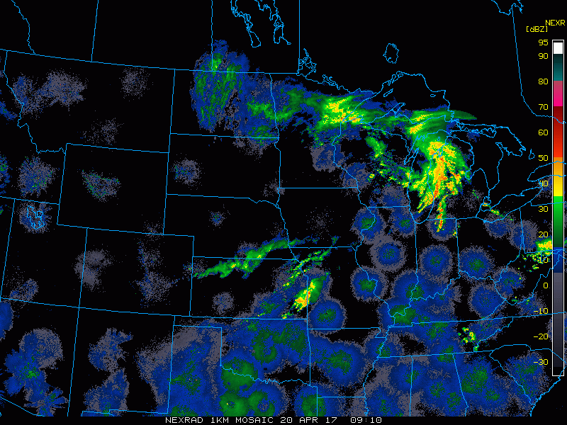
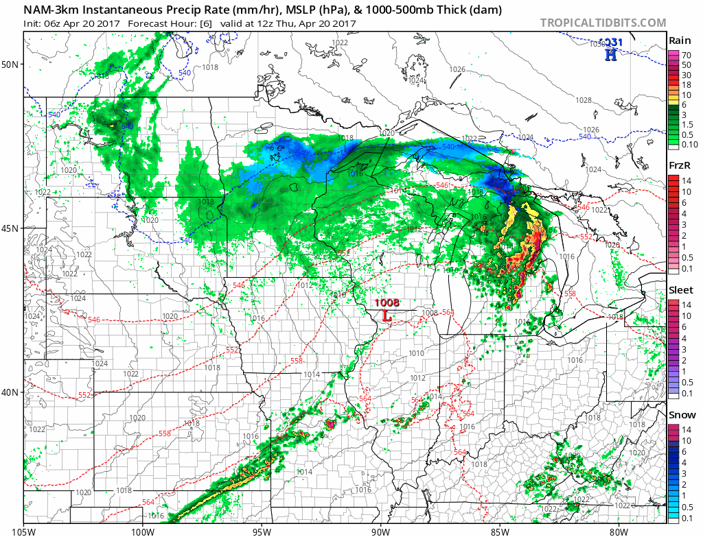
Current radar…seeing a few ongoing showers across Kansas, south Nebraska into Missouri…as well as that complex system to the north still lingering around which will make for a pretty raw day across the northern Plains as well.
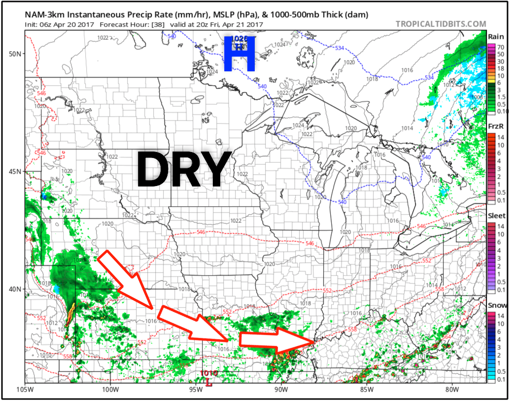
Simulated radar as the showers and storms across the Kansas and Missouri work east into the Midwest along the cold front, and the complex to the north works off slowly to the east as well through the day. By this evening most of the Ag Belt is dry.
High pressure works in across most of the Ag Belt on Friday, however on the periphery of this high pressure will be some heavy rain working in across portions of Missouri as well as western Nebraska and Kansas into Saturday morning.
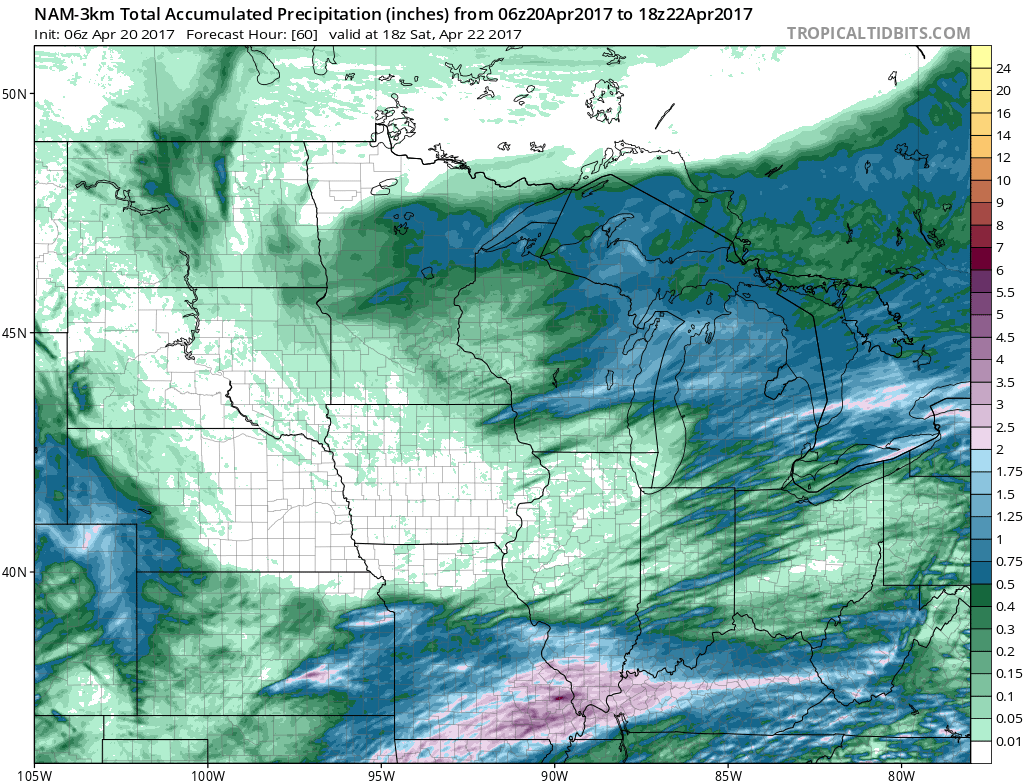
Rainfall expected over the next 60 hours from the latest NAM-3km model…a welcome site for folks across Iowa who have been very wet as of late, but unfortunately the heavy rains continue across eastern Kansas into Missouri where we are already very saturated (some folks here could see over 2.0″+ through Saturday).
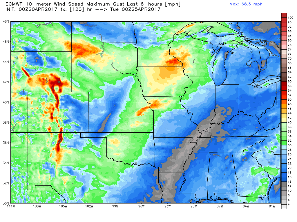
We are dry pretty much until Monday, first off check out these forecasted wind gusts from the latest European…some locations across eastern Kansas, northwest Missouri into Iowa, Minnesota even North Dakota may see wind gusts over 40mph at times, even up to 50mph will not be impossible (will watch for a potential wind advisory here).
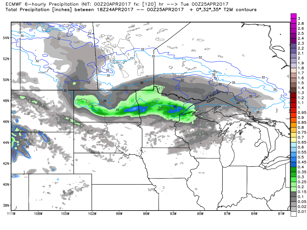
As mentioned above, we are looking for a surface low to track through the northern Plains on Monday that will keep folks up there wet. The second piece of energy ejects further south keeping Zone 8 folks wet on Tuesday with a disturbance moving through from west to east bringing a chance for scattered rain and storms.
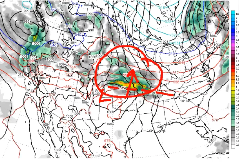
The active pattern picks up by mid-week next week with another warm front lifting north Wednesday into Thursday bringing rains to most of the Ag Belt…even some heavy potential here as well. We’ve been talking about the 29th-1st of May for quite some time now…this is that system showing up on data now along with a trailing cold front following this.
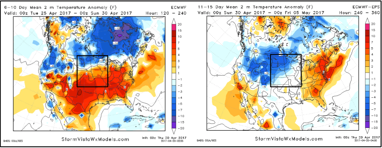
Warmth overspreads the central Ag Belt in the 6-10 day timeframe through late next week, although you can see we are quite chilly across the northern Plains. Getting into the 11-15 day a little further out, you can see the cooler anomalies working further south into the northern Plains and central Ag Belt.
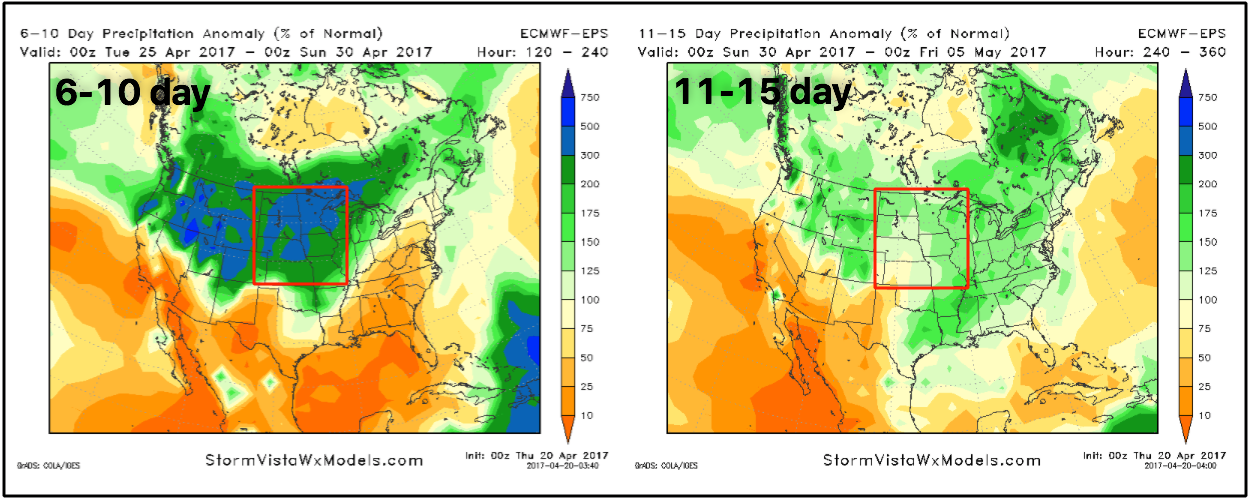
Percent normal precipitation in the 6-10 day is very wet overall in the Ag Belt and in the 11-15 day we are still slightly above normal as well, although a little drier in the southwestern Ag Belt.
Confidence and Risk:
- Above average confidence the remaining showers and storms exit east of Zones 8/9 today clearing by later this afternoon into the evening.
- Average to above average confidence we have a relatively dry stretch of weather ahead through early next week.
- However, average confidence folks from Kansas to Missouri get in on some heavier rains along a frontal boundary Friday into Saturday before that ejects east.
- Increasing confidence for above normal rainfall getting into the 6-10 day timeframe and beyond.
- Above average confidence, with the exception of the northern Plains we are above normal in the temp department over the next 7-10 days.
- Average confidence we return to a more seasonal to slightly below normal temperature pattern in the 11-15 day…need to watch this unfold.
Today’s video (7 min):