Key Points – Wednesday, May 17, 2017:
Synopsis: A lot going on through the rest of the week, today’s update is absolutely packed discussing the risks for high winds, severe storms next 2 days and additional heavy rainfall. The active pattern continues into next week with cooler risks emerging as well, have a blessed day.
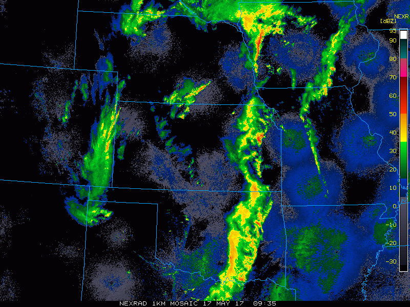
Current Radar:
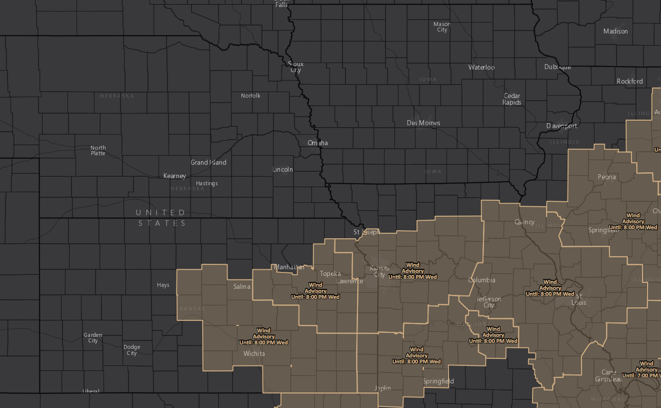
Wind advisories issued this morning…would like to see these pushed further north to include Iowa as well based off latest guidance below this.
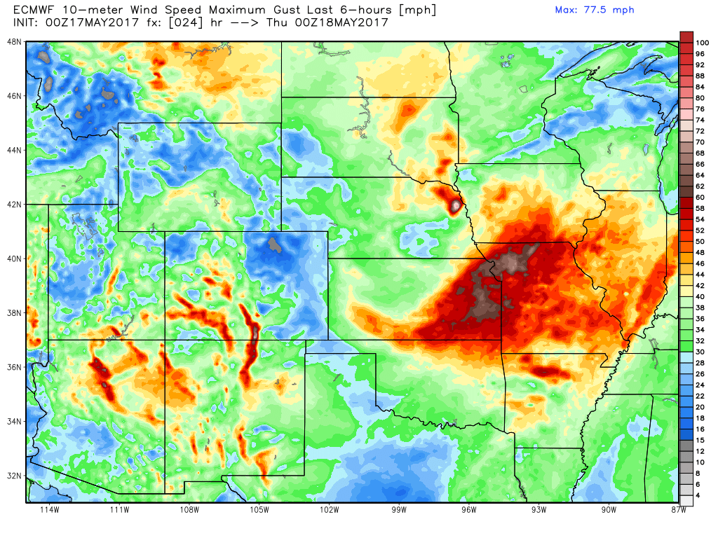
European wind gusts from this morning are quite impressive today across most of the central Plains…wouldn’t be shocked to see gusts topping 45-50+mph at times.
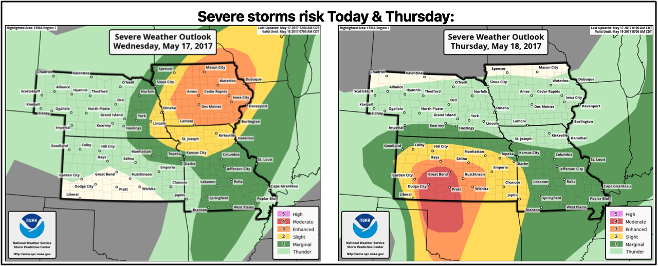
A multi-day severe weather threat is becoming more likely over the next 2 days. All modes of severe weather possible today focused mainly across Iowa in an Enhanced risk, but getting into tomorrow we already have a moderate risk issued from Kansas to points south (could see this expanded north a bit as well). We mentioned in the video would wouldn’t be shocked to see this upgraded to a High Risk tomorrow with strong tornadoes possible.
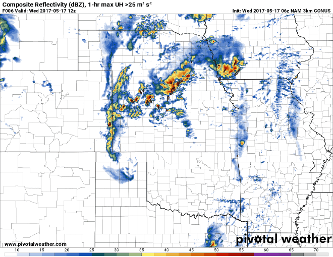
Simulated radar for today…we can see the scattered storms lifting northeast throughout the day with a dangerous line of storms pushing into Kansas/Nebraska and into Missouri/Iowa later this evening into the overnight. There is an elevated risk for stronger storms across Iowa, northern Missouri, extreme NE Kansas and far east Nebraska.
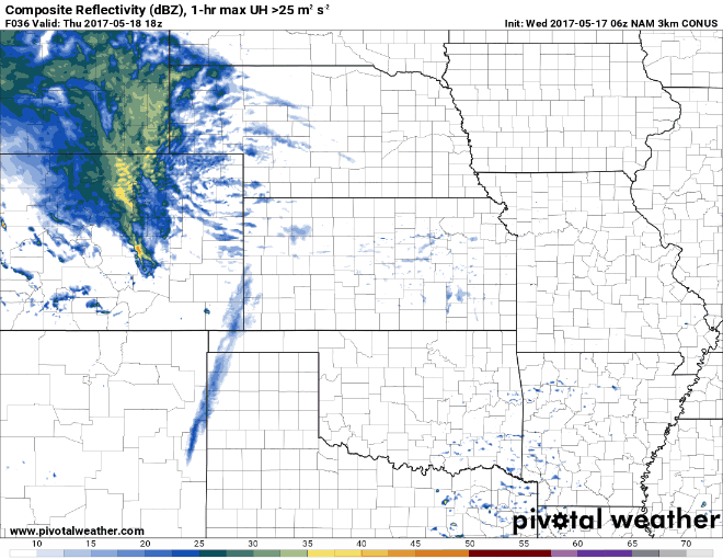
Tomorrow looks very dangerous in the severe weather department with multiple supercells possible and an elevated tornado threat as well across far southern Nebraska into Kansas.
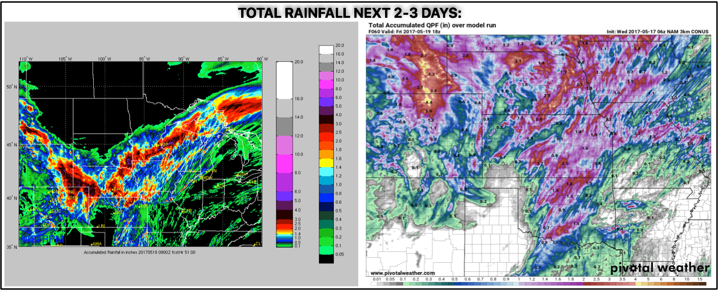
Total rainfall next 60 hours from the RPM and NAM-3km models..both agree on many locations see 1-2″ of rainfall, with higher amounts possible where the strong to severe storms move through.
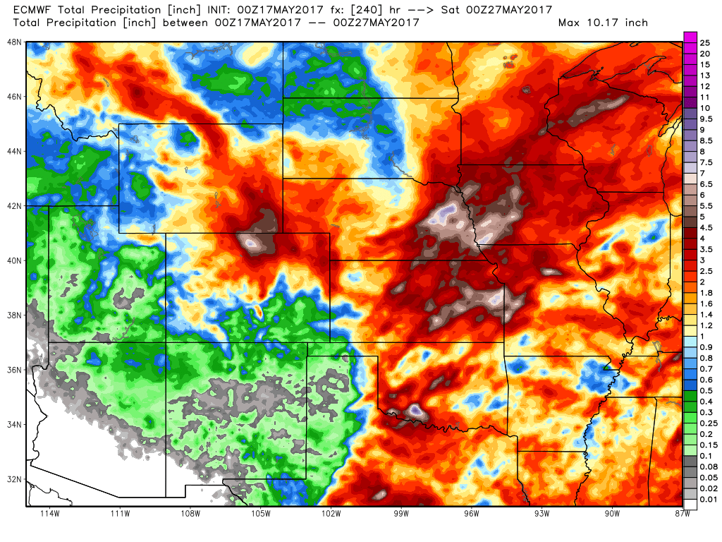
10 day rainfall from the European…pattern remains very active with cooler risks emerging as well across the central Plains.
Confidence and Risk:
- Above average confidence of additional storms today especially across the northeast Zone locations.
- Average risk here for severe storms with all modes of severe in play including damaging winds and tornadoes especially across Iowa.
- Average risk again for severe storms including tornadoes across the southern half of the Zone Thursday.
- Average risk some locations see 2″+ of total rainfall next 3 days especially those under a severe storm.
- Above average confidence the active pattern continues into next week with cooler risks emerging as well across the central Plains.
Today’s video (9 min):