Key Points – Monday, May 1, 2017:
Synopsis: Good Monday morning! Today we discuss the incredible rainfall totals over this past weekend, the remaining precipitation through Tuesday morning and then our next potential heavy rain maker mid-week for the southern half of the Zone. Good news though, after the system mid-week I think we see some drier times across the central Plains into the weekend overall, couple that with a brief stretch of warmer than normal temps and conditions could slightly improve. However, we also discuss that the pattern overall we expect to be active and cooler for the month of May. Have a wonderful week.
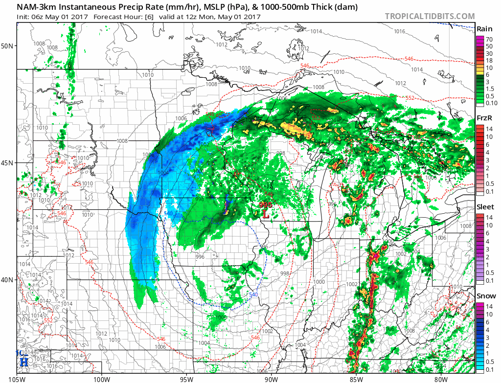
Current radar…snow showers working in across Nebraska to western Iowa, and showers working across eastern Iowa into Missouri and northern Kansas.
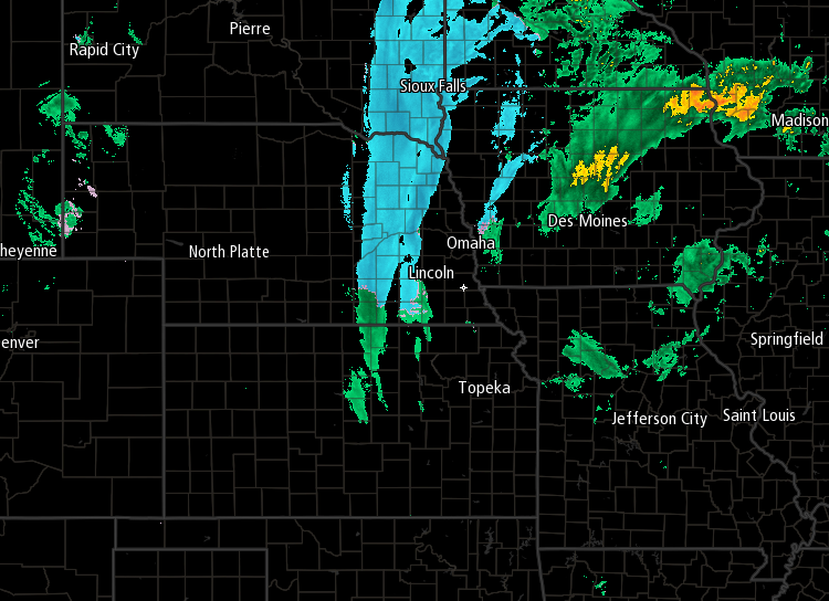
Remaining showers today…some snow showers mixing in will continue across northern Nebraska/Iowa today before the low pressure exits north and east. Otherwise, scattered showers possible across Iowa and Missouri. A few scattered showers will be possible late tonight into early Tuesday across Nebraska once Kansas as well.
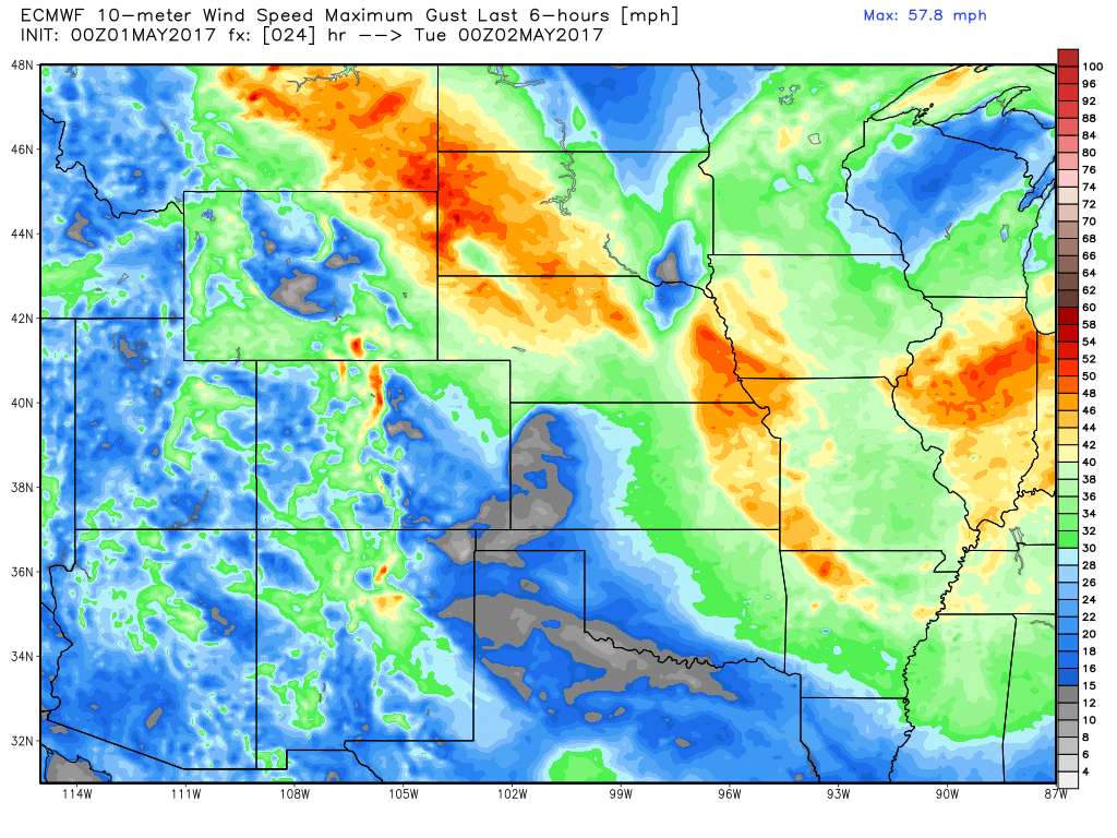
Will be gusty today with winds out of the northwest gusting at times over 40mph across Zone 8.
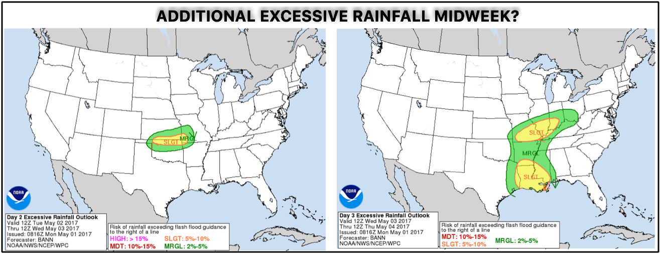
Next rain chance…discrepancies amongst the European and GFS models as to how far north the low pressure system tracks Wednesday into Thursday:
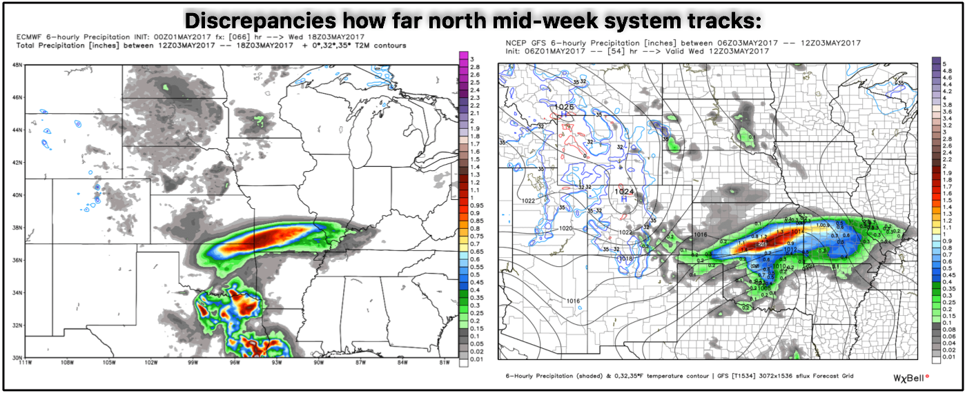
Excessive rainfall possible here as well? Depends on the track and intensity, but would not be ideal given those higher rainfall totals falling across areas very saturated with rainfall already.
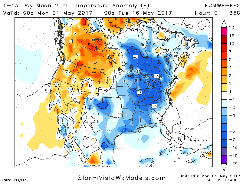
Temperature outlook through the first half of May…although a brief warm up will be possible in the 6-10 day (at least for the western half of the zone), overall we believe the pattern will be slightly cooler than normal.
Confidence and Risk:
- Above average confidence scattered showers continue today along the low pressure mainly across Missouri, Iowa and portions of Nebraska.
- Above average confidence we are quite windy today as well with wind gusts out of the Northwest over 40mph possible.
- Below average confidence in the exact track of our next rain chance mid-week.
- Average confidence the pattern over the next week is overall drier than normal across the Zone.
Today’s video (8 min):