Key Points – Tuesday, April 11, 2017:
Synopsis: Good Tuesday morning! We discuss our next rain chances coming Wednesday into Thursday, as well as into the weekend with some gustier storms possible Friday into Saturday along a warm front. The concern continues to grow for above normal rainfall into late April given the latest data…right now we are seeing a storm system every 2-3 days which makes it very difficult to find a dry window to get out in the fields for planting. Check back often.
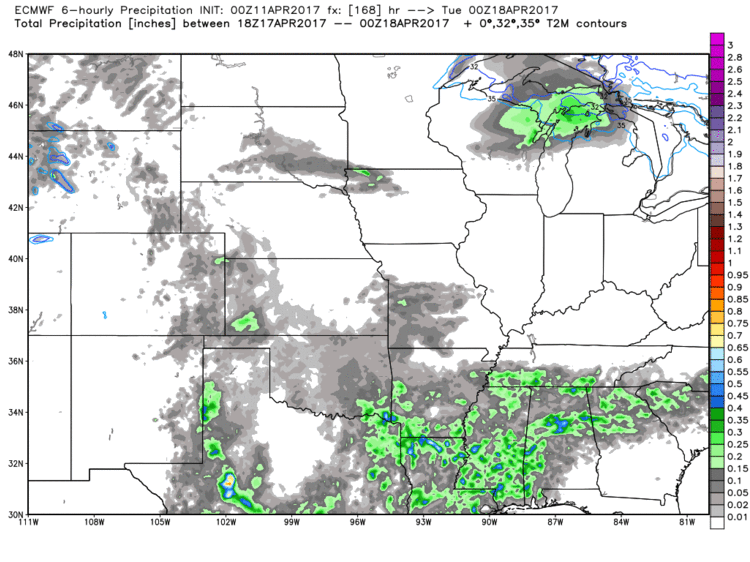
Dry time today through the start of Wednesday, however our next rain chance comes Wednesday into Thursday morning mainly across the eastern half of Nebraska into Iowa…these will be scattered in nature.
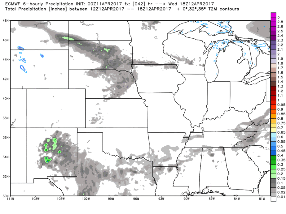
Following right on the heals of this rain and storm chance is a warm front that lifts north the second half of Thursday into Friday, starting south from Oklahoma moving north through Kansas into Nebraska on Thursday, western Missouri into Iowa on Friday morning.
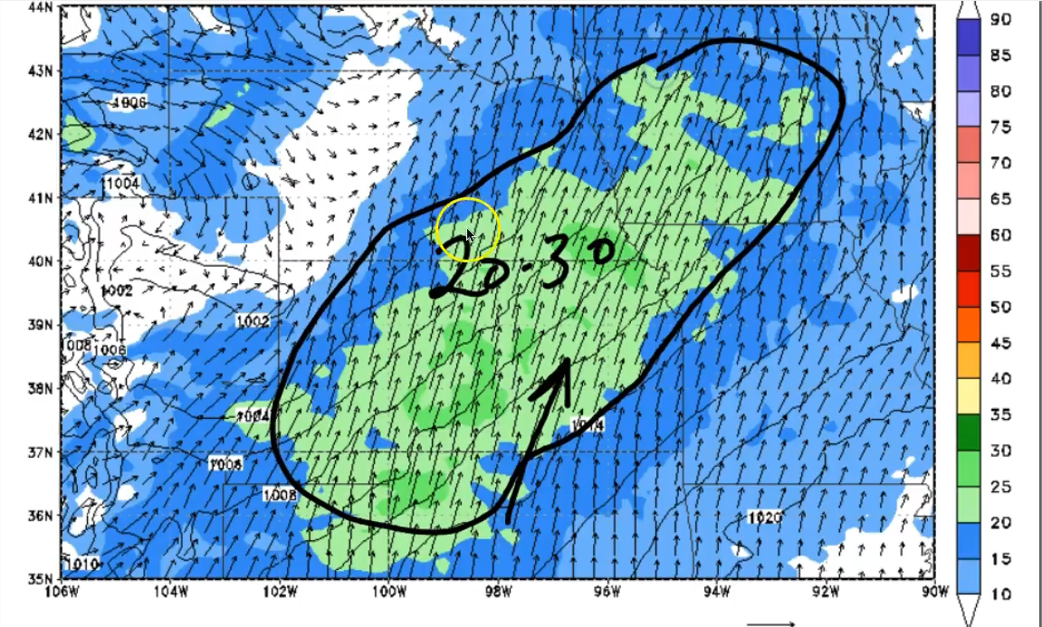
We get breezy on Friday into Saturday with winds gusting out of the southwest at 20-30mph at times.
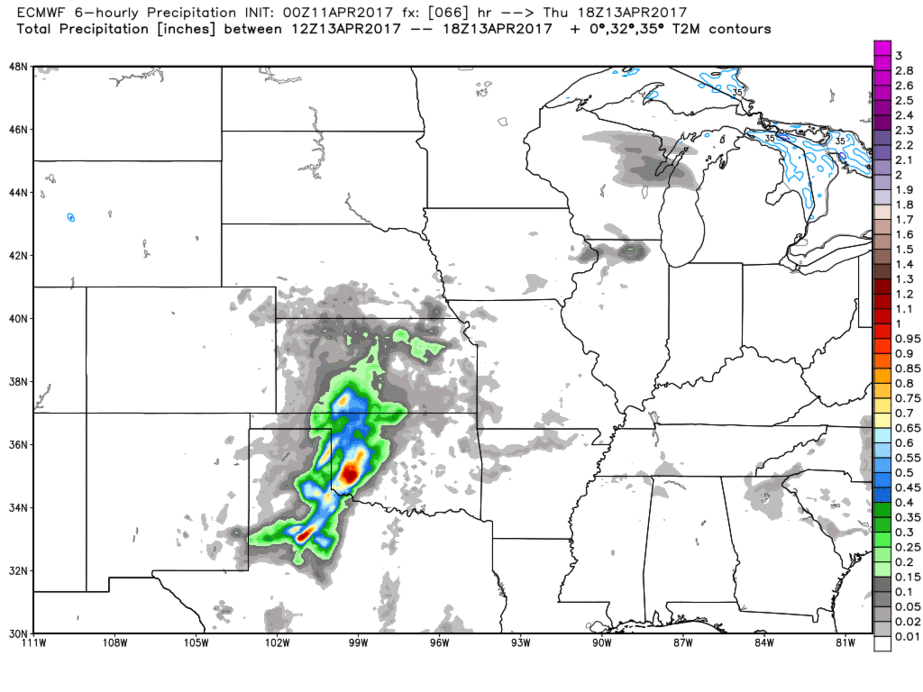
Waking up Saturday with some showers and storms still situated along the warm front for the far northern Zone locations, otherwise we start the day dry. Getting into the afternoon and into the overnight we see additional showers and storms that move east along a front impacting folks from Kansas, Iowa south to Missouri into Sunday morning.
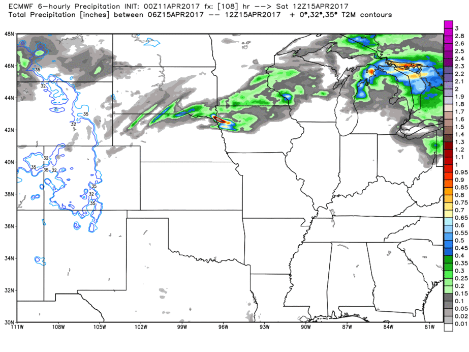
We get about 2 days of dry time before our next system moves in later Monday into Tuesday and Wednesday bringing showers and storms. We are getting very concerned with folks across portions of Nebraska into Iowa where the rain just doesn’t seem to want to shut off. Latest data suggests rainfall stalls out across portions of Iowa next Tuesday through Thursday which could spell more trouble…something we are watching very closely and will update on often.
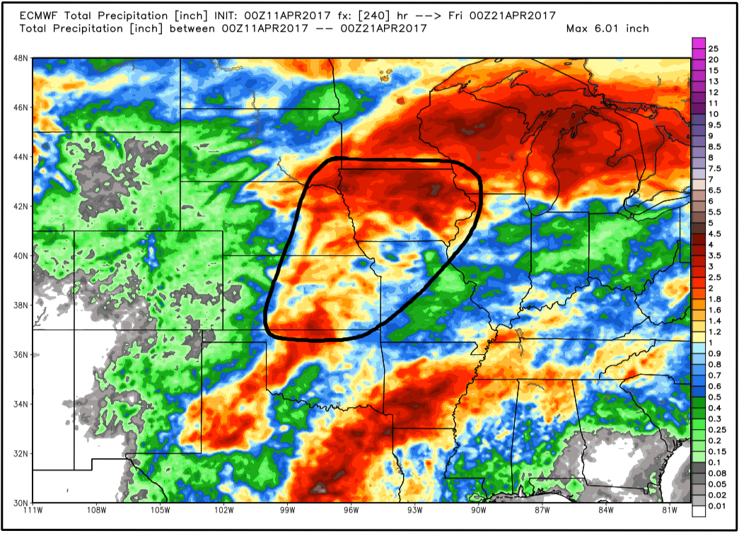
When glancing at 10 day rainfall totals, we’ve highlighted an area where the heaviest rains will set up…2-3″ + will be possible, especially getting into Iowa where that rainfall looks to stall out mid-next week.
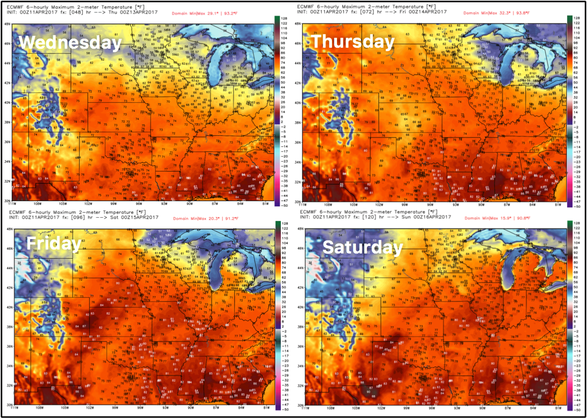
Temps are very warm starting Wednesday getting into Saturday with many folks seeing highs in the 70s and 80s!
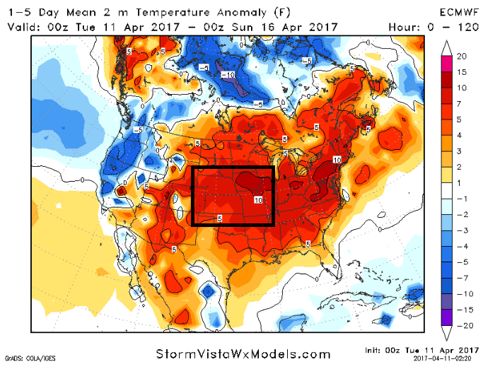
You can see the above normal warmth here over the next 5 days at an average of 5º, with portions of Iowa and Missouri even warmer at 5-10ºF!
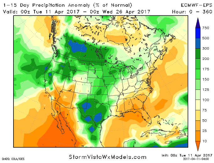
In terms of precipitation from normal over the next 15 days, you can see why we are very concerned about how wet things continue to be into late April across Zone 8 and the Ag Belt…we don’t really see a window ahead for a lot of dry time, it’s a system every 2-3 days right now unfortunately. Check back often, but we expect the wet pattern to continue going forward.
Confidence and Risk:
- High confidence we remain dry and nice today into the first half of Wednesday.
- Above average confidence we have multiple rain and storm chances later Wednesday into the weekend.
- Average risk for some gustier winds Friday into Saturday, some topping 25mph+ possible out of the Southwest.
- Average confidence a couple of days of “drier weather” expected late weekend into Monday before our next rain maker moves in and hangs around into mid-next week.
- High confidence temps are overall above normal into the weekend across Zone 8.
Today’s video (7 min):