Key Points – Friday, June 9, 2017:
Synopsis: Good Friday morning! Today we discuss the scattered rainfall chance across eastern Iowa later today. We then see an increase in storm coverage coverage to the north later Saturday into early Sunday as a storm cluster looks to work its way east across northern Iowa. The pattern turns more active into next week with the warmth remaining. Have a blessed weekend!
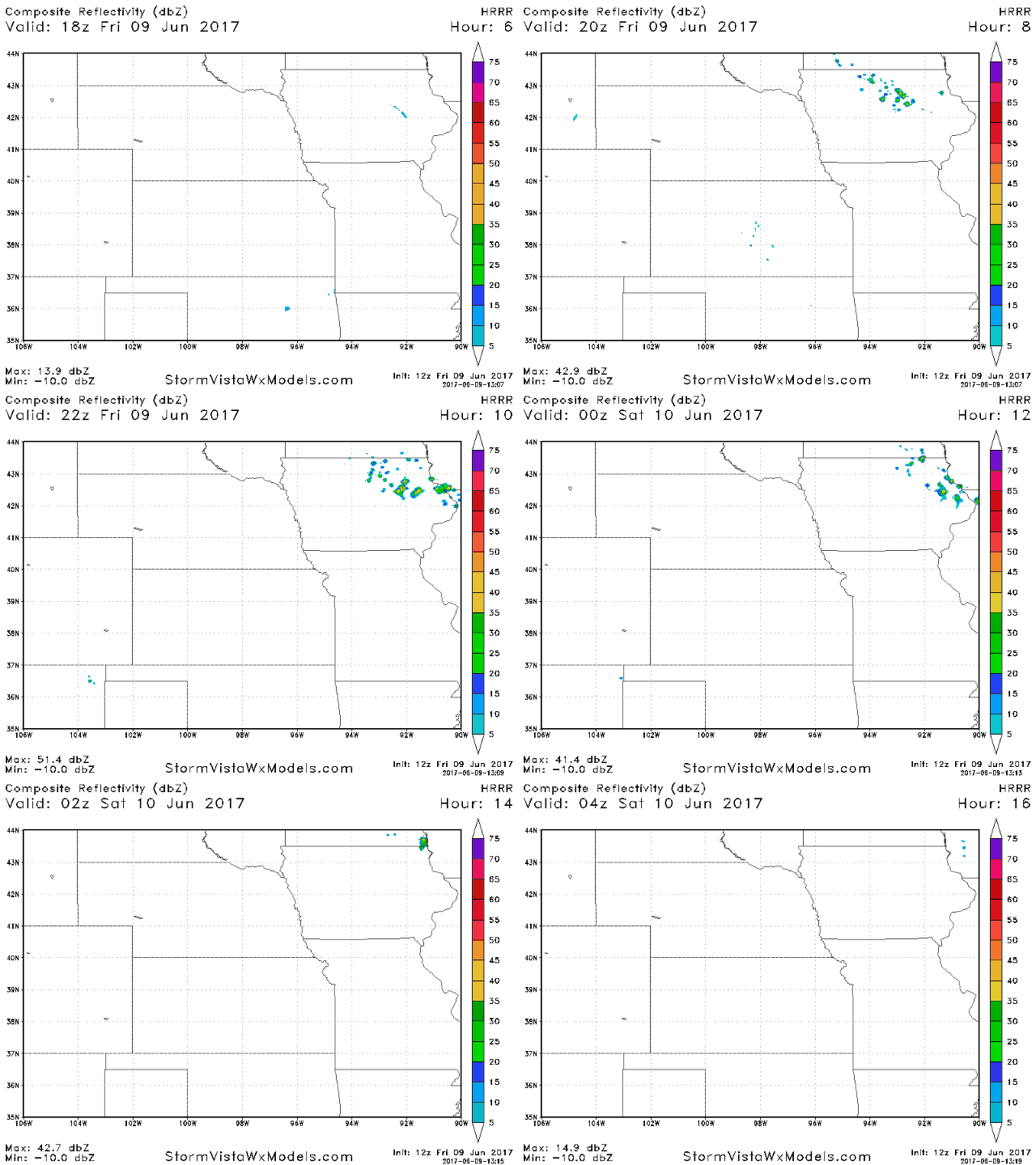
Isolated showers and storms possible across the eastern half of Iowa later today getting in on some daytime heating…these will diminish as the sun goes down tonight…otherwise, the large majority of Zone 8 stays rain-free.
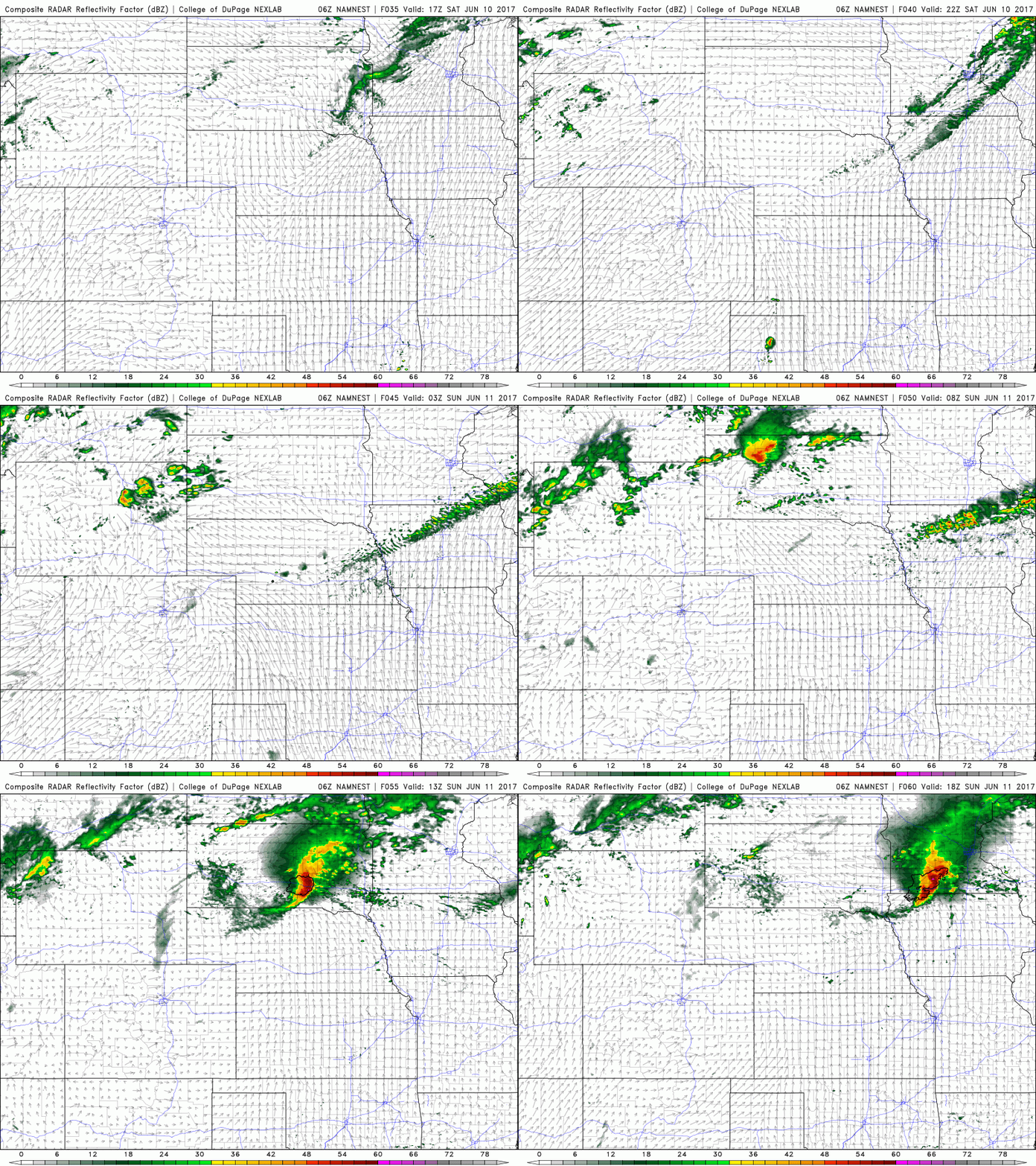
Getting into tomorrow we stay dry, warm and sunny…watching for a band of showers and storms tomorrow evening and overnight across northeastern Nebraska into Iowa ~30/40%. The one feature we need to watch closely is a potential MCS (storm cluster) moving east across South Dakota into northern Iowa late Saturday night into early Sunday morning that could produce some strong storms.
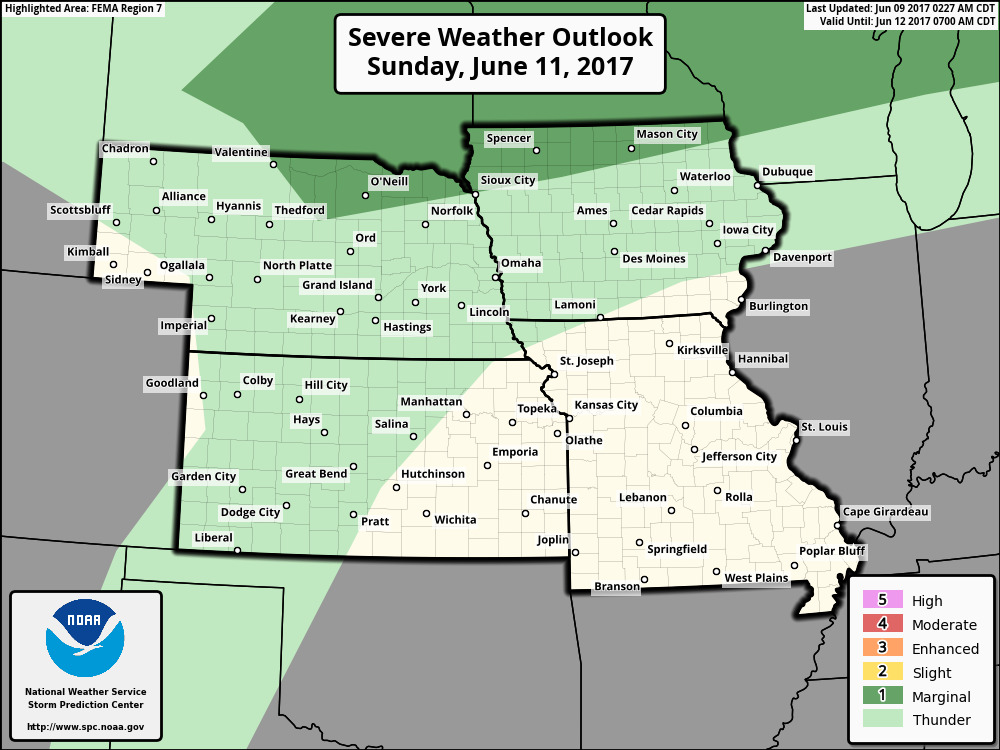
Latest strong storm risk seen below to cover Saturday night into Sunday…the main risk will be damaging winds and isolated large hail across parts of Nebraska and Iowa.
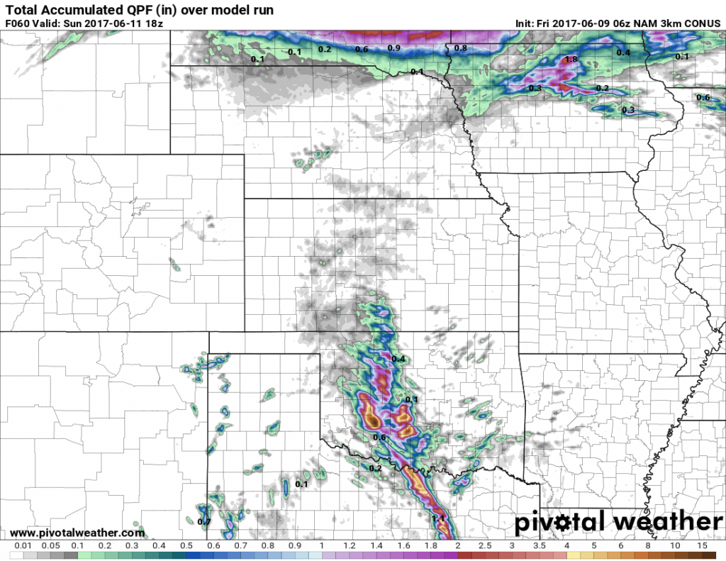
Total rainfall expected over the next 60 hours from the 3km-NAM…where that storm cluster moves east across northeastern Nebraska and Iowa is where the heavier rains set up…isolated amounts of 1-2″ will be possible.
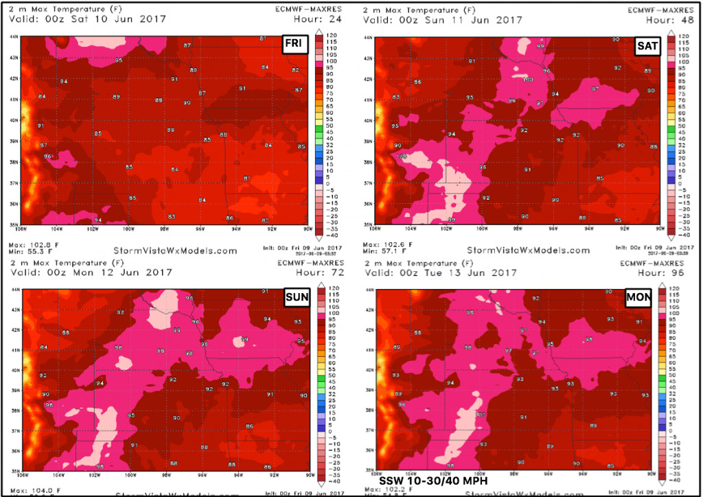
Temperatures over the next 4 days will be quite warm with many folks seeing 90s even isolated triple digits through early next week.
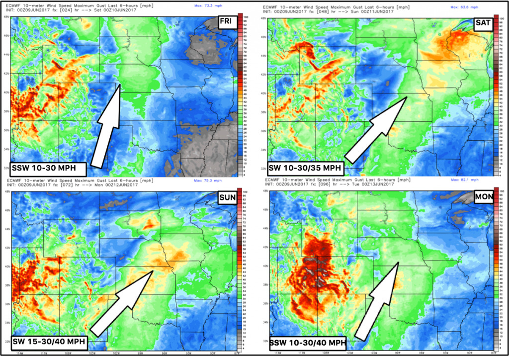
Winds expected over the next 4 days will be gusty with times gusting over 35-40mph out of the southwest.
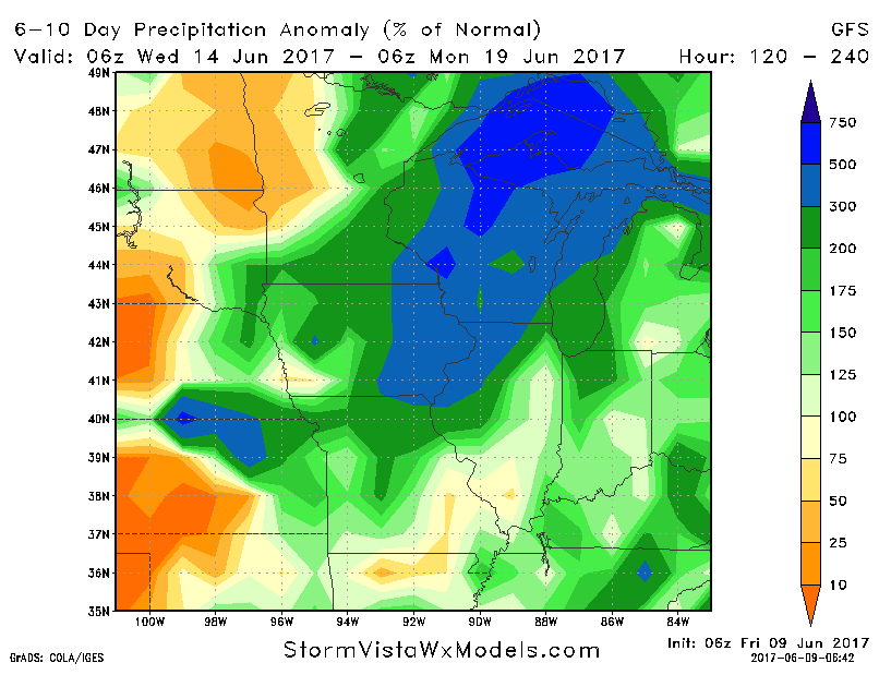
In the video we discuss a more active precipitation pattern getting into next week in the video with a drier look further west across western Nebraska and western Kansas. Again we need to note, the pattern that we are in and will continue to be in focuses on the haves and the have-nots…not everyone gets in on the rainfall unfortunately.
Confidence:
- Average confidence a few scattered storms possible across eastern Iowa later tonight.
- High confidence of very warm temperatures through this weekend into early next week across the central Plains.
- Increasing confidence additional rain/storm chances getting more into next week…it’ll be the haves and the have-nots…not everyone will get in on these for sure.
Video (7 min):
