Key Points – Wednesday, May 24, 2017:
Synopsis: Good Wednesday morning! For the most part it’s a quiet day across the central Plains with the exception of parts of central/eastern Iowa, Missouri and extreme eastern Kansas who will see some scattered showers on the backside of the upper-level low pressure system. The next threat we need to watch is later Thursday into Friday morning for a cluster of showers/storms and gusty winds to move west to east across the central Plains and then another wave of heavy showers and storms Saturday into Sunday morning from west to east. Have a blessed day!
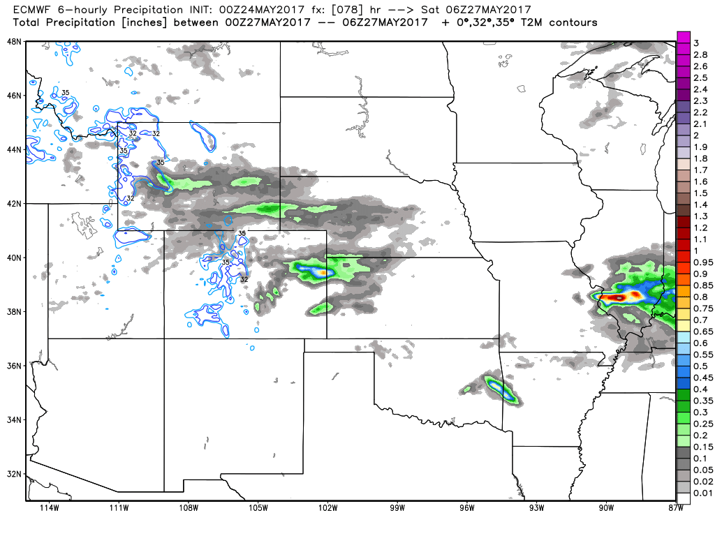
Simulated radar the remainder of today shows the spotty showers across parts of Iowa, Missouri and far eastern Kansas.

Need to watch this cluster of showers and storms move east across the Midwest later Thursday into Friday morning…the exact track is not nailed down yet, we have some data that takes it further north and then we have other reliable data that keeps it further south mainly across Kansas and Missouri. We discuss the risks in the video.

Right on the heals of this pulse of showers and storms is another impressive wave of precipitation that sweeps east across Zone 8 Saturday into early Sunday. Data still differs on the exact track of this wave, confidence is lower on this at this time.
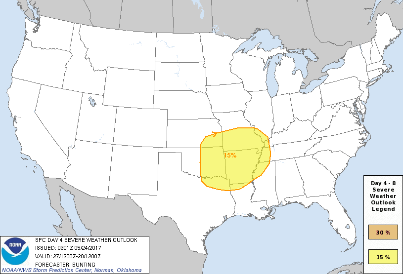
We need to watch this wave of energy in this timeframe as well for some strong to severe storms across the central Plains…we still have a couple of days to hone in on exactly where the risk will pan out, but right now the south and eastern Zone locations look to be at risk.
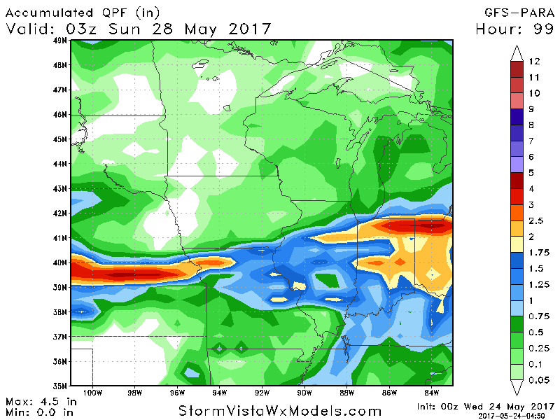
Rainfall totals through Sunday showed the best by the latest GFS Parallel model; again the exact track of these waves will determine where this area of heavier rainfall sets up…can’t rule out 1-2″+ through early Sunday.
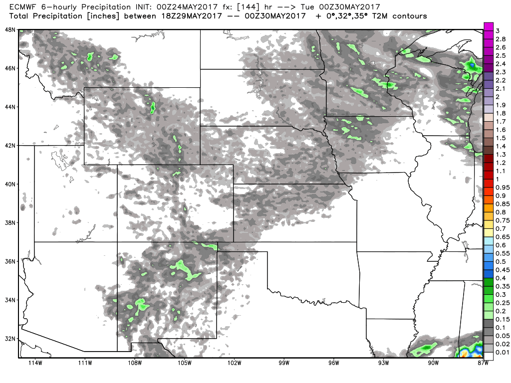
For the most part Sunday into Monday are pretty clear, it’s later next Monday into Tuesday we need to watch for our next chance of some scattered showers and storms ~20-30% from a cold front sweeping northwest to southeast.
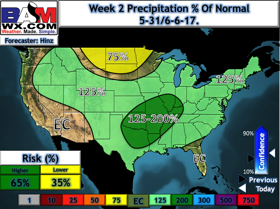
We updated our long-range outlooks this morning and we continue the theme of above normal rainfall across the central Plains through week 2…where exactly the heaviest rains set up is still slightly still up for grabs, but largely this active pattern looks to continue going into early June.
Confidence:
- Average confidence of scattered showers and a few storms possible across Iowa and Missouri today spinning around the periphery of the upper-level low pressure working into the Midwest.
- Average confidence of a cluster of storms moving west to east later Thursday into Friday morning (we call this an MCS).
- Average confidence in an additional wave of energy moving east Saturday into early Sunday from west to east that we need to watch for heavy rainfall and potential strong storms as well.
- Overall above average confidence we remain cooler than normal across Zone 8 through the next week.
Today’s video (7 min):