Key Points – Monday, June 5, 2017:
Synopsis: Good Monday morning! Today we discuss some heavy rainfall/strong storms possible to the west over the next 2 days and then target some major heat working in across the central Plains getting into next week. We also discuss the scattered rainfall threats this week, there really isn’t much in the way of a disturbance that comes in bringing more widespread rains until early next week. Have a blessed day, if you have any questions please don’t hesitate to reach out!
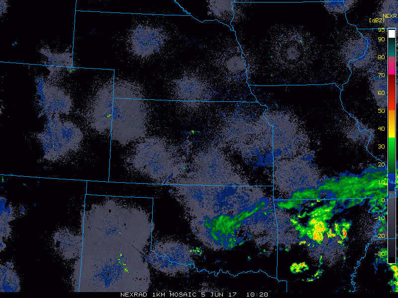
Current Radar…really only rainfall this morning across southeast Missouri, clear across most of Zone 8.
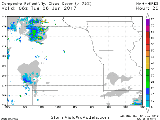
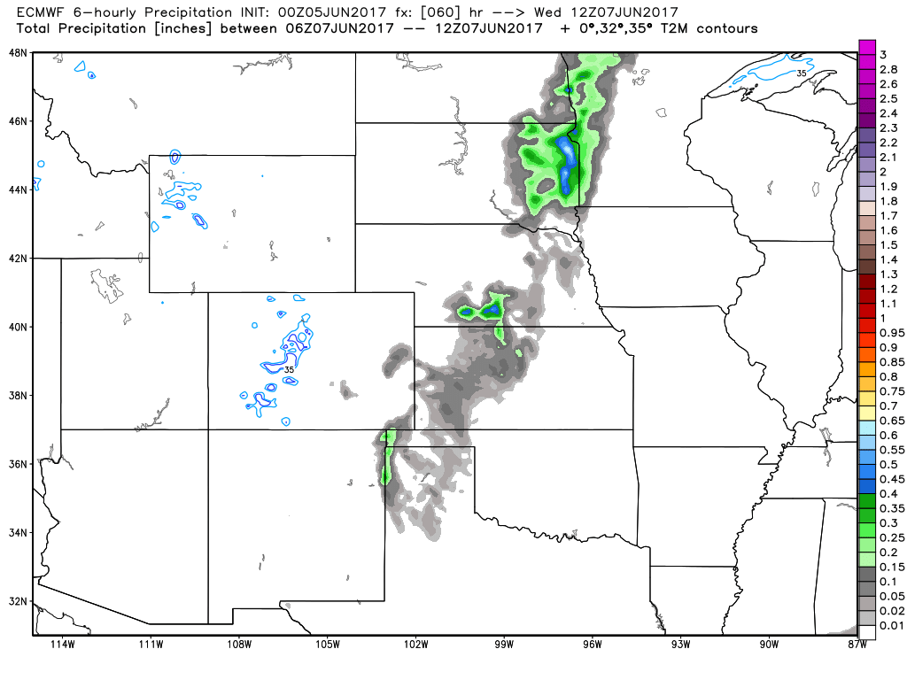
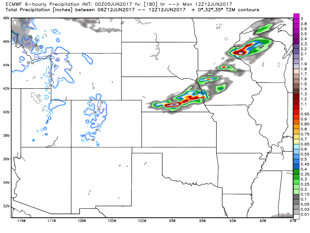
Simulated radar…fairly quiet today, it’s waking up early tomorrow morning we are expecting some storms across northwestern Nebraska and continue throughout the day. We expect these to drift south into Kansas later Tuesday evening. On Wednesday we expect the majority of the heavy rainfall and storms to linger across central Kansas.
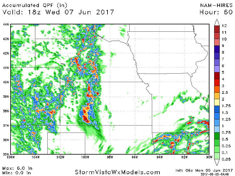
Some very heavy rainfall favored across central Nebraska and central Kansas where the front stalls the next 2 days…some isolated amounts of 4″+ of rain not out of the question. Not much of any rainfall across Iowa and Missouri…that’ll be the tune for most of the week.
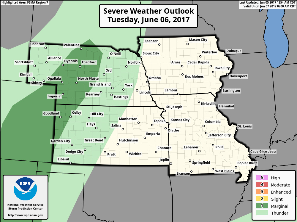
Marginal risk for some strong storms on Tuesday across parts of Nebraska and western Kansas…gusty winds and some hail are the main hazards.
Beyond this, our next more scattered chance for showers and storms comes Wednesday into Thursday across parts of Nebraska, western Iowa and Kansas.
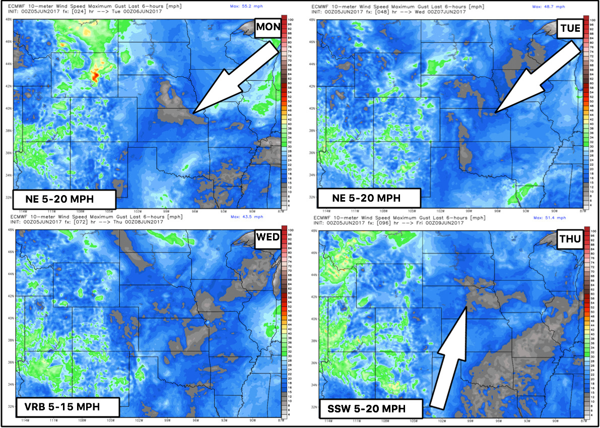
Wind forecast next 4 days:
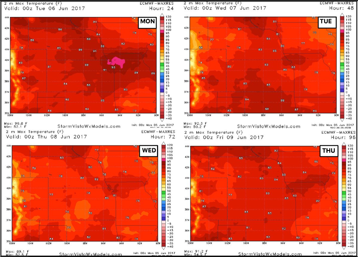
Temperatures next 4 days…very warm today across central parts of the zone with 80s possible, staying more in the upper 70s and lower 80s through Thursday.
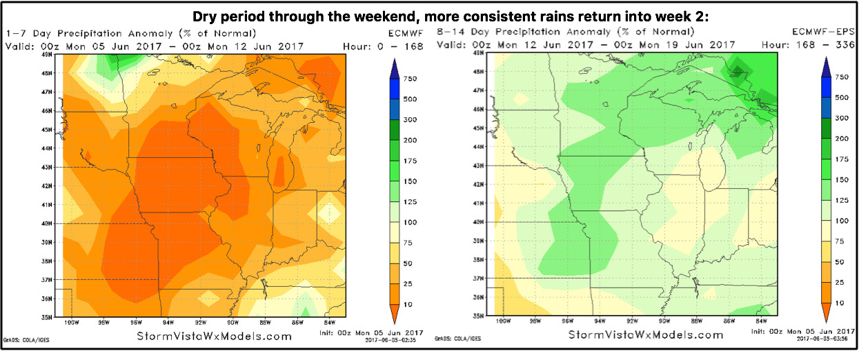
Precipitation from normal next 2 weeks…overall drier stretch settling in through the next week (with the exception across central Nebraska/Kansas…models not picking up on this) more consistent rains return during week 2 as the ridge in the west relaxes, allowing the pacific jet influence to work more into the Ag Belt and Midwest.
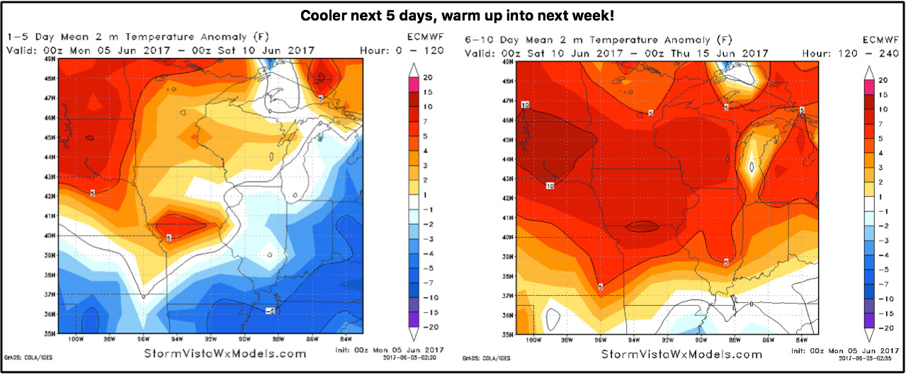
Temps from normal next 10 days…warm across the northern half of the zone through the next 5 days, and then a more consistent warmth across much of the Ag Belt getting into the weekend into next week.
Next system early next week as a low pressure slides into the central Plains…will update on this more as we progress forward this week.
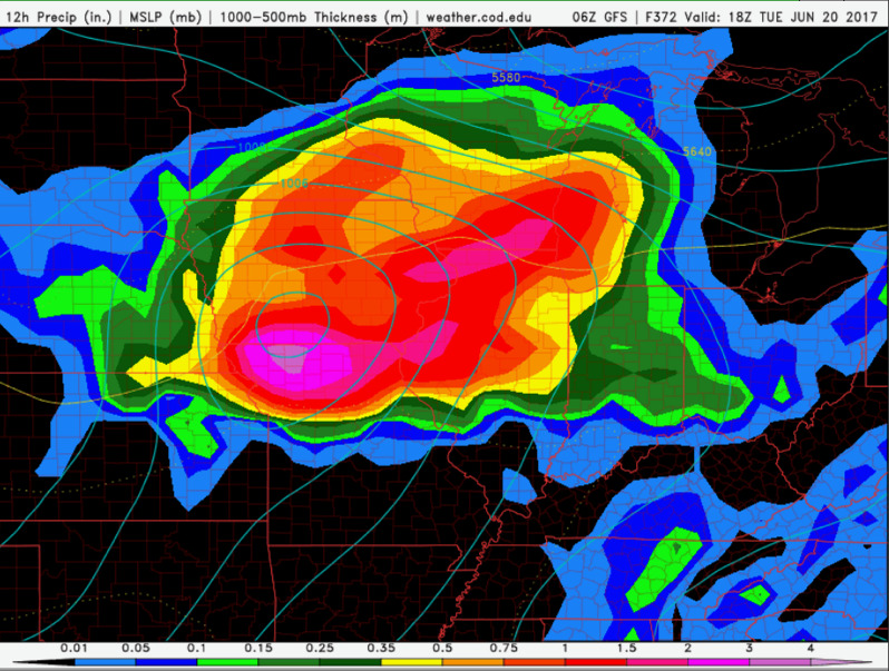
If you’ve been watching our long-range videos you know that we’ve been targeting the ~20th for a big system noted by a large SOI drop…check out the latest GFS this morning picking up a big storm system throughout the central Plains. Just something to keep in mind as we go forward.
Confidence:
- Above average confidence some heavy rainfall and potential strong storms to the west over the next 2 days.
- Overall, we are warmer than normal across the northern half of the zone through the week, and much warm overall through the coming weekend into mid-next week.
- Much of the area is drier than normal across the central Plains this week and then we start seeing more consistent rains featured in the week 2 forecast.
Today’s video (8 min):