Key Points – Thursday, April 13, 2017:
Synopsis: Today we discuss the multiple t’storm chances over the next 10 days, very heavy rainfall possible as well across portions of Iowa, Missouri into eastern Kansas as well. We continue the warming trend over the next week, but we also note the cooler trend in the 11-15 day that we’ve been discussing for quite some time. Have a blessed Thursday!
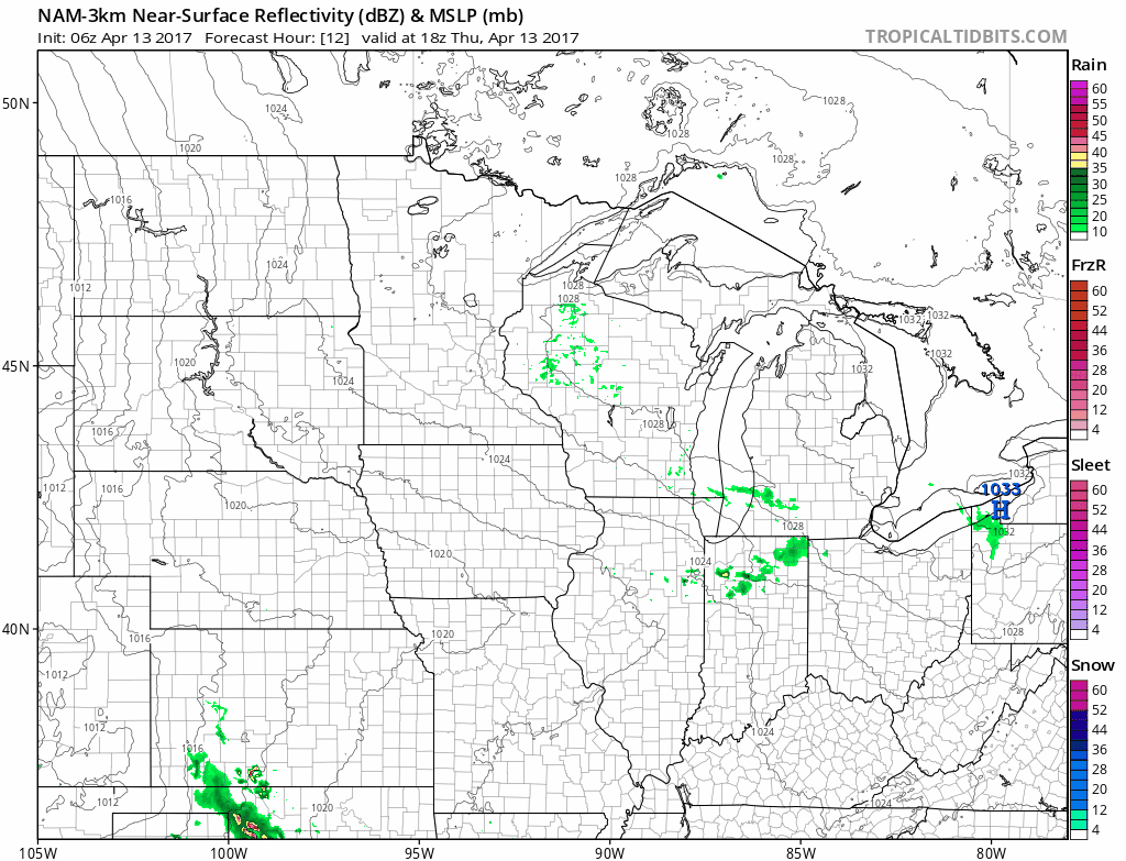
Simulated radar as the warm front lifts north across Zone 8 today, we will see showers and t’storms become scattered in nature across Kansas and southern Nebraska through about 7pm, and then pushing deeper into the overnight we see the threat spread into Iowa as well. As you wake up Friday morning we will see continued t’storms expanding across eastern Kansas, eastern Nebraska into southwestern Iowa and western Missouri. The rain starts to become a little bit more widespread across Iowa by 5pm Friday, coverage will be 50-60% with these.
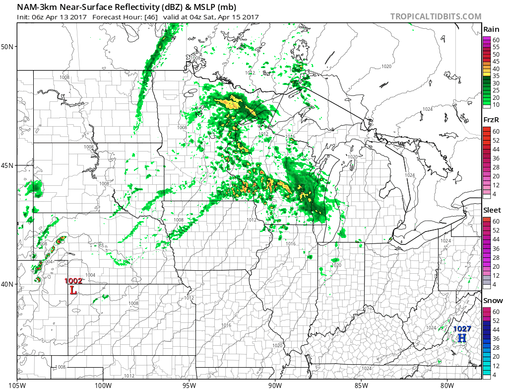
We get additional shower and storm development along the surface low later Friday night into the pre-dawn hours Saturday (some could be heavy) across Nebraska and into Iowa.
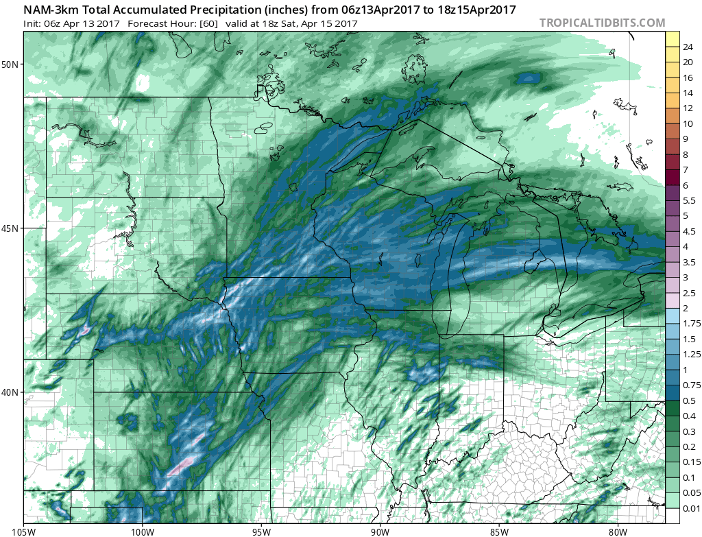
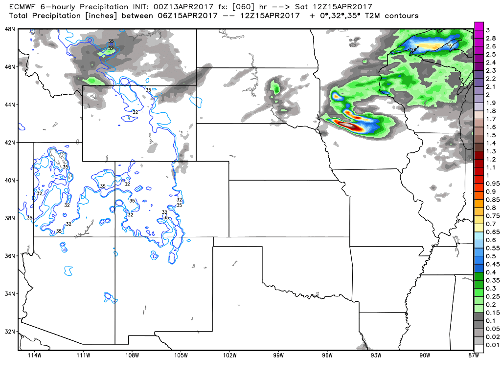
In regards to total rainfall from these 2 pulses of shower and storm activity over the next 60 hours…some places in northwestern Iowa into eastern Nebraska at 1-2″ locally, and then across central Kansas 1.0-2.5″ is expected. Meanwhile, the southern half of Missouri looks to stay dry.
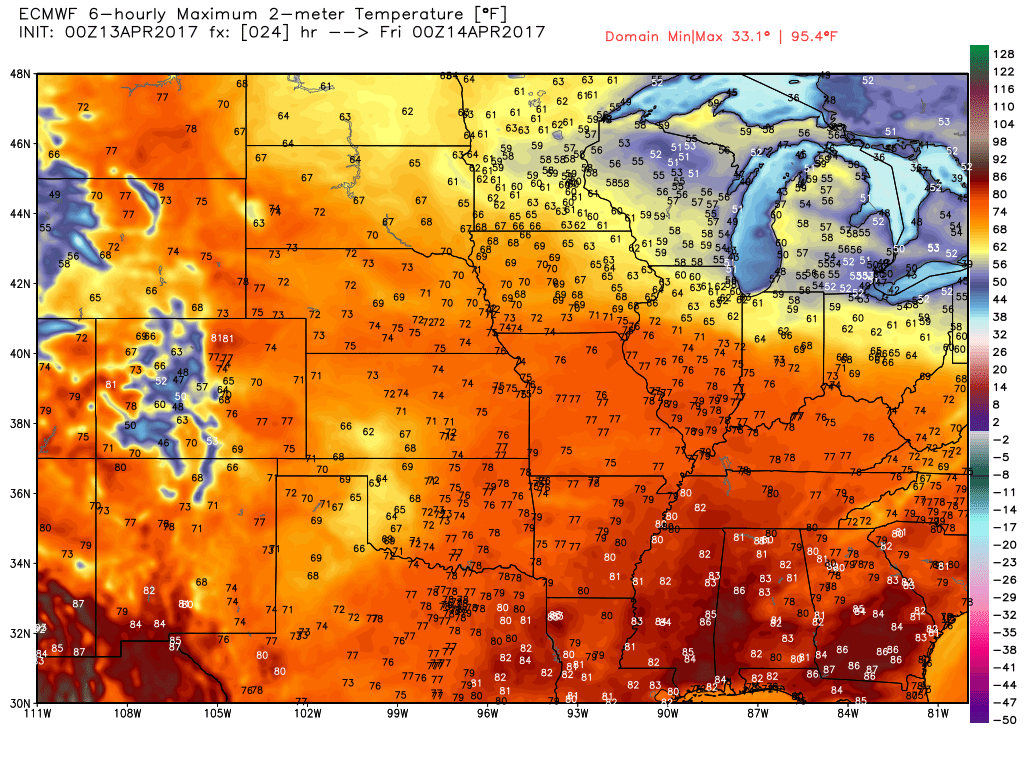
We will be very warm today headed throughout the weekend as well see by a little animation we put together for you this morning. Highs expected consistently in the 70s, with isolated 80s possible Saturday and Sunday as well!
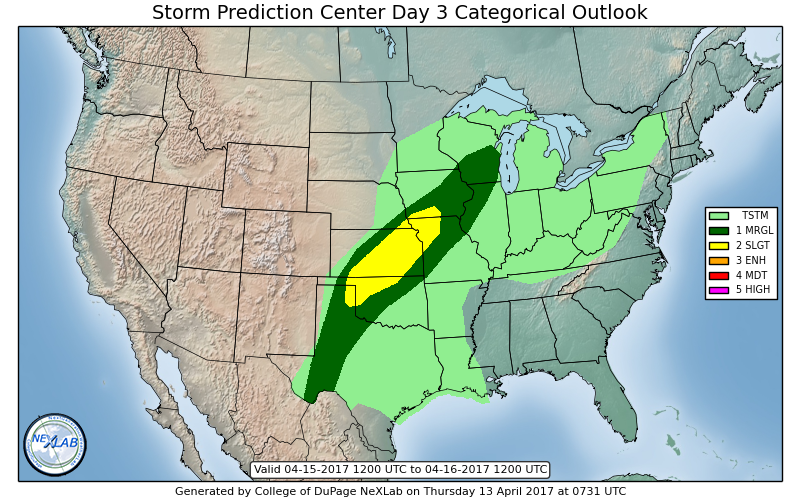
Still can’t rule out a few strong storms on Saturday evening across southeastern Nebraska, southern Iowa into Northern Missouri and Kansas with some gusty winds and isolated large hail at this time.
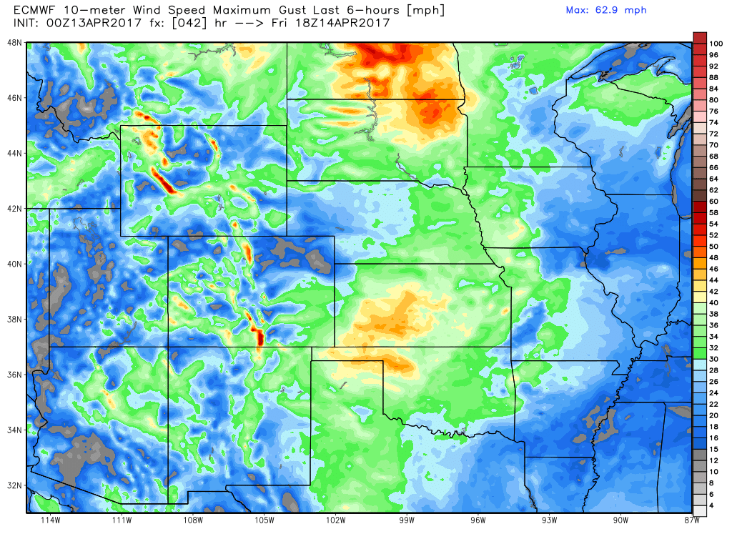
Outside of t’storm activity, we are quite windy on Friday afternoon into Saturday as well with winds out of the south to southwest expected at 10-15 mph, gusting upwards of 40mph at times (noted by the yellows and oranges).
Here is the system responsible for this inclement weather…widespread t’storms expected across Iowa Saturday (some heavy rainfall possible here), and then showers and t’storms expanding east along a cold front later Saturday evening into the overnight across southeastern Nebraska, eastern Kansas into Missouri with a coverage ~40-50% expected.
Our next chance for t’storms comes right on the heels of this system Sunday night into Monday across southern Nebraska, eastern Kansas into Missouri with a coverage of ~50% expected into Monday morning from west to east.
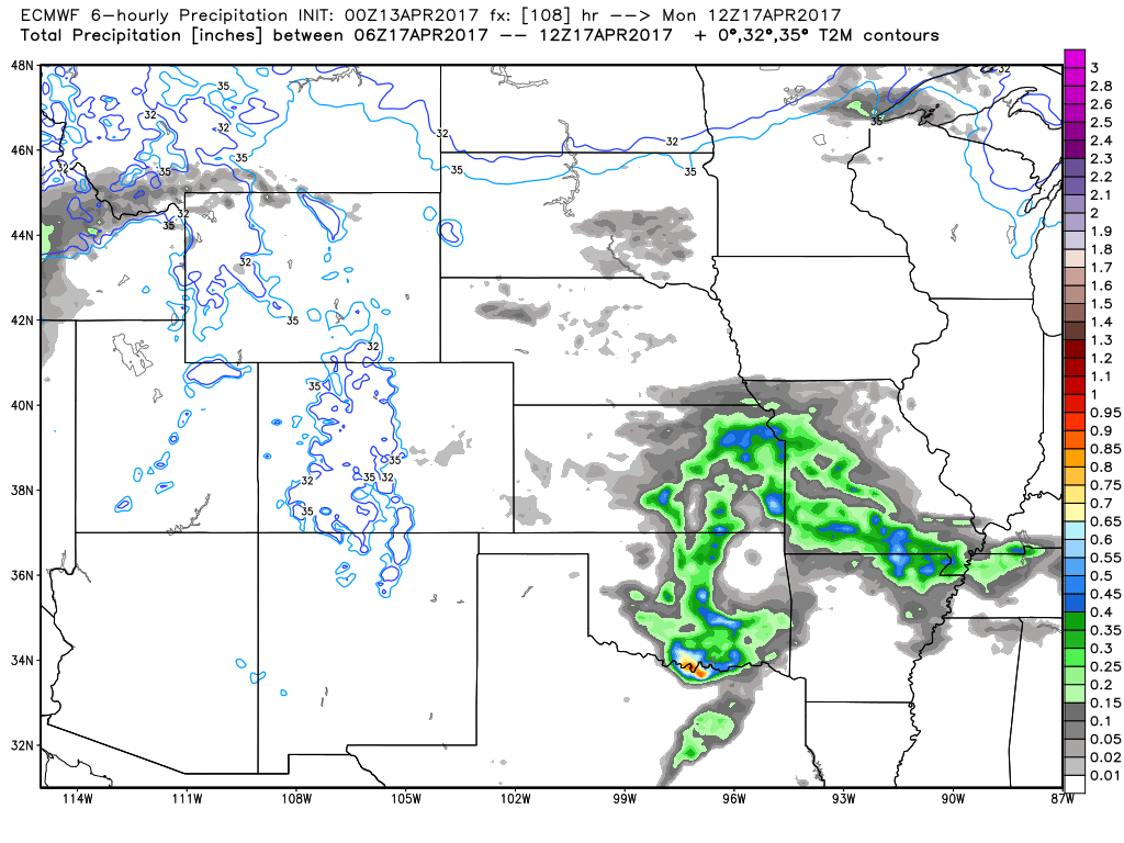
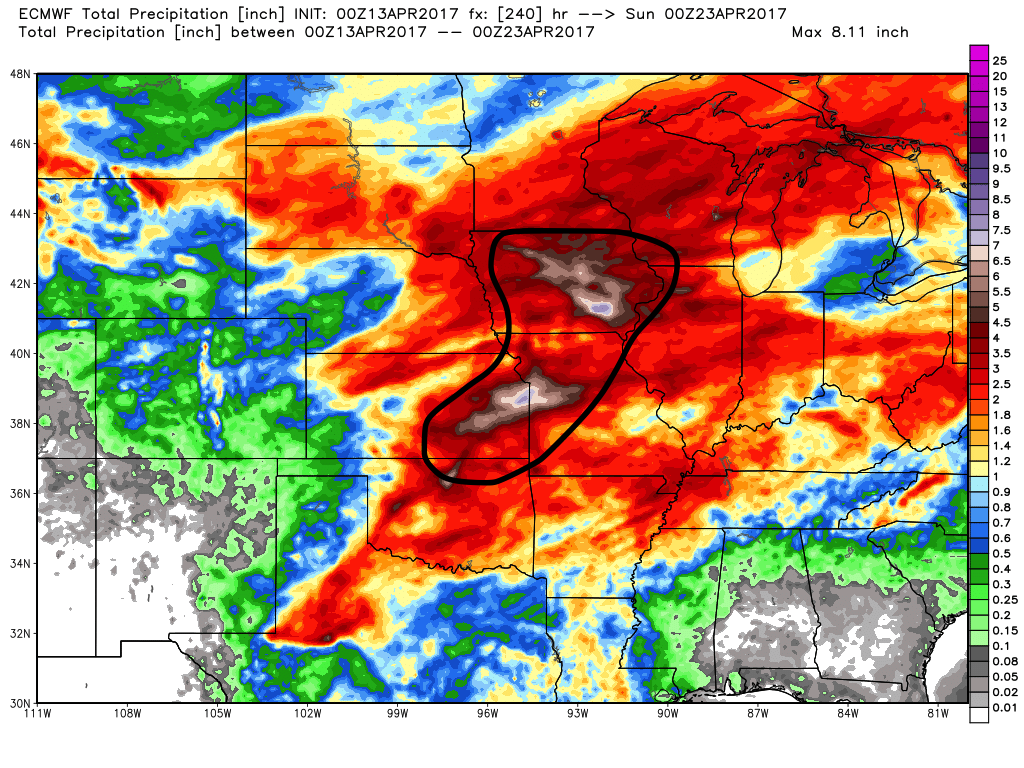
We have big concern for heavy rainfall in the black circled area below over the next 10 days from Iowa to western Missouri and eastern Kansas that the European is forecasting 5-7″ of total rainfall in a week and a half…quite incredible, really.
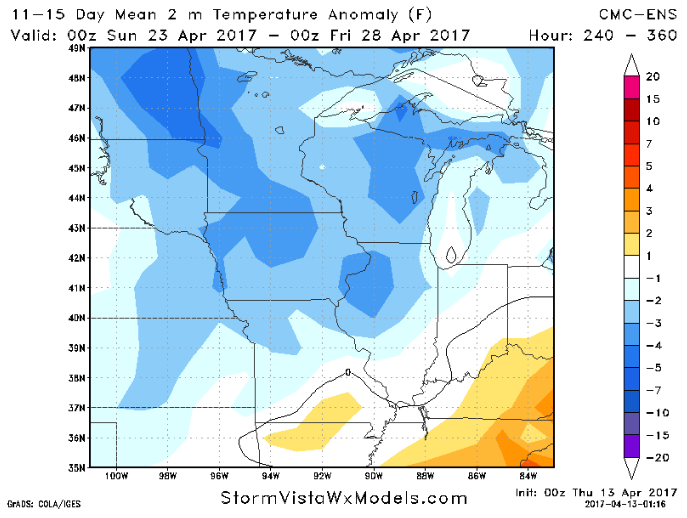
Overall we are warmer than normal in the next 7-10 days, but check this out, this is temperature anomalies in the 11-15 day timeframe…not ideal for planting as we will be both wet and anywhere from 1-5º cooler that we’ve been mentioning for a while now.
Confidence and Risk:
- Above average confidence scattered showers and storms lifts north of the warm front today from south to north into Friday morning.
- Above average confidence additional showers and storms possible Friday into Saturday morning across Nebraskan and Iowa along the surface low moving east.
- Above average confidence we are gusty Friday into Saturday as well with winds gusting upwards of 40mph out of the south to southwest at times.
- Average risk for strong storms Saturday night into Sunday morning for damaging winds and isolated large hail across southeastern NE, southern IA, eastern KS into northern MO.
- High confidence we continue the active pattern over the next 10 days, which we have big concerns for portions of Iowa, Missouri into eastern Kansas for very heavy rains and continued saturated soils.
Today’s video (8 min):