Key Points – Tuesday, May 23, 2017:
Synopsis: Good Tuesday morning! Pay close attention to today’s video, we mention the risks for the forecast over the next week, because models are doing a poor job of picking up on total rainfall given how active we continue to be. New European weeklies were issued last night as well and continue the theme of active and cooler times into June…have a blessed day!
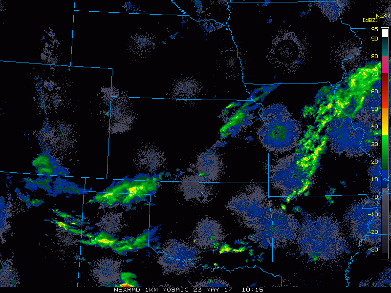
Current Radar:
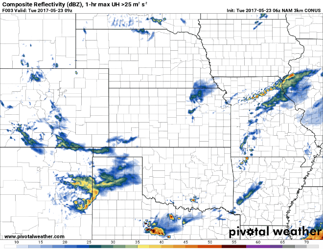
Simulated radar…instability showers (popcorn storms) will pop up through the day today, will be hit and miss; these continue east across Iowa and Missouri on the day on Wednesday.
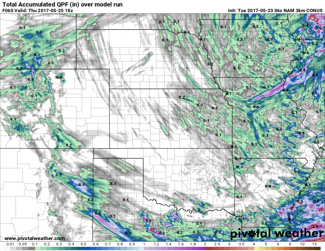
Total rainfall through the next 2-3 days…the 1″+ in northern Missouri is the rains that have fallen this morning, most likely any showers/storms that form today into tomorrow drop between 0.1-0.3″ overall.
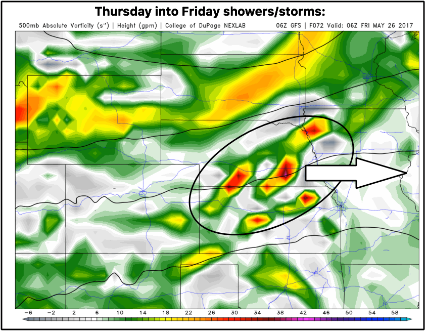
Next round of scattered storms comes Thursday into Friday across the central Plains as a piece of energy moves west to east. This has signs of being an MCS (mesoscale convective system) which tends to persist overnight and drop decent rains…will need to watch this closely.
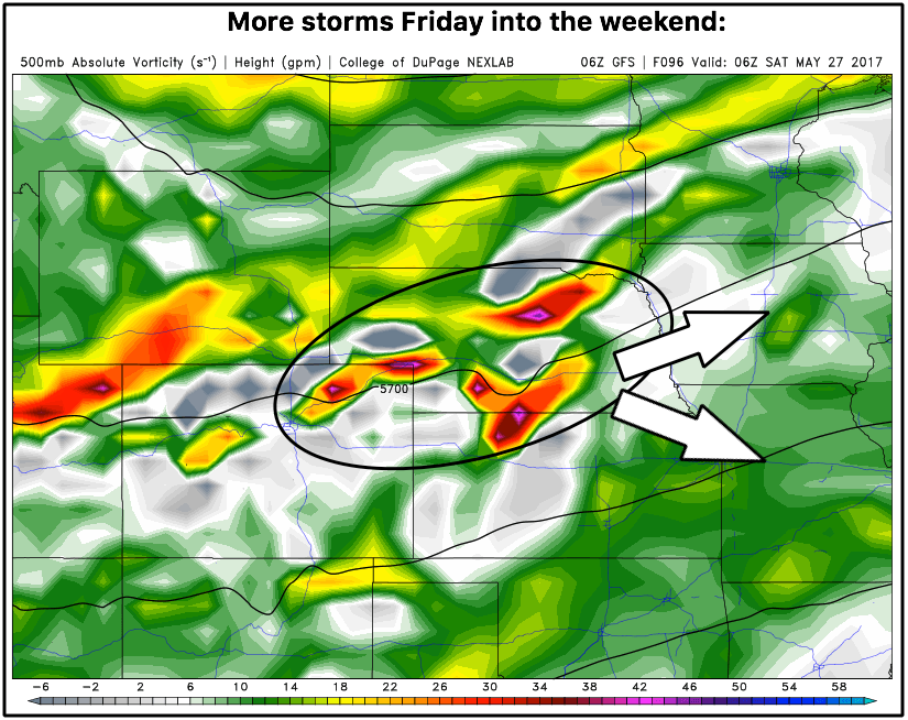
Late Friday through Saturday another stout piece of energy moves through the Zone from west to east that needs watching for additional heavy rainfall.
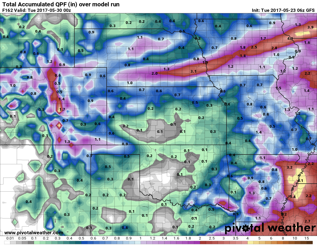
An idea of rainfall totals through early next week…use this just as guidance, it does show the heavy rains well spanning from Nebraska to Missouri and Iowa…certainly think another 2-3″ localized will be possible here.
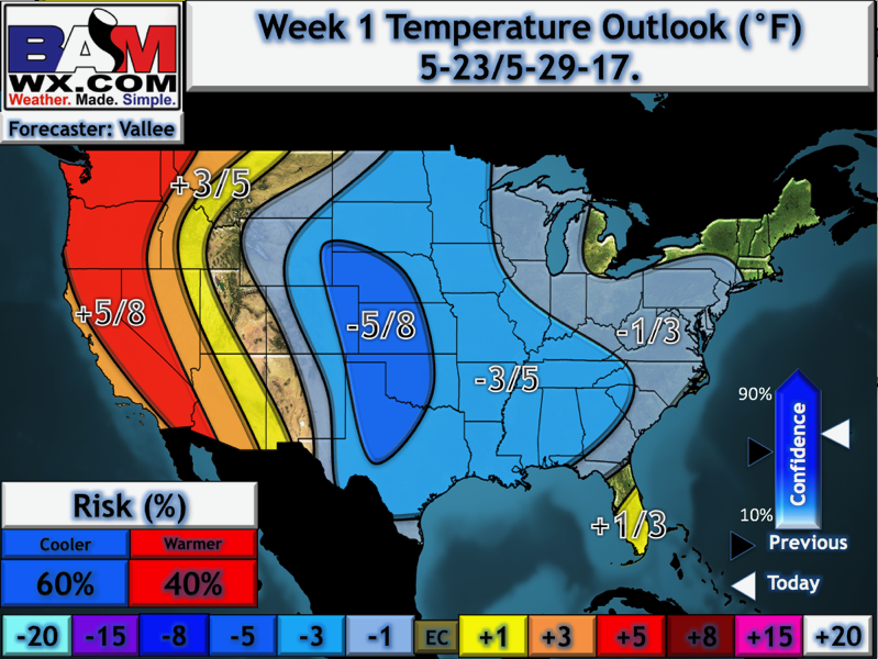
Temperatures from normal through the next week were updated on the site this morning, overall we are cooler than normal in the central US.
New European weeklies came out last night, certainly suggests a cooler than normal and wet June for the Central US which if you look at our long-range outlooks, this has been our thoughts for quite some time.

Confidence:
- Above average confidence of scattered showers and storms through Wednesday during the daylight hours main focused east.
- Average confidence a cluster of storms persists later Thursday night into Friday morning from west to east across the central Plains.
- Average confidence another wave of showers and storms moves east Friday into Saturday that could bring some heavy rainfall to the Zones.
- Overall, above average confidence we are cooler than normal over the next week throughout the central US.
Today’s video (8 min):