Key Points – Tuesday, April 18, 2017:
Synopsis: Good Tuesday morning! Continue to have rain and storms moving east across eastern Nebraska into Iowa throughout the day. A warm front lifts north tonight into Wednesday morning that could bring some strong storms to portions of Nebraska and Iowa as well as heavy rainfall potential. A front starts to establish itself on Wednesday evening into Thursday morning along the cold front across NW Missouri, SE Nebraska into portions of Iowa. An additional system moves east and north on Friday into Saturday that will bring additional moderate to heavy rains from Kansas to Missouri and portions of Iowa. So, as you can tell, the overall theme here is very active getting into late April. Have a terrific Tuesday.
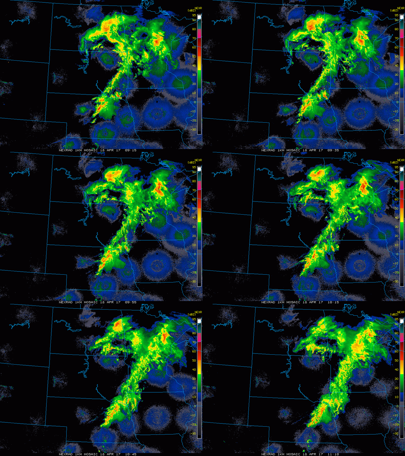
Current Radar…storms continue to advance east across eastern Nebraska and western Iowa this morning.
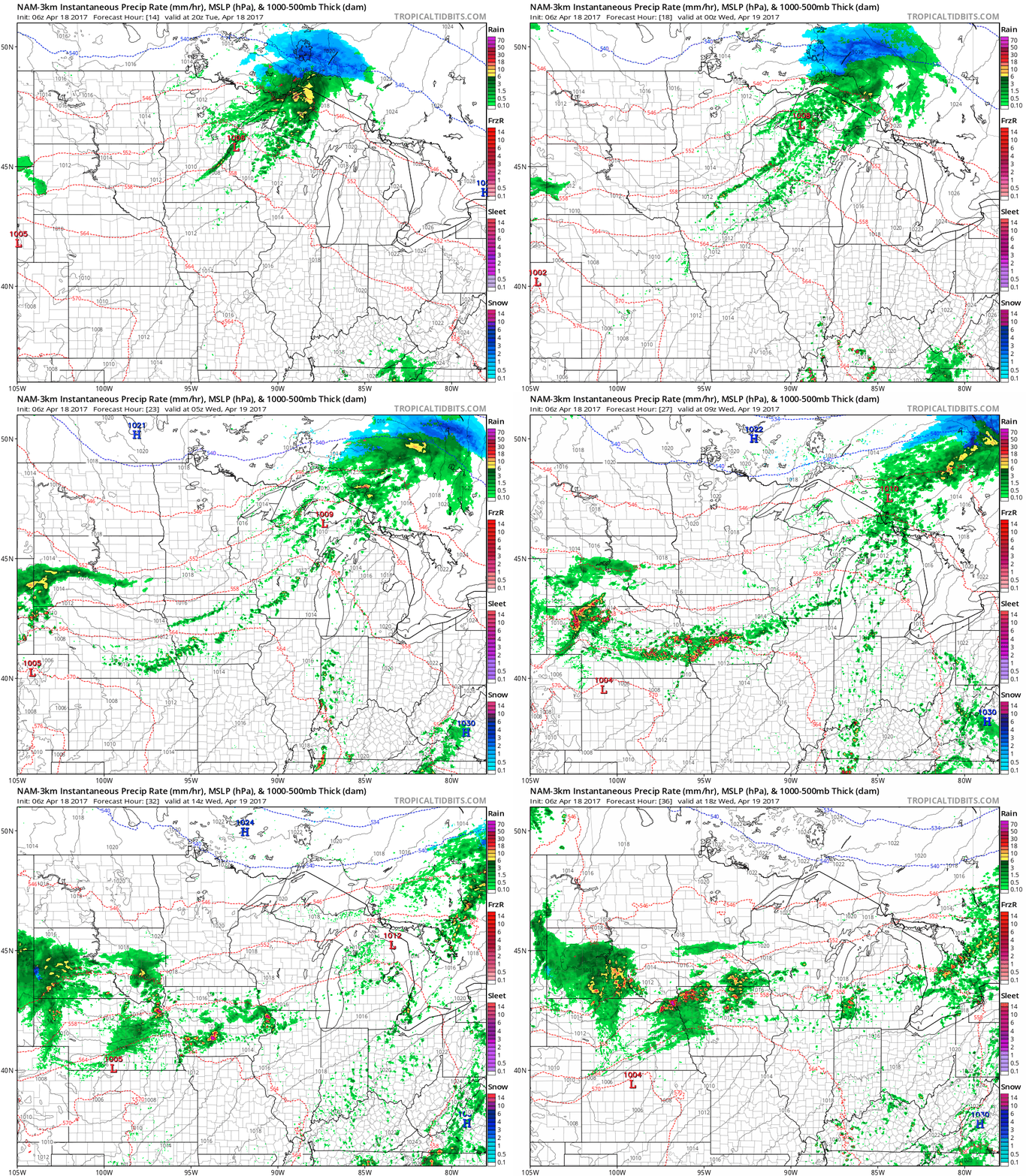
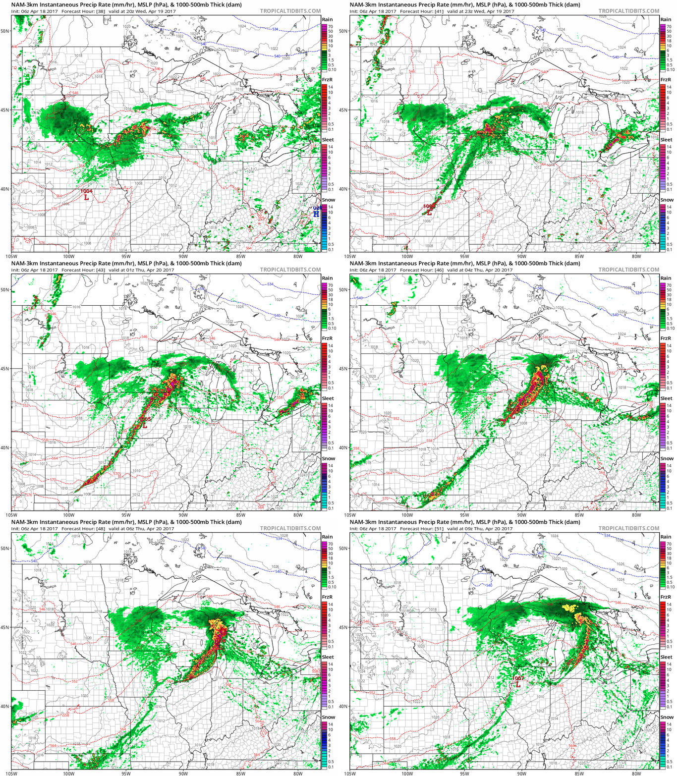
The 3km NAM has the storms diminishing throughout the day across eastern Iowa. However, it redevelops storms along a warm front Tuesday night into Wednesday bringing extensive t’storm development across Nebraska and portions of western Iowa (some being strong).
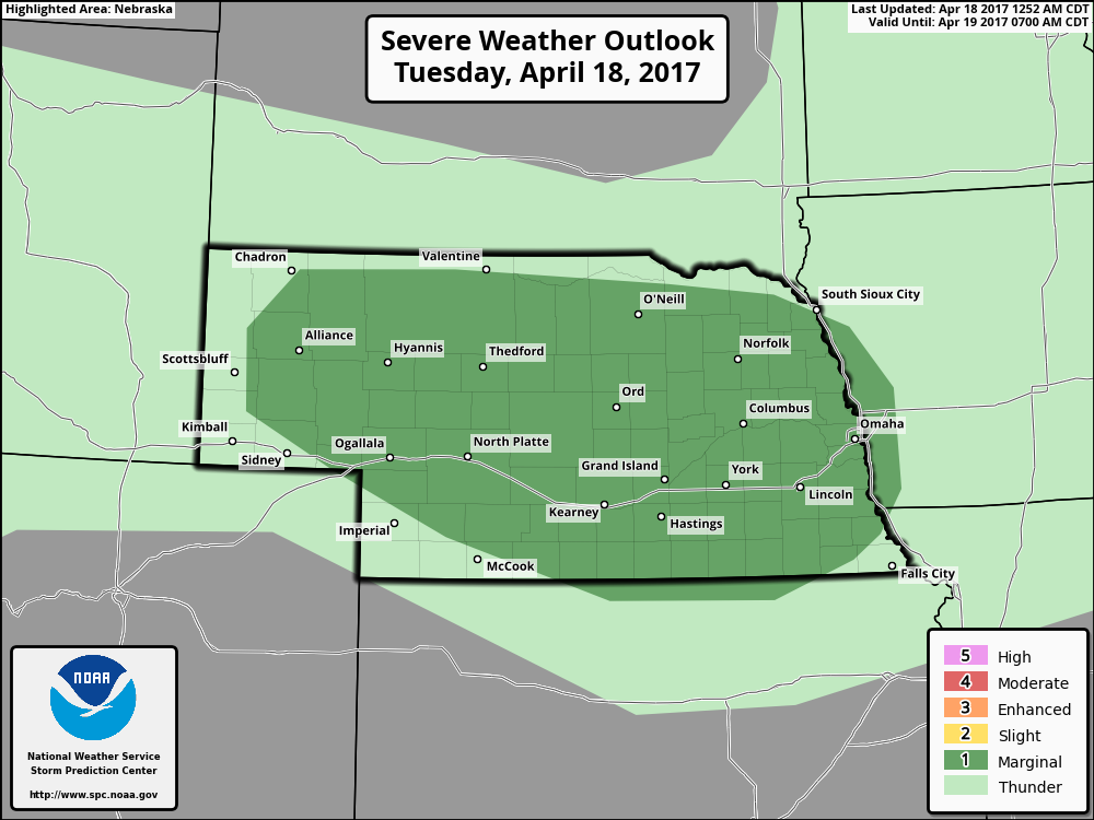
Today’s risk for strong storms as the warm front comes through later this afternoon into tonight. A few gusty storms and hail possible across Nebraska into western Iowa.
Warm front continues to advance east and turns into a cold front, bringing additional showers and storms to portions of SE Nebraska, eastern Kansas, southern half of Iowa into northern Missouri.
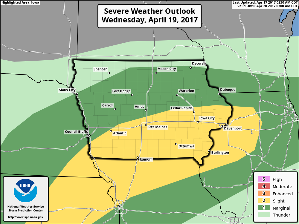
Risk for strong to severe storms on Wednesday into Thursday across SE Nebraska, the southern half of Iowa into northern Missouri. Some gusty storms even some damaging winds, isolated large hail and a few isolated tornadoes cannot be ruled out.
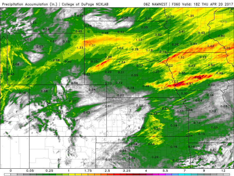
Total rainfall from the warm and cold front over the next 2 days, some heavy rainfall over 1.5″ possible across portions of Nebraska into Iowa as we get into Thursday. Isolated higher amounts will certainly be possible, which is not the best of news given how wet some of these areas have been this month so far.
Friday into Saturday a surface low starts to work in across southern Kansas and portions of Missouri bring a heavy rainfall potential via the latest GFS. By Saturday during the day the threat shifts off to Iowa as well.
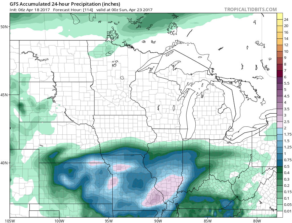
Total rainfall from this system via the latest GFS, some localized heavier rain over 1.0″ possible across SE Nebraska, eastern Kansas into southern Iowa and Missouri.
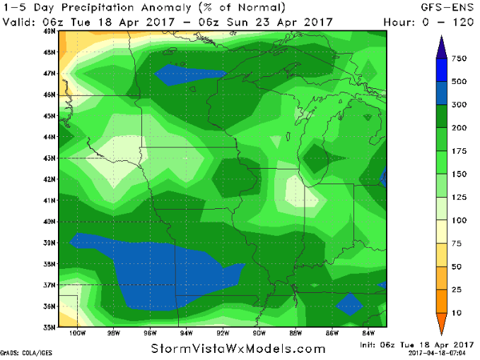
Next 5 day perfect normal rainfall from the latest GEFS suggest basically the entire Zone with above normal rainfall through the weekend, with eastern Kansas into Missouri really feeling the brunt of those heavy rains.
Confidence and Risk:
- Above average confidence showers and storms continue this morning across eastern Nebraska and western Iowa before diminishing.
- Above average confidence storms redevelop along a warm front Tuesday night into Wednesday across the same area as above.
- Average risk here for some stronger storms.
- Storms then develop Wednesday night into Thursday mainly across SE Nebraska, eastern Kansas, Missouri into southern Iowa along a cold front.
- Average risk here for strong to severe storms, including potential isolated tornadoes.
- Average confidence in the details of our next rainmaker Friday into Saturday across southern Kansas and portions of Missouri.
Today’s video (9 min):
