Key Points – Tuesday, May 30, 2017:
Synopsis: Good Tuesday morning, we hope you all had a wonderful Memorial Weekend! In today’s update we target a few storm clusters that your free weather apps would never pick up on, so make sure to pay close attention to the details. Another MCS (storm cluster) event looks to pan out later Wednesday into Thursday bringing additional heavy rainfall, and then we watch for a low pressure system to sweep through late week into the weekend with more heavy rainfall and storms in the cards as well. If you have any questions please let us know, have a blessed week!
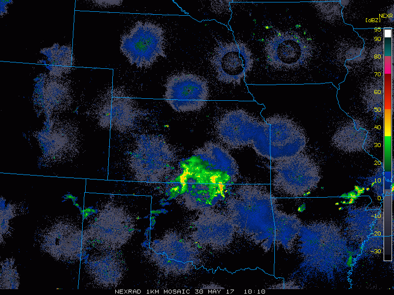
Current Radar:
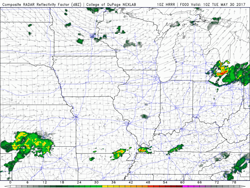
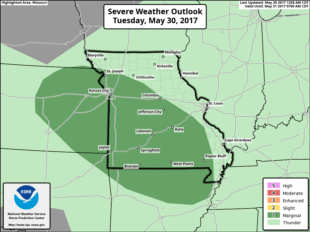
Simulated radar from the HRRR shows the storm threat shift to the east across eastern Kansas, Iowa and Missouri today from west to east. Coverage will be ~30% with this wave, can’t rule out a strong storm here, an upgrade to a slight risk may be possible to outline this threat across parts of the Zone.
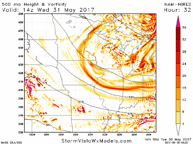
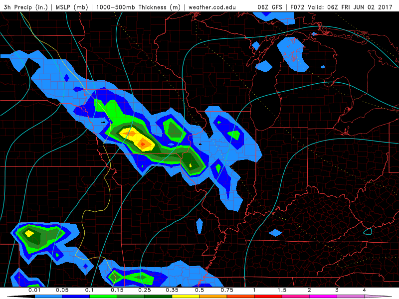
Wednesday night into Thursday will be our next chance for showers and storms across the central Plains, we pick this up well by looking at energy aloft in the atmosphere (called vorticity). This wave moves in on across Nebraska, Kansas into Missouri…likely an MCS (storm cluster) working in here.
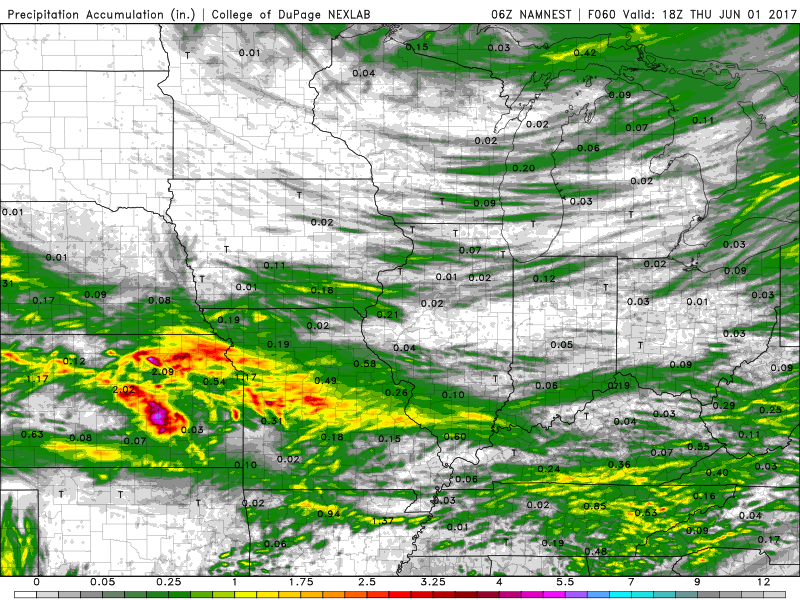
Total rainfall through the next 60 hours, we can see that MCS (storm cluster) work its way in here later Wednesday into Thursday, some heavy rains will be possible spanning from Kansas to Missouri in excessive of 2-3″+.
As we get in on the northwest flow this week we will introduce scattered strong storm threats (mainly gusty winds and isolated large hail) from today through Thursday. Wouldn’t shock us to see these upgraded to slight risks to cover the threats.
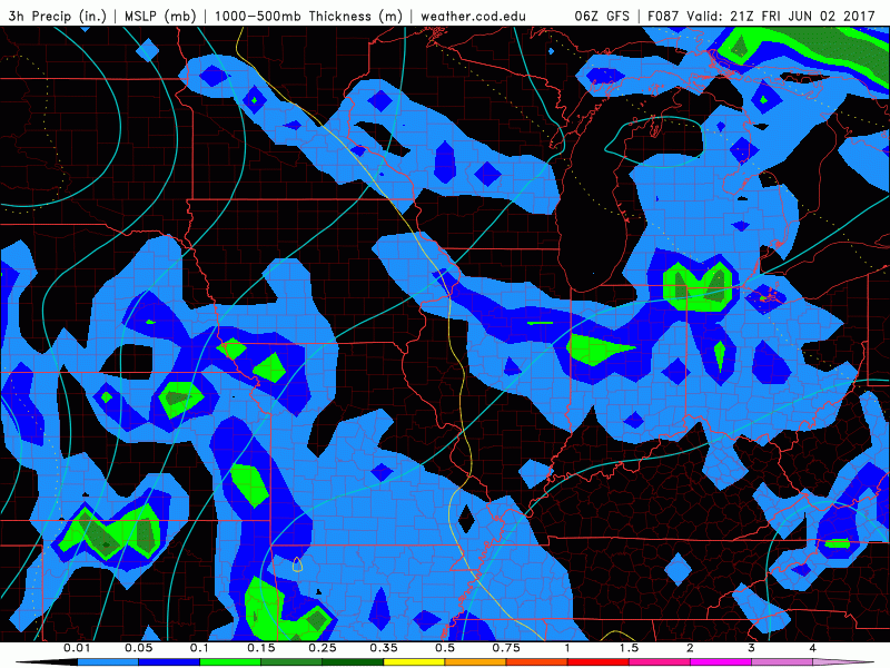
As we go throughout the weekend we are going to watch another storm system work its way in Friday as warm front starts to lift into the central Plains bringing scattered storms across Iowa even northern Missouri.
Friday evening coverage will be 40-50% for rain and storms…getting in on Saturday more heavy storms across Kansas and Missouri and then on Sunday the wave of low pressure moves east targeting more rain. Definitely not looking very dry this coming weekend.
Total rainfall through early next week as we get in on the northwest to southeast flow, nearly all locations have chances to get in on some rains here of 1-3″.
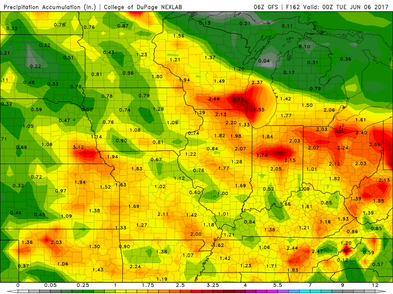
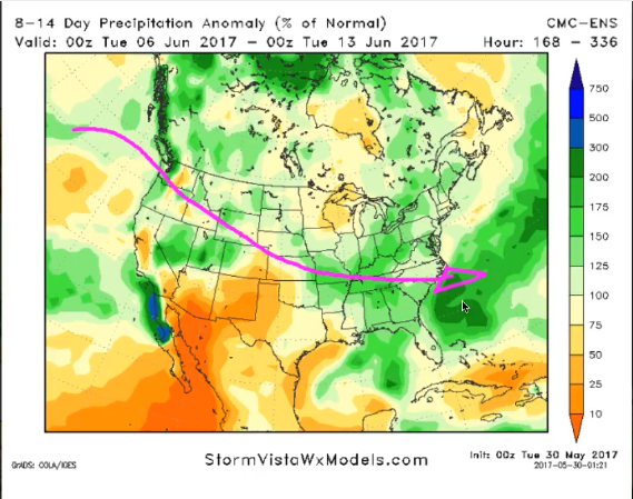
We see the influence of the Pacific jet stream amplifying getting into week 2, this will keep the pattern very active in the Ag Belt for sure with above normal rainfall. Again, it’s important to note that until we see this jet stream take a hiatus, above normal rainfall continues to be in the forecast.
Confidence:
- Above average confidence of scattered storms from west to east across parts of eastern Kansas, Iowa into Missouri.
- Increasing confidence of another MCS (storm cluster) event later Wednesday into Thursday that has the potential to bring heavy rainfall.
- Increasing confidence of another heavy rainmaker moving east of the Rockies into the central Plains late week into the weekend as a warm front and low pressure system works its way in.
- Above average confidence of nearly seasonal temperatures over the next 1-2 weeks expected.
Today’s video (8 min):