Key Points – Thursday, April 6, 2o17:
Synopsis: Hey good Thursday morning and thanks for checking out the latest forecast update! We discuss rainfall over the past 30 days, a brief dry stretch of nice, warm weather ahead into the weekend and next week…our next rain and storm chances as well as the wet pattern looking to return in the medium to long-range based off latest data. Have a terrific day!
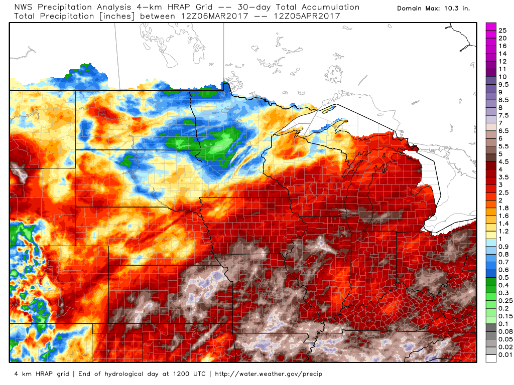
Precipitation over the past 30 days (doesn’t include yesterday)…many locations with 5″+ since early March…we continue to be concerned with Planting delays as we go deeper into April; something we don’t think is talked about enough.
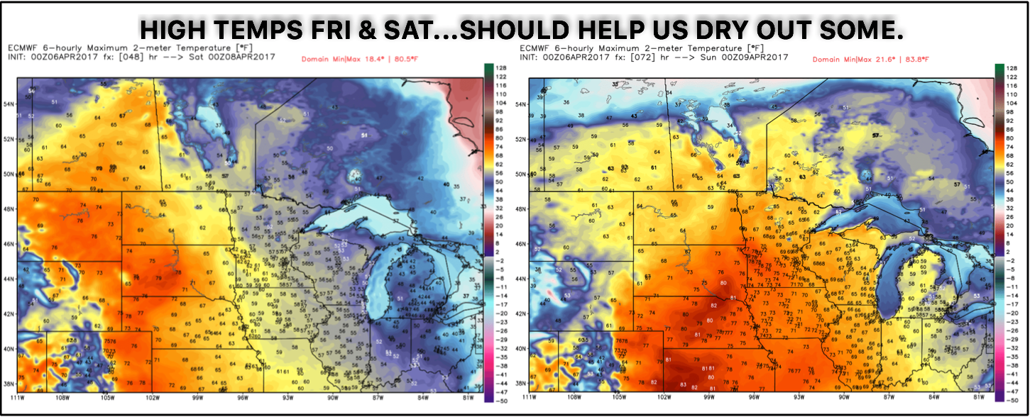
High pressure dominates the forecast area over the next few days with temperatures getting into the 50s/60s, even 70s and 80s by Saturday and Sunday. This should definitely help us dry out some from recent rains.
Next chance for rainfall comes late weekend into early next week. Stronger storms possible? Details below.
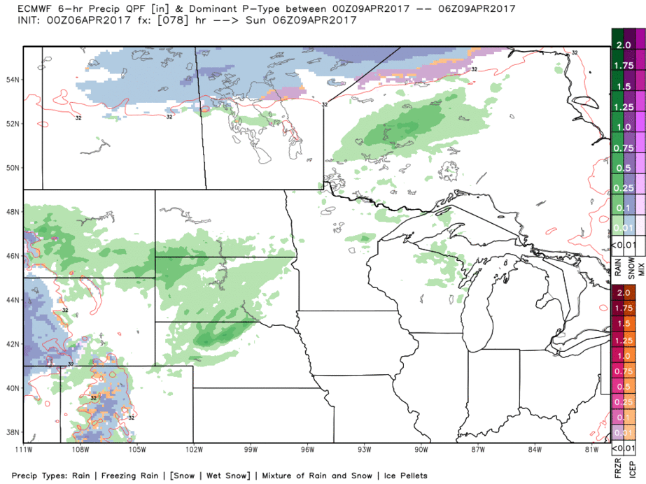
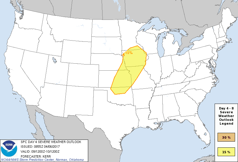
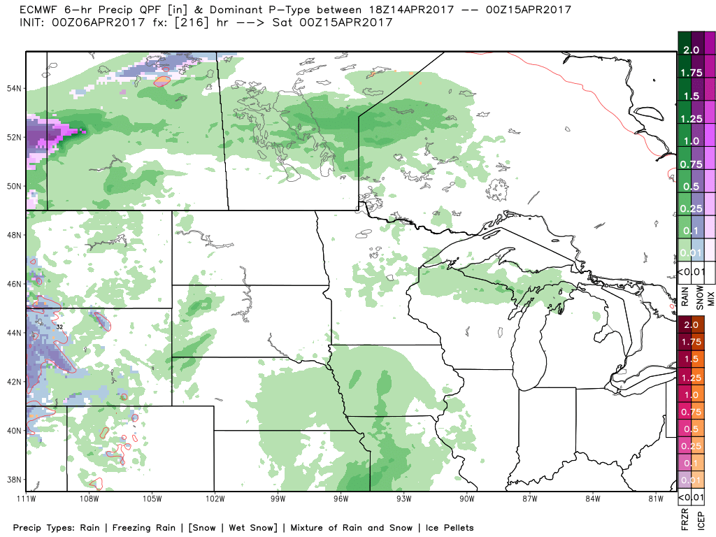
We do think a few gusty wind reports and/or isolated large hail are possible later Sunday into early Monday across eastern Kansas, Iowa into western Missouri as we destabilize the atmosphere and feel the influence of a lower-level jet. We not expect this to be an outbreak of severe weather being that the trough still has a positive-tilt nature to it.
Next real rainfall chance doesn’t look to move in until late next week into next weekend…obviously it’s a ways out, but overall the pattern next week looks dry which we discuss below.
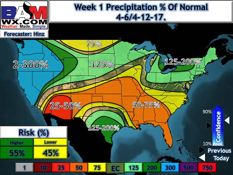
If you’ve been paying attention to the long-range updates, you’ll know that we’ve been eyeing a drier stretch of weather the second week of April. You can see this reflected in our week 1 precipitation from normal forecast, with the exception of folks in the northern Plains.
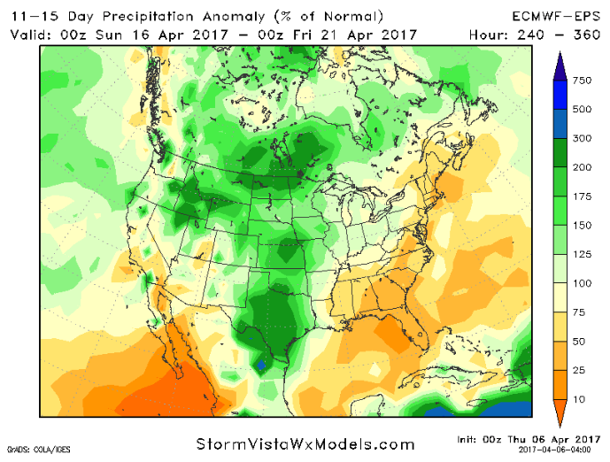
However, we’ve also been mentioning the fact that we don’t believe this dry stretch lasts and that’s also reflected in the latest days 11-15 data. This is a concerning looking because we know this is about the timeframe most folks are aiming to get things going in the fields. Highly encourage you to check back often.
Confidence and Risk:
- High confidence we have a nice dry stretch of normal to above normal temperatures through the early weekend.
- Average but increasing confidence of showers and storms possible across the Zone Sunday into Monday.
- At this time, above average risk for strong to severe storms during this timeframe as well across eastern Kansas, Iowa into Missouri given the positive tilt nature of the trough.
- Above average confidence we see a drier stretch of weather overall through the next week, with the exception of folks in the northern Plains.
- Increasing confidence rains return in the 11-15 day, however…a trend we are watching very closely.
Today’s video (6 min):