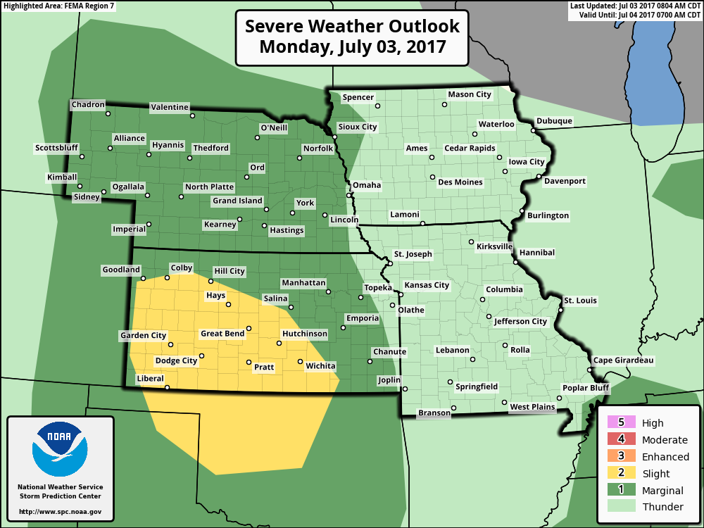
Key Points – Monday, July 3, 2017:
Synopsis: Good Monday morning! We are watching for additional heavy rainfall over the next 48 hours across the central Plains in localized areas, as well as potential strong storms as well through mid-week. Models are handling these storm clusters very poorly, in the video we discuss why we went with pieces of data over others. Also, getting into early next week we see the northwest flow set-up shop, areas to the west and south look to stay drier (miss out on the moisture) and locations north and east we are watching for energy to produce storm clusters along the famous “588” line. Let us know if you have any questions, have a blessed Holiday!
Current Radar:
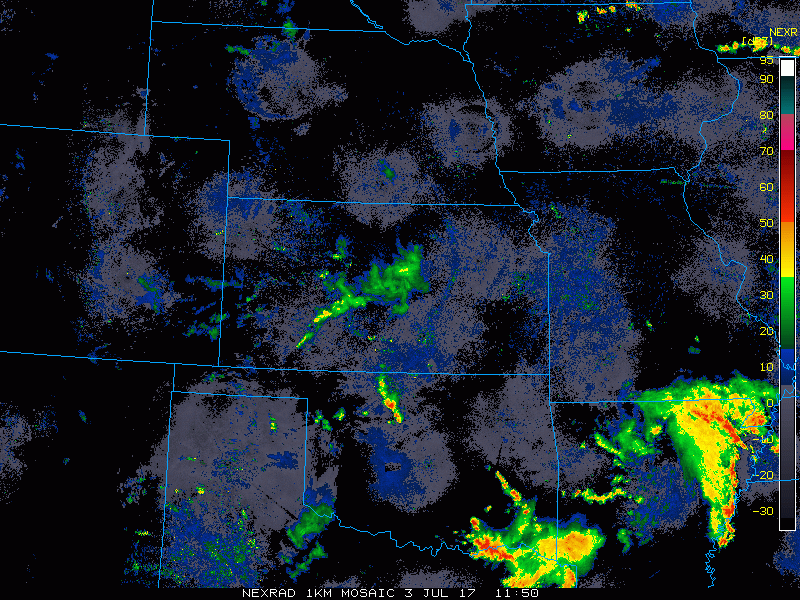
Simulated radar guidance from the last WRF model through today…watching ~4pm for scattered storms development will be possible across parts of the Zone…it’s getting into the overnight and early Tuesday morning we see additional storm development occur across Nebraska heading east into Iowa. Some of these have potential to be strong and heavy. Locations across Missouri have a lower chance for storm development today.
There is potential for some strong storms today as well more specifically west and south.
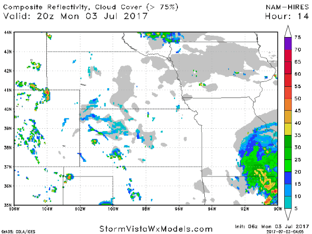
In the video we discussed how we need to watch for an outflow boundary to initiate additional storm development eastward across Nebraska and Iowa for Tuesday…the WRF actually picks up on this as well getting into the afternoon and overnight timeframe. Additional storms across Missouri will also be possible Tuesday as a surface low pressure system moves east into the Midwest. Here again, some of these may be strong to severe with heavy rainfall possible.
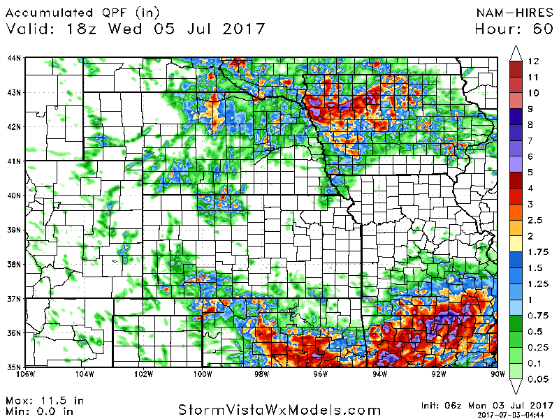
Total rainfall guidance here over the next 60 hours…again, this isn’t “gospel”, it’s an idea. Across Nebraska and Iowa we see localized amounts of 3-5″ certainly on the table here especially if storms fire along a boundary. Southwest Kansas and southwest Missouri, 1-3″ with localized higher amounts also possible.
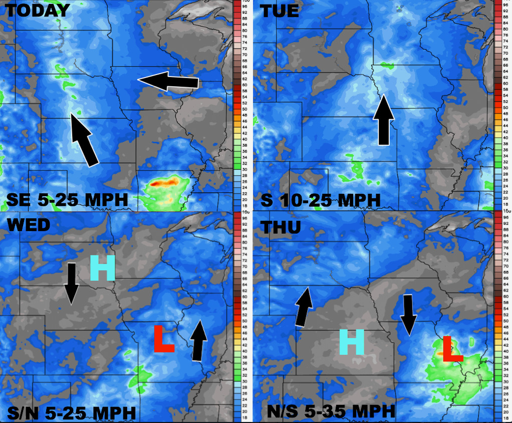
Wind forecast through Thursday:
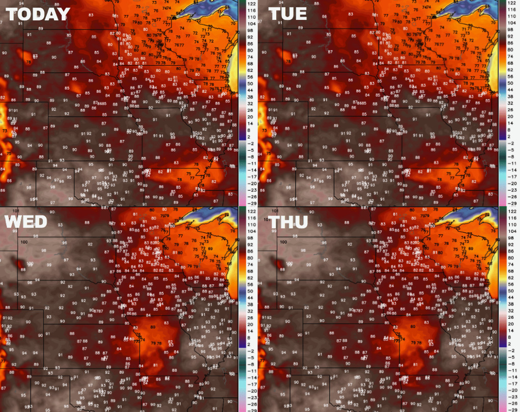
Temperatures through mid-week here as well:
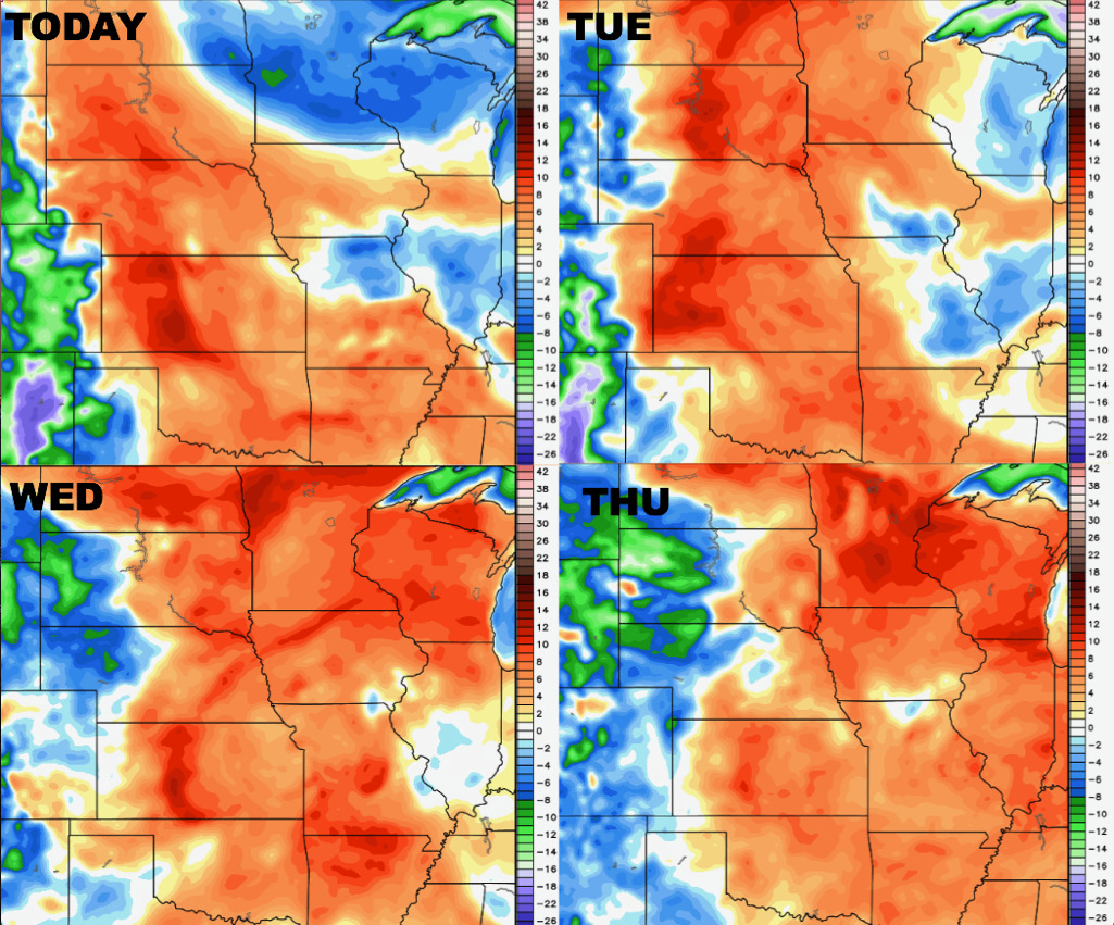
Dew points from normal forecast over the next 4 days…overall a fairly muggy week with the exception of some eastern Zone locations.
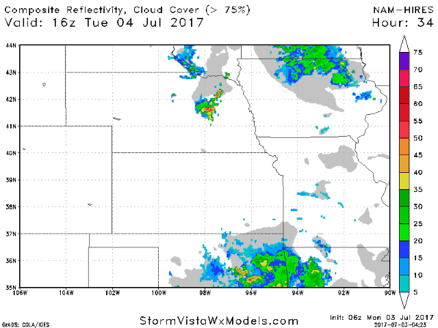
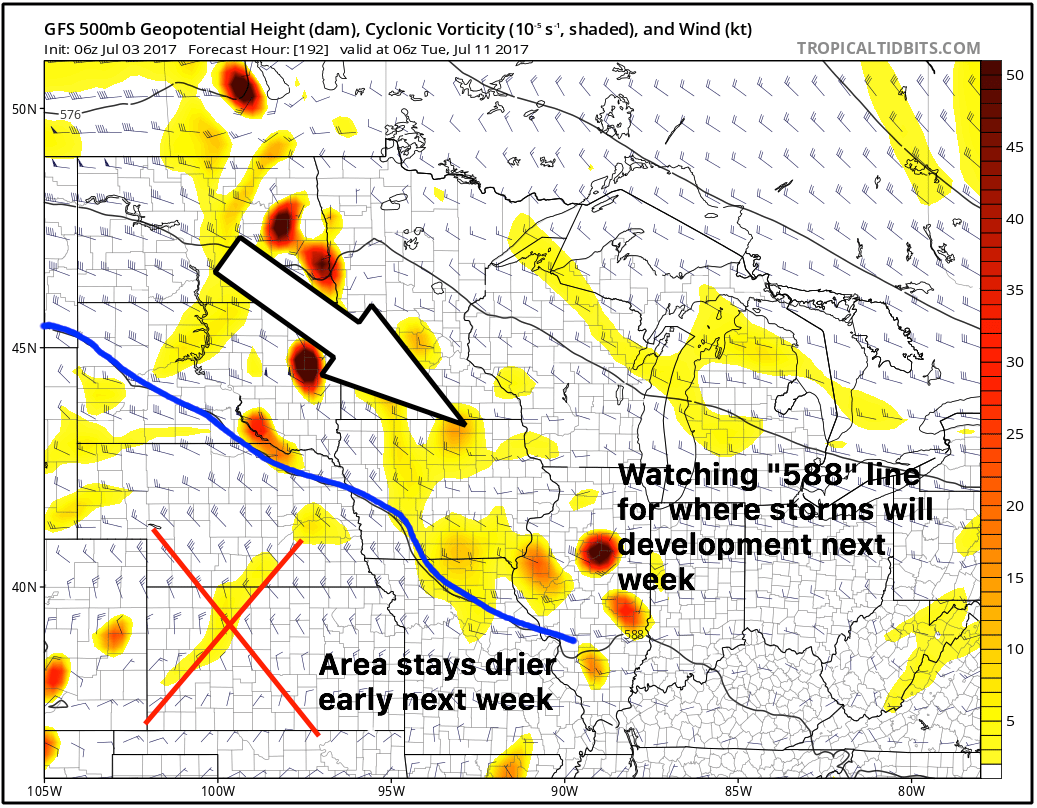
Getting to early next week we see the “northwest flow” set-up shop across the central Plains…areas to the south and west stay drier in this pattern, while locations nearly the “588” height is where we are watching for those storm clusters to develop as discussed in the video.
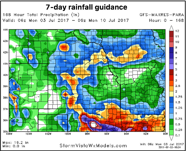
7-day rainfall guidance across the central Plains…we chose the GFS because the European data has been missing these storms clusters very badly, where we feel the GFS has a good handle on where the heavier precipitation will fall. Localized 1-3″ with higher amounts possible on the table here.
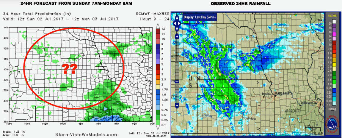
Here’s an illustration of why we didn’t choose the European data…over the past 24 hours it completely missed the rainfall in Nebraska and Kansas.
Confidence:
- Average but increase confidence of additional storm development across the central Plains today, some being strong to severe with heavy rainfall possible.
- Slightly Below average confidence on the exact details, but watching for additional storm development late tonight into Tuesday across NE/IA along an outflow boundary.
- Average confidence some locations will see 3″+ possible over the next 60 hours due to heavy nature of these storm clusters.
Video (7 min):