Key Points – Wednesday, May 10, 2017:
Synopsis: Good Wednesday morning! Thunderstorms overspread a good majority of the Zone today, watching for the potential for some strong storms and heavy rainfall as well along a stationary boundary. Overall, there’s a nice stretch of weather coming after the next 2 days of inclement weather with some warmth as well before we turn back to active into next week. All the details are packed in the video, let us know if you have any questions!
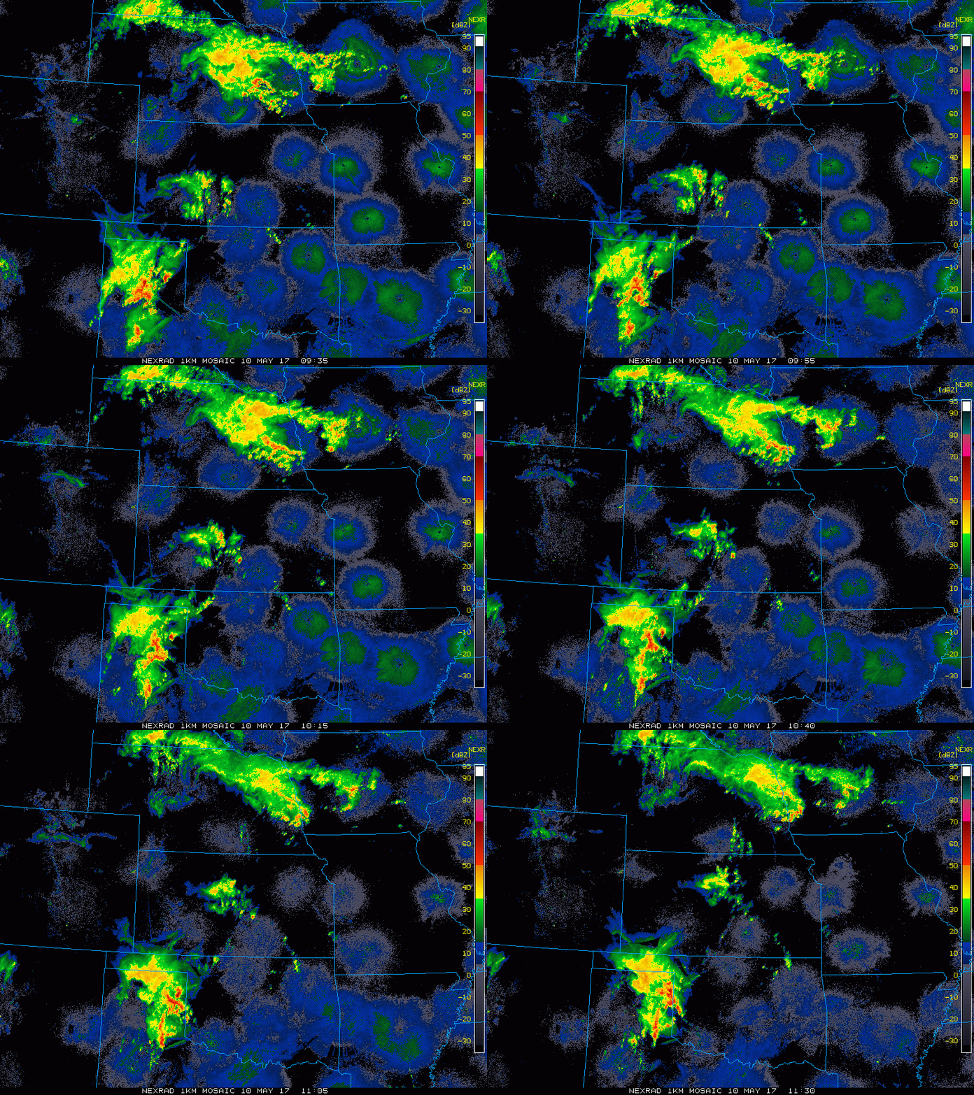
Current Radar:
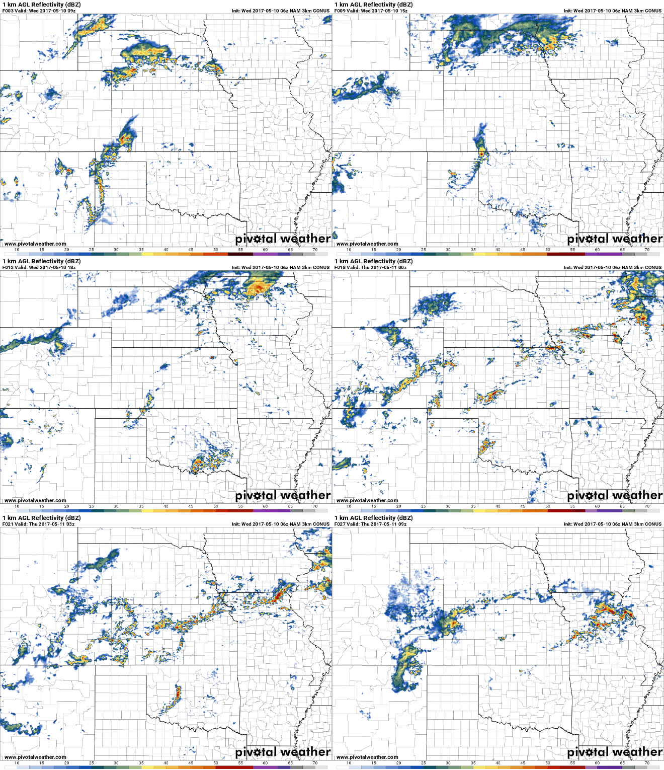
As we get in on the heating of the day, a good bet for thunderstorm activity ~50-60% by 4pm today across portions of Nebraska into Iowa…however, it needs to be noted that not everyone gets in on the rains here further south. The threat gets a little bit more widespread getting into later tonight and Thursday morning.
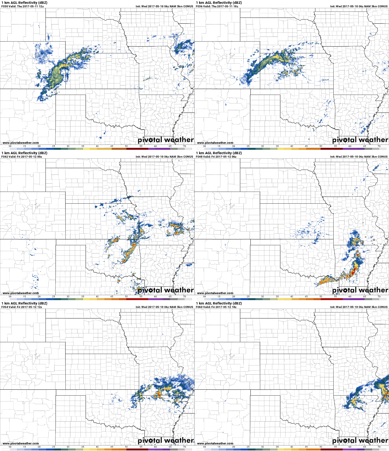
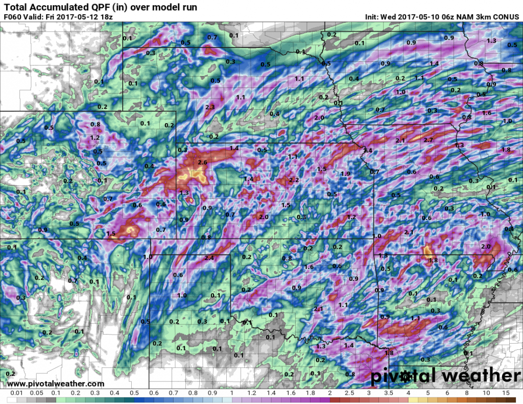
The frontal boundary sags back south into Thursday and early Friday bringing additional heavy rains and strong storm risks. We see showers and storms linger across eastern Missouri on Friday as the low pressure moves into the Midwest.
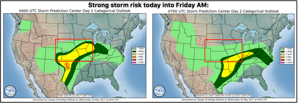
A look at the strong storm risks today into early Friday morning…main threats being isolated damaging winds and large hail, but cannot rule out an isolated tornado as well today across a good portion of Kansas, southern Iowa into northern Missouri today. Into tomorrow the risks shift east mainly across eastern Kansas into Missouri as the low pressure departs.
Not everyone gets in the heavy rains, as noted above, but those that do are likely to see 1-2″ with isolated higher amounts possible over the next 2 days. It’ll be a case of the “have’s and have-not’s”.
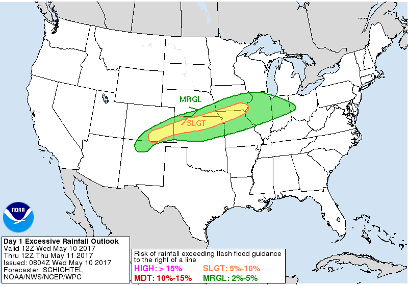
Yesterday we mentioned in the video we needed to see an expansion of the excessive rainfall risk as well including more of Iowa and Missouri…we see that reflected in the latest forecast below. Can’t rule out isolated flash flooding into Thursday.
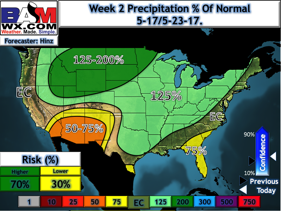
We mentioned in the video today a window of drier weather ensues this weekend into early next week with some warmth settling in, however, a more active pattern returns to the central Plains as seen below in our updated week 2 precipitation from normal outlook.
Confidence and Risk:
- Above average confidence scattered showers and storms move across the central Plains today along a frontal boundary into Thursday morning.
- Average risk for localized flash flooding and strong storms here as well.
- Above average confidence additional showers and storms continue east Thursday into Friday as the low pressure pushes east.
- Similar to above, average risk for strong storms across eastern Kansas and Missouri Thursday into Friday morning.
- Average to above average confidence we see a brief window of warm and drier into early next week before we turn active again.
Today’s video (8 min):
