Key Points – Wednesday, April 12, 2017:
Synopsis: Good Wednesday morning! Today we discuss shower and storm chances today into late week, and also some strong to severe storm chances into the weekend we are watching very closely. Data continues to be robust in the rainfall department into next week with multiple targeted storm systems. We highly encourage you to watch each update as the pattern continues to be very active and we know many folks are eager to find windows to get out into the fields. Have a great day!
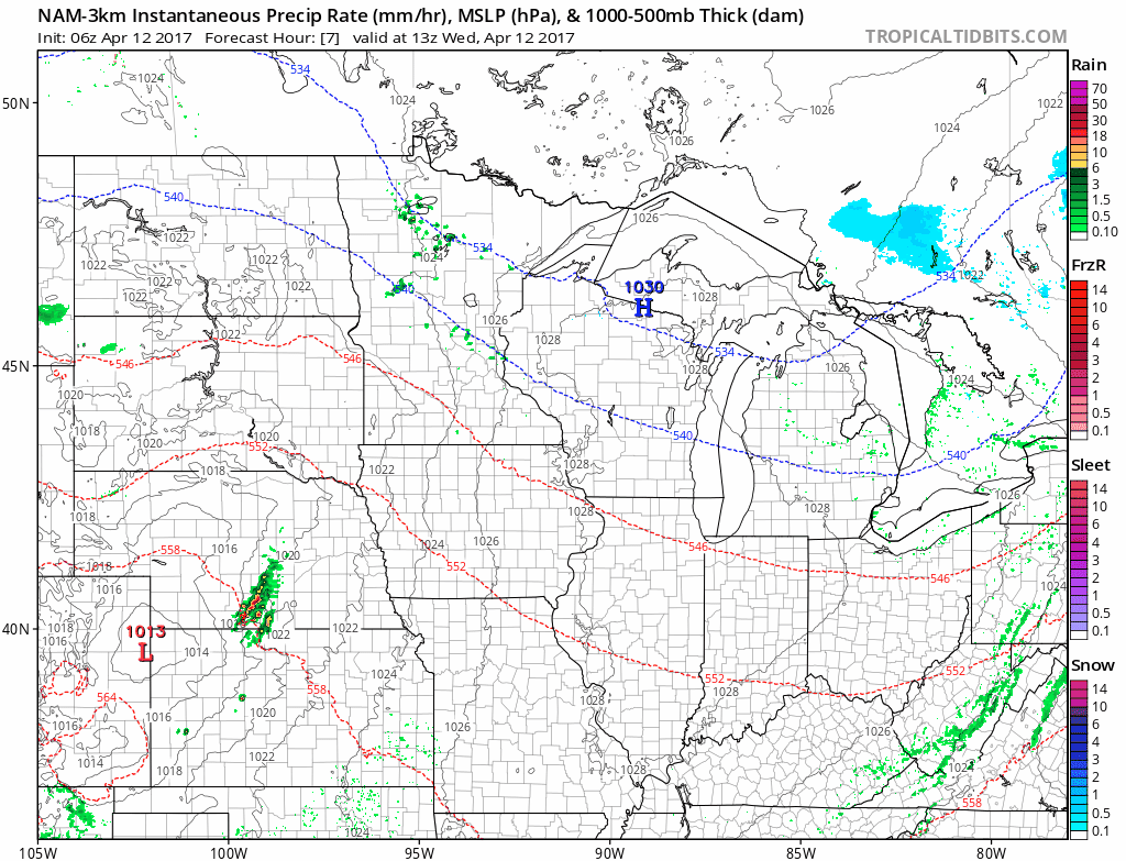
Targeting scattered showers and some storms today gearing up late morning across Nebraska move further east throughout the state and overnight hours into Iowa and northern Missouri.
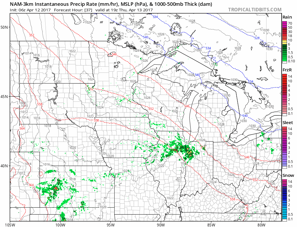
An additional scattered showers and storms later Thursday into Friday across central Kansas into eastern Nebraska and Iowa on Friday morning. Coverage will be 30-40%.
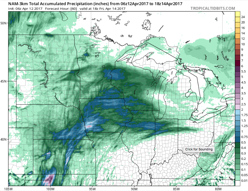
Total Rain over the next 60 hours…0.5-1.0″ possible across eastern Nebraska into Iowa and central Kansas.
Thunderstorm threat expanding Saturday evening into Sunday morning. We discuss the strong storm threat below and in the video, but some heavy rainfall will be possible along the boundary as it moves east to southeast as well.
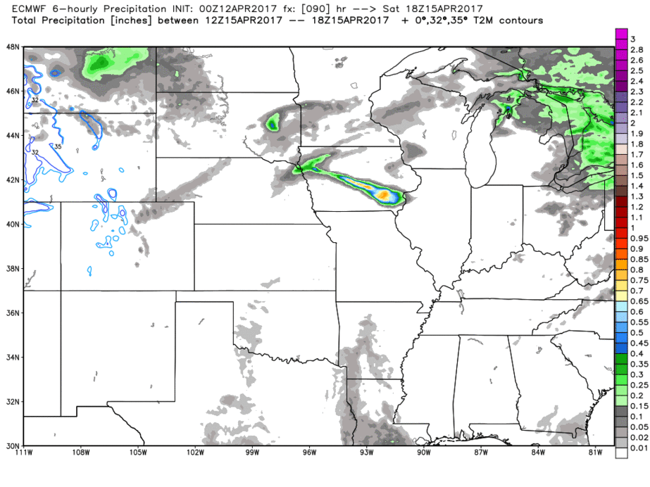
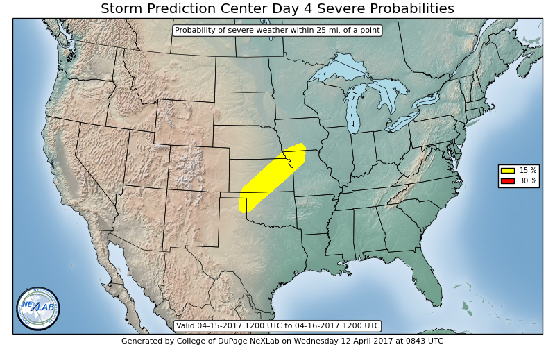
Day 4 (Saturday) Severe risk fits the ingredients of potential strong to severe storms…details are still fluid in terms of the timing and risks but the threat is there. The target area is southern Iowa, southeast Nebraska, Kansas into northwest Missouri…we think this could grow in size slightly as well. Main risks will be damaging winds and isolated large hail at this time.
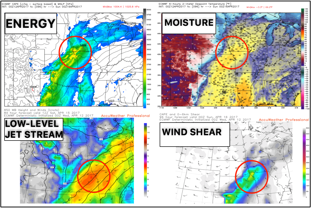
Speaking of those ingredients, here’s kind of a one-stop shop of some of the necessary mechanisms needed (energy, moisture, low-level wind support and wind shear) for strong storms.
Next chance for storms and heavy rain early to mid-next week we are watching closely across the northern half of our Zones…data has been consistent on some heavier rains across eastern Nebraska, northern Kansas east through Iowa and northern Missouri. Fits the pattern of having a storm system every 2-3 days in this current pattern.
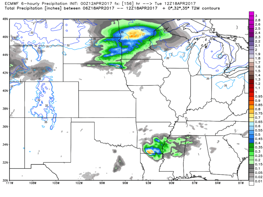
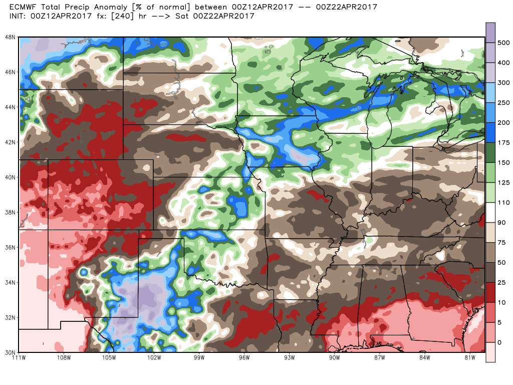
Precipitation anomaly over the next 10 days well above normal…some locations will see 200-300% the normal rainfall especially getting into Iowa which equates to 3.0″+ possible.
Confidence and Risk:
- Above average confidence of some scattered showers and storms today and tomorrow across the Zones ~30-40%.
- Average risk for strong to severe storms later Saturday into Sunday that we are watching very closely.
- Average confidence a heavy rainmaker moves in across the northern half of the Zone early to mid-next week.
- High confidence temperatures overall are above normal the next week.
- Above average confidence we are very active into mid-April.
Today’s video (8 min):