Key Points – Friday, May 26, 2017:
Synopsis: Good Friday morning! Storms across the eastern Zone locations slowly pushing off to the east into the Midwest this morning, leaving behind an isolated storm threat throughout central Zone locations on the day today. We then target multiple rounds of storms overnight into Saturday that have potential to bring heavy rains and strong storms from west to east. It’s a complex forecast, if you have any questions please don’t hesitate to reach out, have a blessed holiday weekend!
Current Radar:
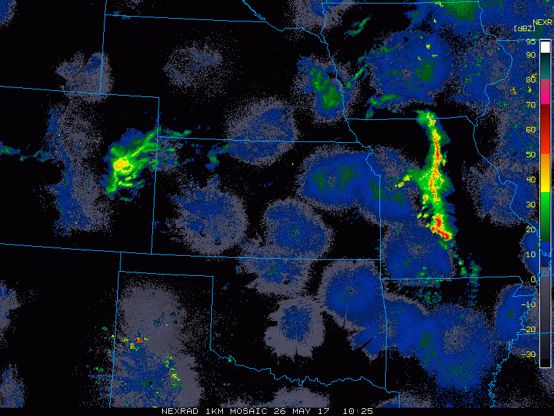
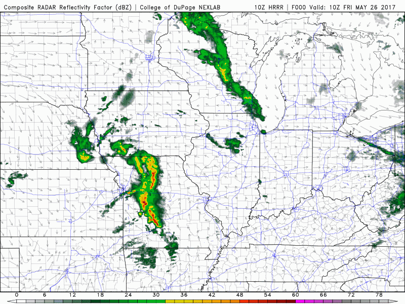
Simulated radar rest of today…watching for storms to intensity across eastern Iowa later this morning before pushing east into Illinois. Other than that, just an isolated storm threat across central Zone locations throughout the day.
Before showing you simulated radar, here’s the “why” behind the multiple rounds of storms late tonight into Saturday. Our first wave moves south and east across Kansas and Missouri into Saturday morning, then right on its heals is the secondary wave originating from Nebraska pushing south and east eventually pushing into Missouri as a large cluster of storms later tomorrow night.
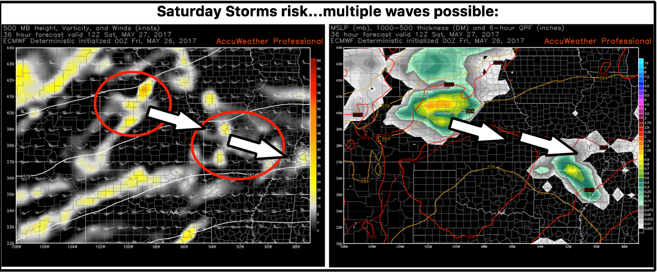
Simulated Radar from the European model best shows the multiple wave event late tonight into Saturday…from eastern Nebraska, eastern Kansas into Missouri is concerning for a large storm cluster later tomorrow evening.
Severe storms risks for Saturday…all modes of severe weather are possible from eastern Kansas into Missouri being the focus: damaging winds, large hail, heavy rainfall and isolated tornadoes.
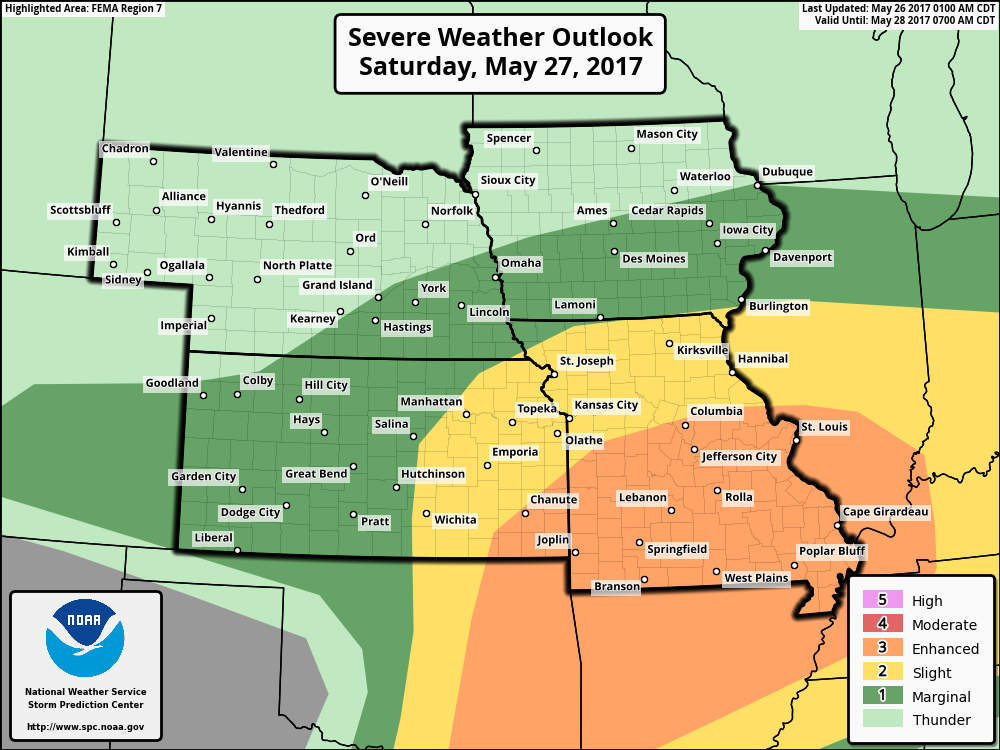
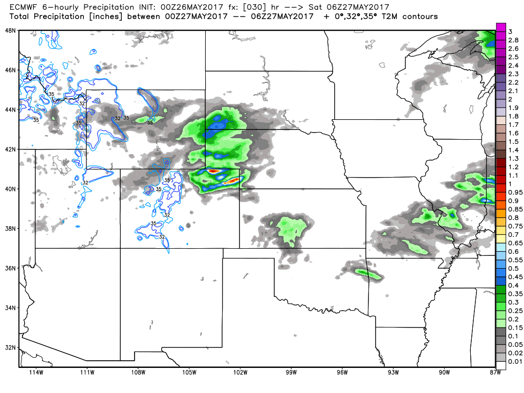
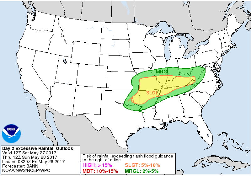
Some excessive rainfall and flash flooding will be possible as well with the big cluster of storms that moves east into the Midwest through Sunday morning mainly focused across Missouri:
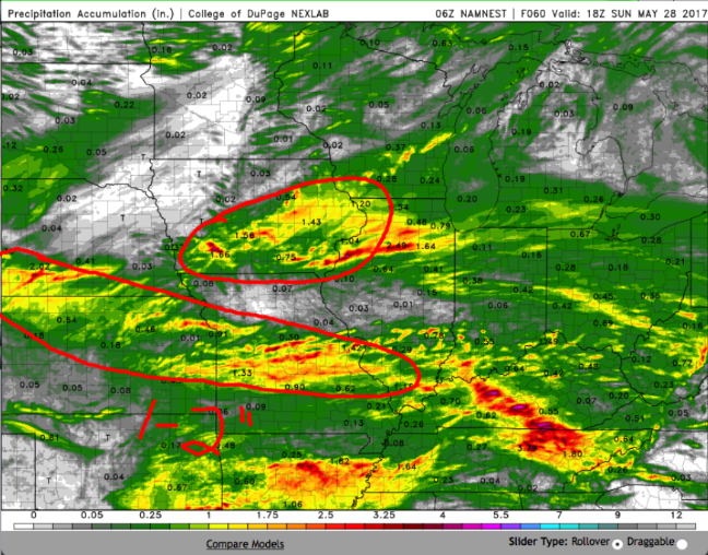
Total rainfall thoughts are below which is a screenshot from the video…the areas circled in red indicated locations we feel confident could see 1-2″ with isolated higher amounts of 3″+ possible when it’s all said and done Sunday.
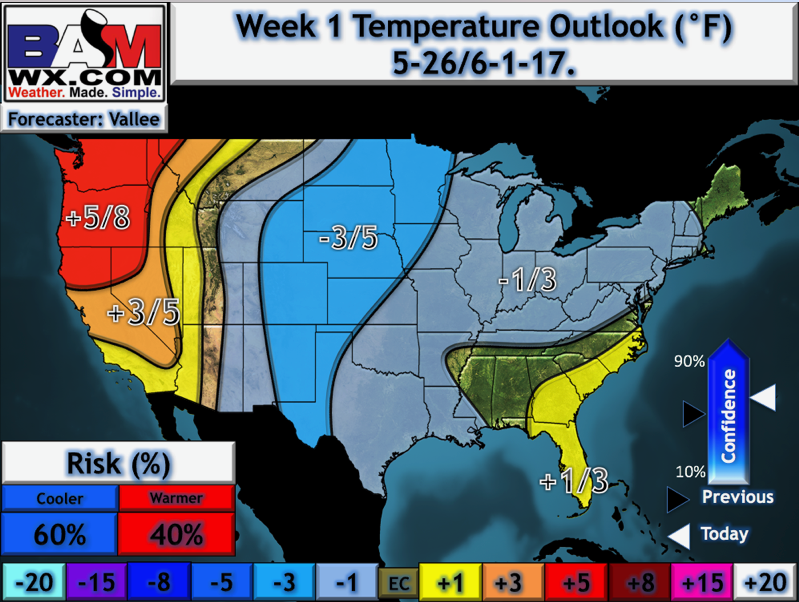
We really tried to focus on the forecast through the next 3-4 day because that’s where our confidence is the highest…when looking at temperatures from normal via our latest updated long-range outlooks, overall confidence is with a cooler than normal look.
Confidence:
- Above average confidence showers and storms across the eastern Zone locations push-off into the Midwest this morning, with an isolated storm threat possible throughout the day in the central Plains.
- Average confidence of multiple waves of large storm clusters push east overnight and on the day on Saturday.
- Average confidence for heavy rainfall and strong storms Saturday into Sunday as well before the threat pushes east into the Midwest.
- Overall, confidence is fairly high that we are cooler than normal over the next week, which we’ve been discussing for quite some time now.
Today’s video (7 min):