Key Points – Wednesday, April 19, 2017:
Synopsis: Good Wednesday morning! It’s a busy forecast today with a lot to discuss, make sure to watch the video through until the end to catch everything and let us know if you have any questions. Flash flood watches hoisted across southern Iowa through early Thursday morning. We discuss below and in the video the strong to severe storm threat later this evening as well as the heavy rain maker late week into the weekend as a stationary front is forecasted to stall out across portions of Kansas into Missouri. Overnight lows get chilly this weekend too with some locations falling into the upper 30s which doesn’t help the planting process to be sure. Have a blessed day!
Current Radar:
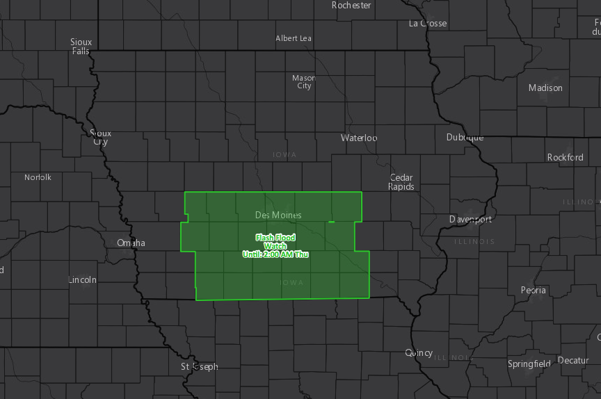
Flash flood threat across southern Iowa starting this morning through 2am Thursday morning.
Using hi-res data this morning we can see the HRRR suggesting the storms slowly weakening across eastern Iowa through the late morning hours.
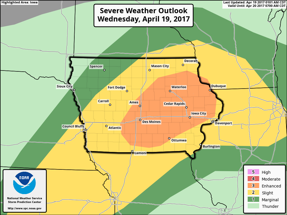
However, we do have an enhanced severe weather threat issued today for severe storms across Iowa, and then a slight risk for strong storms encompassing the threat of Iowa into southeastern Nebraska, Northern Missouri into eastern Kansas. The main hazards will be heavy rainfall, damaging winds, large hail and isolated tornadoes. Keep an eye on the weather, can’t rule out a watch box issued for this.
Simulated radar via the 3km-NAM…things get going by around 7pm this evening across western Iowa, eastern Nebraska into northeastern Kansas congealing into a line of storms. The storms will head eastern throughout the overnight into Thursday morning.
Getting into Thursday…heavy storms push east across eastern Kansas into Missouri…can’t rule out a strong storm here as well as they push east throughout the day further into the Midwest.
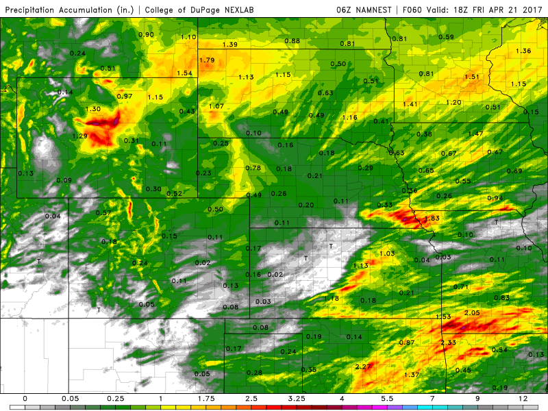
Total rainfall over the next 60 hours…as shown above with the flash flood watch issued, some heavy rainfall across southern Iowa, southern Missouri, southeastern Nebraska and eastern Kansas possible. However note, western Kansas locations will likely stay in the clear from most rainfall in this timeframe.
We discuss in the video our concern as an upper-level low pressure stalls out across our Zone starting Friday morning and will drop some potentially very heavy rains along a stationary front through the weekend. By Friday morning through Saturday morning the heavy rainfall will be hanging around across southern Kansas through western and southern Missouri, and then on the day on Saturday into Sunday the threat slowly shows off to eastern Kansas into Missouri and exits east on Sunday. Note, Nebraska and Iowa will stay north of these rains and stay drier.
Total rainfall from the European model advertising 5″+ of rain through the weekend possible, especially eastern parts of eastern Kansas and southeastern Missouri along the stationary front.
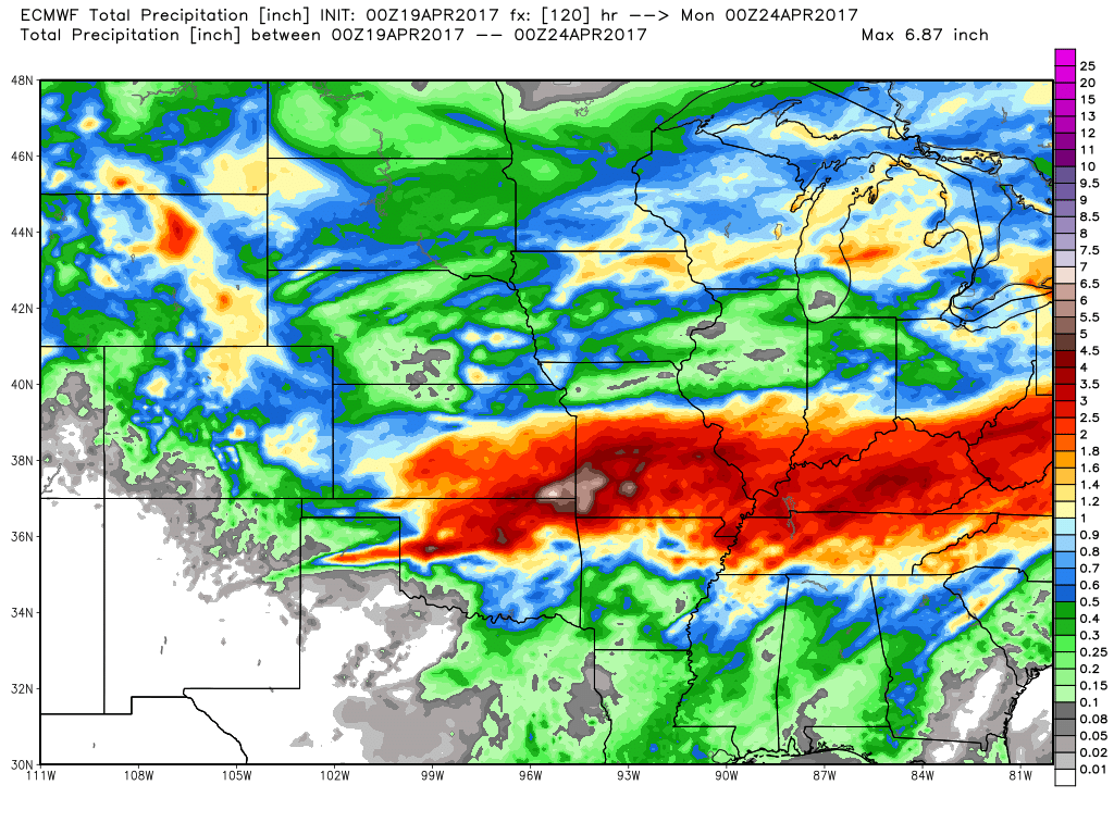
There’s been a Day 3 excessive rainfall risk for this threat as well for eastern Kansas into Missouri. This is the same system models were advertising last week to be further north, but has just shifted south.
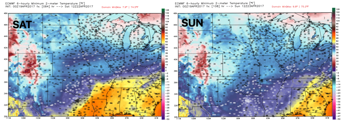
Now, behind this system will be chilly temperatures, especially with overnight lows Saturday and Sunday mornings. The latest European data suggests some upper 30s will be possible especially across northern Nebraska and Iowa on Saturday and then including western Kansas on Sunday morning as well.
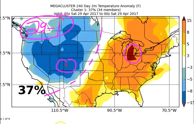
As discussed in the video we are targeting a big storm system ~April 29th-May 1st, which also matches the major SOI (southern oscillation index, we’ve been discussing this in the long-range videos) drop last week.
Confidence and Risk:
- Slightly higher than average confidence showers and storms will slowly weaken across eastern Iowa getting into the late morning hours.
- Average risk for severe storms including isolated tornadoes across Iowa tonight.
- Above average confidence a line of storms develops later tonight that has the potential to develop some strong storms across Zone 8.
- Average risk for flash flooding across southern Iowa as well through Thursday morning.
- Average risk for a very heavy rainmaker late week into the weekend as a stationary front is forecasted to stall out across portions of Kansas into Missouri.
Today’s video (time):