Key Points – Wednesday, May 31, 2017:
Synopsis: Good Wednesday morning! Today we discuss winds and temperatures through the weekend, as well as 3-4 waves of storms yet ahead from later today through Saturday. We target everything in the video so please if you have any questions don’t hesitate to reach out. We are warm over the next 4-5 days, but see things trending cooler than normal in the 6-10 day. The active pattern continues, have a blessed day!
Current Radar:
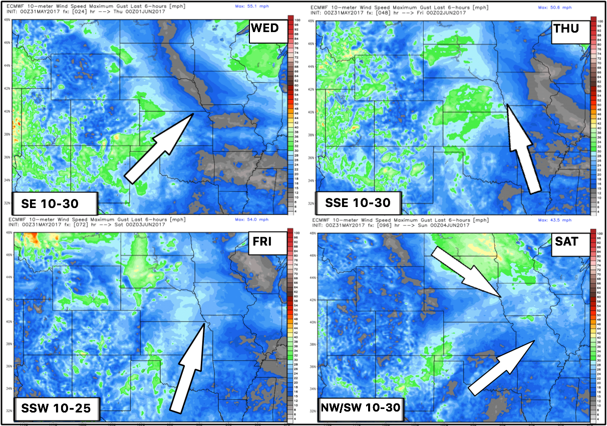
Backed by popular demand, we will be providing wind forecasts now with the daily updates…here’s the next 4 days. Thank you for the feedback!
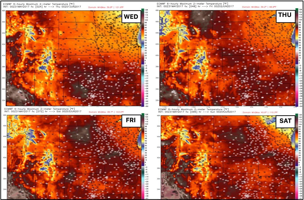
Temperatures over the next 4 days are below as well, it will be overall warmer than normal with plenty of 70s, even 80s!
We need to watch this wave of energy that likely sparks a cluster of storms (MCS) from northwest to southeast across southeast Nebraska, eastern Kansas into Missouri later today into Thursday. Wave number one is ~8pm-3am for storms tonight along a cluster of storms, and then a warm front lifts into the central Plains on the day Thursday bringing additional showers and storms (everything timed out in the video).
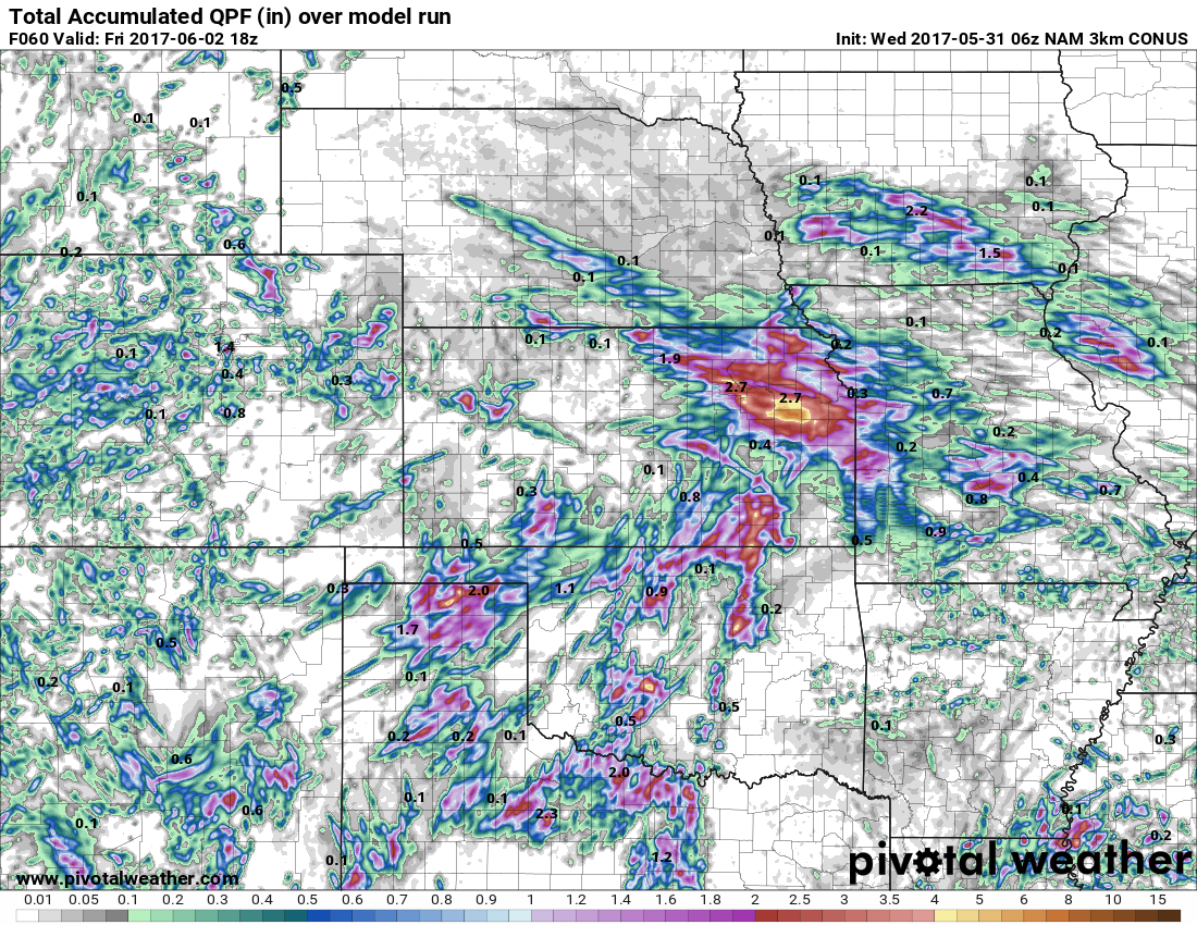
Total precipitation over the next 60 hours from the NAM-3km…we have a growing concern for very heavy rainfall possible across parts of eastern Kansas and western Missouri…wouldn’t be shocked for some locations to see 4″+ in some spots.
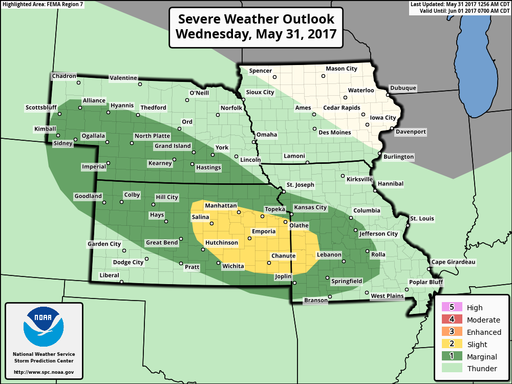
We highlighted in the video yesterday how we thought this risk needed to be upgraded to a slight risk as you can see below and even pulled further southeast into Missouri. The main threats being damaging winds and isolated large hail…some heavy rainfall will also be possible.
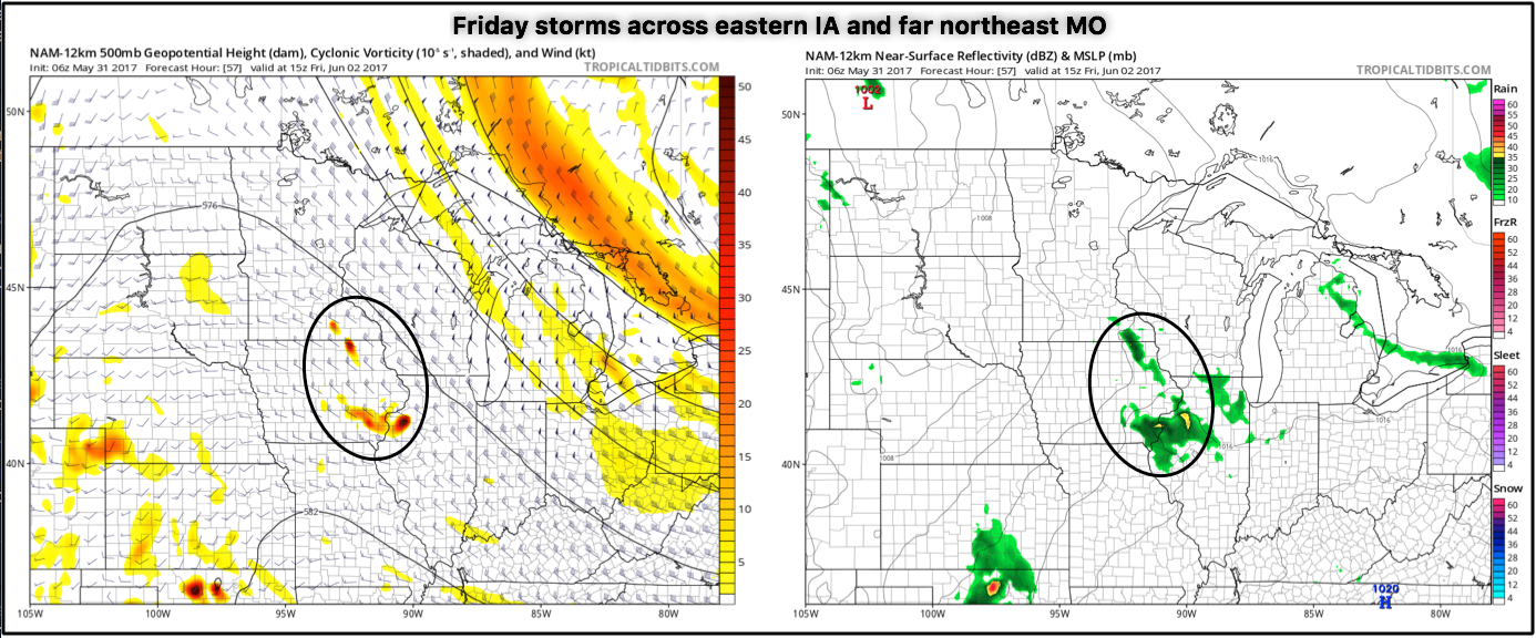
Moving into Friday we have 2 waves that need watching, the first being across eastern Iowa to far northeastern Missouri for showers and storms early Friday morning pushing east throughout the day.
The second wave comes afternoon Friday into Saturday from west to east across nearly the entire central Plains. We start across Nebraska and Kansas with showers and storms after lunch on Friday shifting off to the east during the overnight and on the day on Saturday across Missouri and parts of Iowa. Coverage is expected to be 50-60% at this time, can’t rule out isolated strong storms and heavy rainfall here as well.
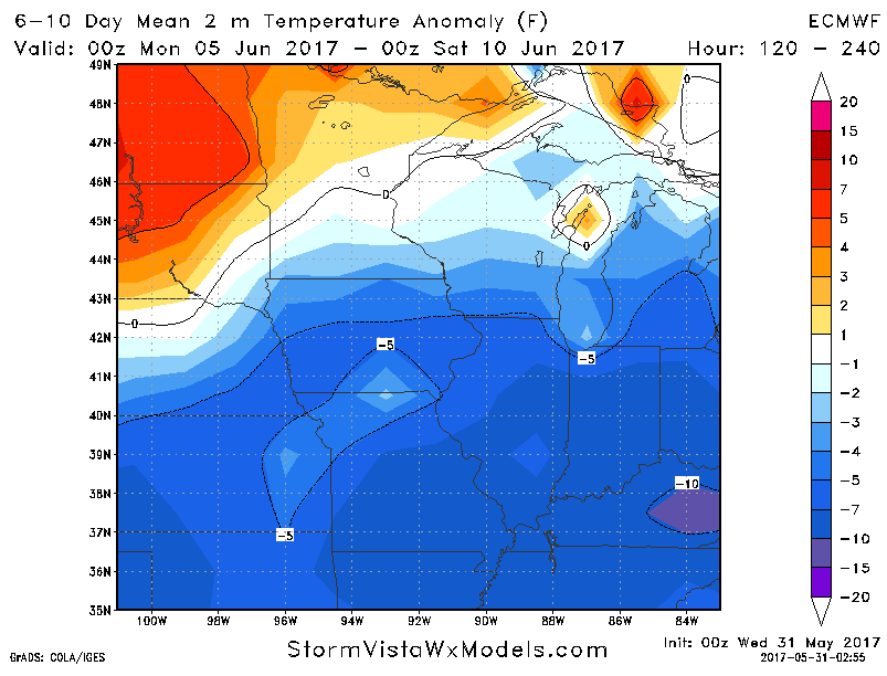
We turn cooler in the 6-10 day timeframe away from the heat the next 4-5 days across Zone 8…we aren’t talking frost/freeze threats anymore, but cooler than normal for June.
Confidence:
- Average confidence of 2 waves of showers and storms across the central Plains later tonight through the day on Thursday.
- Average confidence of some heavier rains and strong storms here as well across some locations…eastern Kansas is the focus for heavy rainfall at this time.
- Average confidence of another 2 waves of storms on Friday into Saturday as well across Zone 8, additional strong storms and heavy rainfall possible in some locations.
- Above average confidence we are warmer than normal across the central plains next 5 days, increasing confidence we turn cooler than normal in the 6-10 day.
Today’s video (8 min):