Key Points – Thursday, May 25, 2017:
Synopsis: Much to discuss today in terms of multiple of waves of showers and storms today through the weekend, with some heavy rainfall/strong storms also possible working its way in across Kansas into Missouri. It is also important to note that much of Iowa stay overall drier than normal through the next week. Everything is covered in today’s video, if you have any questions please don’t hesitate to reach out. Have a blessed day!
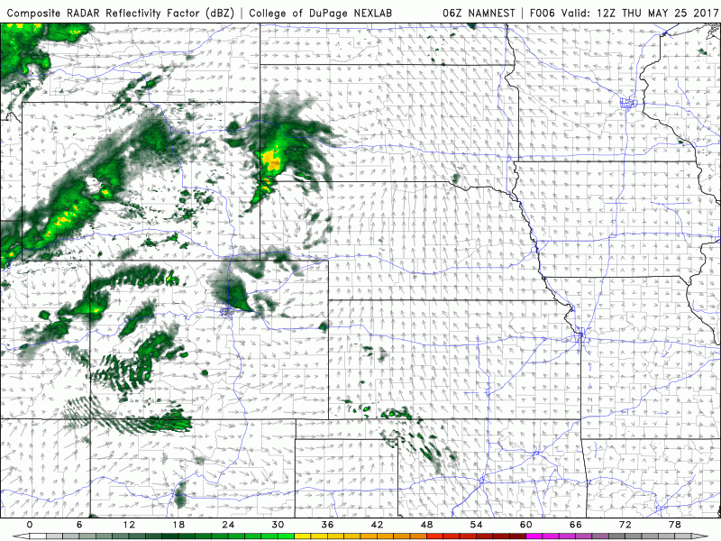
Target for potential storms to start working in is ~4-10pm tonight from west to east…a stronger storm risk kicks up across western Nebraska and western Kansas ~6-7pm off to the east.
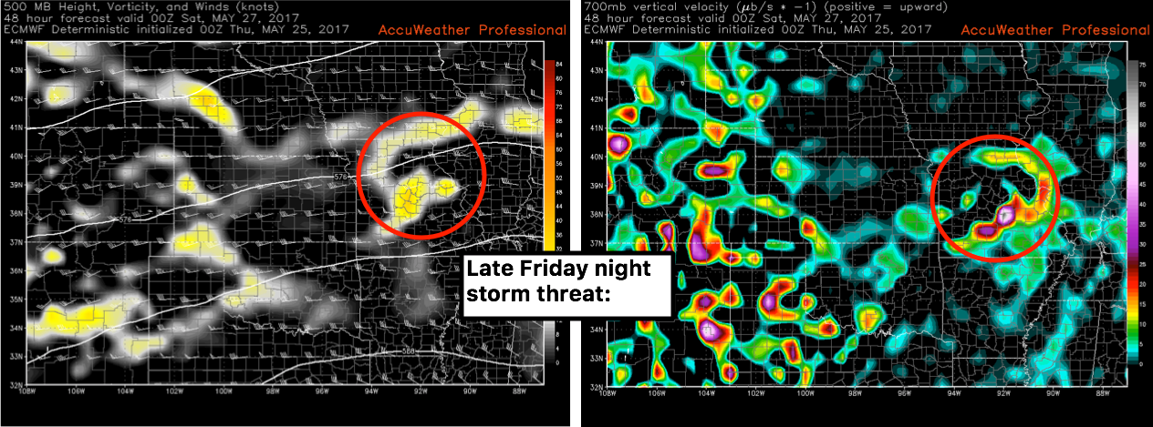
As we go throughout the forecast later Friday night into Saturday things get dicey for southeastern zone 8 for severe t’storm potential. Additional storms will be possible across parts of Nebraska into Nebraska here as well, can’t rule out a strong storm here into Saturday.
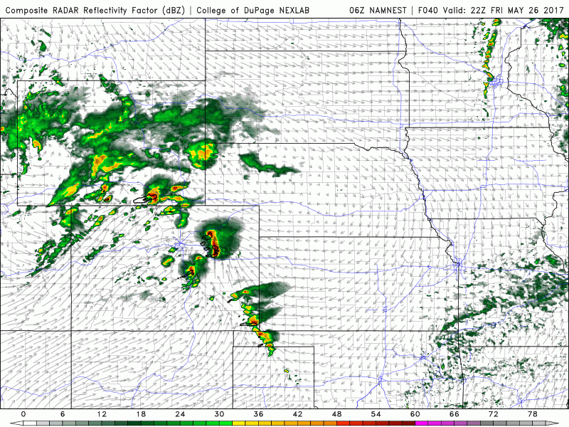
European model Friday night from eastern Kansas into central Missouri has an impressive wave of energy moving off to the east, need to watch for a cluster of heavy rainfall and strong storms.
Next system moves east Saturday…strong storms and heavy rainfall Saturday night as well across Kansas into Missouri and parts of eastern Nebraska, even potentially part southern Iowa.
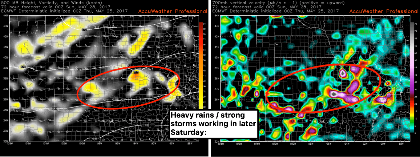
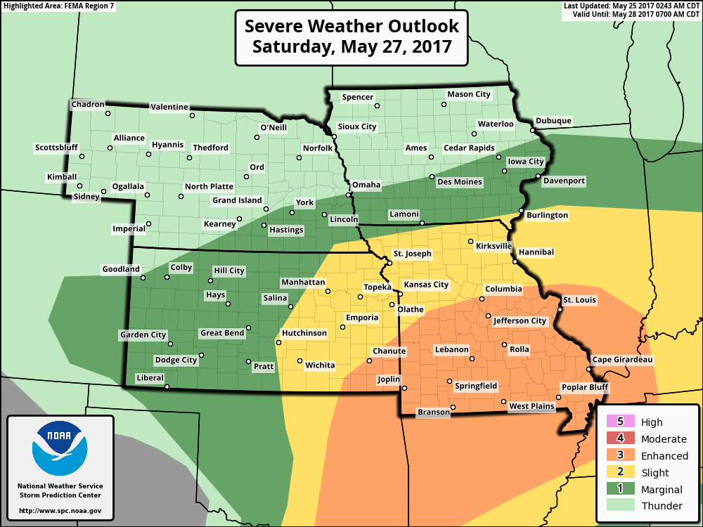
Day 3 enhanced risk across Missouri and eastern Kansas…a widespread event certainly on the table spanning across the southern and southeastern Zone 8. All modes of severe storms will be possible.
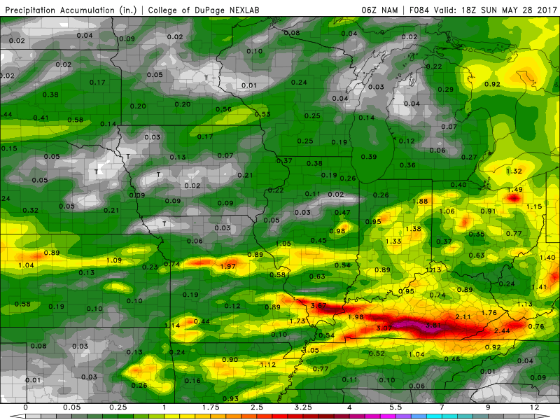
Total precipitation from the NAM next 3 days…focus is from Kansas to Missouri with isolated amounts of 2-3″+ of rainfall possible as we have multiple waves to move through here. The exact track of these waves are still fluid, it’s possible some of these heavy rains will work into Nebraska as well.
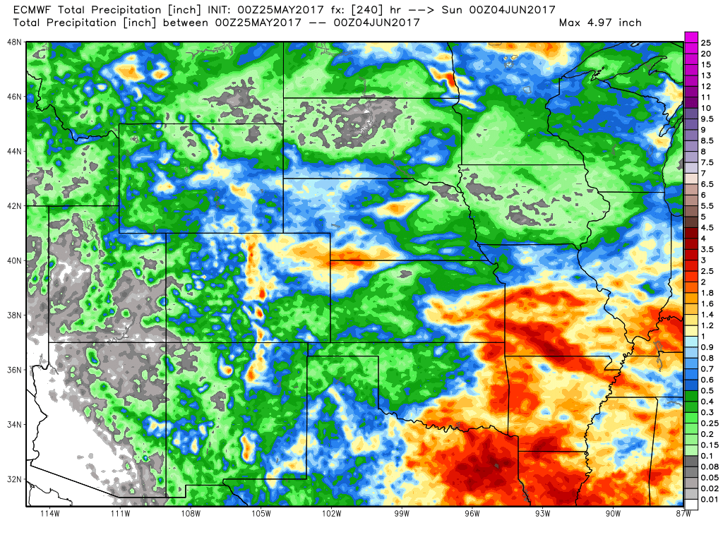
Precipitation snapshot from the European model next 10 days, for the most part we are dry in Iowa, but across Nebraska to Kansas and Missouri we are quite active with 3″+ certainly on the table here.
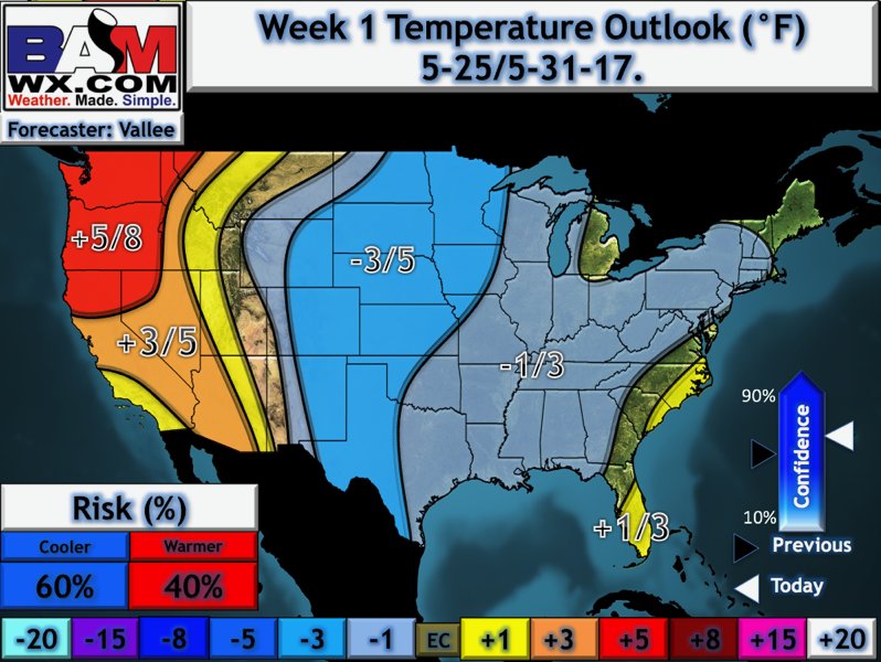
We need some sustained warmth as we are missing out on some key growing days right now, unfortunately some sustained above normal warmth is going to be tough to find. Here’s our latest week 1 temperature outlook updated this morning.
Confidence:
- Above average confidence storms work their way in from west to east tonight across parts of Nebraska/Kansas into Missouri…can’t rule out a strong storm here as well.
- Average confidence in multiple waves of showers and storms will move east Friday into Saturday across the central Plains.
- Increasing confidence of potential of a more widespread strong storm threat here on the day on Saturday…need to watch this closely
Today’s video (6 min):