Key Points – Tuesday, June 27, 2017:
Synopsis: Good Tuesday morning! Today we discuss the risks for strong storms over the next 3 days across the central Plains along with the risk for excessive rainfall and localized flash flooding as well. The video is packed with all the details, if you have any questions please let us know! Have a blessed day.
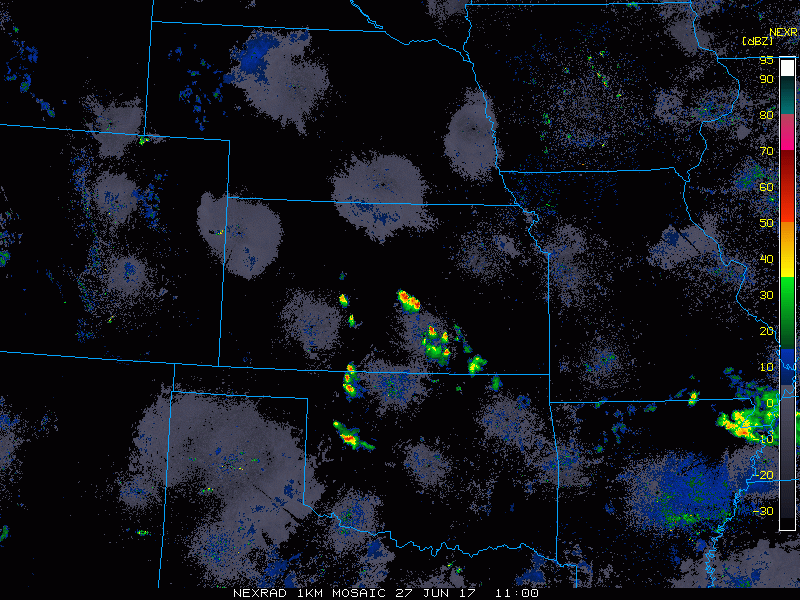
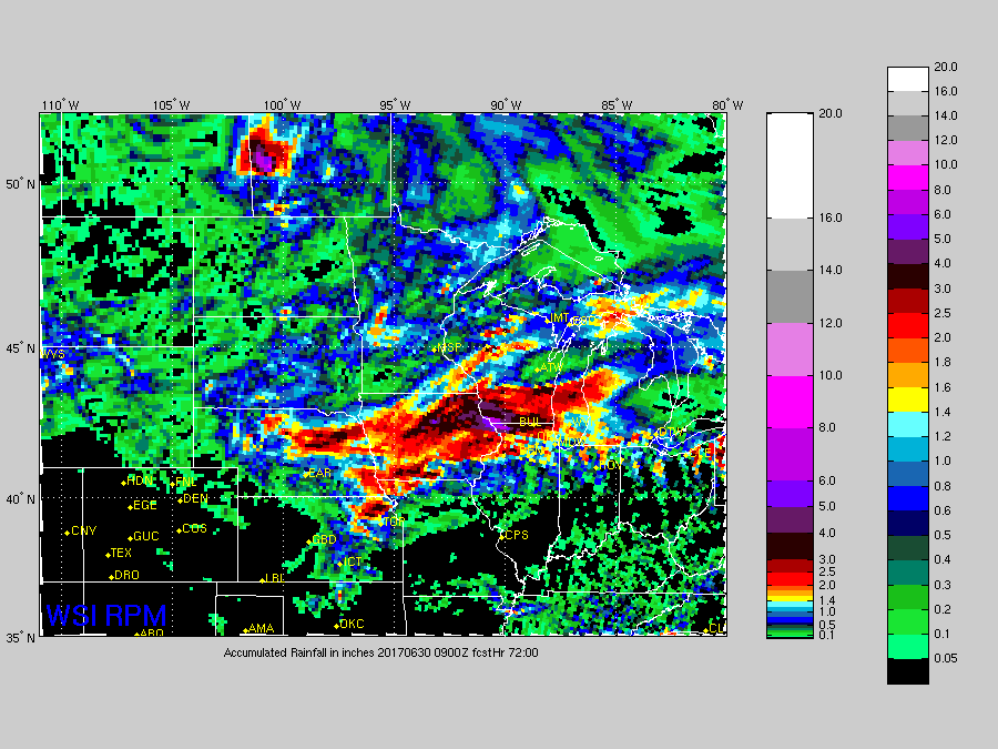
Current Radar:
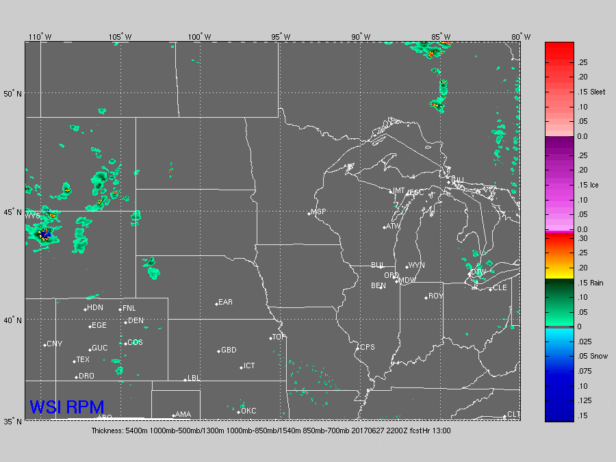
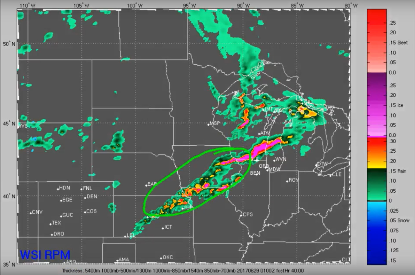
Models are trending strong with the potential strong MCS to travel east across Nebraska into Iowa:
Additional strong storm development possible across parts of Kansas, Iowa and northern Missouri later Wednesday evening as discussed in the video.
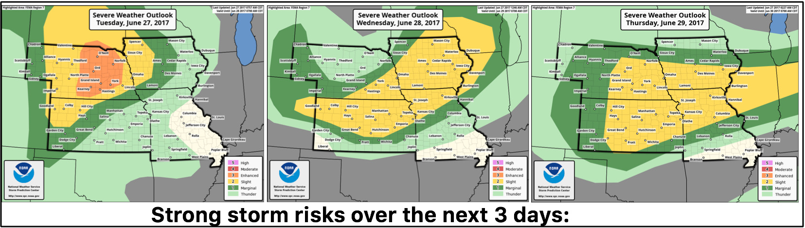
Strong to severe storm risks over the next 3 days…the enhanced risk was just elevated today across parts of Nebraska which increases confidence on that storm cluster moving east later tonight.
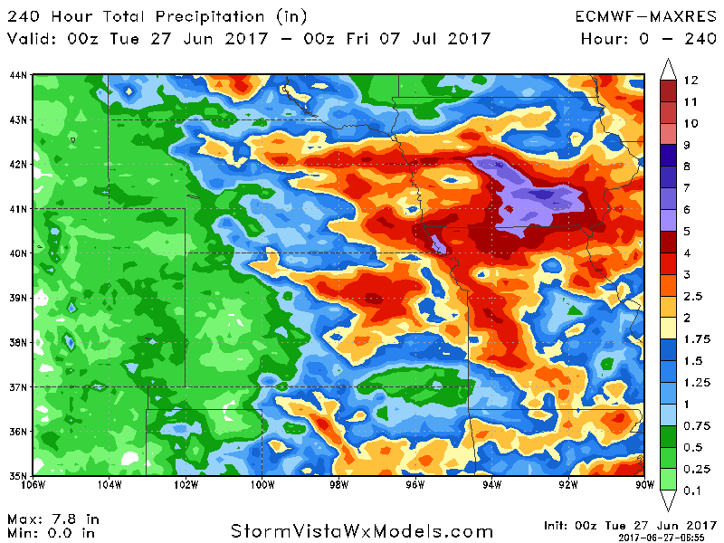
Latest guidance on rainfall totals…there will be parts of eastern Nebraska, northeastern Kansas, Iowa and northern Missouri who will see 3″+ of total rainfall over the next 72 hours…can’t rule out some locations seeing localized 5″ rainfall totals when it’s all said and done.
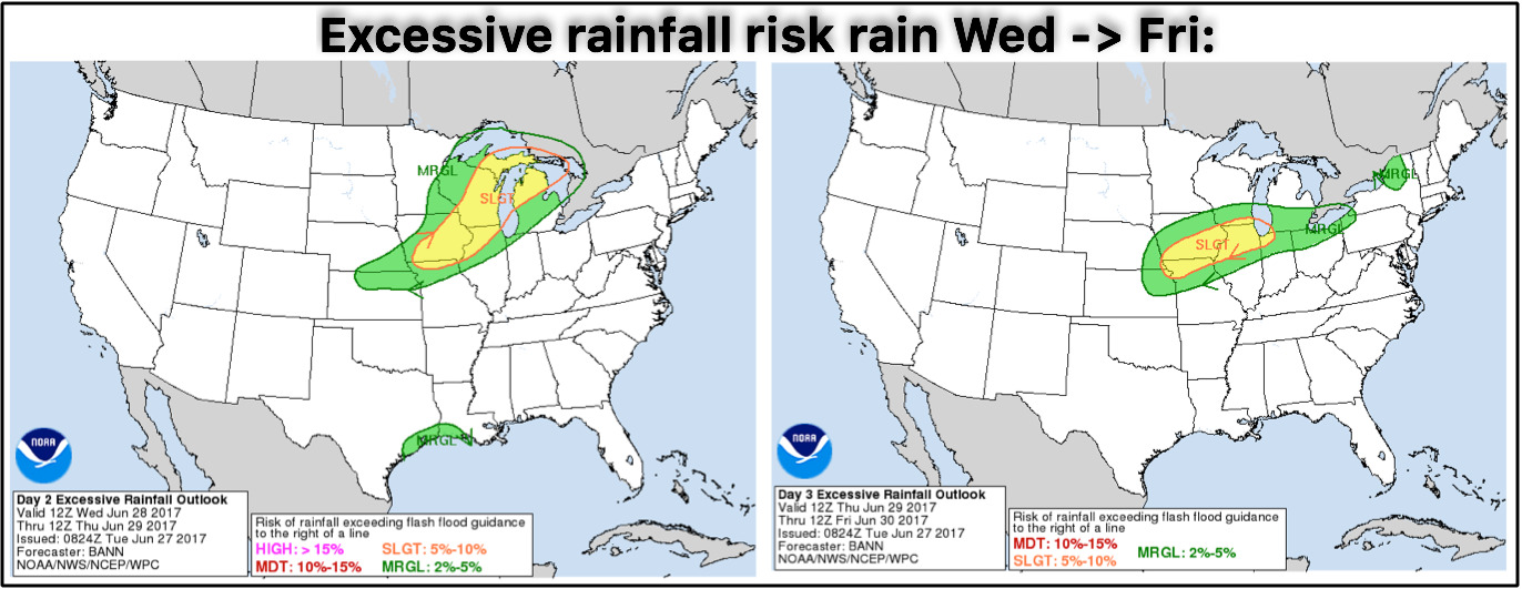
Excessive rainfall risks over the next 3 days into late week…localized flash flooding possible into Friday.
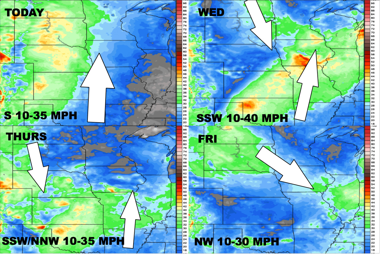
Here’s a glance at the wind forecast over the next 4 days:
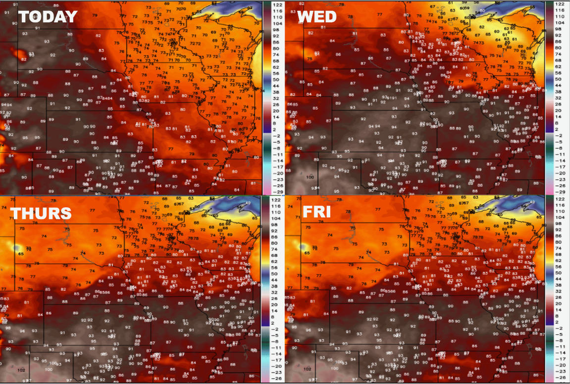
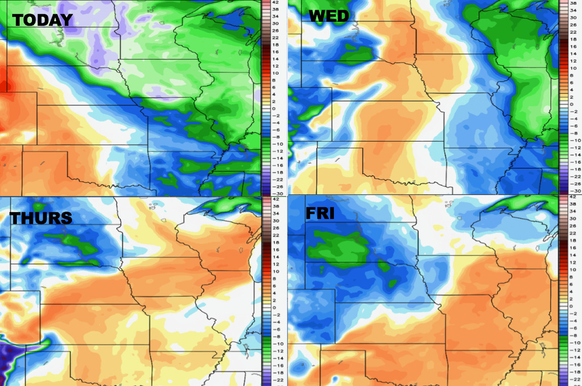
Looking at temperatures the warm air expands across the central Plains:
Dew points from normal:
Total rainfall guidance through the next 10 days…we see the heavy rainfall risks here, but also the drier risks across the western parts of Zone 8:
Confidence:
- Average but increasing confidence of a strong storm cluster pushing east across Nebraska into Iowa overnight.
- Average confidence of continued strong storm risks across central parts of Zone 8 Wednesday night.
- Increasing confidence the western parts of the Zone stay drier than normal going forward.
Video (7 min):