Key Points – Wednesday, June 28, 2017:
Synopsis: Good Wednesday morning! We discuss the latest rainfall analysis that’s occurred recently and the difficult forecast over the next 4-5 days across the central Plains…models are struggling with these storm clusters as they head east. We also discuss the warmth that builds in start next week into early July…all the risks discussed in the video, have a blessed day!
Current Radar:
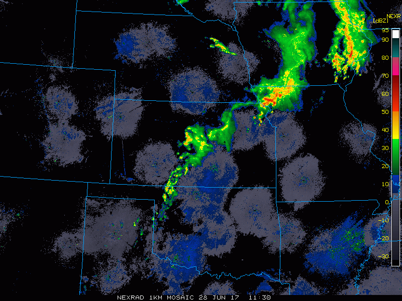
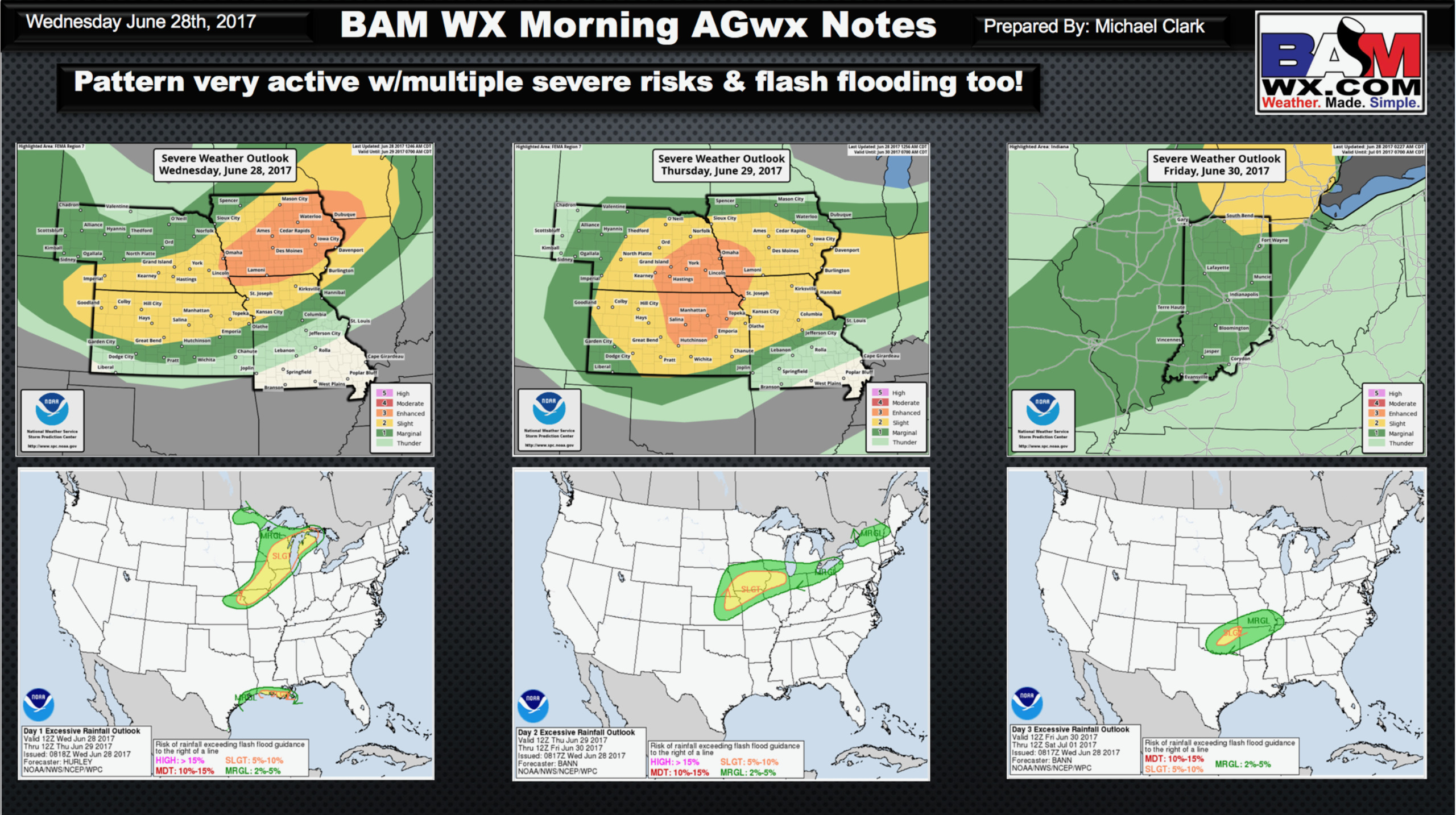
Strong storms and excessive (heavy) rainfall risks the next 2 days…wouldn’t be completely shocked to see an upgrade to a moderate risk in tomorrow’s outlook:
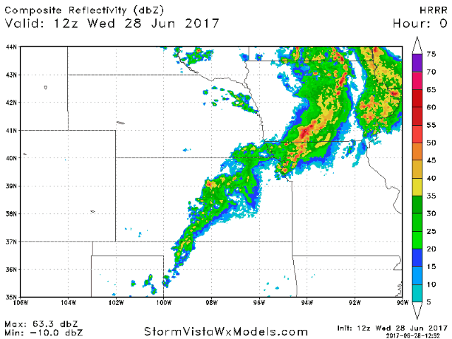
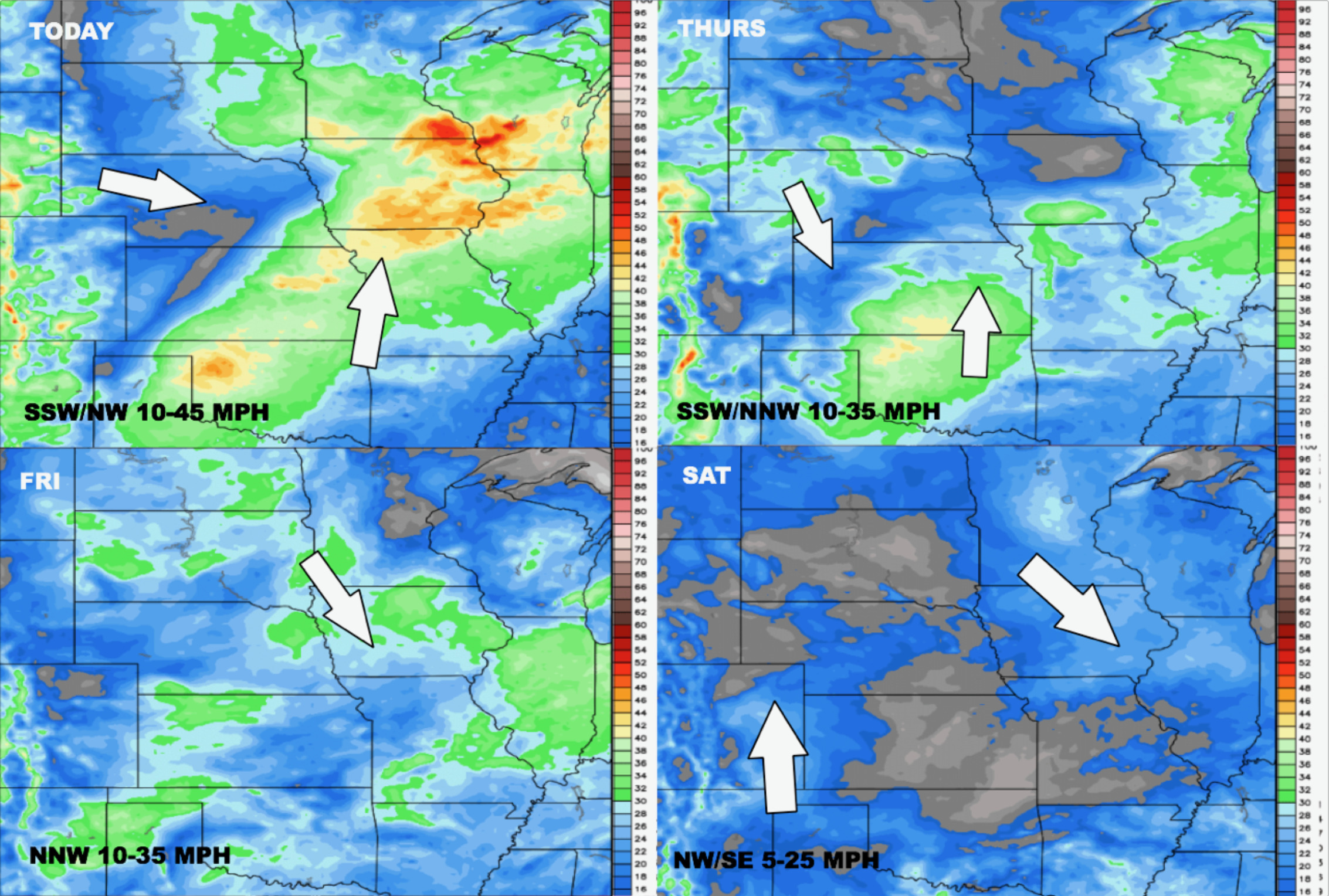
Latest guidance on simulated radar for today…main focus will be across Iowa, eastern Kansas into Missouri for storms…some certainly could be strong.
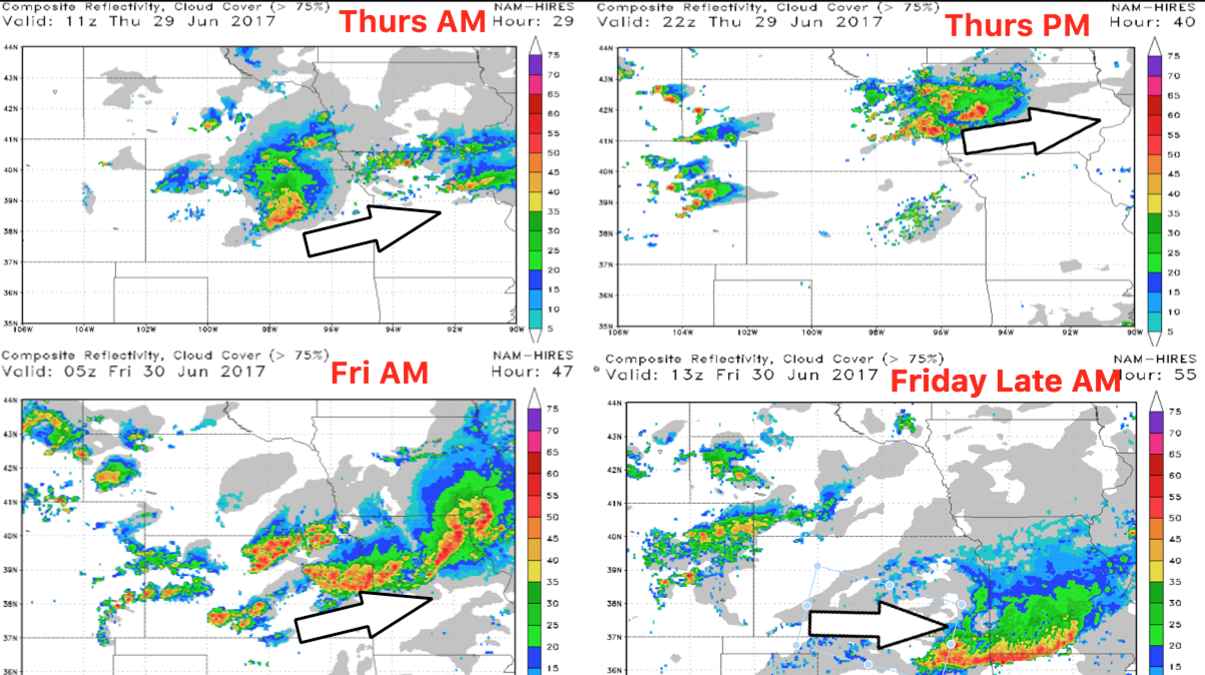
Moving into Thursday and Friday morning, here’s snapchats of simulated radar guidance where we feel storms, some being strong to severe will be focused. Expecting multiple clusters of storms actually across eastern Nebraska, Iowa, eastern half of Kansas into Missouri.
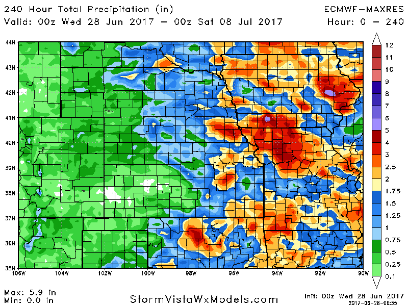
Latest guidance on rainfall the next 10 days…from the eastern half of Nebraska/Kansas eastward 1-3″ possible with isolated higher amounts of 4″+ certainly on the table especially in Iowa/Missouri.
Wind forecast the next 4 days:
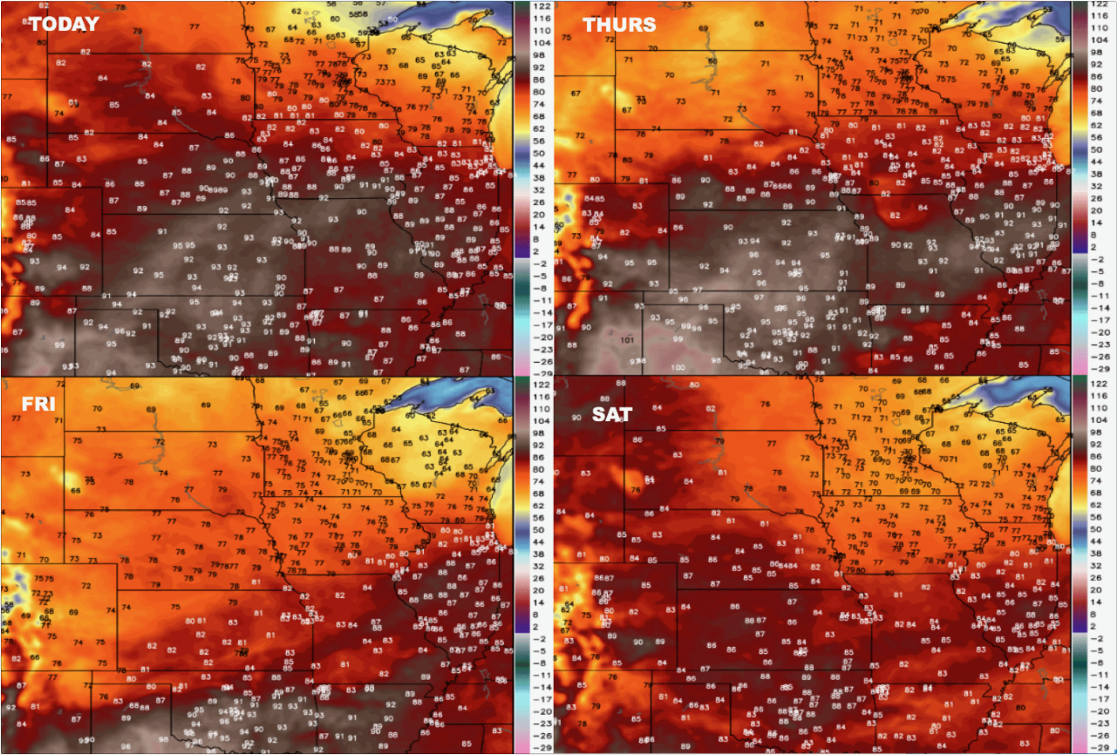
Temperatures into the weekend:
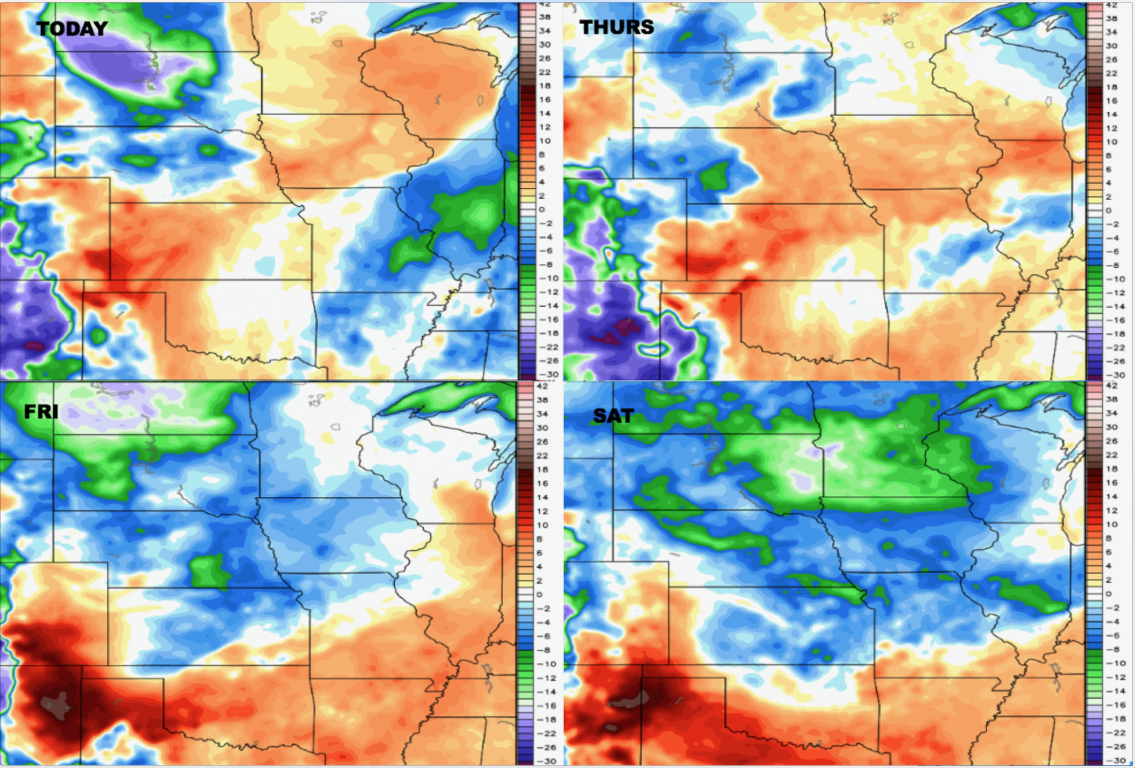
Dew points from normal here as well as we move into the weekend:
Confidence:
- Above average confidence for multiple storm clusters moving east over the next 2 days.
- Above average confidence for some localized heavy rainfall of 3″+ along with strong storms possible as well.
- Increasing confidence of an increase in above normal warmth as we head into need week.
Video (8 min):