Key Points – May 9, 2017:
Synopsis: Good Tuesday morning! Today we discuss our latest thoughts on excessive rainfall and heavy rains mid-week and the active pattern continuing mid to late month. Have a blessed day!
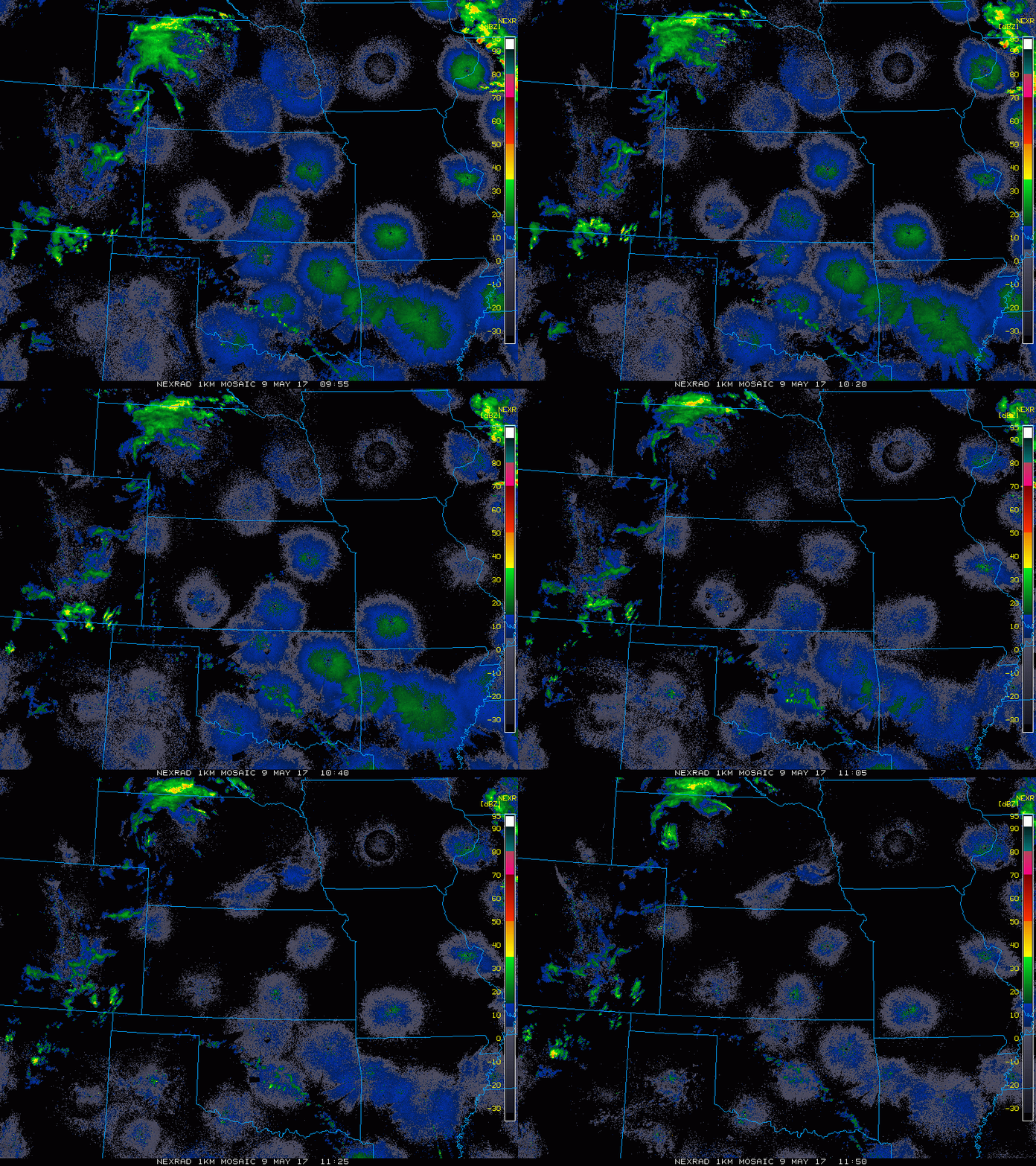
Current Radar:
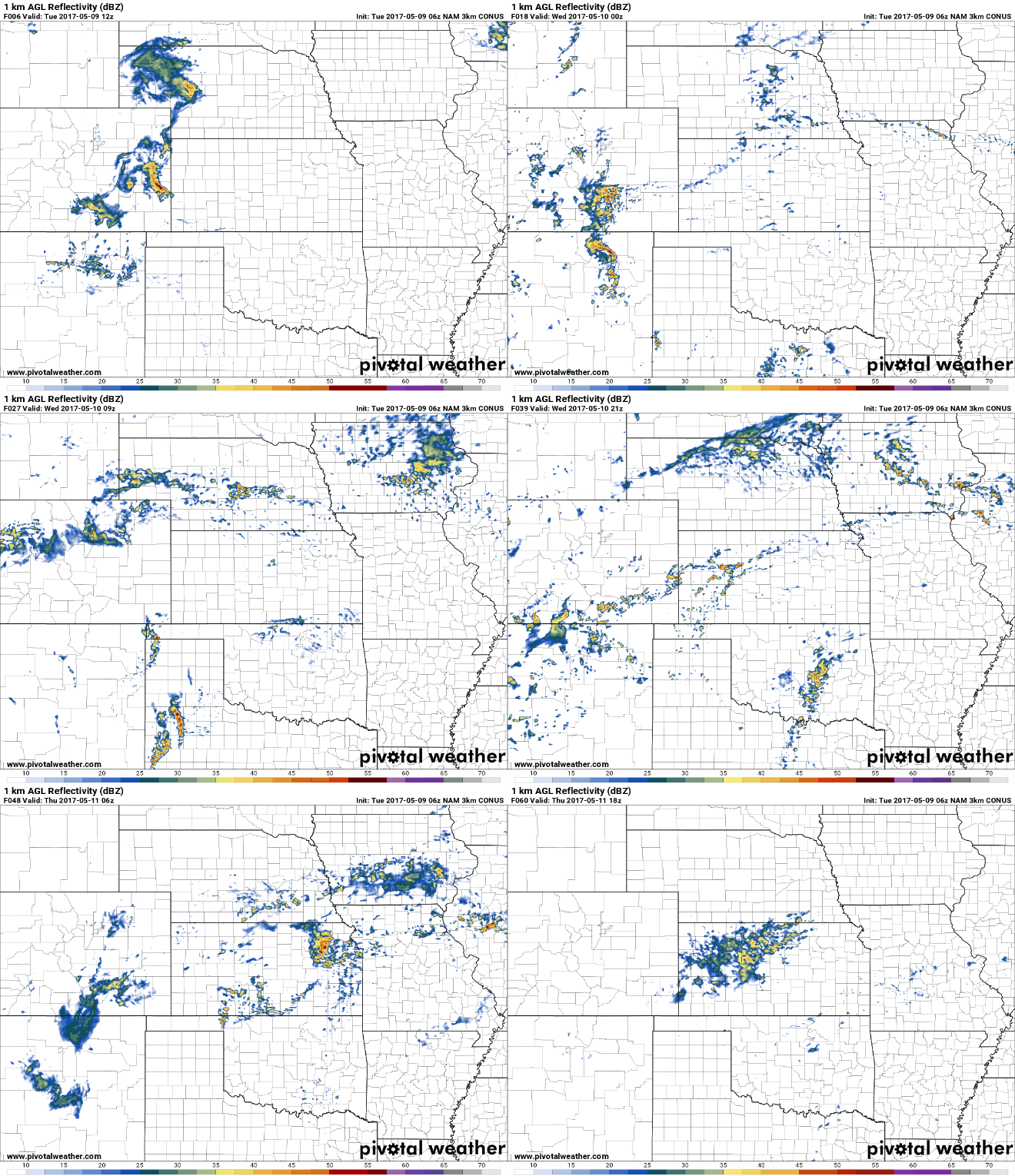
Simulated radar from the latest 3km NAM below…scattered showers and storms the rest of today, with storms increasing in coverage hanging around Wednesday night into Thursday along a frontal boundary…this is where we need to look for heavy rainfall including flash flooding and even some stronger storms.
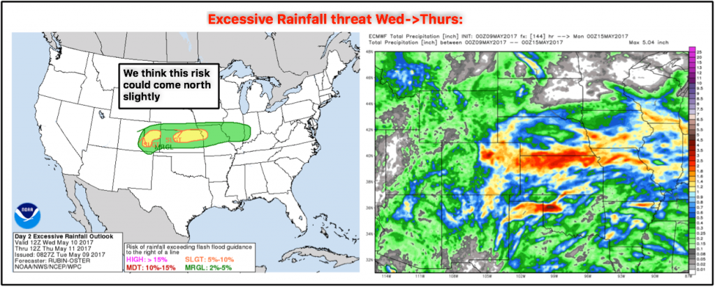
Excessive Rainfall threat mid-week…as mentioned in the video, we do think this risk could shift slightly further north to include more of northern Missouri, southern Nebraska and southern Iowa.
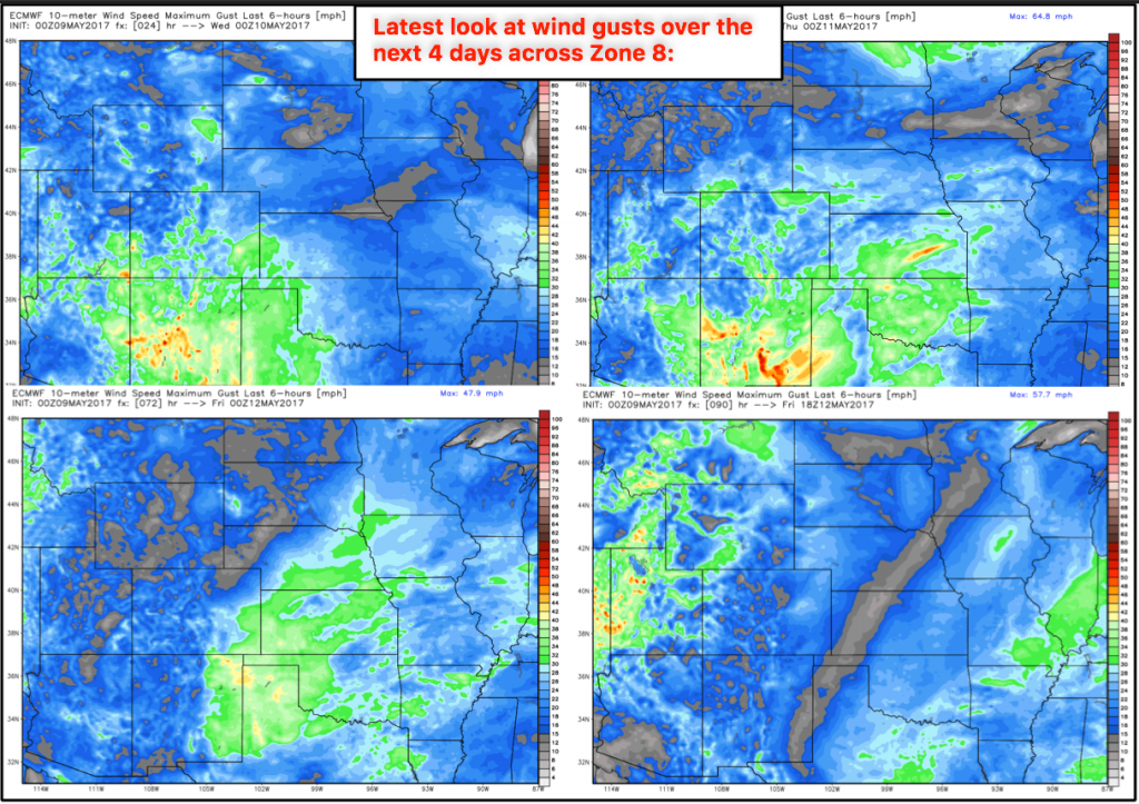
Wind gusts over the next 4 days:
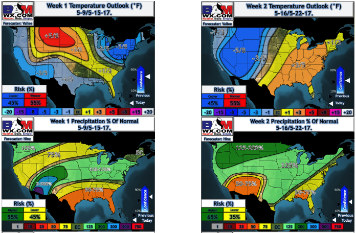
Latest long-range outlooks updates this morning…warmth expected over the next week followed by some cooler anomalies getting into the week 2 timeframe across the western half of the Zone. Meanwhile, we continue the above normal rainfall trend into mid-month…there’s just no signal right now that indicates these heavier rains shut off. More in the long-range later this morning.
Confidence and Risk:
- Average confidence the showers remain across the western half of the zone today.
- Above average risk for strong storms across the far western zone locations today as well.
- Average confidence in the specifics of where the storms firing across the frontal boundary on Wednesday into Thursday.
- Average risk for some additional excessive rainfall and localized flash flooding Wednesday into Thursday as well.
- Average risk for some stronger storms across southern Nebraska, southern Iowa, NW Missouri into portions of Kansas.
Today’s video (7 min):
