Key Points – Monday, May 15, 2017:
Synopsis: Good Monday morning, we hope you all had a wonderful Mother’s Day weekend! Very complex week ahead in regards to storm placement and heavy rainfall…things will likely change slightly in regards to the details so we highly recommend watching each update going forward. We start warm this week as well, but heading into the weekend we start to see a shift back to cooler than normal temperatures settle back in. Have a blessed week!
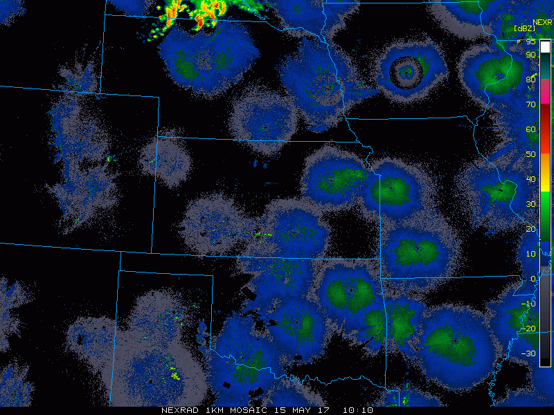
Current radar…seeing a wave of showers and storms persisting across northern Nebraska that will continue to travel east into Iowa throughout the day.
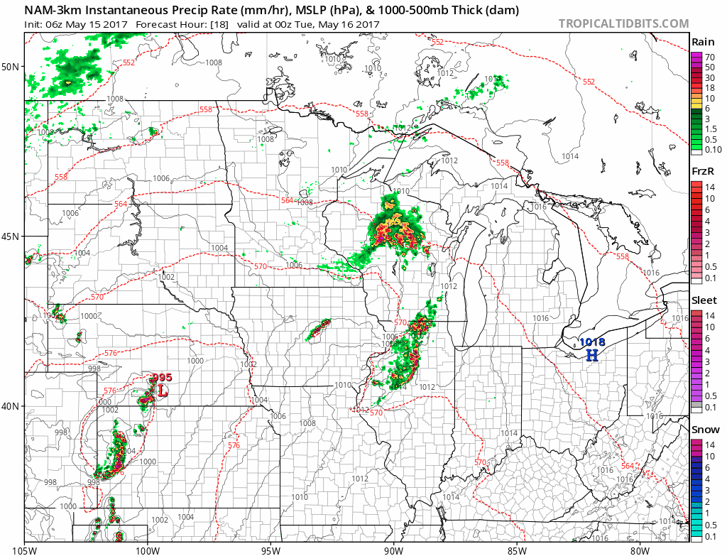
Simulated radar product from the NAM-3km as it’s one of the only hi-res models picking up the current placement of rainfall. Need to watch late tonight into the pre-dawn hours of Tuesday for strong storms across portions of Kansas into Iowa as well.
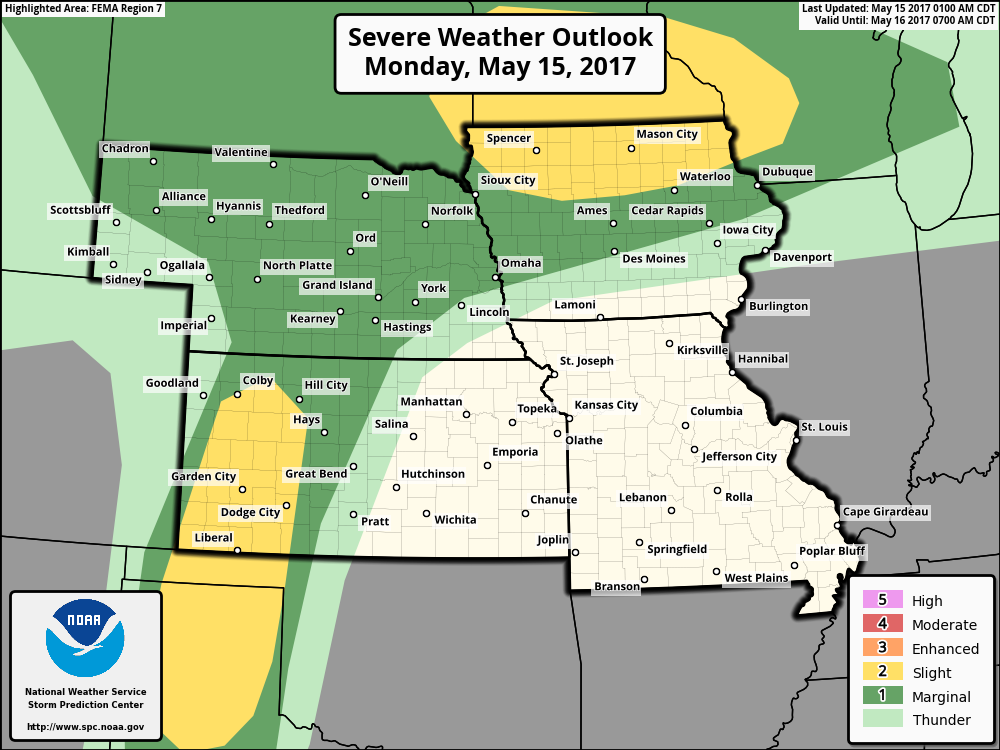
Current strong storms risk area…overall I agree, wouldn’t be shocked to see the slight risk in Kansas shift further north and east into Nebraska. The main threats will be damaging winds and isolated large hail…although an isolated tornado cannot be ruled out in northern Iowa along the warm front.
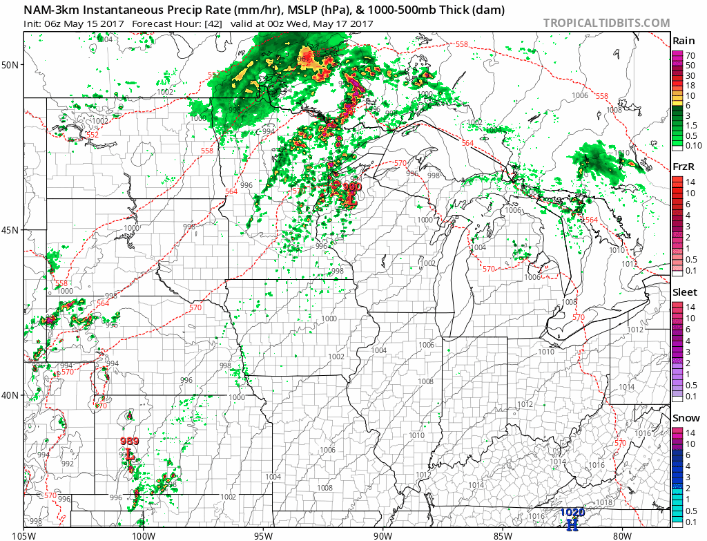
More strong storms possible on late Tuesday into Wednesday as well as multiple waves of showers ands storms move through on the day…some being strong as well across Nebraska, Kansas and Iowa.
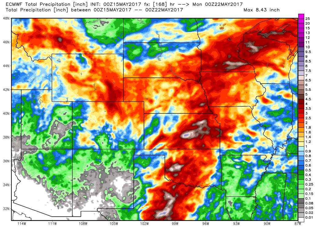
Rainfall totals over the next 7 days via the European model…the theme here is very active, with multiple waves of storms possible nearly every day this week…wouldn’t be shocked for some locations to see 3.0″+ when it’s all said and done.
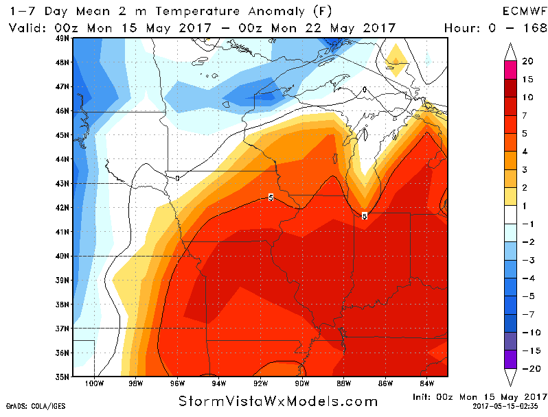
We start warmer than normal this week across much of the Zone, with the exception of western Kansas/Nebraska…it’s when we get into the pattern this coming weekend into next week where those cooler than normal anomalies begin to show up once again across the central US.
Confidence and Risk:
- Average risk the complex in northern Nebraska continues into Iowa today bringing showers and storms.
- Average risk for stronger storms across portions of Iowa, Nebraska and Kansas today.
- Average risk additional strong storms possible across these same locations on Tuesday into Wednesday…much of Missouri stays out of harms way here.
- Above average confidence the central Plains is overall warmer than normal the next 5 days, with cooler anomalies intruding in later this weekend into next week.
Today’s video (7 min):