Key Points – Friday, April 28, 2017:
Synopsis: Good Friday morning! Forecast is packed in today’s video, we target very heavy rains focused to the south and to the east, strong storms here as well with all modes of severe on the table along the warm front including flash flooding as well. The system pulls off to the north and east later on Monday morning leading to a fairly quiet week of weather next week. If you have any questions please feel free to reach out, have a blessed day!
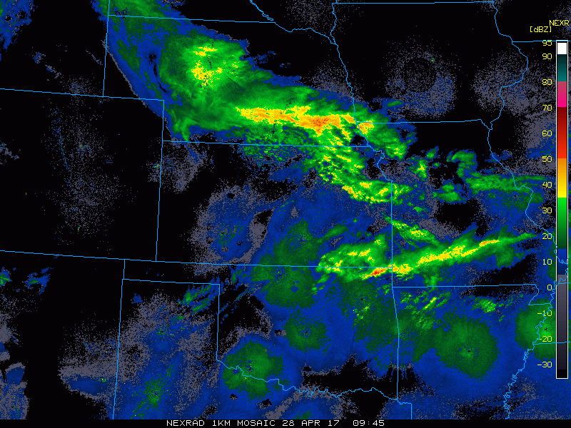
Some wintry precipitation is mixing in on across portions of Nebraska this morning with scattered showers moving northeast across eastern Kansas into Missouri and southern Iowa this morning.
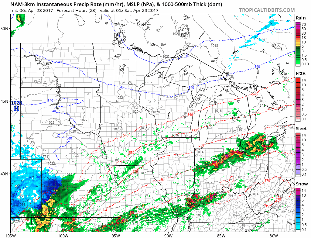
Simulated radar from the NAM-3km as storms start to lift across the warm front across southern Kansas and Missouri early Saturday morning pushing further north throughout the day. Will be VERY heavy rainfall at times across southeastern Kansas into the southern half of Missouri on Saturday…flash flooding becoming more likely. Meanwhile, some wet snow will be possible across western Kansas and southern Nebraska…accumulations not likely as warm as surface temps will be.
Strong storms possible late tonight into Saturday morning along the warm front with all modes of severe possible: flash flooding, damaging winds, large hail and isolated tornadoes.
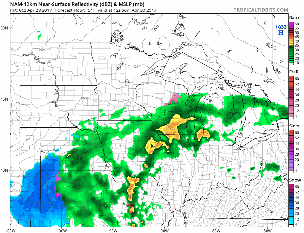
Early Sunday throughout the day the low pressure will continue to track into the Zone north and east, bring a trailing cold front along with it. Some additional gusty winds possible here as well mainly across the eastern half of Missouri. More wet snow will be possible across the western half of Kansas and Nebraska Sunday into Monday morning…the issue here once again is surface temps will be too warm for much in the way of accumulations.
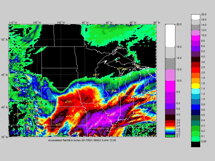
Total rainfall from the RPM model as it’s done very well handling this system. Expanding 5″+ across the southern 2/3 of Missouri and Eastern Kansas, areas further north and west likely see 1-3″ throughout the weekend.
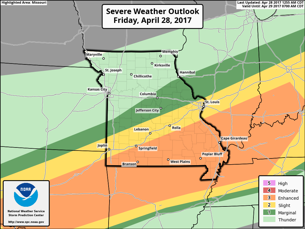
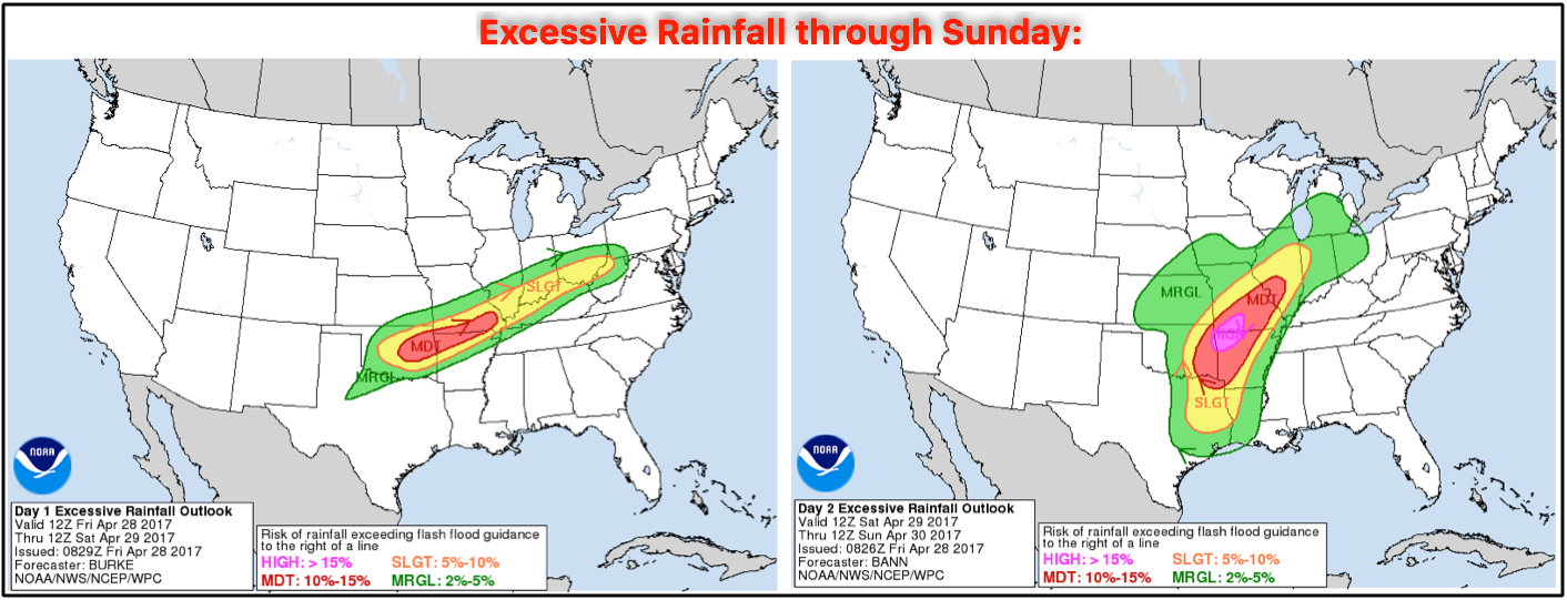
Here’s where we are expecting some excessive rainfall and flash flooding potential through Sunday…the main focus areas will be across southeastern Kansas into the southern half of Missouri.
More quiet weather settles in next week, next rain chances looks to come ~Wednesday next week to the southern half of Zone 8.
Confidence and Risk:
- Average confidence of scattered showers throughout the Zone today, main focus will be later tonight.
- Above average confidence showers and storms lift north of the warm front into early Saturday morning.
- Average risk for flash flooding Saturday into Sunday as well across southeastern Kansas and the southern half of Missouri.
- Above average risk for accumulating snow across western Kansas and portions of Nebraska on the backside of the low pressure through this weekend as surface temps are forecasted to be too warm.
- Average risk for some strong storms into Saturday with all modes of severe possible mainly along the warm front.
Today’s video (7 min):