Key Points – Monday, April 17, 2017:
Synopsis: Good Tuesday morning, we hope you all had a very nice Easter Weekend! Today we discuss the heavy rain and severe storm chances Wednesday into Thursday, as well as another impressive system moving through mid to late week with more heavy rain possible. Medium range data also continues to suggest, and we agree, cooler temperature anomalies in the 6-10 day timeframe which is an issue because of how active the pattern is here as well…so difficulties getting out into the fields continue (can’t rule out frost/freeze threats, either). We touch on in the video how active the Pacific jet extension remains, which in turn means the pattern remains very active going forward even extending as far out as early May. Have a wonderful week!
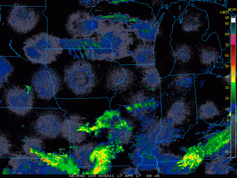
Current radar…not much going on today into Tuesday across Zone 8 in regards to inclement weather, the remaining showers are pushing off to the east.
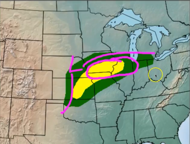
Strong to severe storms possible on Wednesday along a warm front that will bring the potential for large hail, heavy rains, gusty winds and even a few tornadoes cannot be ruled out.
Here’s where we think there’s a chance for an enhanced risk for severe storms including large hail and tornadoes.
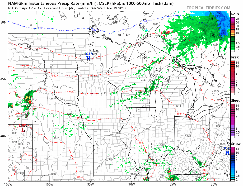
Simulated radar via the latest NAM-3km data. It tracks a strong band of storms east across Nebraska into Iowa on early Wednesday morning into the day. There certainly is a risk here for heavy rainfall, but also along the warm front there is a risk for large hail and isolated tornadoes.
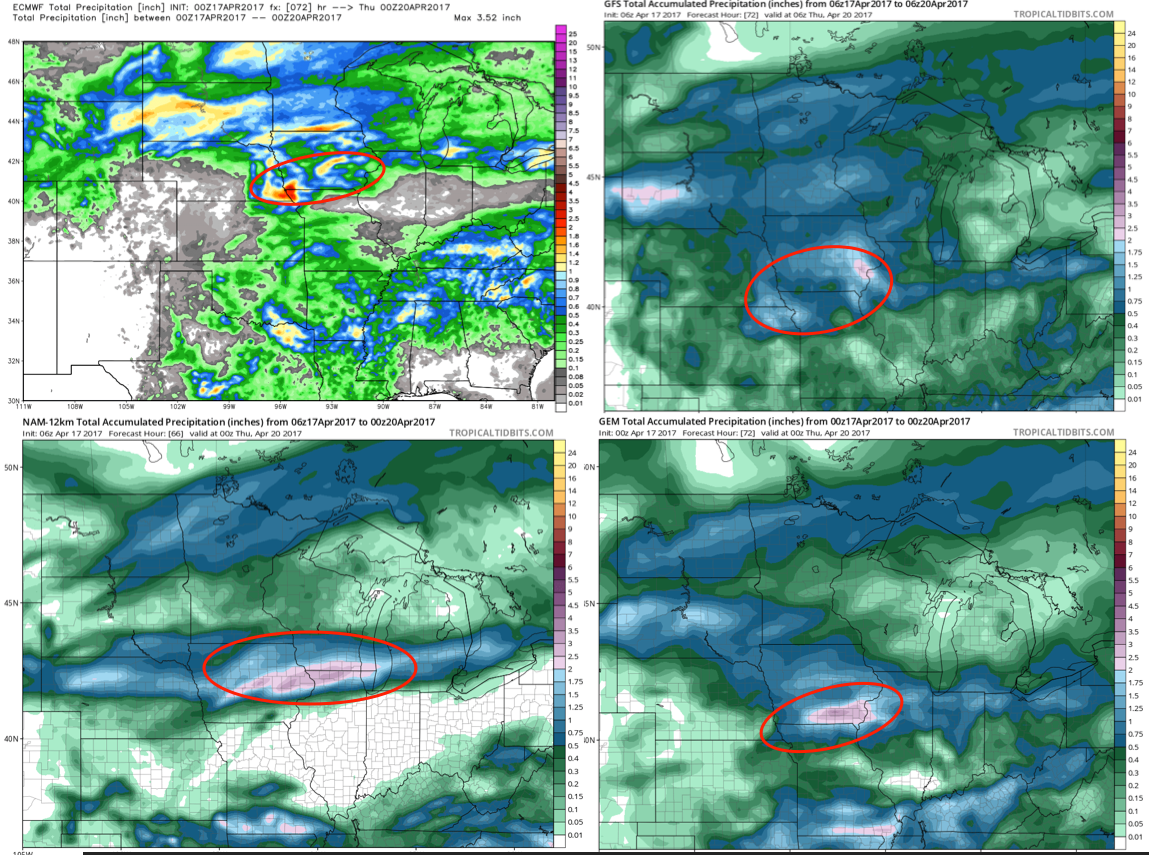
Rainfall totals over the next 72 hours…poor model performance and MAJOR uncertainty remains in the exact placement of the heaviest rainfall, so confidence is low on this. However, confidence is average to above average of localized heavy rain possible with this system which is common with warm fronts.
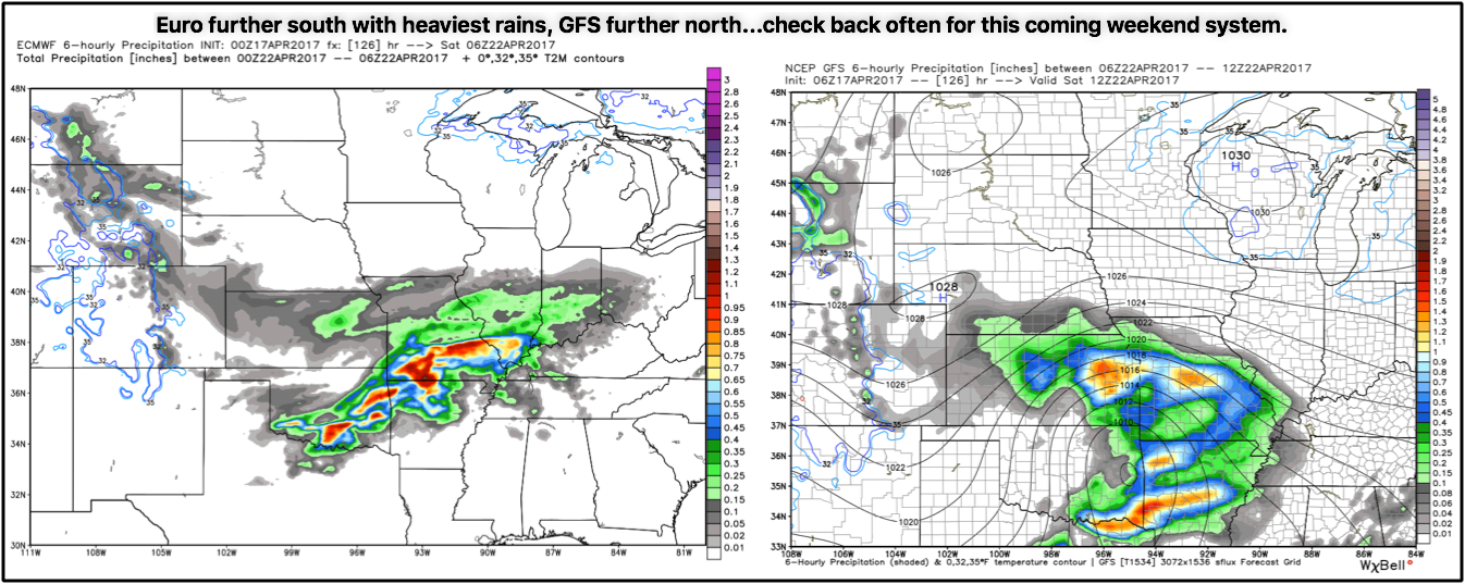
Beyond this getting into the weekend where we continue to see discrepancies in the data. Friday into Friday evening there’s a large system that will be generating some heavy rainfall. The question is, how far north does the system come? The European is not as aggressive in bringing heavy rainfall north, meanwhile the GFS brings heavy rainfall in that same area. The problem is where the heaviest of the rainfall will track…check back often.
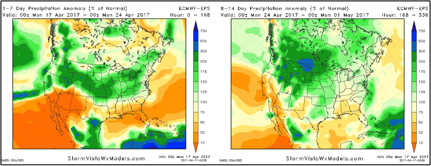
Precipitation from normal over the next 2 weeks…the takeaway here is Zone 8 locations are right in the center of the above normal rainfall pretty consistently…so the active pattern continues, growing concern for saturated fields late April into early May.
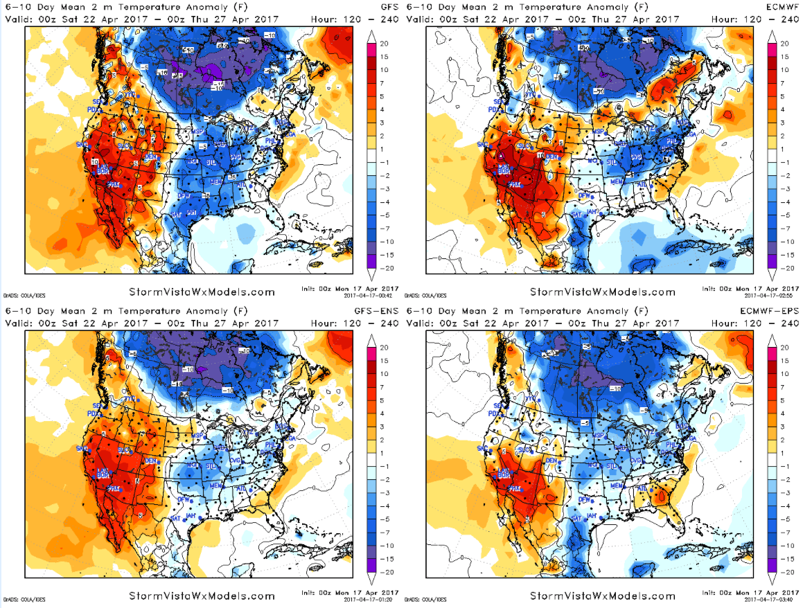
Temps from normal in the 6-10…a risk for much below normal temperatures further south that what previous data has suggested.
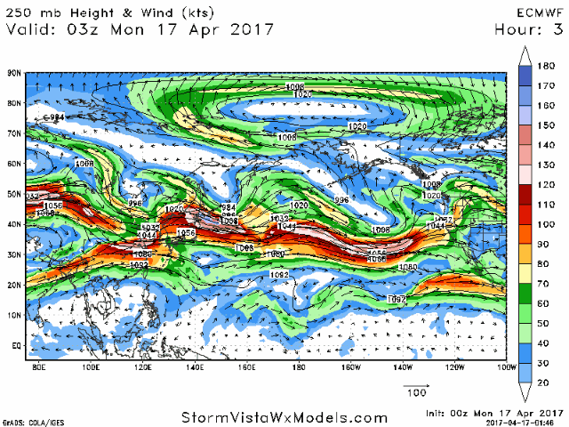
Lastly, we discuss in the video how the Pacific jet extension continues over the next 10 days…if you’ve been watching the videos for a while, you know that this means our pattern will remain very active in the Ag Belt.
Confidence and Risk:
- Above average confidence we see some showers and storms moving east across Nebraska into Iowa on Wednesday.
- Average risk for severe storms here as well with some potential large hail and isolated tornadoes…as well as heavy rainfall.
- Above average risk as to where the heaviest precipitation will set-up Wednesday into Thursday morning.
- Average but increasing confidence another potential heavy rain maker moves through the Zone late weekend into early weekend.
- Again, high risk as to the placement of the heaviest rainfall due to discrepancies in the data.
Today’s video (9 min):