Key Points – Tuesday, April 25, 2017:
Synopsis: Good Tuesday morning! Today we discuss the inclement weather moving in over the next week including heavy rains, strong storms…even some wintry precipitation working in across Zone 8 (crazy, I know given it’s almost May!) as well. Much needed rain working in across western Nebraska where we’ve been dry…that’ll move west to east today as well. Strong storms and heavy rainfall move across eastern Kansas, Missouri into portions of Iowa Wednesday into Thursday, as well as additional heavy rains, even wintry precipitation working in this coming weekend! All the details posted in the video, please let us know if you have any questions.
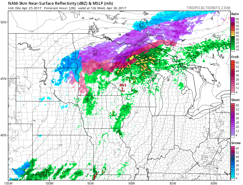
- Current Radar:
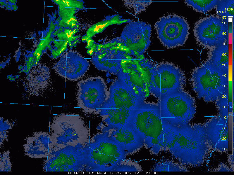
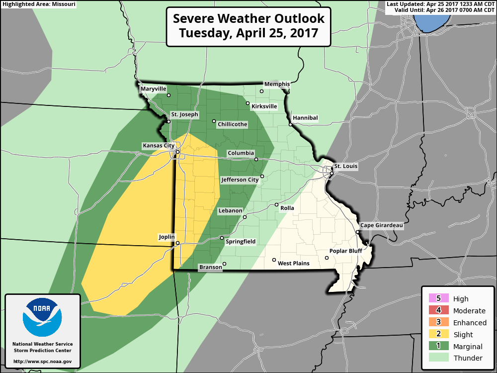
- Storms today move east across eastern Kansas and the western half of Missouri today late tonight into early Wednesday morning.
- Slight Risk also issued for today across western Missouri and eastern Kansas mainly in the form of some gusty to damaging winds and isolated large hail tonight.
- Another strong to severe storm threat exists for the day on Wednesday as a relentless stream of moisture works in across the southern half of Missouri. Are thinking currently is all modes of severe storms will be possible.
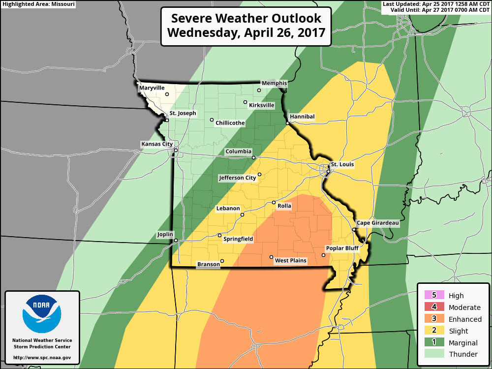
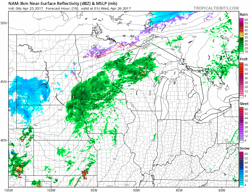
- Strong to severe storms then work across southwest Missouri moving northeast through the morning to afternoon and evening hours…working its way up through eastern Iowa as well Wednesday evening through early Thursday morning.
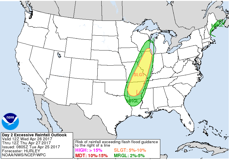
- Along with a strong storm threat is a risk for excessive rainfall Wednesday into Thursday across Missouri for localized flash flooding.
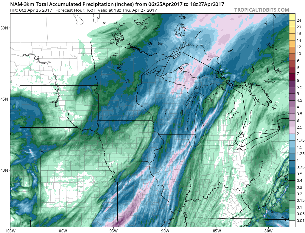
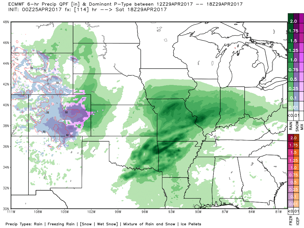
- Total rainfall from the NAM-3km over the next 60 hours: ~0.5″ possible through today across portions of Nebraska into northern Iowa, but the heaviest rains work across far eastern Kansas into Missouri (with the exception of northwest Missouri who stays dry) with 1-3″ (localized higher amounts possible) forecasted through Thursday.
- A warm front lifts north Friday into Saturday morning across Kansas into Missouri…can’t rule out some heavy rainfall across southeast Kansas into western Missouri.
- The low pressure continues to track northeast Saturday night carrying along with it a ton of Gulf moisture that will bring heavier rains across far eastern Kansas into Missouri and Iowa.
- What gets interesting is later Sunday night through Monday morning where the very cold air gets wrapped around the backside of the low pressure moving north and east, can’t rule out some wintry precipitation working in across the northern half of Iowa…not expecting much in terms of accumulation, but it could make a mess.
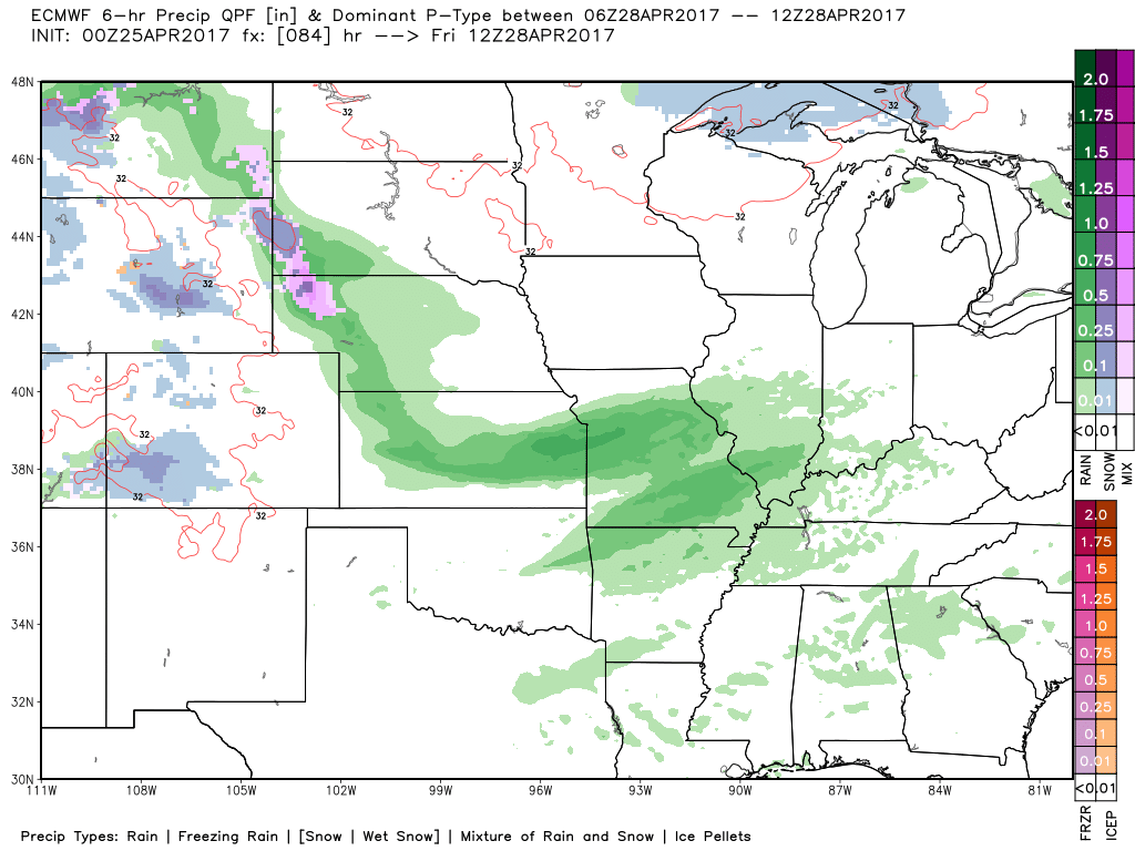
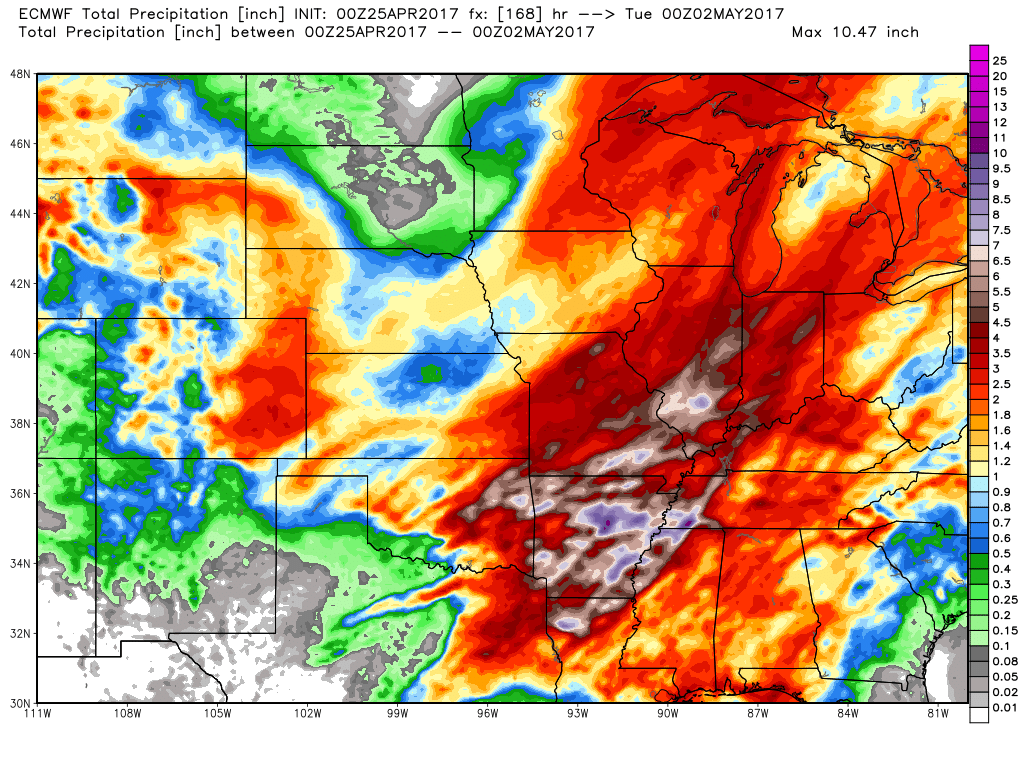
- Rainfall from the European model next 7 days with very heavy rains 3″+ across eastern Iowa into Missouri, even portions of Iowa through early next week…some localized 5″+ wouldn’t shocked us across portions of Missouri.
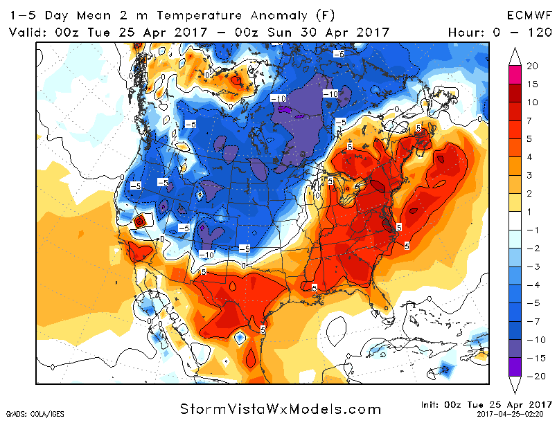
- A check at temperatures over the next 5 days…colder than normal temperatures expected across the western half of Zone 8 which is not the best news for increasing soil temps as we near the end of the month. Unfortunately, we think chilly overnight lows continue well into May, so keep an eye on this closely.
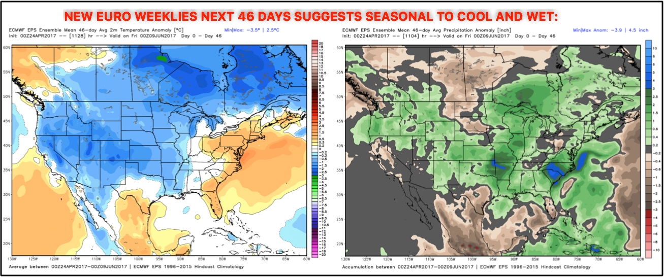
- New Euro Weeklies with a seasonal to cooler look into May (slightly warmer east) and wet as well.
Confidence and Risk:
- Above average confidence storms move east across eastern Kansas and the western half of Missouri today late tonight into early Wednesday morning.
- Above average risk for strong storms across this same area as well in terms of damaging winds/isolated large hail.
- Above average confidence additional heavy storms work northeast Wednesday into Thursday across SW MO into eastern IA.
- Average risk of excessive rainfall (localized flash flooding) Wednesday into Thursday in the same areas as above…we are watching closely.
- Average confidence additional heavy rains work in Friday through Sunday across Zone 8 as a warm front and low pressure system tracks through.
- Average to above average risk for a wintry mix to work in across northern Iowa Sunday night into Monday morning as temps fall on the backside of the low pressure.
Today’s video (9 min):