#NEwx #KSwx #MOwx #IAwx #AGwx Discussing excessive rainfall into the wknd…wintry risks as well? K.
Synopsis: Good Friday morning! We continue to have heavy rainfall and strong storm risks through the next 36 hours as the low pressure system moves north and east throughout the central Plains; we even think there are wintry precipitation risks, as crazy at that is, across western Nebraska and western Kansas later tonight into Saturday morning. Next week offers up multiple shower chances as well, there’s little reprieve in the active pattern ahead, plus we mention the cooler risks ahead in store. Have a wonderful weekend!
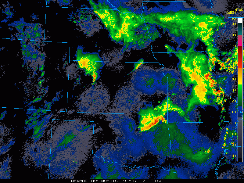
Current Radar:
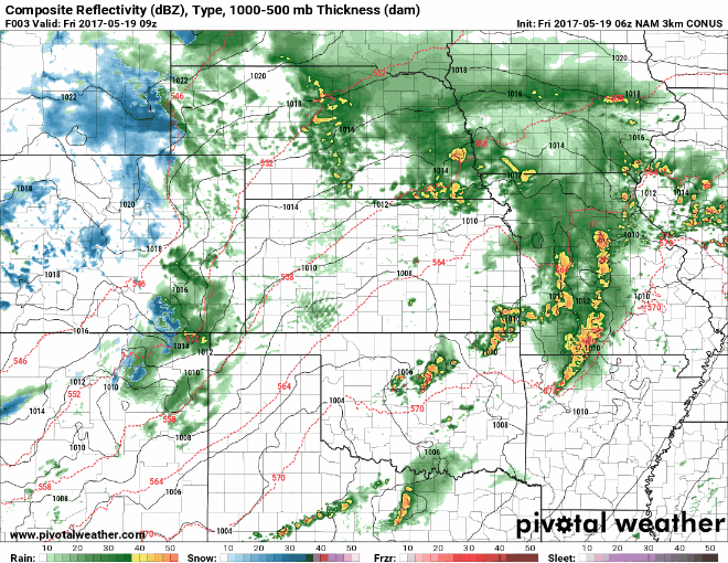
Simulated radar through Saturday…everything is timed out in the video, but we are watching for strong storms to develop across eastern Kansas into Missouri, I don’t think southern Nebraska and the southern half of Iowa are out of the woods from this threat either…the main risks being strong wind gusts, large hail and very heavy rainfall; an isolated tornado cannot be ruled out here. Also to note is some snow showers possible across western Nebraskan and western Kansas late Friday night into Saturday morning…some accumulation may be possible on grassy areas for a time.
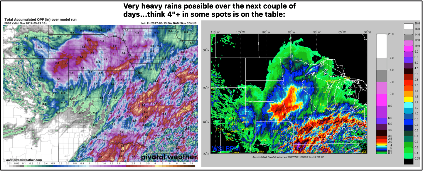
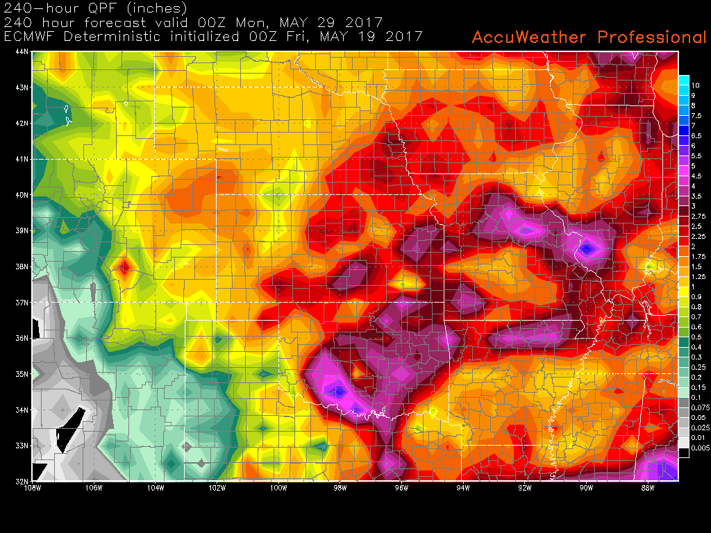
Total Rainfall through the weekend…very heavy rains will be possible across eastern Nebraska, eastern Kansas, Missouri into parts of Iowa as well. Wouldn’t be shocked to see isolated 4″+ as well.
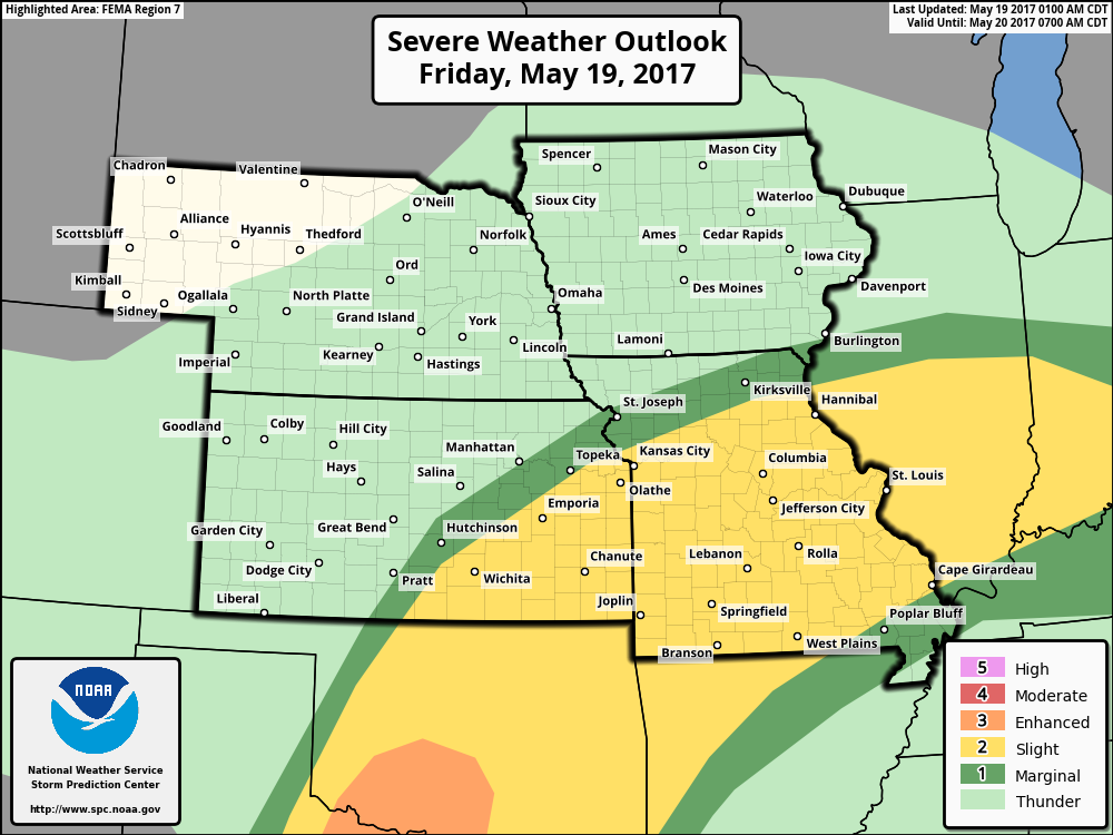
Strong storm risk through Saturday morning…we think this risk could be pulled further north to include parts of southern Nebraska and southern Iowa through Saturday morning.
Total rain from the European over the next 10 days…I think in some spots this is underdone given that some locations in Missouri and eastern Kansas could see 3-4″+ over the next 60 hours alone.
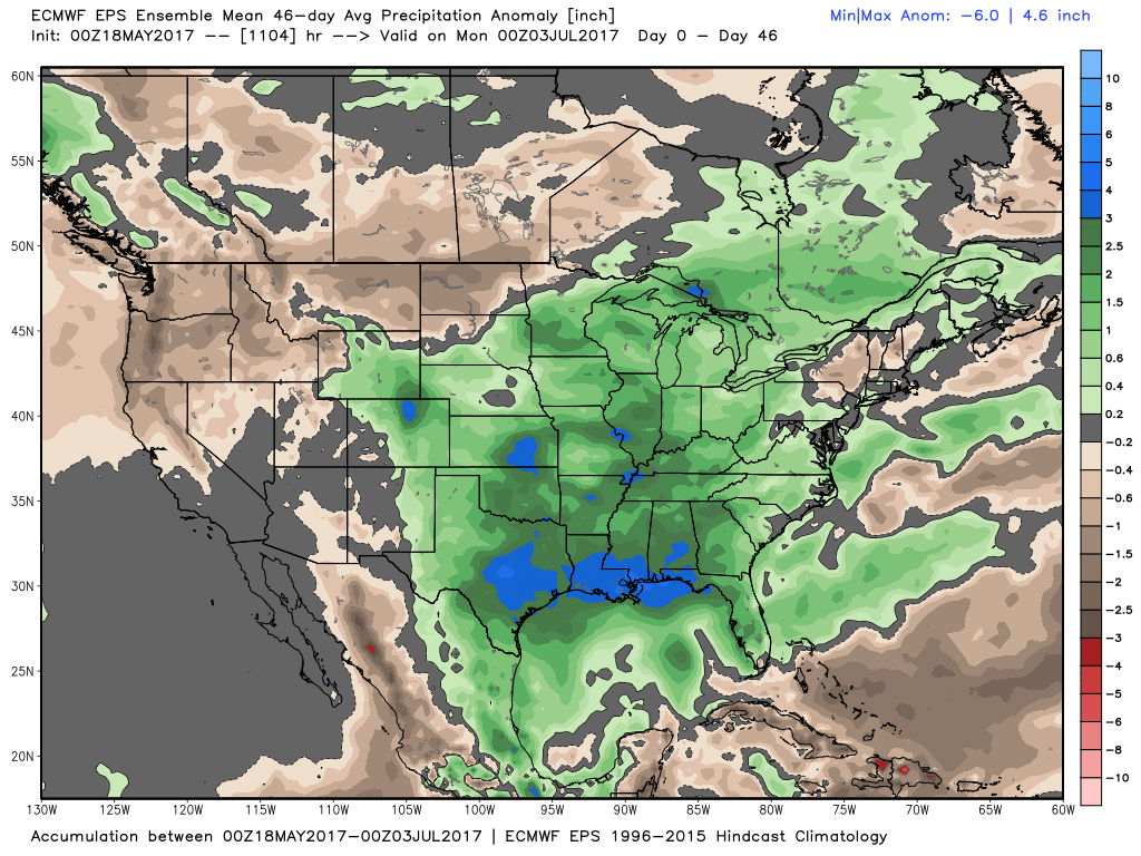
New European Weeklies in with a continued active pattern over the next month and a half through June, we discuss also in the video how we have cooler risks as well.
Confidence:
- Above average confidence additional storms develop later tonight through Saturday morning moving north and east along an area of low pressure.
- Average confidence on the strong storm risk, although we discussed above we feel the risks need to include parts of southern Nebraska and southern Iowa through Saturday morning.
- Average confidence the pattern remains active through next week, already targeting multiple rain chances.
- Above average confidence the pattern turns cooler as we go through the latter half of the month across the central Plains.
Today’s video (8 min):