Key Points – Monday, June 12, 2017:
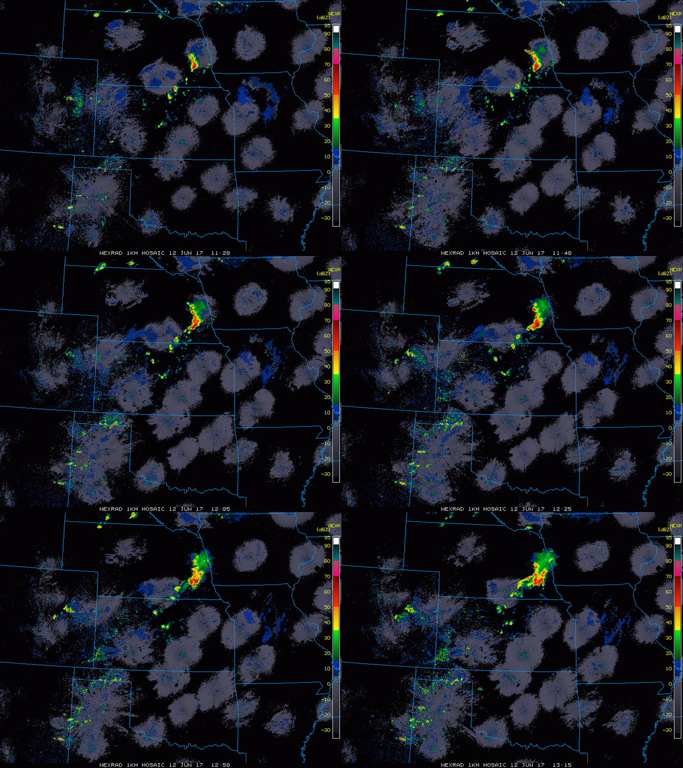
Synopsis: Good Monday morning! Heavy rains and t’storms stalling along a frontal boundary across Southeastern Nebraska this morning bringing heavy rainfall to the area. Need you to understand, forecast models will handle the storm solutions very poorly this week so we will do our best to illustrate the risks. More heavy rain and t’storms work in across the central Plains through mid-week with a hit or miss nature. We will continue to be warmer than normal, but a pattern change looms getting into next week as a trough starts to replace the ridge in the central US. Have a blessed week!
Current Radar:
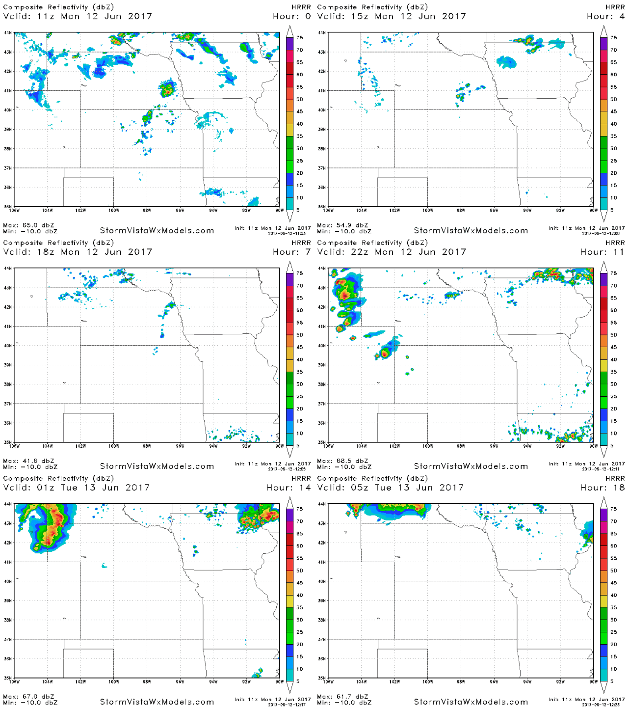
Storm cluster tonight into Tuesday morning possible across the northern tier of the Zone…strong storms will be possible as noted below.
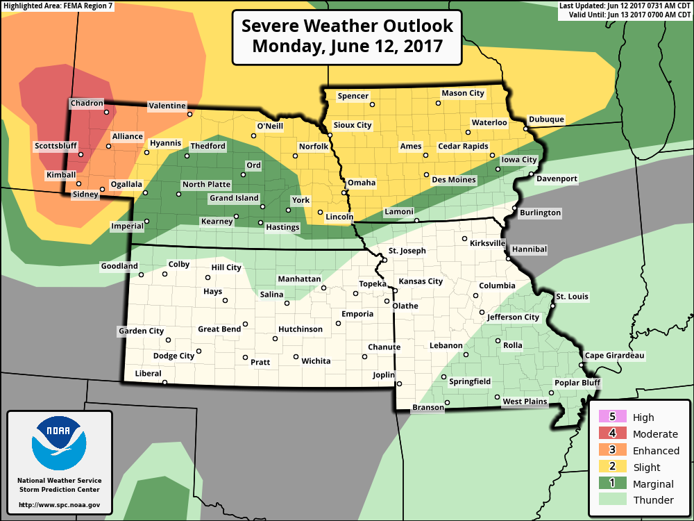
Severe storms possible across eastern western Nebraska along a dry line…all models of severe storms will be possible there. Further east across Nebraska and Iowa a slightly lower risk for strong storms exists, but some damaging winds, isolated large hail and localized heavy rainfall will be possible.
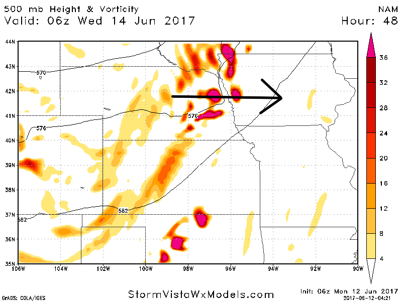
Tuesday night into Wednesday morning…could be a strong cluster of storms here that could deliver some heavy rains and damaging winds from west to east that we need to watch closely. Coverage here will be 30-40% in nature.
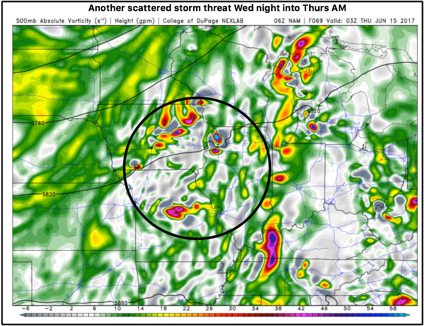
Wednesday night into Thursday another storm cluster will impact the central Plains, with the focus being across the eastern half of Iowa and Missouri ~30-40% coverage.
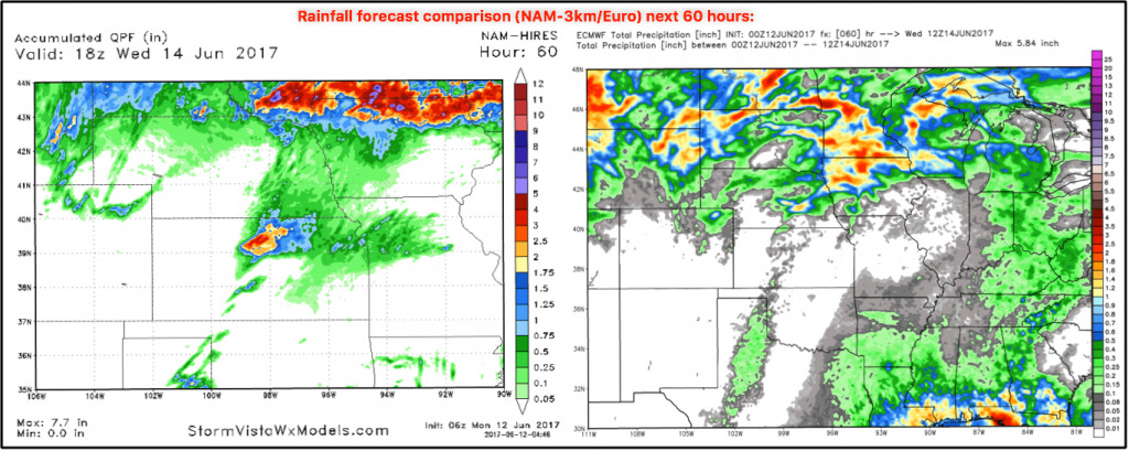
Precipitation from the NAM-3km and European forecast models…definitely favoring the northern/northeast section of Zone 8, but the data still isn’t picking up on the exact nature of where the heavy rains set-up. Locations further south across Kansas and Missouri will see lower amounts given the convective (pop-up) nature of the storms.
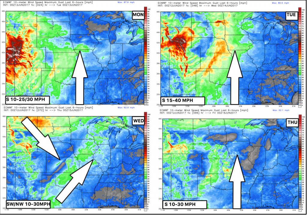
Winds forecast next 4 days…will be quite wind getting into Tuesday with gusts up to 40+mph.
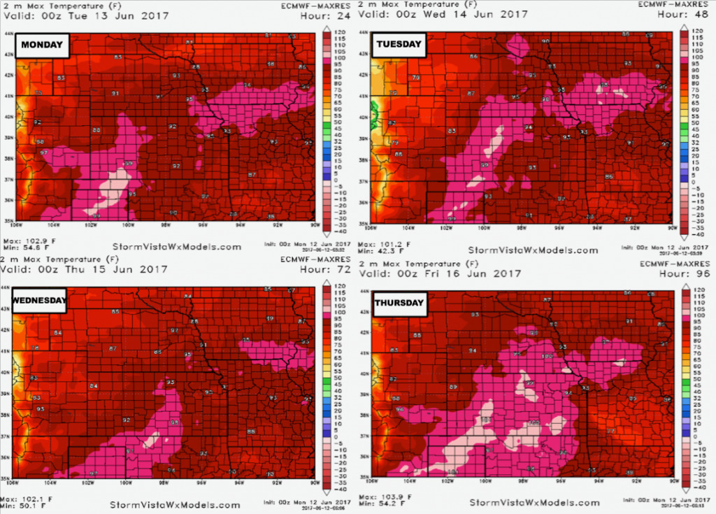
Temps next 4 days quite warm, with many seeing 90s.
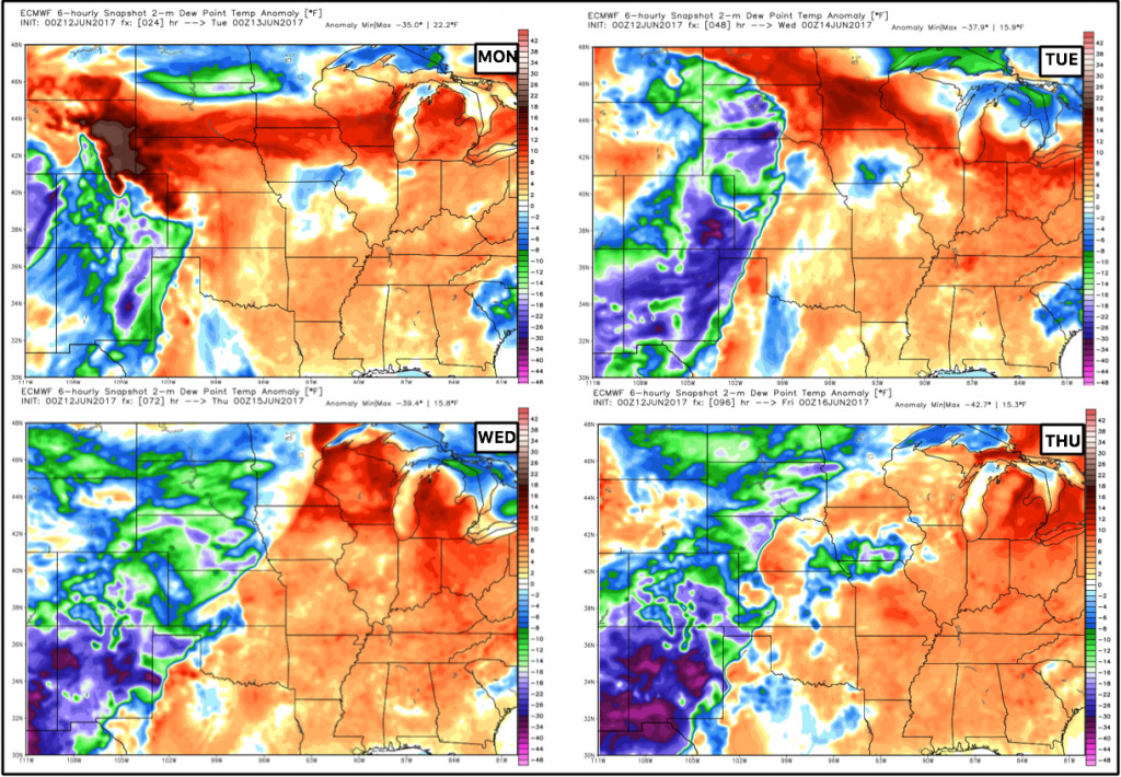
Dew points from normal over the next 4 days with the reds being humid and the blues being “drier”. You can tell the cooler, more comfortable feel will be situated to the west.
Precipitation from normal over the next week…the focus of the above normal rains will be north and east, drier to the south.
The pattern starts to transition getting into next week with a cooler pattern settling in across the central Plains:
Confidence:
- Average confidence of some strong storms across the northern tier of Zone 8 later tonight through the overnight.
- Average confidence on an isolated/scattered storm threat through Thursday this week across parts of the central Plains…tough to nail down exactly where.
- Above average confidence we are overall above normal in temperatures this week.
- Increasing confidence of “cooler” times ahead getting into next week as a trough replaces a ridge.
Today’s video (8 min):
