Key Points – Friday, April 7, 2017:
Synopsis: Good Friday morning! Today we discuss the frost threat on vegetation across eastern Kansas into Missouri this morning, a big-time weekend warm-up followed by our next chance for strong storms Sunday night into Monday. Overall we are drier than normal over the next ~5 days, but we have additional shower and storm chances reintroduced mid-next week and, based on latest data, believe we start turning more wet again in the week 2 forecast. Have a wonderful weekend!
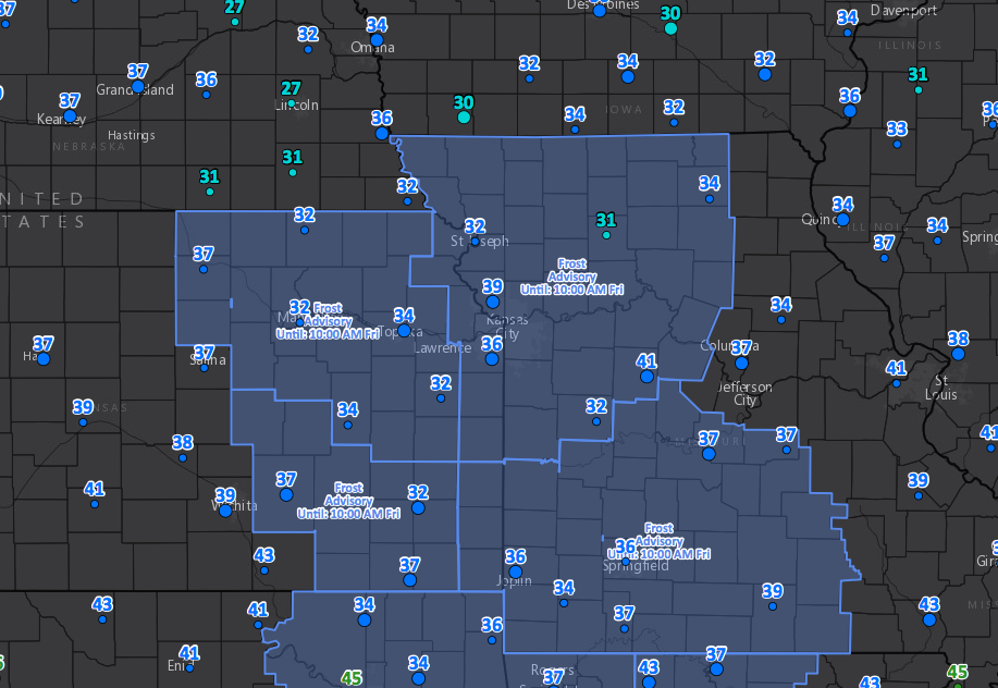
Frost Advisories this morning:
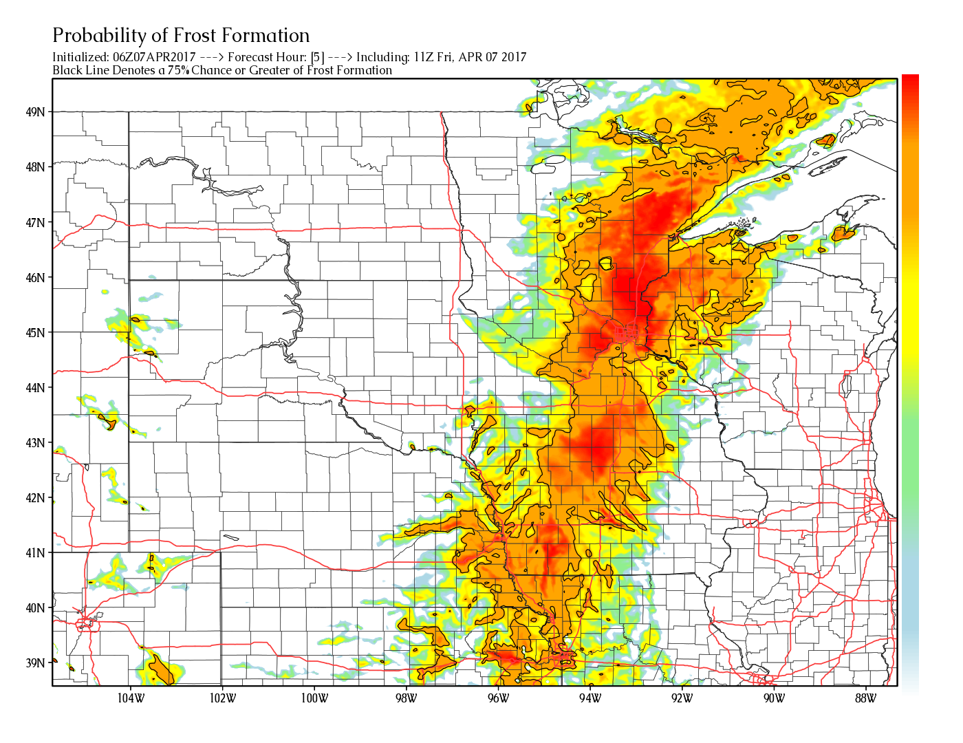
You can see the threat very well here with our exclusive product that forecasts the probability of frost on vegetation. Any time you see the brighter colors with the black line around it, it suggests a 75%+ probability for frost on vegetation. We’ve been mentioning these risks since March where frost/freeze potential still exits with storm-induced cold.
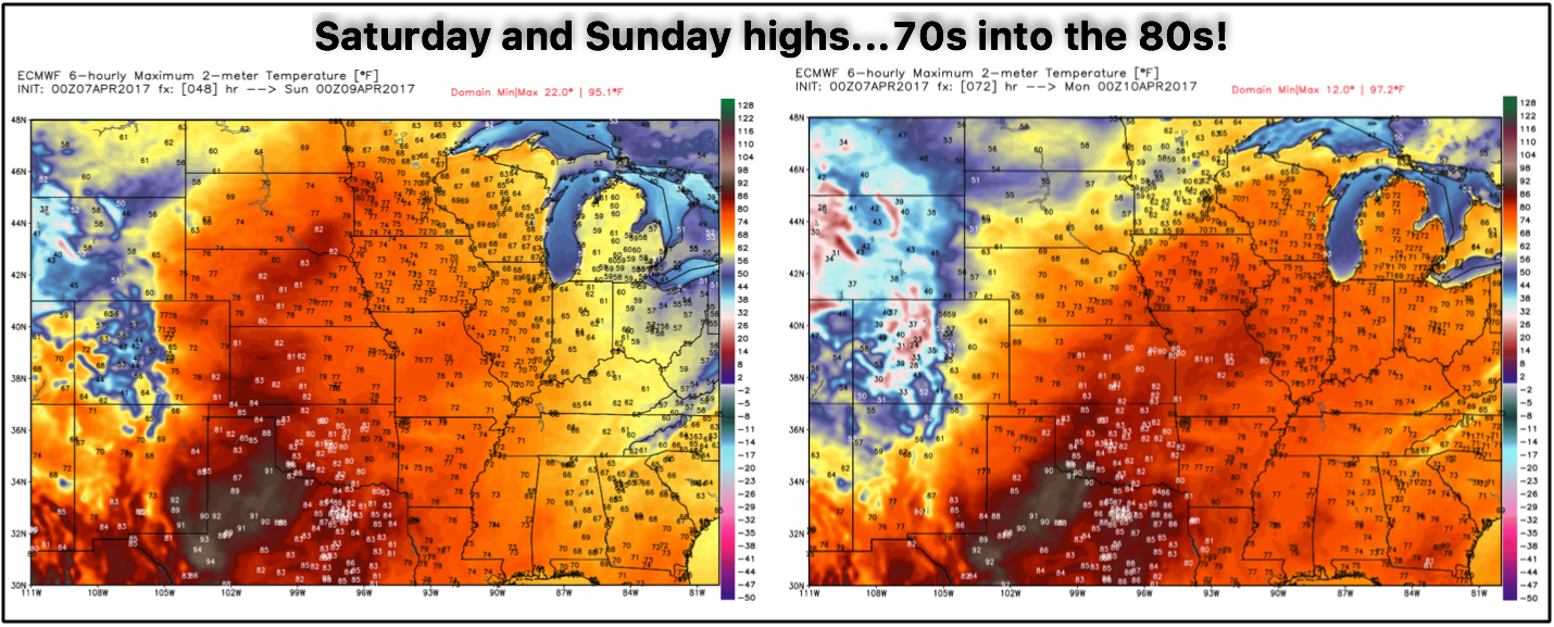
The cold doesn’t last long, however, check out these highs on Saturday and Sunday that we’ve been mentioning all week! Widespread 70s and 80s that should help (some) to dry up all that rainfall Zone 8 has seen over the past 2 weeks.
Any time we get a big surge of warmth like that, though, you can expect a pretty powerful storm system has something to do with it…and this instance is no different. We see precipitation start early on Sunday further west then trailing east through the day into the overnight Monday, some of these storms could be strong to severe as well as discussed below.
The “forcing” behind this strong storm chance starts with an upper-level jet max (~20,000ft) move=ing through, and what this does is increase lift for storms continue to rise and intensify on the nose of the jet streak across eastern Kansas into Iowa and Missouri late Sunday into Monday.
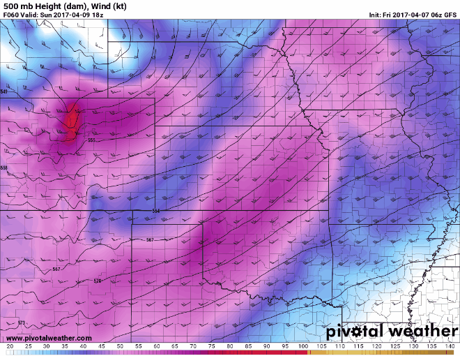
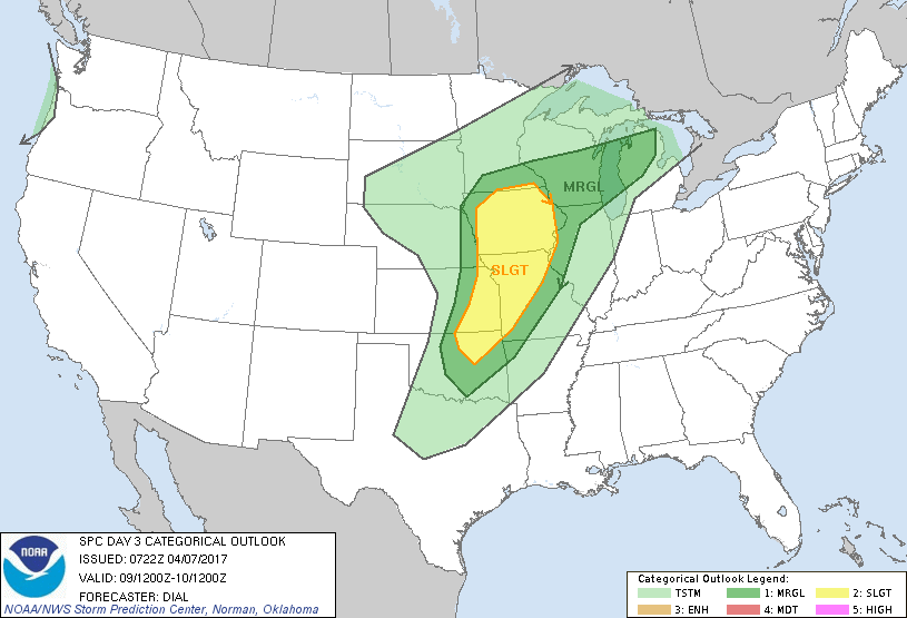
Risk for strong storms Sunday into Monday exists from eastern Kansas, Iowa into Missouri. Initially we may see some discrete cells, likely turning into more of a linear shape bringing threat of damaging winds, isolated large hail…and cannot rule an isolated tornado at this time.
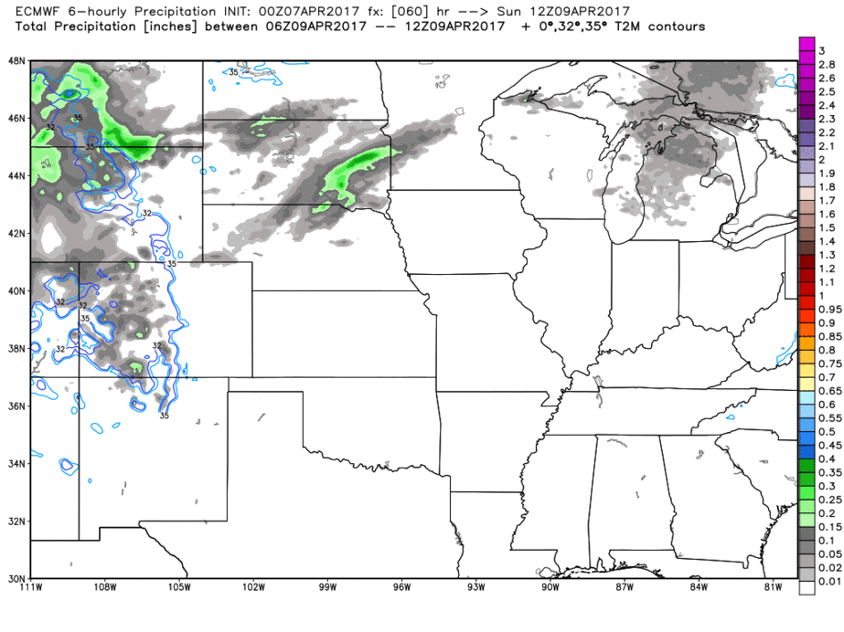
Rainfall for this system will be ~0.25-0.50″ with this, not too impressive as it’ll be a quick mover from west to east.
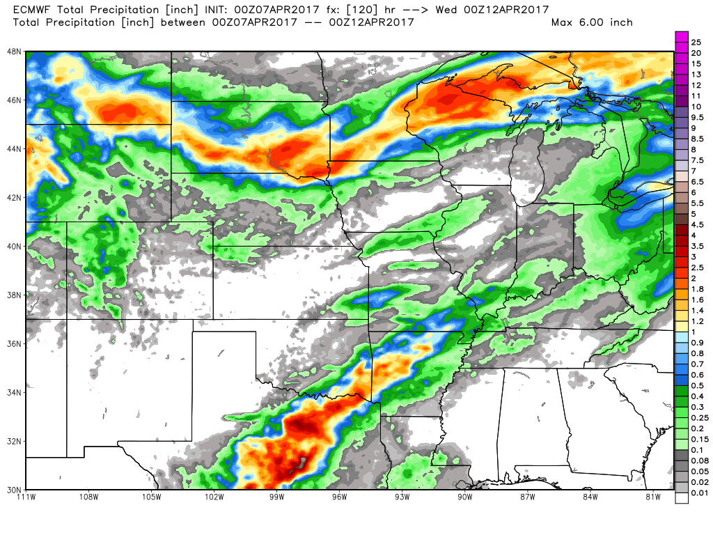
Next chance for heavier rains comes Wednesday into Thursday across Zone 8…this fits the pattern of having a system every ~5 days move through, which is why it’s been difficult to dry out any.
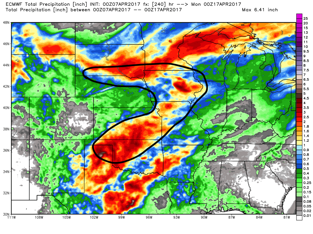
When looking at rainfall totals over the next 10 days in the area circle in the black, 1-3″ of precipitation is expected…overall the theme ahead is: active.
Confidence and Risk:
- Average risk for some frost on vegetation this morning across eastern Kansas into Missouri.
- High confidence we warm-up in a big way this weekend with highs expected in the 70s/80s.
- Average and increasing confidence of storms Sunday into Monday, with a strong storm risk across eastern KS into IA and MS.
- Average confidence in the details, but expecting a heavier shower and storm chance to return Wednesday into Thursday next week from west to east.
- Above average confidence the pattern remains very active with a system about every ~5 days moving through…hard to get us dried out from recent rains heading into mid-April.
Today’s video (6 min):