Key Points – Tuesday, April 4, 2017:
Synopsis: We have our next storm system moving off to the east this morning across the panhandle of Oklahoma that will set-up an environment possible conducive severe weather and heavy rains tonight across southeastern Kansas into Missouri. Confidence is increasing for a frost/freeze threat Thursday/Friday mornings as those chilly northwest winds from high pressure assure in temps of 20s and 30s. We warm up in a big way this weekend however with temps in the 70s even 80s expected. Our next chance for showers and storms comes late weekend into early next week. Latest long-range data suggests active pattern continues through April with a growing concern for planting delays across the central Ag Belt.
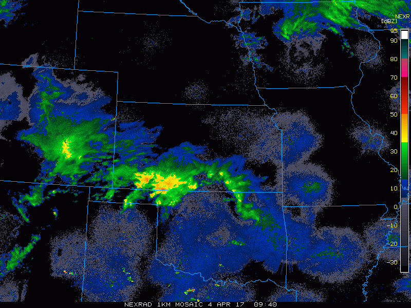
Current Radar…ongoing showers across Kansas right now that will continue north and east throughout the day impact Missouri and Iowa folks.
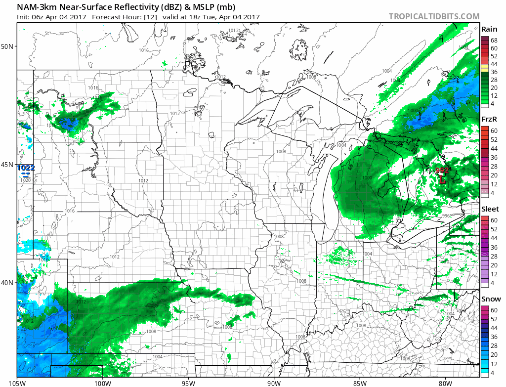
Simulated Radar today as a powerful low pressure system moves off to the east today bringing showers and storms, including some heavy rains expanding from Kansas north and east through Missouri and the eastern half of Iowa. Meanwhile some scattered showers possible across North Dakota and eastern South Dakota into western Minnesota as well.
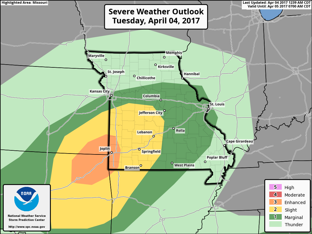
Area where we believe strong to severe storms sets up later today into tonight across southeastern Kansas and southwestern Missouri. The main threats will be large hail, gusty winds and heavy rainfall.
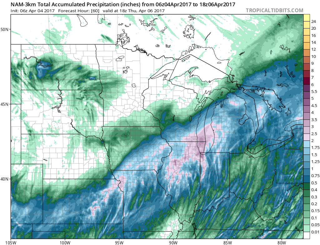
Rainfall accumulation over the next 60 hours, with a large swath of 2.0″+ across eastern Kansas through the northern half of Missouri, eastern Iowa into the Midwest. Around 0.2-0.3″ (isolated 0.5″) will be possible across North Dakota into western Minnesota.
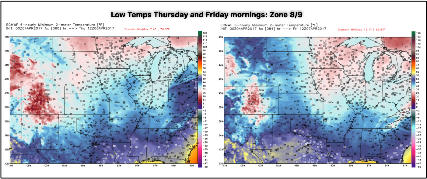
High pressure sets in this weekend ushering in some warmth, but first we get in on those chilly northwest winds ushering in lows into the 20s and 30s on Thursday and Friday mornings. This increases confidence for frost and freeze chances Thursday and Friday mornings as well.
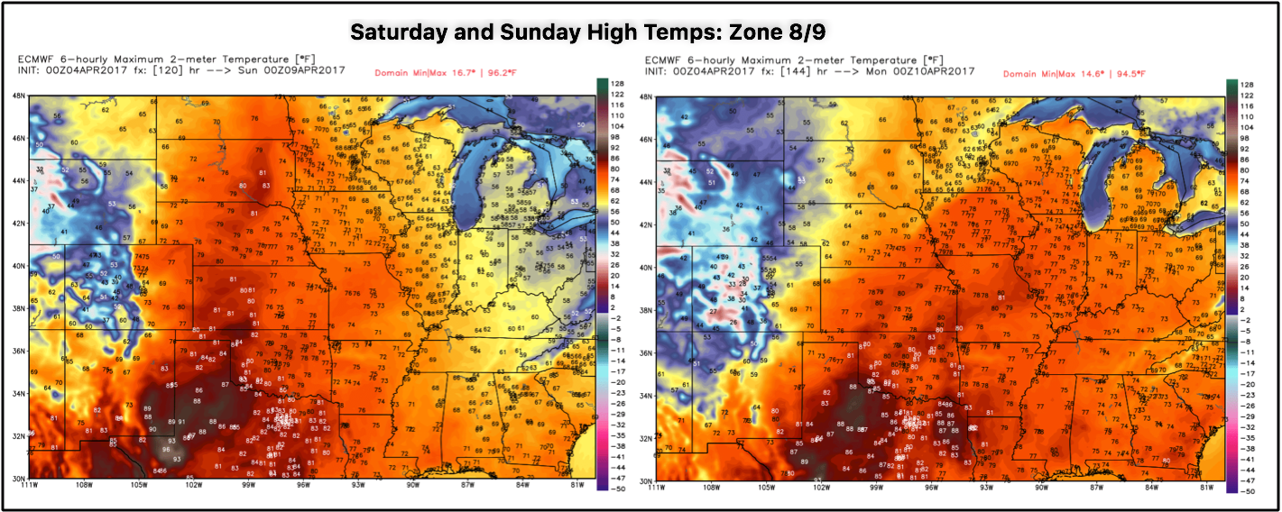
Highs on Saturday and Sunday get into the 70s and 80s with some much welcomed sunshine expected before our next storm system is forecasted to move through late weekend into early next week.
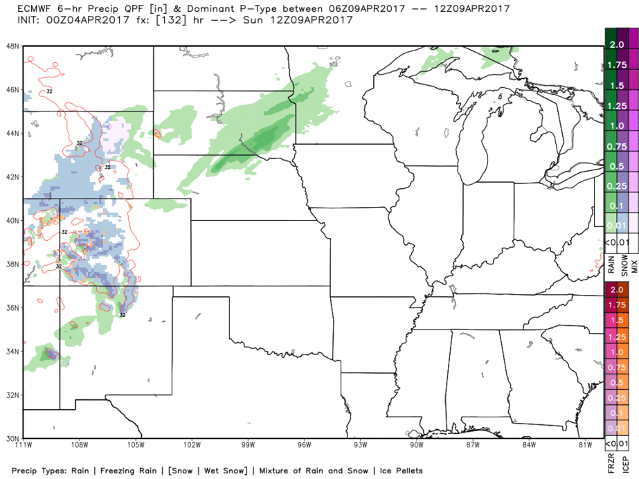
Next rain chances comes Sunday into Monday across Zones 8/9 from west to east, we discuss the details in the video.
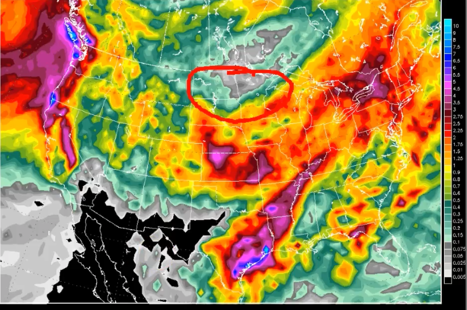
10 day rainfall totals with very robust rainfall across the central Ag Belt keeping fields wet and saturated; we do feel that the area circle in red gets in on some additional rains getting into the week 2 forecast as they have been very dry as of late.
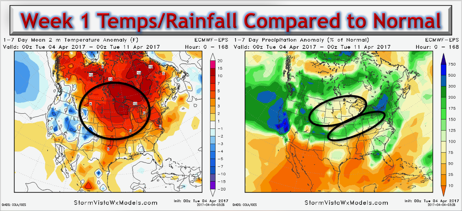
Temperatures and precipitation over the next week are overall above normal with above normal rainfall expected across the central Plains, and below normal rainfall expected across the northern Plains locations.
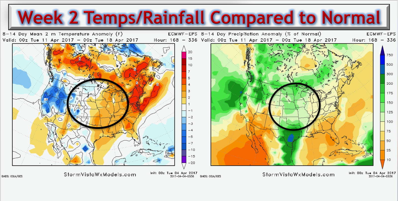
Temperatures and precipitation into week 2 expected to be split…slightly warm to neutral across the eastern half of Zones 8/9 and neutral to slightly cooler to the west; meanwhile the overall signal is slightly above in the precipitation from normal department.
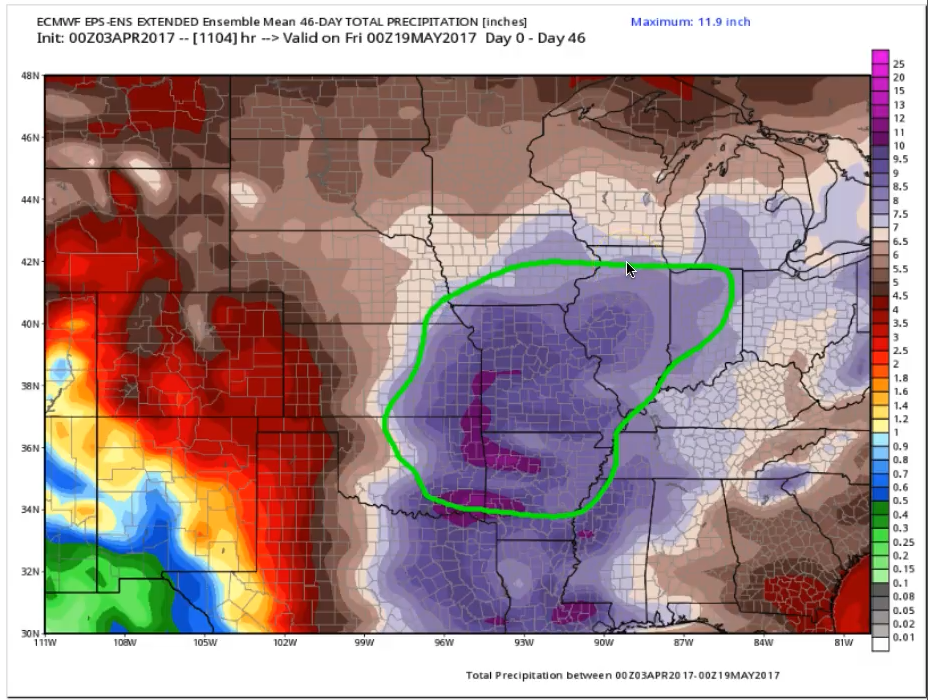
New European Weeklies are in and here’s a look at its forecast over the next 46 days. The area circle in green we are concerned with planting delay issues. Overall, it’s a very wet and active pattern ahead similar to what we are seeing now!
Confidence and Risk:
- High confidence showers and storms expected across eastern Kansas into Missouri and the eastern half of Iowa today into tonight.
- Average risk for strong to severe storms across southeastern KS into southwestern Missouri, the main threats will be large hail, gusty winds and heavy rainfall. We just have to see how this unfolds.
- Overall above average confidence the northern Plains continues to feel the effects of high pressure and largely stays drier than normal with the exception of a few scattered showers.
- Increasing confidence of a potential frost and freeze threat on vegetation Thursday and Friday mornings as temps get into the 20s and 30s.
- Above average confidence we warm up in a big way this weekend with temps in the 70s and 80s expected overall.
Today’s video (7 min):