Key Points – Friday, March 31, 2017:
Synopsis: Good Friday morning! Today we discuss the heavy rains that have fallen across the central US over the past 1-2 weeks, and reversely how dry we’ve been across the northern Plains in the same timeframe. The wet and active pattern continues across Zone 8 this weekend into next week. Via our newest frost potential on vegetation tool, we also are watching for some frost Saturday morning across portions of the Ag Belt so make sure not to miss this. Latest European Weekly data over the next 46 days is very wet across the central Ag Belt, we have a growing concern for more widespread planting delays in April as the active pattern looks to continue. Have a wonderful weekend!
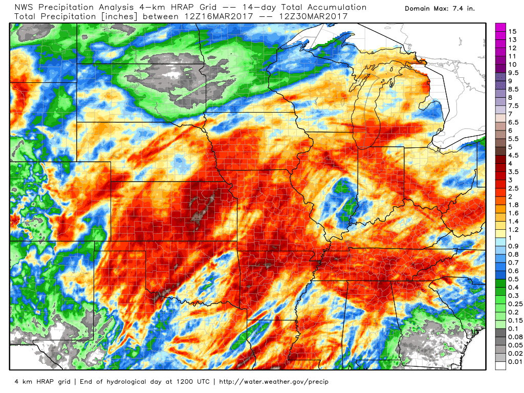
Precipitation analysis over the past 2 weeks…some locations in the central US including Kansas saw upwards of 5.0″+ of rainfall! We mentioned the pattern would turn wet where we’ve been dry especially across central to southern Ag Belt and that’s confirmed below. We also note, however, how dry it’s been across the northern Plains, with some locations not even seeing a drop of rain across South Dakota.
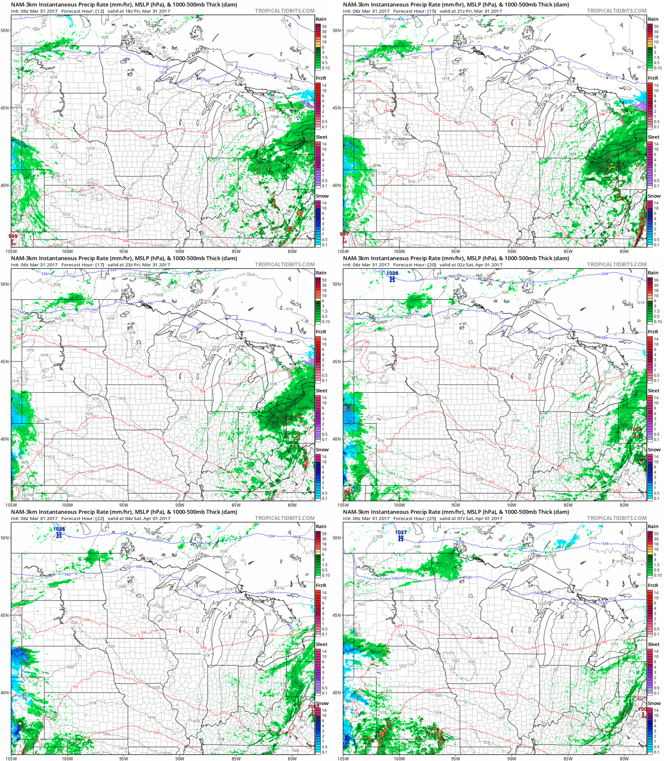
Light Showers today possible from North Dakota pushing east later today into northern Minnesota overnight. Western Nebraska also has a chance for some light showers throughout the day today as well.
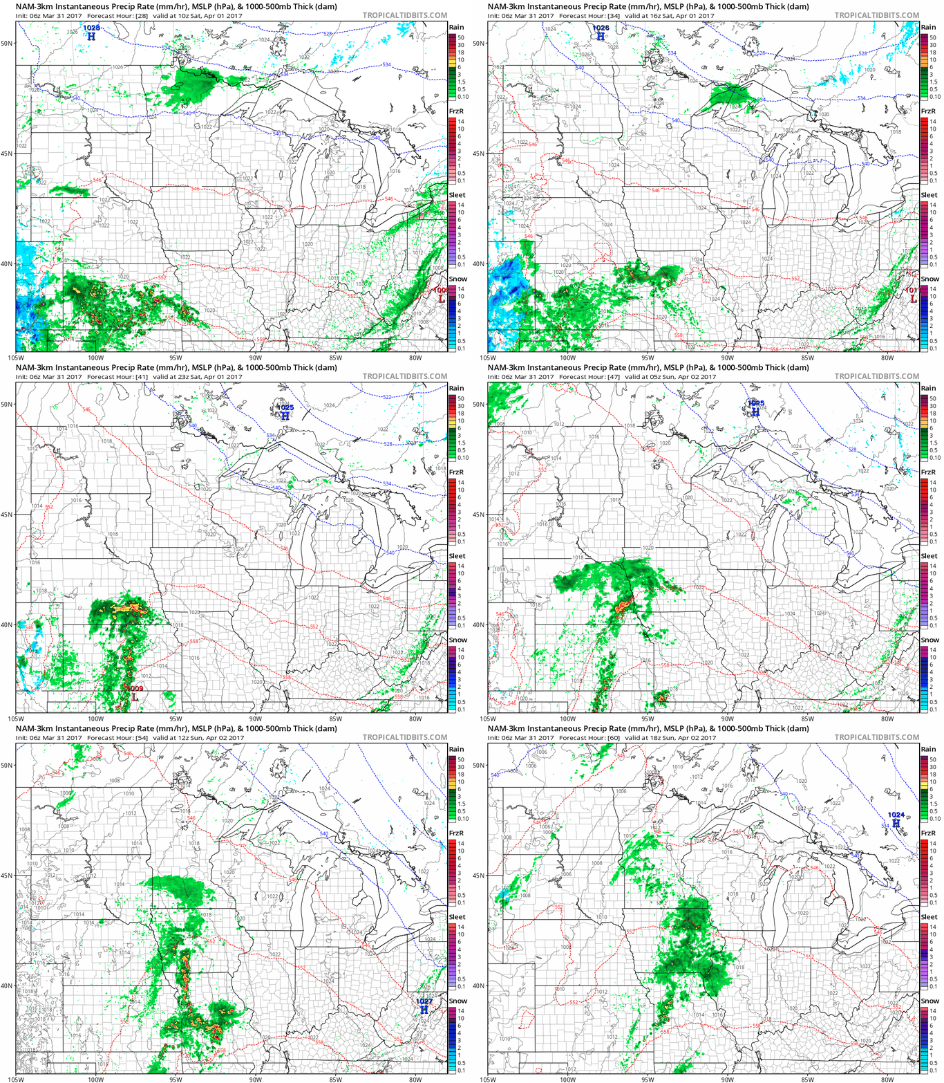
Moving into Saturday, we increase chances for showers and gusty thunderstorms especially from Kansas to Nebraska, shifting off to the east Sunday across Iowa and Missouri. High pressure keeps our northern Zone folks dry on Saturday and Sunday.
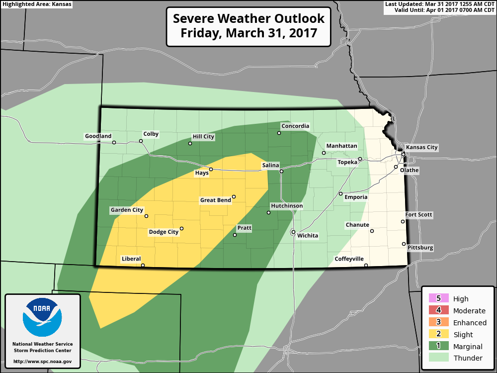
Our thinking is some isolated large hail is also possible along with gusty winds for portions of Kansas overnight into Saturday.
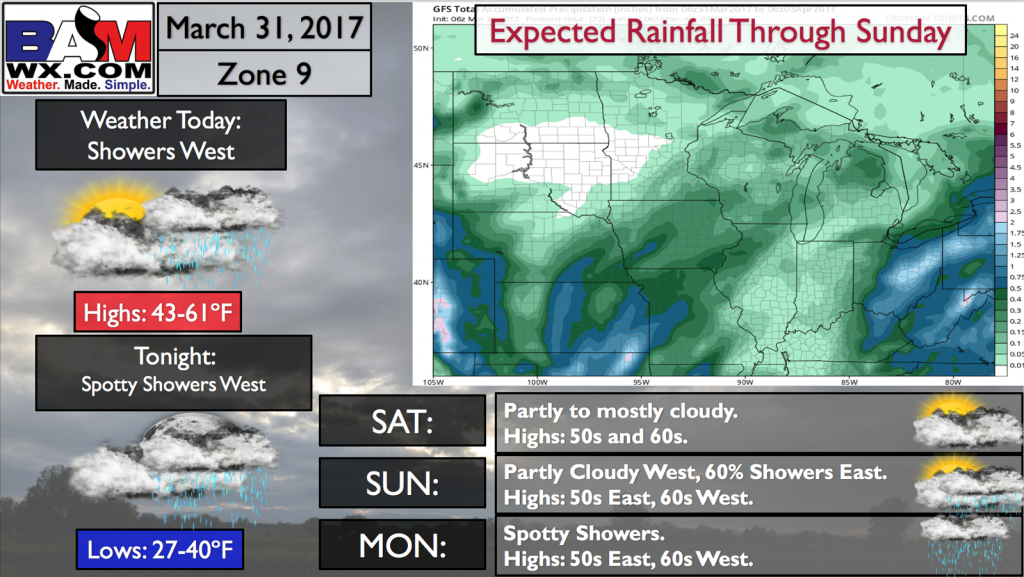
Rainfall totals over the next 60 hours focused primarily across Zone 8 with 1-2″ expected, whereas Zone 9 folks experience continued high pressure and dry conditions. With that being said, 0.2-0.3″ is possible from North Dakota to northern Minnesota.
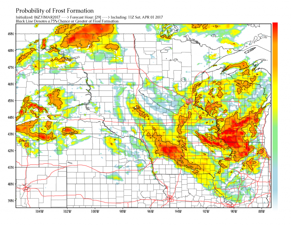
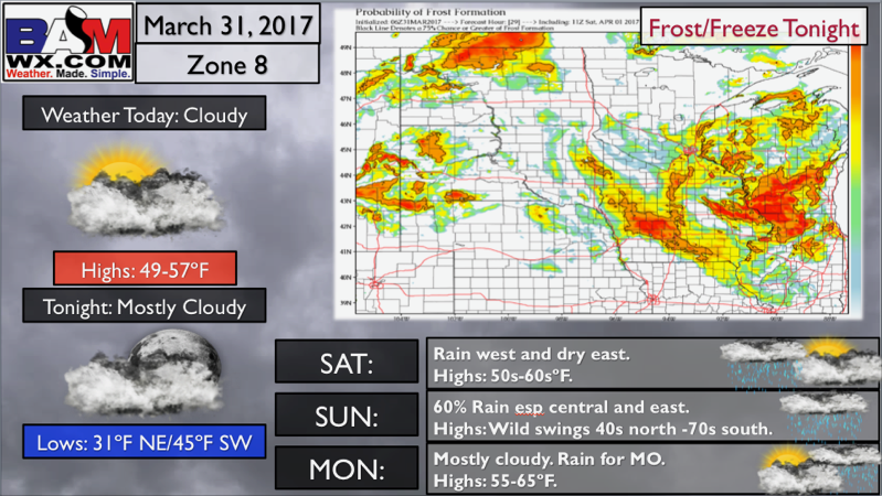
Saturday morning features some frost on vegetation potential as seen below. The brighter the color, the higher the probability for frost. Most of Iowa, southern Minnesota, northern Illinois into North Dakota are the areas we are focusing in on the threat.
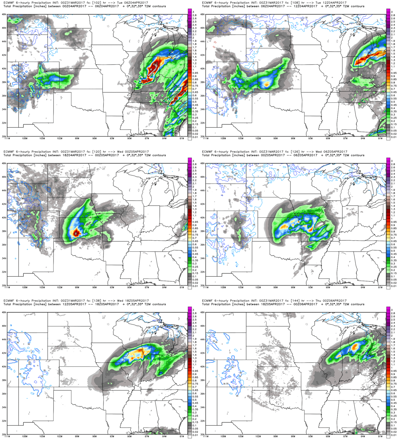
A more robust system moves through the central Plains from west to east early to mid next week we are watching for additional strong storm potential and heavy rainfall…the active pattern is not letting up as we get into April, that’s for sure.
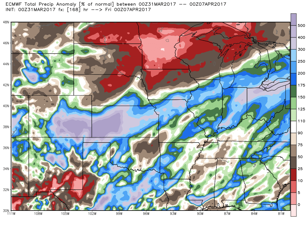
Precipitation anomaly over the next 7 days is 3-500% above the normal amount from Kansas to the southern locations of Nebraska and Iowa into Missouri as well. The dry pattern continues over the next week for Zone 9, but as we discuss below we believe this pattern changes getting into the week 2 forecast.
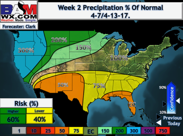
Week 2 precipitation from normal forecast shows we a pattern more favorable for rains where we’ve been dry across the northern Plains.
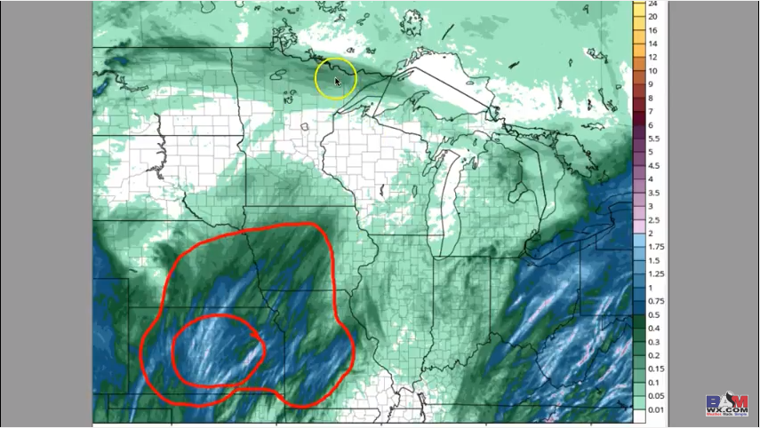
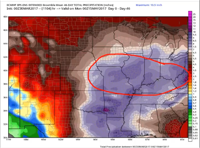
We have a continued growing concern for problems with planting in the red circled area below. This is a look at the latest European Weekly mean precipitation forecast over the next 46 days, with a big time signature for rainfall from eastern Nebraska east all the way through the Midwest. The northern Plains have been dry but we do feel that rains return as we get deeper into April. It’s a trend we are watching closely, if we are still dry over the next 2 weeks up north we will need to reevaluate.
Zone 8 Quickcast…frost/freeze tonight.
Zone 9 Quickcast…pretty dry through the weekend.
Confidence and Risk:
- Above average confidence for showers and storms across Zone 8 Saturday into Sunday.
- Average risk for strong storms across portions of Kansas overnight into Saturday as well with isolated large hail and gusty winds possible.
- Increasing confidence of some frost on vegetation across the Ag Belt Saturday morning, but some risk does remain as we continue to evaluate our new product.
- Average to above average risk we see the pattern turn more wet across the northern Plains getting into week 2.
- Increasing confidence of planting delays across the central and eastern Ag Belt into April given how wet the pattern ahead is forecasted to be.
Today’s video (7 min):
