Key Points – Thursday, March 30, 2017:
Synopsis: Good Thursday morning and thanks for checking out the latest forecast! Below you will discover a new tool we’ve brought to the Zones today that forecasts frost potential on vegetation which is a key tool going into the planting and growing seasons. Still some ongoing showers across eastern Nebraska and Kansas spinning around the low pressure this morning…those will eventually push-off to the east into Iowa and Missouri later today. Next storm system moves in across the western portions of the Zone Saturday morning into Saturday…we are watching for the threat for some gusty storm as well across portions of southern Nebraska into Kansas as well. Otherwise, watching for continued shower and storm activity into next week with multiple targeted systems. The new JMA data that came out today reflects this well, with an overall warmer and wet theme across the Ag Belt for April. Have a great day!
Current Radar showing showers ongoing across southeast Nebraska and eastern Kansas flowing around the low pressure…otherwise a fairly quiet morning so far across Zones 8/9.
Simulated radar including showers the rest of today moving east across Iowa and Missouri into the Midwest. Otherwise the rest of the Zones stay fairly clear of precipitation.
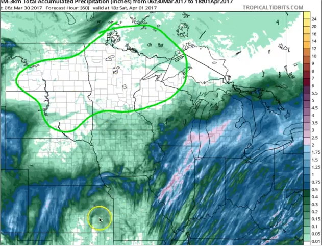
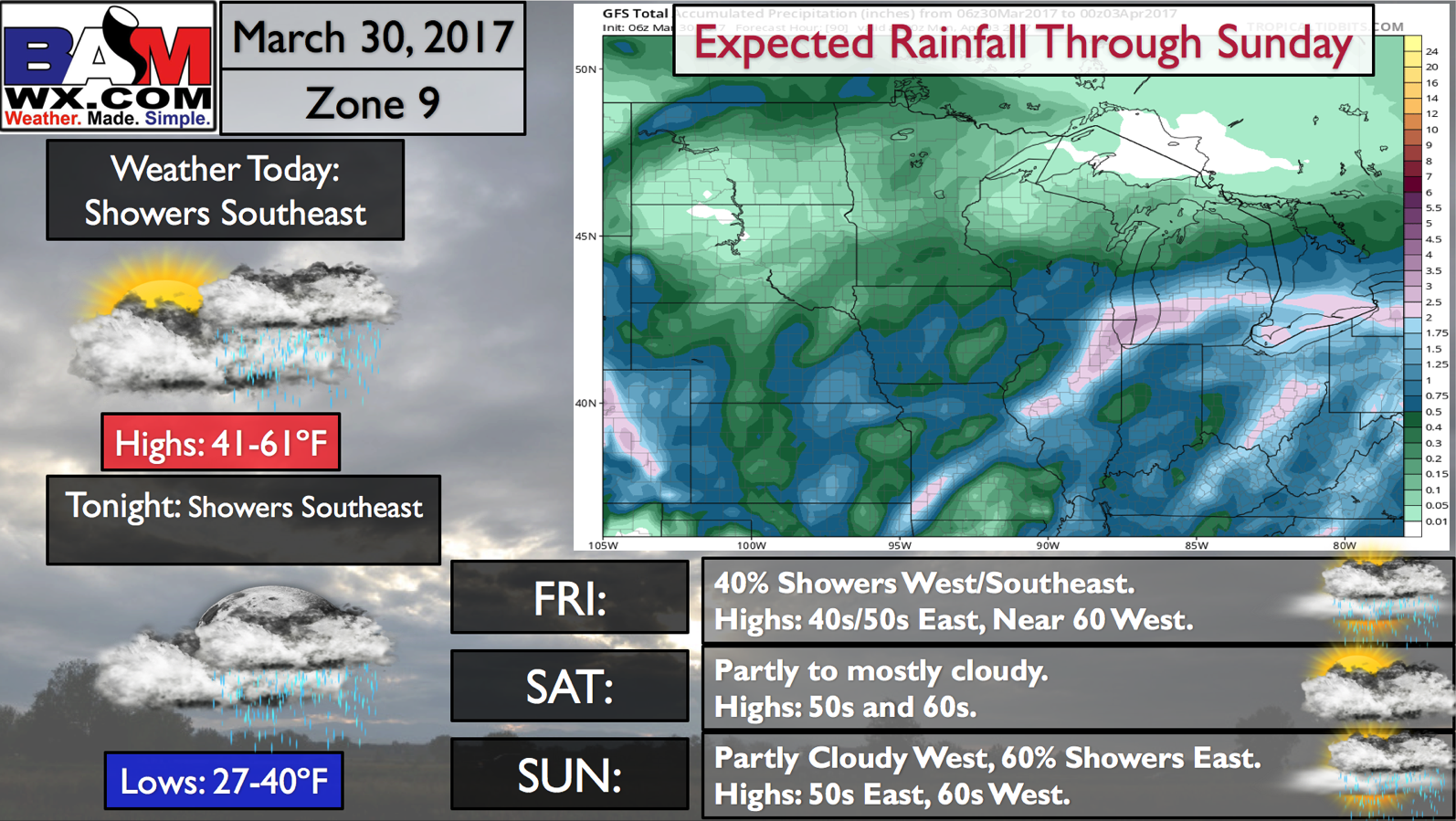
Rainfall totals through the next 60 hours…still seeing a void in precipitation across the northern Plains locations, although we do forecast this to change getting into late next week. Meanwhile, western/southern Nebraska into Kansas, northern Missouri and eastern Iowa are forecasted to see 1-1.5″ during this same timeframe, with isolated higher amounts possible.
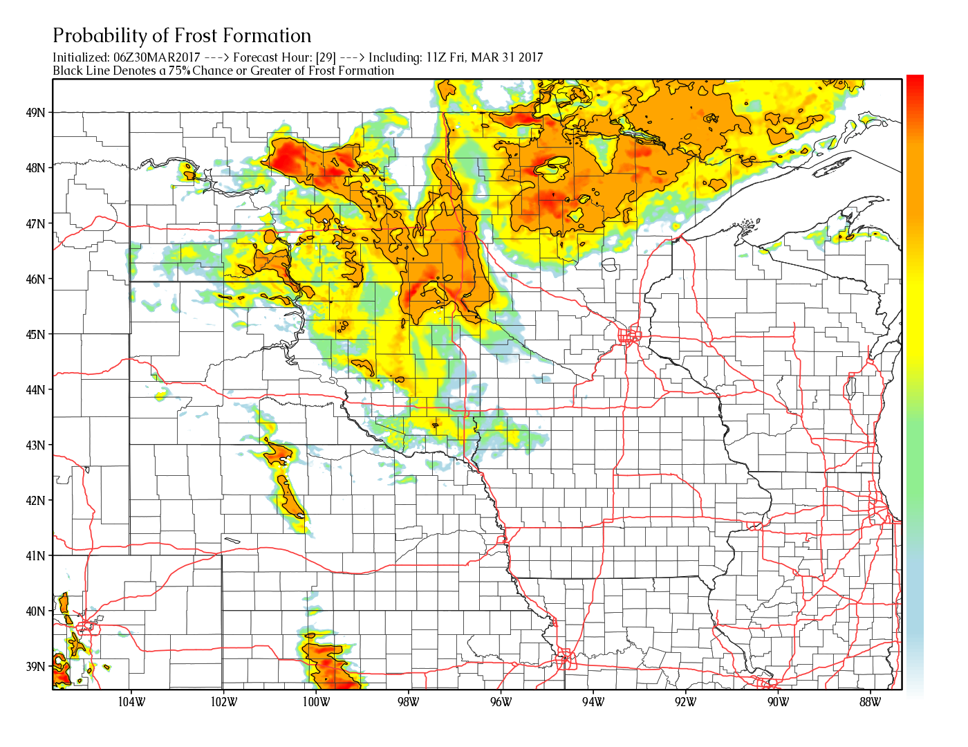
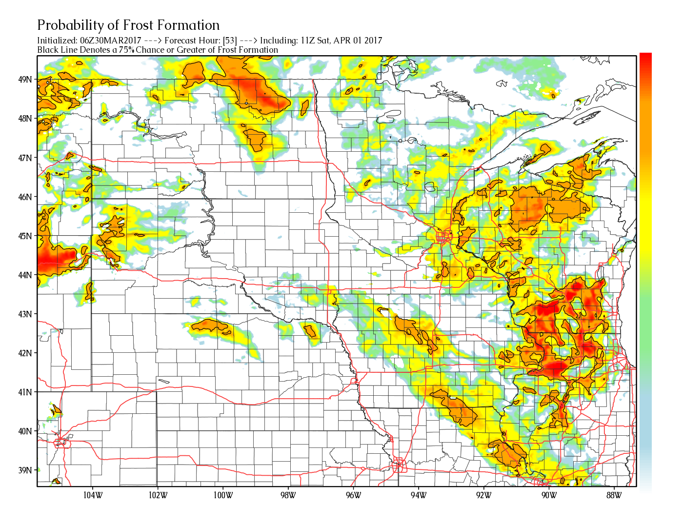
Probability for frost on vegetation is shown below…which is an exclusive, new product we are starting to unveil to our customers getting deeper into the planting and growing season! Through Friday morning, we are watching for some frost potential on vegetation across North Dakota, eastern and northern South Dakota into the northern half Minnesota as well. A few spots in central Nebraska/Kansas will be possible as well.
Using the same parameter getting into Saturday morning, we are watching for some possible frost on vegetation across North Dakota, Wisconsin, even getting as far south as Iowa and northern Missouri. For folks that have already planted crops, this could be an issue.
We are watching our next storm system to move through Saturday and Sunday from west to east that will be a rain maker especially for Iowa into Missouri. A small disturbance does scoot across Zone 9 locations, but it mostly stays out of the area as discussed in the video.
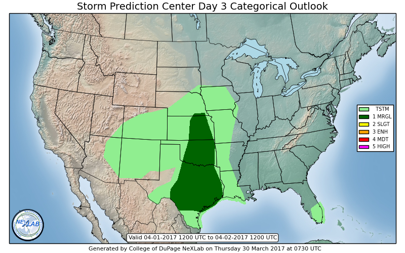
Strong storm risk issued for southern Nebraska into Kansas for some gusty winds on Sunday as well…risk remains higher though as we need more data to fine-tune this forecast. Stay tuned in the coming updates.
Getting a little further out, our data suggests another system Wednesday into Thursday from west to east that could bring strong storms to the central US as well. These rains also should help the dryness across Zone 9 late next week as well.
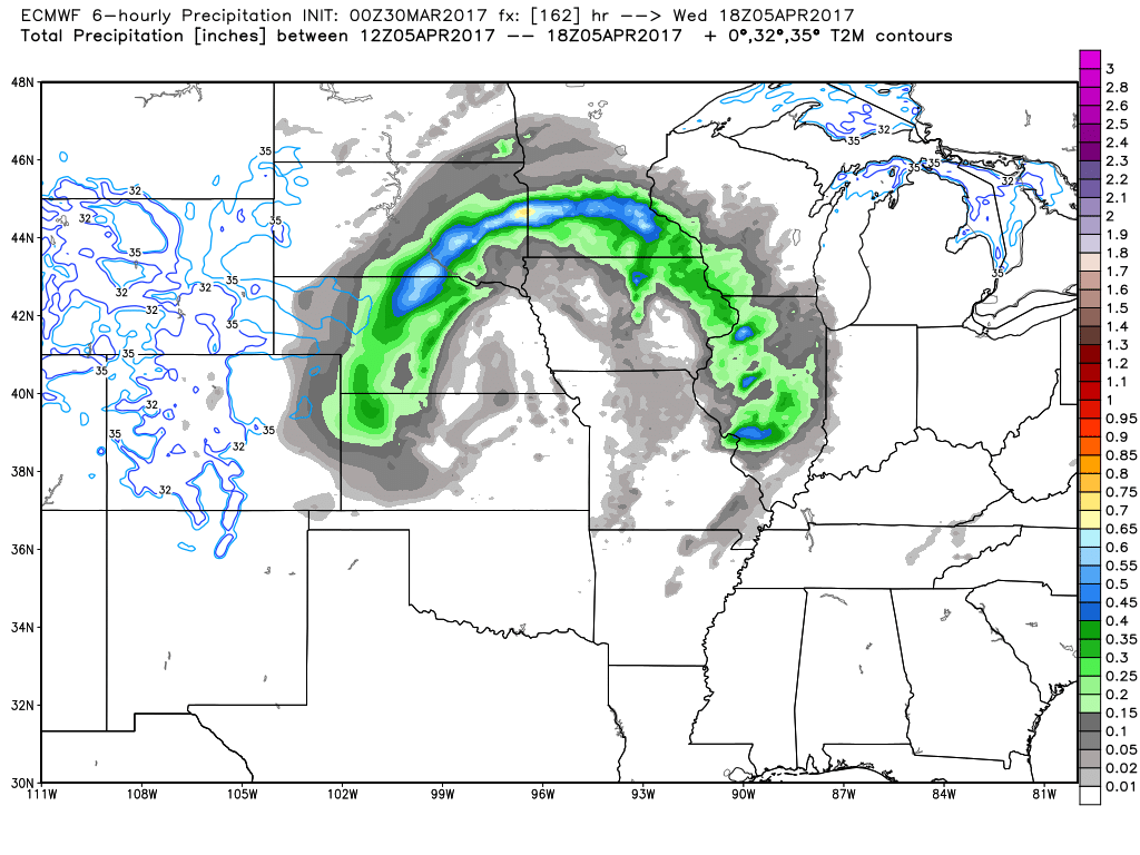
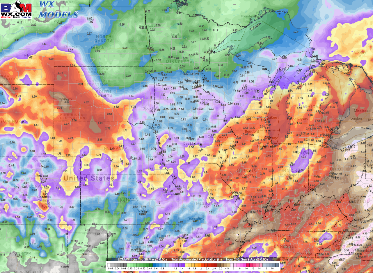
A glance at 10-day rainfall totals from the latest European model shows solid rains for the majority of the Ag Belt, with even some soaking rains forecasted for the Dakotas into Minnesota as well. The active pattern certainly continues into April.
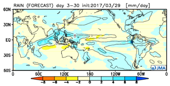
The latest JMA weeklies that were issued today with a theme of warmer than normal as well as overall wet across the entire Ag Belt over the next 28 days as seen below (the blue color indicates above normal rainfall).
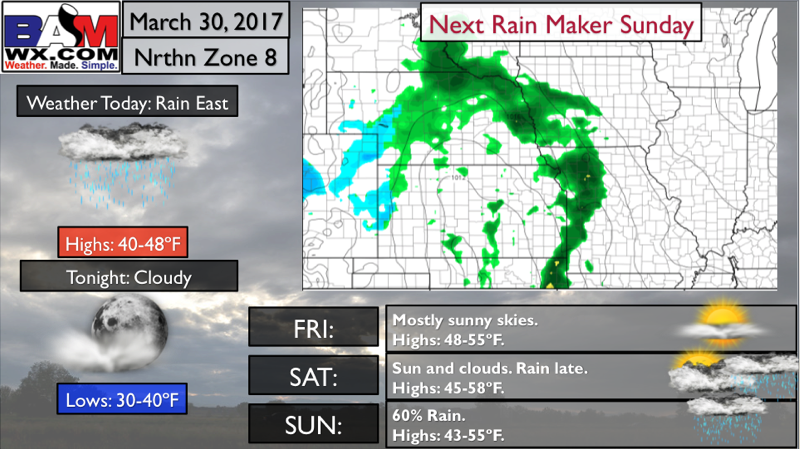
Northern Zone 8 Quickcast:
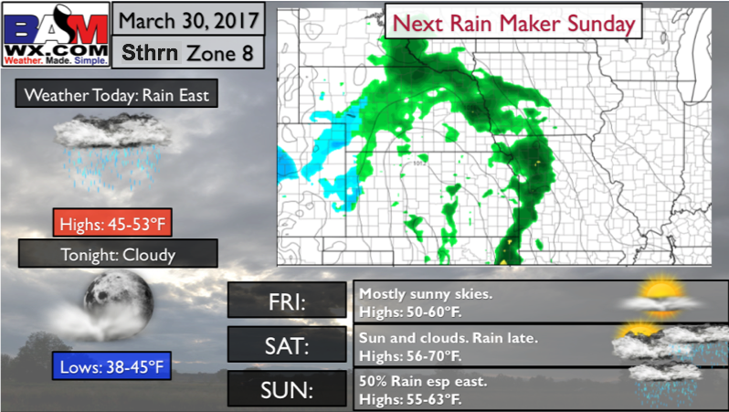
Southern Zone 8 Quickcast:
Zone 9 Quickcast:
Confidence and Risk:
- Above average confidence the rain showers move off to the east across Iowa and Missouri into the Midwest today…meanwhile the rest of the Zones stay fairly clear of precipitation.
- Above normal confidence our next system approaches Saturday into Sunday from west to east.
- Above average risk for some strong storms and gusty winds Sunday across southern Nebraska into Kansas.
- Above average confidence we stay very active next week across the Zones with multiple rain chances in the forecast.
Today’s video (7 min):