Key Points – Monday, March 27, 2017:
Synopsis: Good morning and thanks for checking out the latest forecast update! A few gusty storms possible across the south and eastern portions of the Zone this morning through today, we also discuss the active weather pattern this week especially west. Have a wonderful week!
Current Radar this morning:
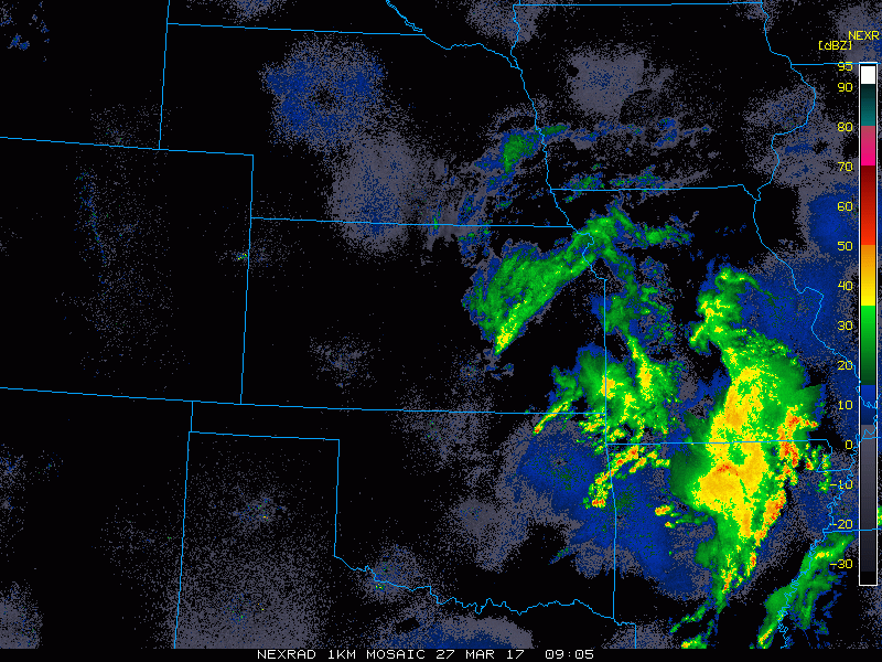
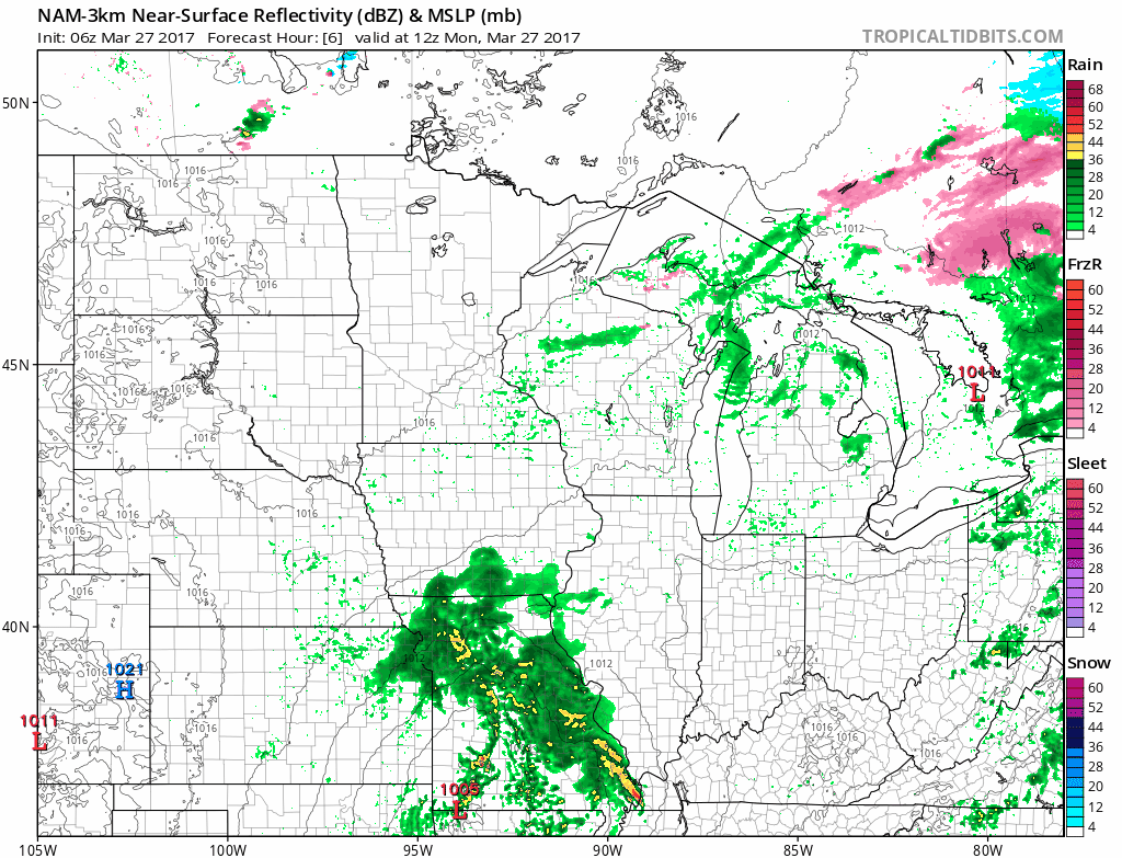
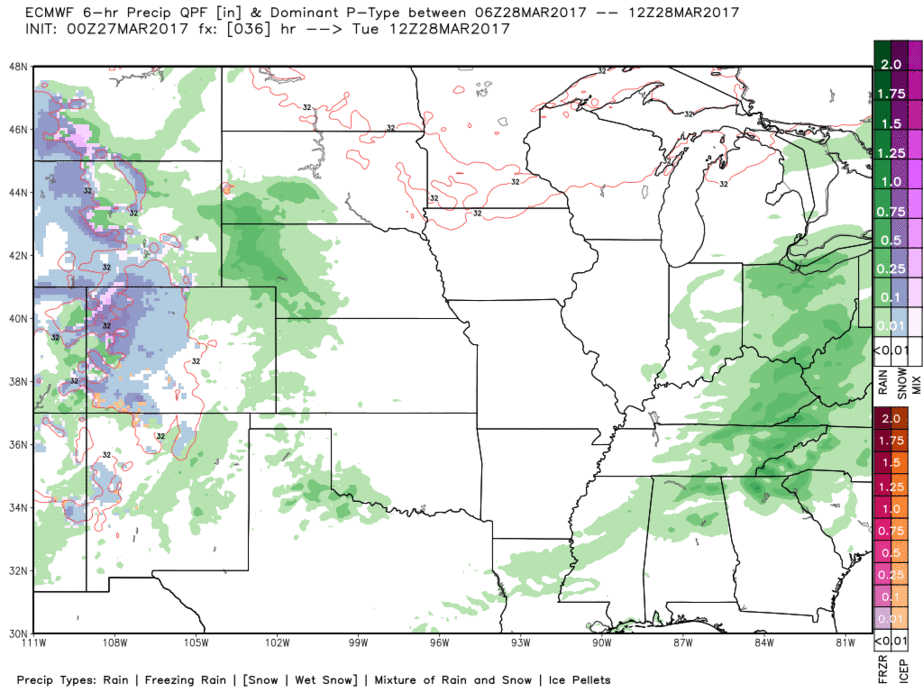
Simulated radar showing the remainder of showers and storms this morning into today mainly across southern Iowa and Missouri. With that being said a mix of sun and clouds will be possible today.
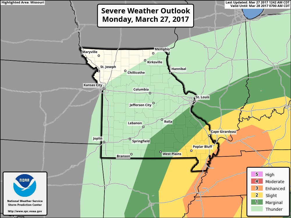
Area where a few gusty winds and isolated large hail will remain possible this morning into today mainly across southeastern Missouri. An isolated tornado, however, cannot be ruled out.
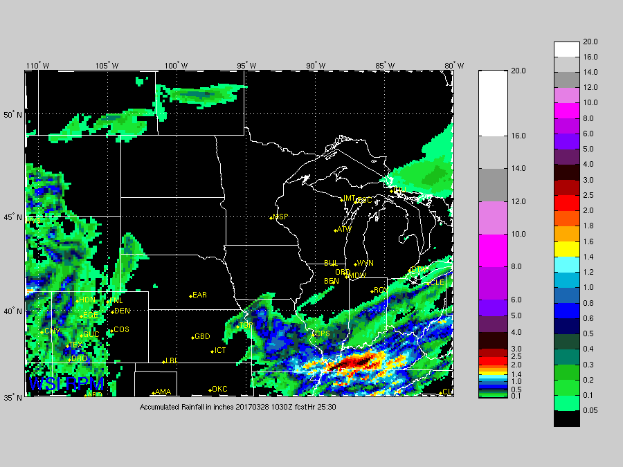
Rainfall totals over the next 24 hours is focused mainly across Missouri with isolated totals > 1.0″ possible across southeastern Missouri into Tuesday.
Our next chance for inclement weather comes Tuesday through Thursday as the low pressure system tracks west to east across the central US bring showers and storms (timing discussed in the video)…some showers heavy at times as well. Remember last week we discussed the pattern ahead was conducive to rain chances every ~3-4 days…well we are certainly seeing that now.
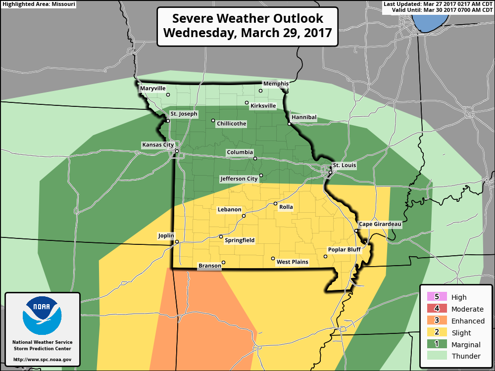
There is a threat for some stronger to severe storms Wednesday into Thursday mainly focused across southeastern KS to Missouri…we are monitoring this very closely.
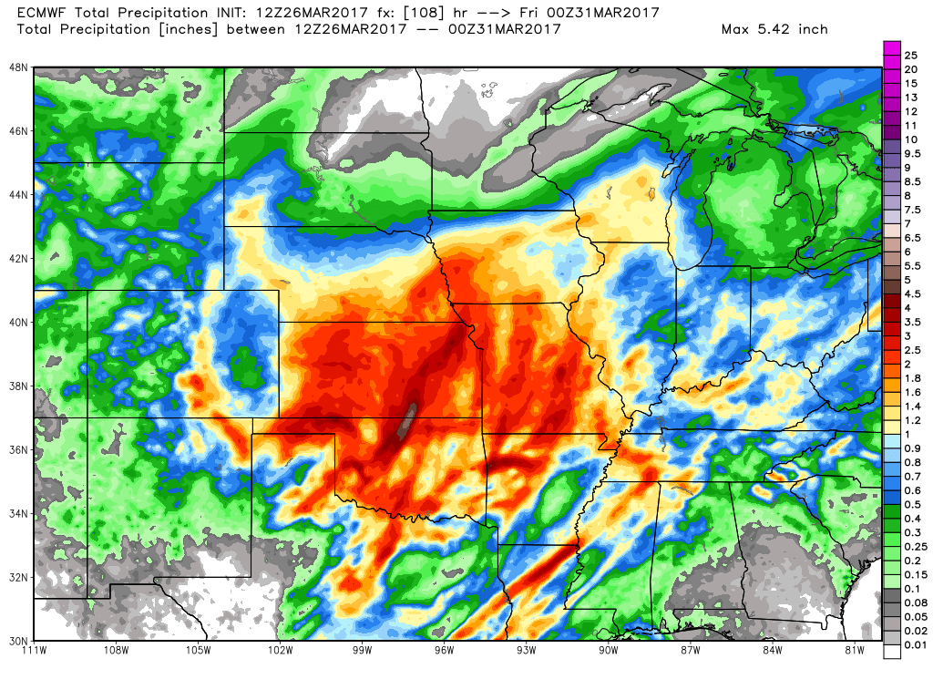
Rainfall totals through late Thursday with a wide swatch of 2.0″+ across Zone 8…which is good news for folks who have been drier than normal this year so far.
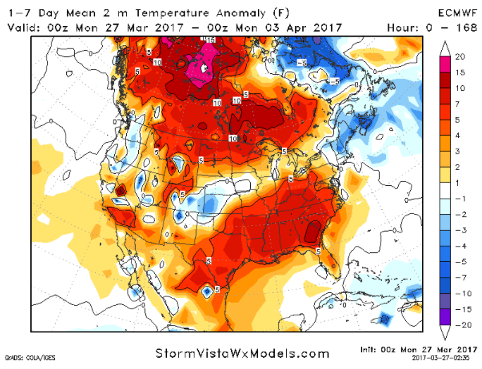
Overall this week will feature variable temperatures from normal with normal to slightly below normal temps overall expected across Nebraska and western Kansas and Iowa, meanwhile most of Missouri is above normal and mild this week.
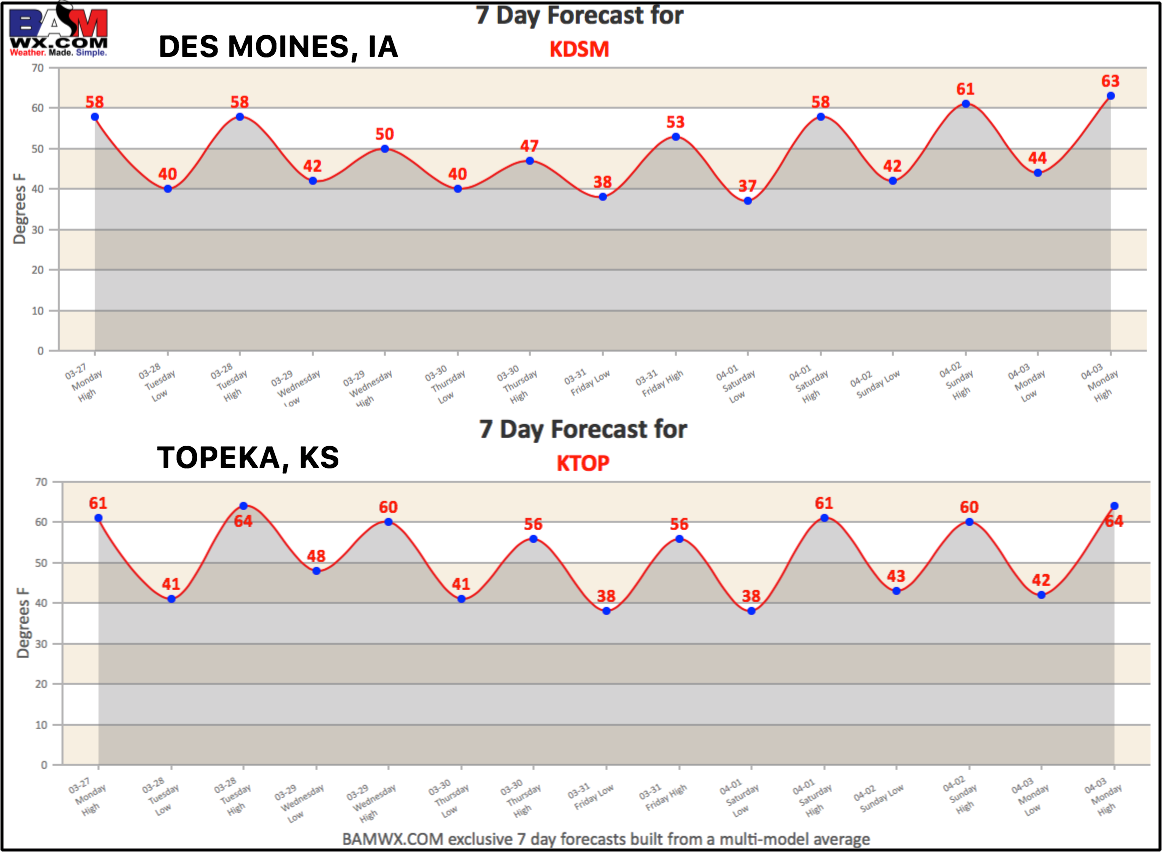
Today’s 7-day forecasts:
Confidence and Risk:
- Above average confidence of continued storm chances mainly across southeastern Missouri this morning into tonight.
- Above average confidence of our next bout of inclement weather coming Tuesday into Wednesday and Thursday from west to east.
- Low risk that we see more than a day or so of dry weather this week before our next system approaches from the west.
- Average confidence of near normal temperatures across the Zone with more mild weather expected across Missouri.
- Low risk that we start to see an improvement in drought conditions due to moderate to heavy rains forecasted over the next week.
Today’s video (7 min):