Key Points – Friday, March 24, 2017
Synopsis: Good Friday morning and thanks for checking out today’s forecast! We have details on the weekend weather, it’s very active with heavy rainfall and even some strong storms possible as well. We maintain on average above normal temperatures throughout the next week across the Zone, as well as potential for some very heavy rainfall. All the details discussed in the video! Have a great weekend!
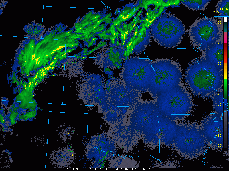
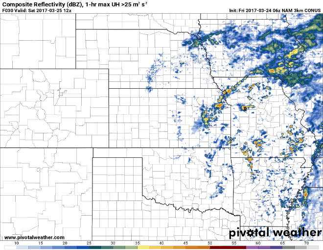
Current radar across Zone 8:
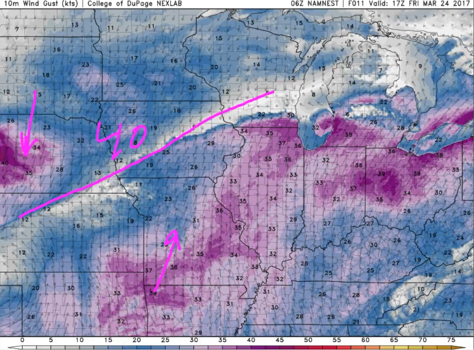
Wind gusts today up to 40+mph at times across the area
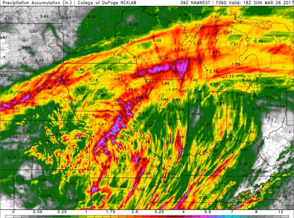
We time out showers and storms today throughout the entire Zone (some strong?), we expect heavy rainfall across portions of Iowa into Missouri today as well, some locations likely exceeding well over an inch of rainfall.
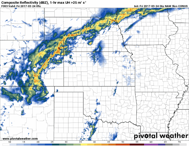
Current glance at where we think some strong storms could set up…our thoughts remain consistent that we could see some stronger storms across eastern Kansas into Missouri for some gusty winds and hail mainly.
Still looking for storms across mainly Iowa and Missouri on Saturday into early Sunday before this disturbance finally moves to the Zones to the east. We time everything out in the video.
Total rainfall through the weekend…some very impressive scattered rainfall totals in there, so some localized flash flooding may be possible where the heavier showers and storms set up across portions of Nebraska, southern Iowa, eastern Kansas and Missouri. With that being said, these should help aid some drought-relief in these same locations that have been severely dry.
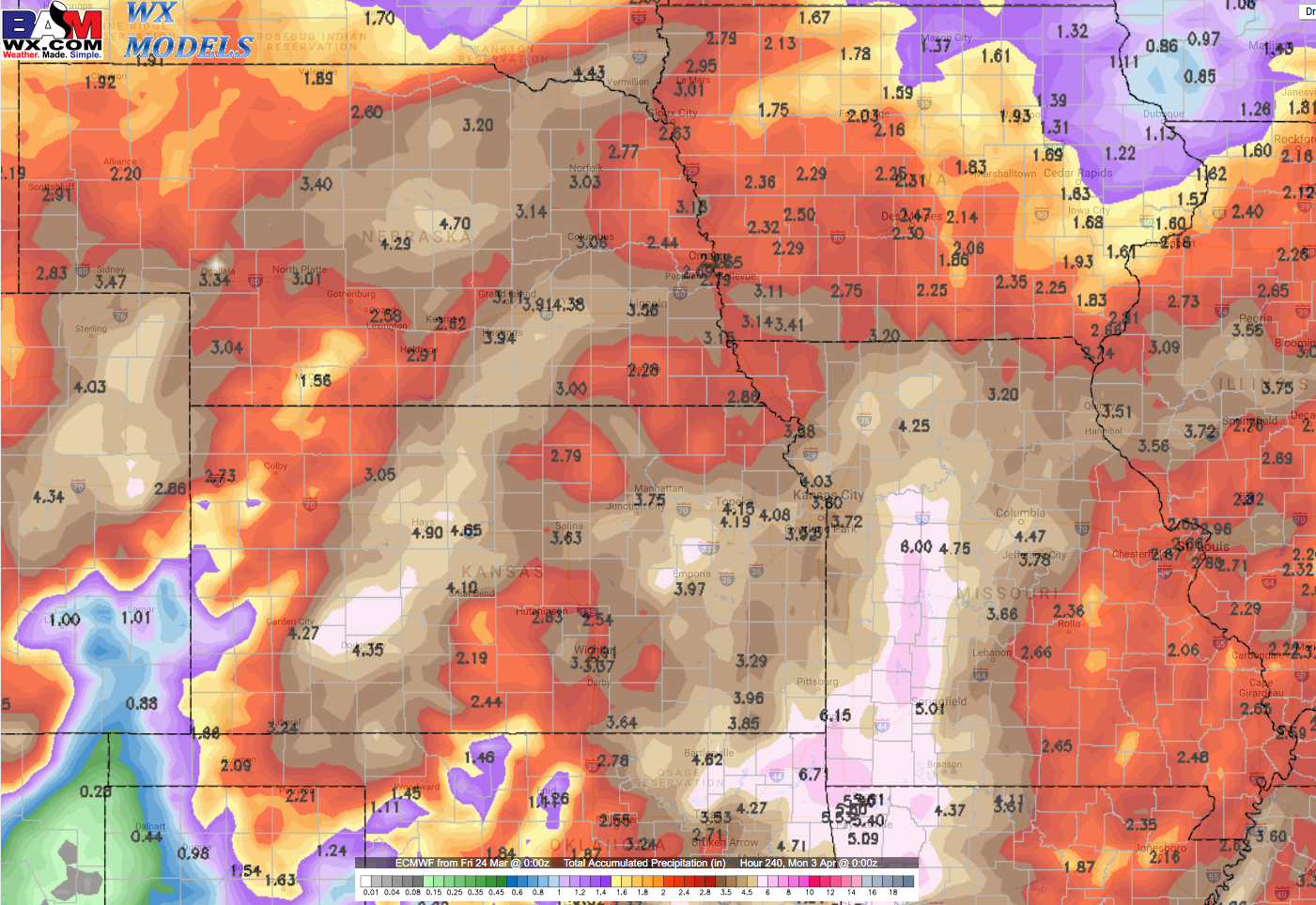
Once again, multiple chances for showers and thunderstorms next week, this is the pattern we’ve been discussing in our long-range videos for the past 2-3 weeks showing up…and it doesn’t look to leave any time soon. Check out these 10 day rainfall totals from the European…the entire Zone is wet especially getting into Missouri.
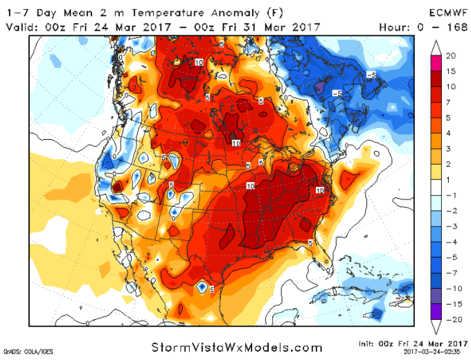
Temperature anomalies over the next 7 days are largely above normal, especially across portions of Iowa into Missouri that will be 5-10ºF above normal on average.
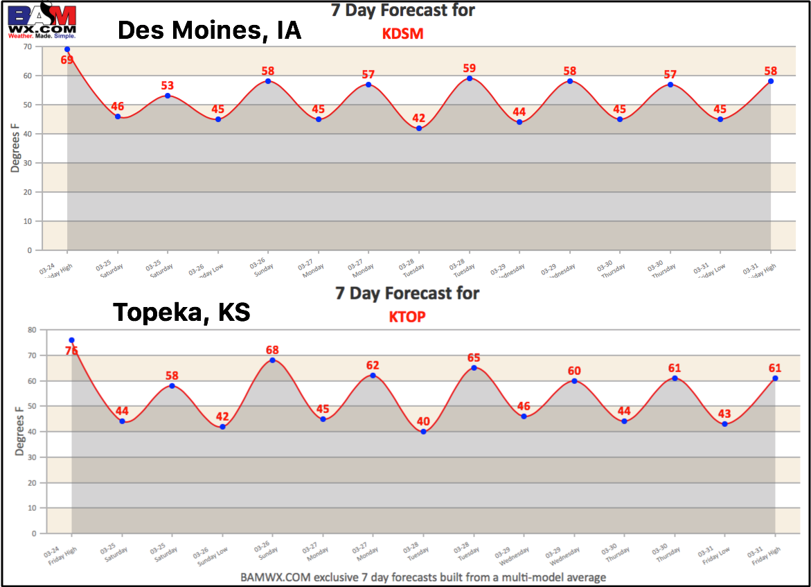
Today’s 7-day forecasts across Des Moines, IA and Topeka, KS:
Confidence and Risk:
- High confidence we will be quite windy today across the zones with wind gusts at times possible upwards of 40+mph.
- High confidence of showers and storms today and moving east into Saturday…some could be strong in nature with gusty winds and isolated large hail.
- Above average confidence we are overall very wet heading into next week as well with multiple shower and storm chances.
- Above average confidence we are above normal on average in the temperature department over the next week.
Today’s video (7 min):