Key Points – Monday, April 3, 2017:
Synopsis: Today’s update is packed with multiple shower and storm chances this week as well as temperatures going for a roller coaster ride from 30s (even 20s?) to 70s and 80s possible this weekend! Welcome to spring, I suppose. Precipitation is split this week with heavier rain focused across eastern Kansas through eastern Iowa and Missouri. The active pattern remains at least through the first half of April, which makes us concerned for potential planting delays going deeper into the month…which is why we highly encourage folks to pay close attention to each update going forward. Have a great week!
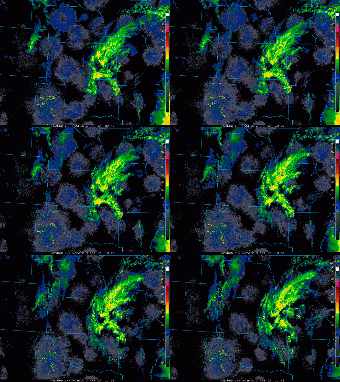
Current Radar with ongoing showers across central Nebraska as well as eastern Kansas, southern half of Iowa into western Missouri.
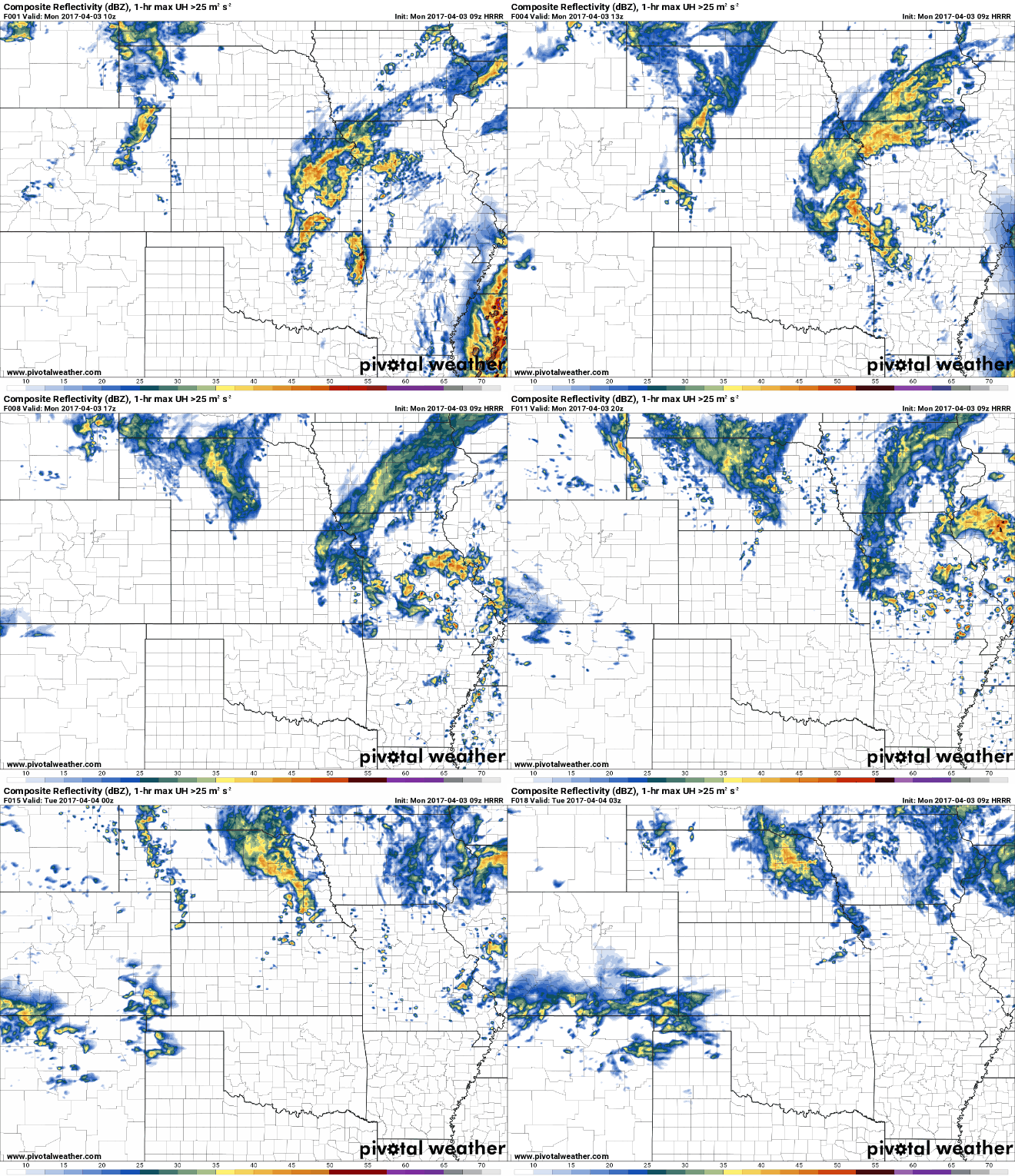
Showers today expected across Nebraska east through Missouri and the eastern half of Iowa. Some gusty storms are possible across southeastern Missouri as well with winds possible gusting upwards of 35-40 mph.
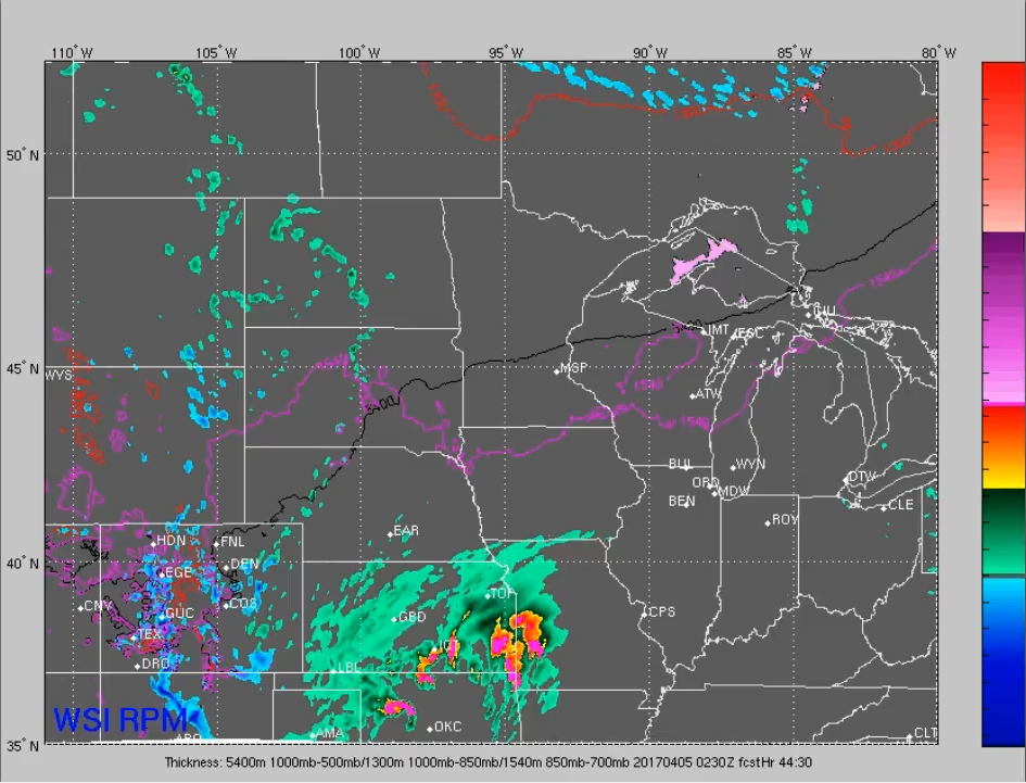
Tuesday night into Wednesday strong storms threat? We go into detail in the video, but our next system is expected to eject east out of the Rockies on Tuesday and strengthen into showers and thunderstorms. We touch on below where some strong thunderstorms are possible with this as well.
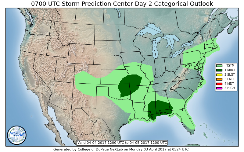
Current risk area for stronger storms Tuesday night into Wednesday from the eastern half of Kansas into Missouri at this time for gusty winds and small hail…confidence is on the lower end of this threat at this time as we need to see how things unfold, but thunderstorms and some heavier rains will certainly be possible.
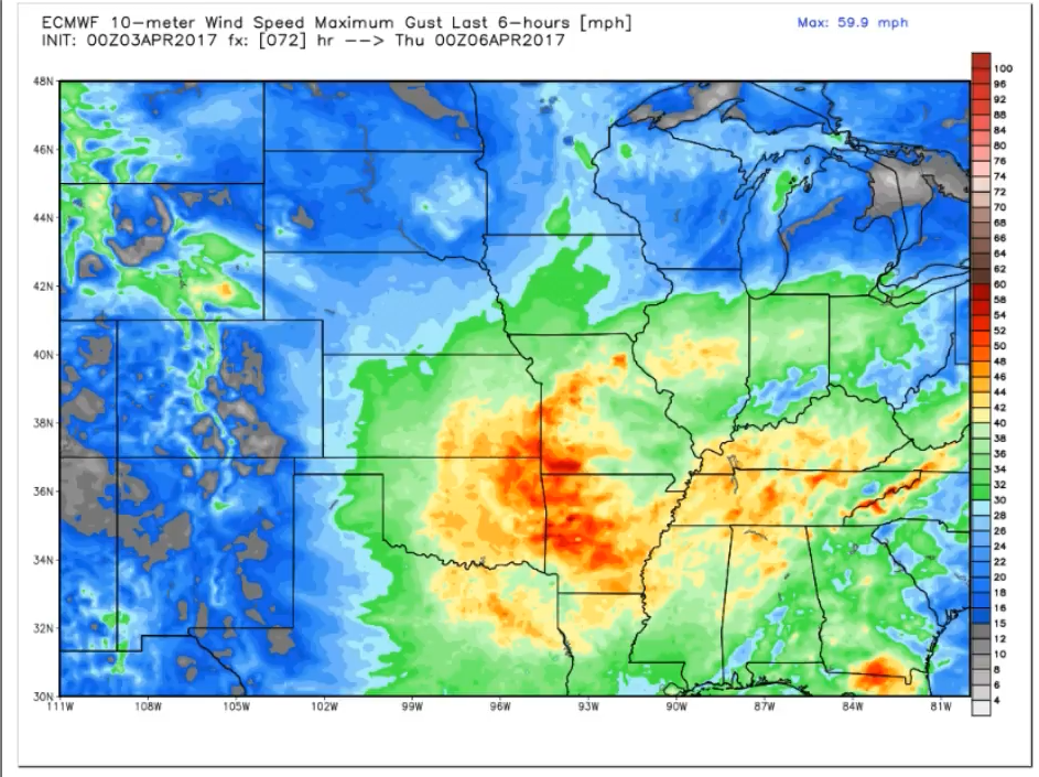
Wind gusts on Wednesday up to 50mph will be possible as well. Latest data from the European certainly hinting at strong winds possible mid-week noted by the brighter colors below especially across the southern half of Zone 8.
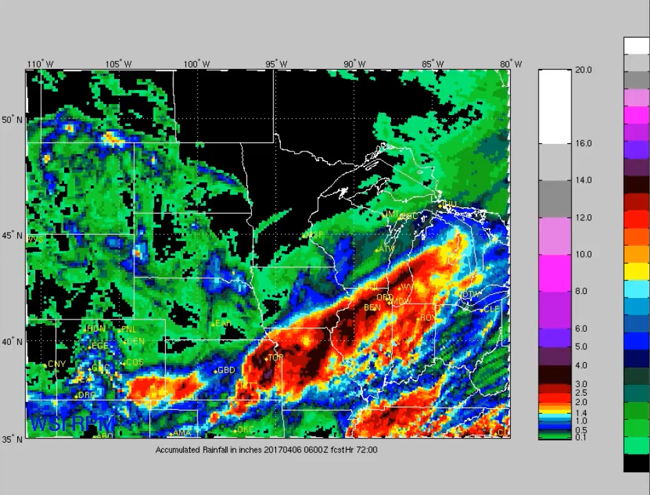
Total rains over the next 72 hours…not much in the way of rainfall expected across western Iowa into Nebraska, but getting into Kansas, southeast Iowa and most of Missouri could see 2-3″+ amounts of rainfall.
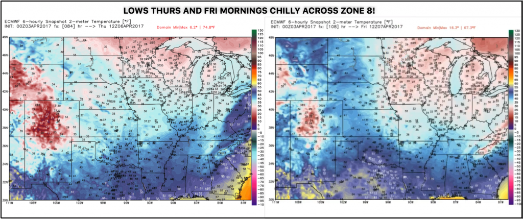
Lows on Thursday and Friday mornings will be quite chilly across Zone 8, with widespread 30s Thursday and even getting into the 20s on Friday morning across Iowa. This is what we meant by “storm-induced cold”, when a strong system departs the cold on the backside can still be conducive to frost/freeze threats will into April.
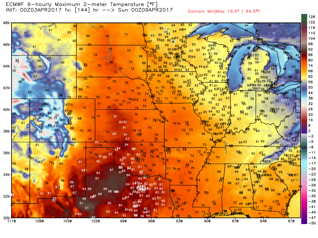
Good news though, we warm back up into the 70s (even 80s?) by this coming weekend with strong south to southwesterly winds which should help dry out this week’s precipitation a bit. The active pattern continues into early next week, however, for more inclement weather so we continue to be in a “rinse-and-repeat” weather pattern.
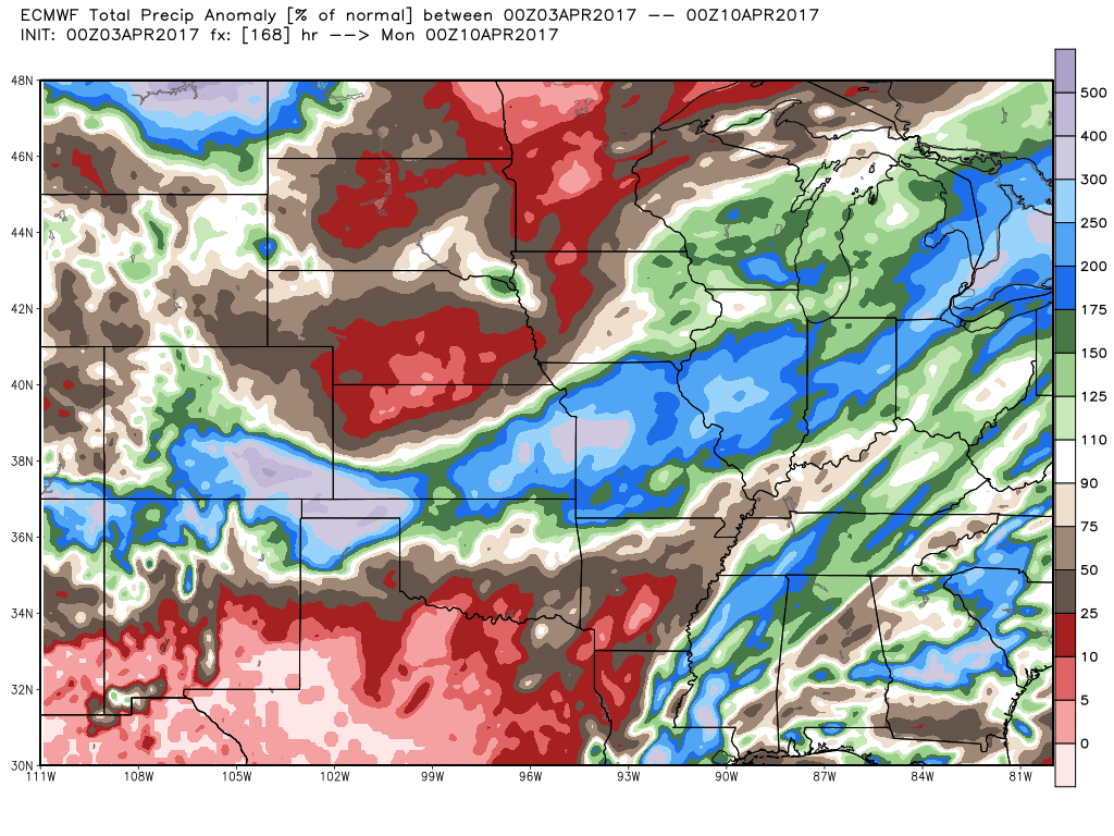
A sharp gradient in rainfall expected over the next week as Nebraska, northern half of Kansas and western Iowa get in on much drier weather, meanwhile the southern half of Kansas east into eastern Iowa and Missouri stay very wet. Below is a look at total precipitation anomaly, with some locations just mentioned seeing upwards of 2-300% the normal. The concern continues to grow for some very saturated fields across the Ag Belt, and can’t rule out some planting delays because of it.
Confidence and Risk:
- Above average confidence of showers and storms expected across portions of Nebraska into eastern Kansas, Iowa and Missouri today.
- Above average risk for stronger storms across the eastern Zone locations, gusty storms are possible but much more than that is a higher risk mention.
- Above average confidence on additional showers and storms across the southern half of Zone 8 Tuesday into Wednesday as our next system ejects east of the Rockies.
- Average risk for frost even freeze threats later this week as temps on the backside of this system mid-week will dip into the 30s and even 20s.
- Above average confidence we issue in a MUCH warmer weekend with temps expected in the 70s even 80s with strong south to southwest winds.
Today’s video (7 min):
