#NDwx #SDwx #WIwx #MNwx #AGwx Warmer Conditions and Variable Rain Chances Into Next Week. E.
Key Points: May 4, 2017
Synopsis: Good morning! A relatively quiet stretch of weather is expected across the region coming up into next week, which is great news for those of you who really haven’t gotten the opportunity to get into the fields yet. Warmer temperatures and only intermittent light rains should make for warmer soils and favorable planting conditions. We are watching the location of a developing upper level ridge over the region. Depending on the location, some shower and thunderstorm threats may develop midweek next week, so stay tuned! Have a great day!
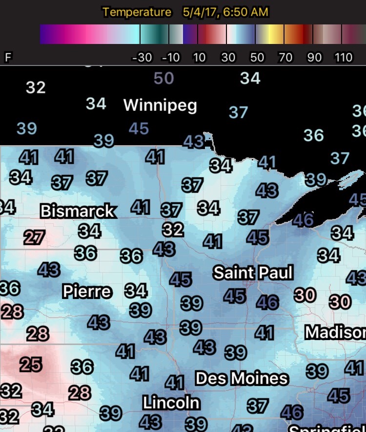
- Temperatures are chilly out there this morning, with some patchy frost around.
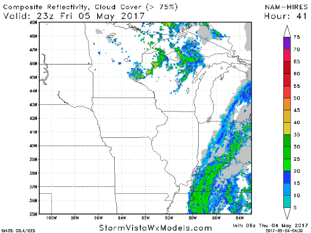
- A few widely scattered showers are possible today across Minnesota, but otherwise a warm, dry day is expected. The next rain chance comes Friday night across Wisconsin and eastern Minnesota.
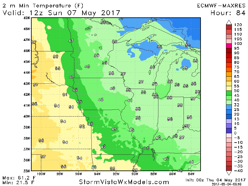
- We look to see warm afternoons and chilly mornings through the weekend, with a frost threat east Sunday morning.
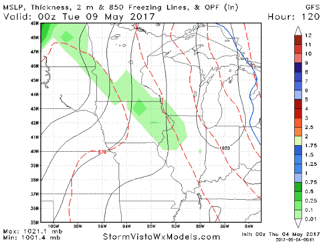
- As an upper level ridge develops in the Plains, we will watch for showers and thunderstorms developing at times toward midweek.
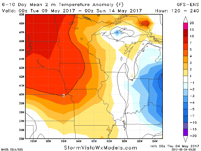
- Temperatures will be above normal next week, especially west.
- Precipitation looks to be near or slightly below normal for the week as a whole despite those intermittent rain chances. Here’s our forecast.

Confidence and Risks:
- Average confidence in patchy frost east Sunday morning.
- Above average confidence in warmer than normal temperatures developing into next week.
- Above average confidence in a drier window for planting, but average confidence in timing and intensity of possible shower/storms next week.
Today’s Video (5 minutes):