#NDwx #SDwx #WIwx #MNwx Active Times Through Early Next Week, Chilly Too! E.
Key Points: May 18, 2017
Synopsis: Good Thursday morning! We are tracking some rain across portions of Minnesota and Wisconsin as an area of low pressure slowly moves to our east. Elsewhere, it’s a chilly morning, with some frost and freezes across the Dakotas! Additional rains are expected Friday and Saturday especially south and east. Very chilly conditions are expected into next week thanks to an upper trough of low pressure moving through the region. Active times look to continue as well, especially south and east. Have a great day!
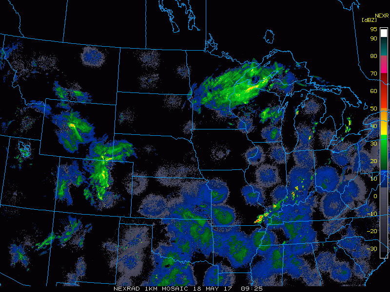
- Current radar shows some rains across Minnesota and Wisconsin this morning.
- More rains are in the forecast tonight into Friday, especially south.

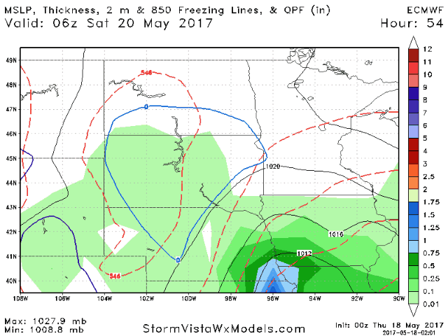
- A strong system is expected for Saturday with heavy rains south and east.
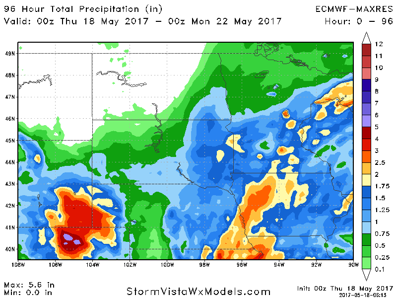
- Total rainfall through the weekend looks impressive south and east with 1-3″ possible. Once again northern areas look to miss out on rainfall.
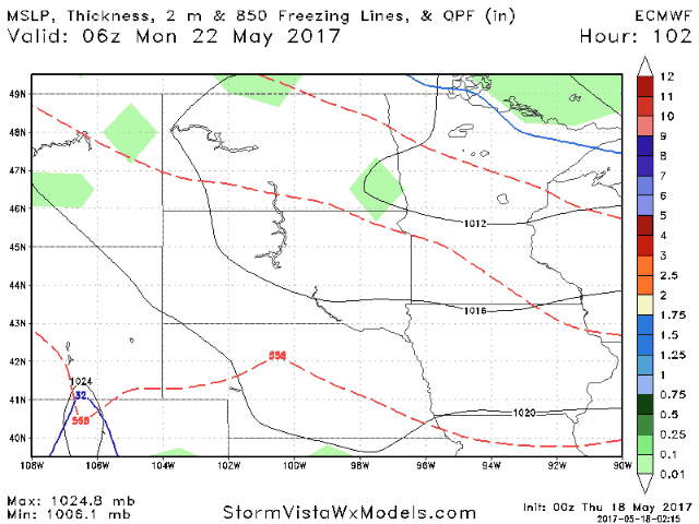
- Additional showers are possible Monday as a weak disturbance moves through before some drier time arrives through the middle of the week.
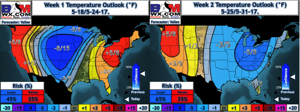
- The big story through next week will the cooler than normal conditions across the region. Most will average 5-10°F below normal especially in week 1.
Confidence and Risks:
- Above average confidence in rainfall threats Friday and Saturday, especially south and east.
- Above average confidence in temperatures remaining below normal through week 2.
- Increasing confidence on active times continuing next week, especially south and east.
Today’s Video (5 minutes):